The LS8 2 postcode sector is within the county of West Yorkshire.
Did you know? According to the 2021 Census, the LS8 2 postcode sector is home to a bustling 13,007 residents!
Given that each sector allows for 400 unique postcode combinations. Letters C, I, K, M, O and V are not allowed in the last two letters of a postcode. With 245 postcodes already in use, this leaves 155 units available.
The largest settlements in the LS8 2 postal code are LEEDS and Roundhay.
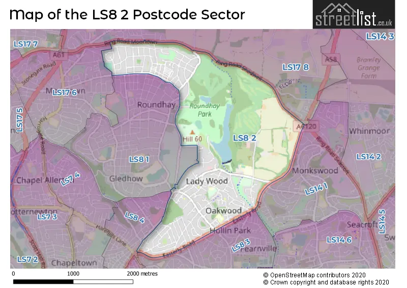
The LS8 2 Postcode shares a border with LS8 1 (LEEDS, Roundhay), LS8 3 (LEEDS, Gipton), LS17 6 (LEEDS, Moortown), LS14 1 (LEEDS, Seacroft), LS8 4 (LEEDS) and LS17 8 (LEEDS, Shadwell, Moortown).
The sector is within the post town of LEEDS.
LS8 2 is a postcode sector within the LS8 postcode district which is within the LS Leeds postcode area.
The Royal Mail delivery office for the LS8 2 postal sector is the Harehills Delivery Office.
The area of the LS8 2 postcode sector is 2.18 square miles which is 5.64 square kilometres or 1,393.94 square acres.

Map of the LS8 2 Postcode Sector
Explore the LS8 2 postcode sector by using our free interactive map.
| L | S | 8 | - | 2 | X | X |
| L | S | 8 | Space | 2 | Letter | Letter |
Official List of Streets
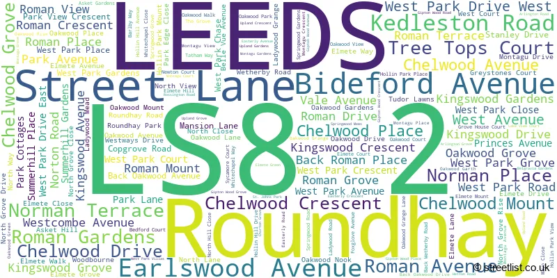
LEEDS (142 Streets)
Unofficial Streets or Alternative Spellings
LEEDS
AYRESOME AVENUE AYRESOME TERRACE BIRCHWOOD HILL BOGGART HILL DRIVE BRANDON CLOSE DEVONSHIRE AVENUE DIB LANE FITZROY DRIVE GLEDHOW LANE GLEDHOW RISE GLEDHOW VALLEY ROAD GRANGE VIEW GARDENS HODGSON AVENUE HODGSON CRESCENT INGLEDEW DRIVE LAWRENCE ROAD LIDGETT PARK ROAD MONTAGU COURT OAKWELL MOUNT OLD PARK ROAD PARK VIEW COURT ROUNDHAY PARK LANE SHADWELL WALK SHAFTESBURY AVENUE SPRINGWOOD MEWS SUTHERLAND AVENUE THE PINES BACK NORMAN PLACE BACK NORMAN TERRACE BACK RAVENSCAR AVENUE BACK ROMAN GROVE BACK ROMAN STREET ELMETE LANE (ACCEESS TO ELMETE HALL) FOXWOOD HARLOW COURT HOLLIN HILL COTTAGES LADY WOOD ROAD OAKHAMPTON COURT OAKWOOD BOUNDARY ROAD RING ROAD (SHADWELL) RING ROAD MOORTOWN ROUNDHAY GOLF COURSE THE CARRIAGE DRIVE WEST PARK DRIVE (EAST) WEST PARK DRIVE (WEST) WETHERBY ROAD ROUNDABOUT WYKE BECK WAYGipton
AMBERTON ROADBardsey
WETHERBY ROADSchools and Places of Education Within the LS8 2 Postcode Sector
John Jamieson School
Community special school
Hollin Hill Drive, Leeds, West Yorkshire, LS8 2PW
Head: Mrs Louise Quinn
Ofsted Rating: Good
Inspection: 2022-03-03 (812 days ago)
Website: Visit John Jamieson School Website
Phone: 01132930236
Number of Pupils: 425
House Prices in the LS8 2 Postcode Sector
| Type of Property | 2018 Average | 2018 Sales | 2017 Average | 2017 Sales | 2016 Average | 2016 Sales | 2015 Average | 2015 Sales |
|---|---|---|---|---|---|---|---|---|
| Detached | £522,505 | 37 | £499,117 | 49 | £423,564 | 46 | £427,410 | 28 |
| Semi-Detached | £289,777 | 82 | £260,568 | 100 | £256,577 | 95 | £243,377 | 95 |
| Terraced | £291,323 | 20 | £268,910 | 24 | £229,031 | 23 | £231,965 | 24 |
| Flats | £195,865 | 34 | £164,656 | 62 | £163,393 | 49 | £170,473 | 43 |
Important Postcodes LS8 2 in the Postcode Sector
LS8 2LG is the postcode for Roundhay School, Primary Campus
LS8 2LJ is the postcode for Elmete Wood School, Elmete Lane, and Education Leeds, Elmete Centre, Elmete Lane
LS8 2PE is the postcode for Oakhaven Care Home, 213 Oakwood Lane
LS8 2PW is the postcode for JOHN JAMIESON SCHOOL, HOLLIN HILL DRIVE, ROUNDHAY, and John Jamieson School, Hollin Hill Drive
LS8 2QJ is the postcode for Roundhay St. Johns C of E Primary School, 20 North Lane, Roundhay, and Roundhay St. Johns C of E Primary School, 20 North Lane
| The LS8 2 Sector is within these Local Authorities |
|
|---|---|
| The LS8 2 Sector is within these Counties |
|
| The LS8 2 Sector is within these Water Company Areas |
|