The PR2 5 postcode sector is within the county of Lancashire.
Did you know? According to the 2021 Census, the PR2 5 postcode sector is home to a bustling 3,321 residents!
Given that each sector allows for 400 unique postcode combinations. Letters C, I, K, M, O and V are not allowed in the last two letters of a postcode. With 107 postcodes already in use, this leaves 293 units available.
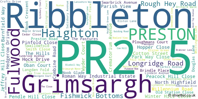
The largest settlement in the PR2 5 postal code is Grimsargh followed by Ribbleton, and Haighton.
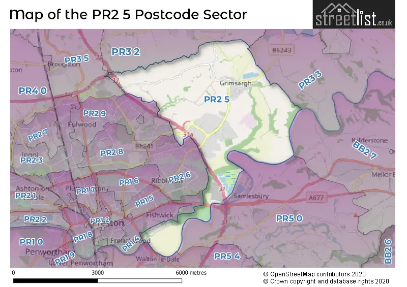
The PR2 5 Postcode shares a border with PR5 4 (Walton-le-Dale, Higher Walton), PR2 6 (Ribbleton, Fulwood), PR2 9 (Fulwood), PR3 2 (Goosnargh, Longridge, Whittingham), PR3 3 (Longridge, Ribchester, Alston), PR3 5 (Broughton, Barton), BB2 7 (BLACKBURN, Mellor, Mellor Brook), PR1 4 (PRESTON), PR1 5 (PRESTON) and PR5 0 (Hoghton, Samlesbury).
The sector is within the post town of PRESTON.
PR2 5 is a postcode sector within the PR2 postcode district which is within the PR Preston postcode area.
The Royal Mail delivery office for the PR2 5 postal sector is the Preston Central Delivery Office.
The area of the PR2 5 postcode sector is 8.01 square miles which is 20.74 square kilometres or 5,125.90 square acres.
The PR2 5 postcode sector is crossed by the M6 motorway.
Waterways within the PR2 5 postcode sector include the Savick Brook.

Map of the PR2 5 Postcode Sector
Explore the PR2 5 postcode sector by using our free interactive map.
| P | R | 2 | - | 5 | X | X |
| P | R | 2 | Space | 5 | Letter | Letter |
Official List of Streets
Grimsargh (63 Streets)
Ribbleton (7 Streets)
Fulwood (8 Streets)
Haighton (4 Streets)
Unofficial Streets or Alternative Spellings
Mellor Brook
PRESTON NEW ROADPRESTON
ASHLEIGH STREET ASHWORTH GROVE BROCKHOLES BROW FRENCHWOOD AVENUE HILLSIDE ROAD LONDON ROADAlston
PRESTON ROADBroughton
DURTON LANESchools and Places of Education Within the PR2 5 Postcode Sector
Grimsargh St Michael's Church of England Primary School
Voluntary aided school
Preston Road, Preston, Lancashire, PR2 5SD
Head: Mr Stuart Booth
Ofsted Rating: Outstanding
Inspection: 2014-03-12 (3738 days ago)
Website: Visit Grimsargh St Michael's Church of England Primary School Website
Phone: 01772653600
Number of Pupils: 206
House Prices in the PR2 5 Postcode Sector
| Type of Property | 2018 Average | 2018 Sales | 2017 Average | 2017 Sales | 2016 Average | 2016 Sales | 2015 Average | 2015 Sales |
|---|---|---|---|---|---|---|---|---|
| Detached | £332,266 | 45 | £341,782 | 49 | £331,907 | 28 | £305,075 | 20 |
| Semi-Detached | £189,888 | 20 | £172,973 | 24 | £220,161 | 19 | £185,338 | 16 |
| Terraced | £203,999 | 5 | £153,998 | 2 | £191,944 | 9 | £135,496 | 7 |
| Flats | £200,583 | 3 | £133,000 | 1 | £100,000 | 4 | £105,000 | 2 |
Important Postcodes PR2 5 in the Postcode Sector
PR2 5PZ is the postcode for Lancashire County Council, Red Rose Hub, Bluebell Way
PR2 5SD is the postcode for Grimsargh St. Michaels C E Primary School, Preston Road
| The PR2 5 Sector is within these Local Authorities |
|
|---|---|
| The PR2 5 Sector is within these Counties |
|
| The PR2 5 Sector is within these Water Company Areas |
|