The PR25 5 postcode sector is within the county of Lancashire.
Did you know? According to the 2021 Census, the PR25 5 postcode sector is home to a bustling 5,790 residents!
Given that each sector allows for 400 unique postcode combinations. Letters C, I, K, M, O and V are not allowed in the last two letters of a postcode. With 106 postcodes already in use, this leaves 294 units available.
The PR25 5 postal code covers the settlement of LEYLAND.
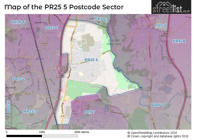
The PR25 5 Postcode shares a border with PR5 6 (Bamber Bridge), PR25 4 (LEYLAND, Farington), PR6 7 (Clayton-le-Woods, Whittle-le-Woods, CHORLEY), PR7 7 (Buckshaw Village) and PR25 3 (LEYLAND, Farington).
The sector is within the post town of LEYLAND.
PR25 5 is a postcode sector within the PR2 postcode district which is within the PR Preston postcode area.
The Royal Mail delivery office for the PR25 5 postal sector is the Preston Central Delivery Office.
The area of the PR25 5 postcode sector is 1.34 square miles which is 3.48 square kilometres or 859.13 square acres.
The PR25 5 postcode sector is crossed by the M6 motorway.

Map of the PR25 5 Postcode Sector
Explore the PR25 5 postcode sector by using our free interactive map.
| P | R | 2 | 5 | - | 5 | X | X |
| P | R | 2 | 5 | Space | 5 | Letter | Letter |
Official List of Streets
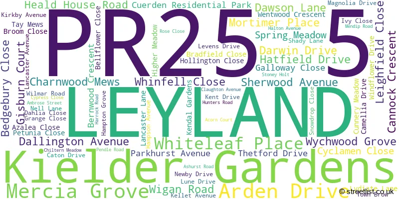
LEYLAND (76 Streets)
Unofficial Streets or Alternative Spellings
LEYLAND
LEYLAND WAY MOSS LANE BACK LANE BAMBURGH DRIVE BEECH TREE CLOSE BIRCH AVENUE CROFT PARK ELM GROVE FERNDOWN AVENUE MAPLE COURT OAKTREE AVENUE TRETHORN AVENUE TRETHORNE AVENUE WEST DRIVE WILLOW CRESCENTWhittle-le-Woods
DAWSON LANEBuckshaw Village
BROOKWOOD WAY DUNNERHOLME AVENUE EATON AVENUEBamber Bridge
SHADY LANE WIGAN ROADSchools and Places of Education Within the PR25 5 Postcode Sector
Lancaster Lane Primary and Pre-School
Community school
Hunters Road, Leyland, Lancashire, PR25 5TT
Head: Mrs Linsey Hankin
Ofsted Rating: Good
Inspection: 2023-04-26 (393 days ago)
Website: Visit Lancaster Lane Primary and Pre-School Website
Phone: 01772433641
Number of Pupils: 207
House Prices in the PR25 5 Postcode Sector
| Type of Property | 2018 Average | 2018 Sales | 2017 Average | 2017 Sales | 2016 Average | 2016 Sales | 2015 Average | 2015 Sales |
|---|---|---|---|---|---|---|---|---|
| Detached | £296,345 | 85 | £285,540 | 127 | £284,151 | 126 | £343,517 | 99 |
| Semi-Detached | £156,910 | 41 | £148,405 | 39 | £137,773 | 30 | £122,400 | 25 |
| Terraced | £78,844 | 8 | £116,290 | 9 | £91,583 | 3 | £133,906 | 7 |
| Flats | £189,498 | 2 | £186,250 | 2 | £184,498 | 2 | £0 | 0 |
Important Postcodes PR25 5 in the Postcode Sector
PR25 5TT is the postcode for Lancaster Lane Cp School, Hunters Road
| The PR25 5 Sector is within these Local Authorities |
|
|---|---|
| The PR25 5 Sector is within these Counties |
|
| The PR25 5 Sector is within these Water Company Areas |
|