The PR26 8 postcode sector is within the county of Lancashire.
Did you know? According to the 2021 Census, the PR26 8 postcode sector is home to a bustling 2,648 residents!
Given that each sector allows for 400 unique postcode combinations. Letters C, I, K, M, O and V are not allowed in the last two letters of a postcode. With 26 postcodes already in use, this leaves 374 units available.
The PR26 8 postal code covers the settlement of LEYLAND.
The PR26 8 Postcode shares a border with PR25 2 (LEYLAND), PR26 6 (Farington Moss, LEYLAND, Midge Hall), PR26 7 (LEYLAND, Moss Side, Midge Hall), PR7 5 (Coppull, Eccleston, Charnock Richard), PR7 6 (Euxton, Eccleston), PR25 1 (LEYLAND) and PR26 9 (Croston, Bretherton).
The sector is within the post town of LEYLAND.
PR26 8 is a postcode sector within the PR2 postcode district which is within the PR Preston postcode area.
The Royal Mail delivery office for the PR26 8 postal sector is the Preston Central Delivery Office.
The area of the PR26 8 postcode sector is 2.72 square miles which is 7.03 square kilometres or 1,737.66 square acres.
Waterways within the PR26 8 postcode sector include the River Yarrow, Wymott Brook, River Lostock.

Map of the PR26 8 Postcode Sector
Explore the PR26 8 postcode sector by using our free interactive map.
| P | R | 2 | 6 | - | 8 | X | X |
| P | R | 2 | 6 | Space | 8 | Letter | Letter |
Official List of Streets
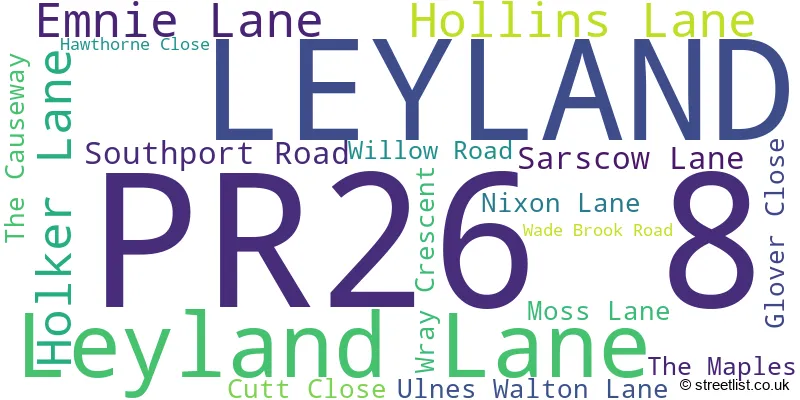
LEYLAND (17 Streets)
Unofficial Streets or Alternative Spellings
Farington Moss
CROSTON ROADLEYLAND
HEATHERLEIGH HEDGEROWS ROAD HUGH LANE MEADOW VALE MIDDLEFIELDCroston
SOUTHPORT ROADMidge Hall
LONGMEANYGATE PUMP HOUSE LANEEuxton
FLAG LANEEccleston
NEW LANE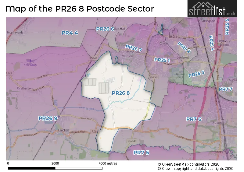
House Prices in the PR26 8 Postcode Sector
| Type of Property | 2018 Average | 2018 Sales | 2017 Average | 2017 Sales | 2016 Average | 2016 Sales | 2015 Average | 2015 Sales |
|---|---|---|---|---|---|---|---|---|
| Detached | £237,500 | 2 | £356,250 | 4 | £0 | 0 | £433,332 | 3 |
| Semi-Detached | £144,667 | 3 | £131,000 | 7 | £162,667 | 6 | £144,390 | 5 |
| Terraced | £107,100 | 1 | £94,875 | 4 | £95,000 | 2 | £115,000 | 1 |
| Flats | £0 | 0 | £0 | 0 | £0 | 0 | £0 | 0 |
Important Postcodes PR26 8 in the Postcode Sector
PR26 8LW is the postcode for H M Prison, Wymott Prison, Ulnes Walton Lane
PR26 8NE is the postcode for H M Prison, Garth Prison, Ulnes Walton Lane
| The PR26 8 Sector is within these Local Authorities |
|
|---|---|
| The PR26 8 Sector is within these Counties |
|
| The PR26 8 Sector is within these Water Company Areas |
|