The RG18 4 postcode sector is within the county of Berkshire.
Did you know? According to the 2021 Census, the RG18 4 postcode sector is home to a bustling 4,838 residents!
Given that each sector allows for 400 unique postcode combinations. Letters C, I, K, M, O and V are not allowed in the last two letters of a postcode. With 97 postcodes already in use, this leaves 303 units available.
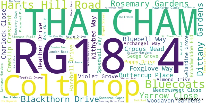
The RG18 4 postal code covers the settlement of THATCHAM.
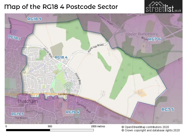
The RG18 4 Postcode shares a border with RG18 3 (THATCHAM, Cold Ash, Benham Hill), RG18 9 (Hermitage, Cold Ash, Curridge), RG19 3 (THATCHAM), RG19 4 (THATCHAM), RG7 5 (Theale, Beenham, Woolhampton) and RG7 6 (Upper Bucklebury, Bradfield, Bradfield Southend).
The sector is within the post town of THATCHAM.
RG18 4 is a postcode sector within the RG18 postcode district which is within the RG Reading postcode area.
The Royal Mail delivery office for the RG18 4 postal sector is the Thatcham Delivery Office.
The area of the RG18 4 postcode sector is 1.43 square miles which is 3.70 square kilometres or 913.79 square acres.

Map of the RG18 4 Postcode Sector
Explore the RG18 4 postcode sector by using our free interactive map.
| R | G | 1 | 8 | - | 4 | X | X |
| R | G | 1 | 8 | Space | 4 | Letter | Letter |
Official List of Streets
THATCHAM (56 Streets)
Unofficial Streets or Alternative Spellings
Beenham
BATH ROADTHATCHAM
COOMBE COURT ELMS AVENUE FLORAL WAY LAWRENCES LANE STONEY LANE THE MOORS BRADLEY-MOORE SQUARE BROADWAY FARMERS GATE LAWRENCES WAY MANGAN MEWS SAINT THOMAS COURT THE COURT THE SPINNEYUpper Bucklebury
LONG GROVESchools and Places of Education Within the RG18 4 Postcode Sector
Thatcham Park CofE Primary
Voluntary controlled school
Park Avenue, Thatcham, Berkshire, RG18 4NP
Head: Mrs Alison Webster
Ofsted Rating: Good
Inspection: 2018-11-28 (2003 days ago)
Website: Visit Thatcham Park CofE Primary Website
Phone: 01635870950
Number of Pupils: 411
House Prices in the RG18 4 Postcode Sector
| Type of Property | 2018 Average | 2018 Sales | 2017 Average | 2017 Sales | 2016 Average | 2016 Sales | 2015 Average | 2015 Sales |
|---|---|---|---|---|---|---|---|---|
| Detached | £466,197 | 30 | £399,772 | 29 | £418,395 | 33 | £406,817 | 27 |
| Semi-Detached | £308,126 | 23 | £318,611 | 9 | £311,817 | 17 | £238,285 | 17 |
| Terraced | £271,265 | 13 | £255,188 | 8 | £309,700 | 13 | £255,069 | 13 |
| Flats | £157,915 | 3 | £169,595 | 10 | £163,395 | 11 | £140,738 | 4 |
Important Postcodes RG18 4 in the Postcode Sector
RG18 4NP is the postcode for Thatcham Park C of E School, Park Avenue, and MAIN BUILDING, Thatcham Park C of E School, Park Avenue
| The RG18 4 Sector is within these Local Authorities |
|
|---|---|
| The RG18 4 Sector is within these Counties |
|
| The RG18 4 Sector is within these Water Company Areas |
|