The RG28 7 postcode sector is within the county of Hampshire.
Did you know? According to the 2021 Census, the RG28 7 postcode sector is home to a bustling 6,418 residents!
Given that each sector allows for 400 unique postcode combinations. Letters C, I, K, M, O and V are not allowed in the last two letters of a postcode. With 226 postcodes already in use, this leaves 174 units available.
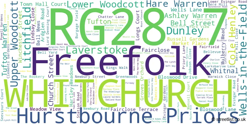
The largest settlement in the RG28 7 postal code is WHITCHURCH followed by Hurstbourne Priors, and Laverstoke.
The RG28 7 Postcode shares a border with RG20 9 (Woolton Hill, Highclere, Burghclere), RG25 3 (Overton, Steventon, Deane), SO21 3 (Sutton Scotney, South Wonston, Micheldever), SP11 0 (Weyhill, Hurstbourne Tarrant, Vernham Dean) and SP11 6 (ANDOVER, Picket Piece, St. Mary Bourne).
The sector is within the post town of WHITCHURCH.
RG28 7 is a postcode sector within the RG28 postcode district which is within the RG Reading postcode area.
The Royal Mail delivery office for the RG28 7 postal sector is the Whitchurch (rg) Delivery Office.
The area of the RG28 7 postcode sector is 29.12 square miles which is 75.41 square kilometres or 18,634.12 square acres.
The RG28 7 postcode sector is crossed by the A34 Major A road.
Waterways within the RG28 7 postcode sector include the River Test.

Map of the RG28 7 Postcode Sector
Explore the RG28 7 postcode sector by using our free interactive map.
| R | G | 2 | 8 | - | 7 | X | X |
| R | G | 2 | 8 | Space | 7 | Letter | Letter |
Official List of Streets
WHITCHURCH (105 Streets)
Hurstbourne Priors (7 Streets)
Laverstoke (4 Streets)
Freefolk (3 Streets)
Litchfield (2 Streets)
Wells-in-the-Field (1 Streets)
Cole Henley (1 Streets)
Unofficial Streets or Alternative Spellings
WHITCHURCH
TESTBOURNE COURTANDOVER
LONDON ROAD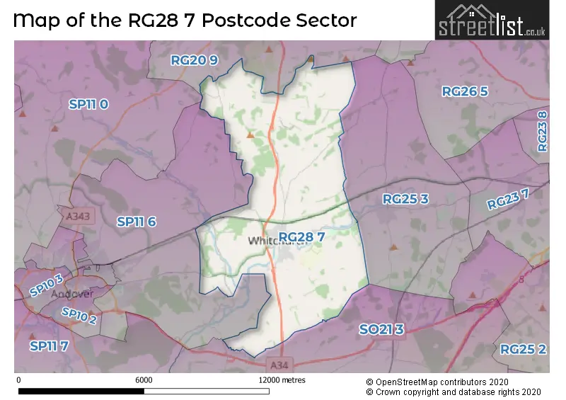
House Prices in the RG28 7 Postcode Sector
| Type of Property | 2018 Average | 2018 Sales | 2017 Average | 2017 Sales | 2016 Average | 2016 Sales | 2015 Average | 2015 Sales |
|---|---|---|---|---|---|---|---|---|
| Detached | £527,742 | 39 | £593,760 | 25 | £512,362 | 29 | £500,326 | 28 |
| Semi-Detached | £357,232 | 56 | £337,031 | 32 | £334,986 | 30 | £299,085 | 26 |
| Terraced | £297,407 | 27 | £309,682 | 22 | £286,315 | 38 | £243,080 | 37 |
| Flats | £148,153 | 16 | £151,636 | 11 | £170,625 | 8 | £134,679 | 14 |
Important Postcodes RG28 7 in the Postcode Sector
RG28 7AE is the postcode for Whitchurch Medical Centre, The Surgery, Bell Street
RG28 7JF is the postcode for TEACHING BLOCK, Testbourne Community School, Micheldever Road, SPORTS HALL, Testbourne Community School, Micheldever Road, Testbourne Community School, Micheldever Road, COMMUNITY SUITE, TESTBOURNE COMMUNITY SCHOOL, MICHELDEVER ROAD, and ORIGINAL BUILDING, Testbourne Community School, Micheldever Road
RG28 7LS is the postcode for Whitchurch C of E Primary School, Daniel Road
| The RG28 7 Sector is within these Local Authorities |
|
|---|---|
| The RG28 7 Sector is within these Counties |
|
| The RG28 7 Sector is within these Water Company Areas |
|