Map of Frain Drive
| Postcodes | ||
|---|---|---|
| Icon | Postcodes for Frain Drive | |
| Walking Distances | ||
| Distance Info | Green Circle = 10 Minutes Walk (800 metres) | |
About Frain Drive
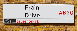
Frain Drive is a street located in Laurencekirk. It uses the postcode AB30 1EG. The street has a length of approximately 615 metres.
Frain Drive is located within the Aberdeenshire Council's jurisdiction. They provide various services, like refuse collection, and manage council tax collection. It's situated in the (pseudo) Scotland region of the UK.
Frain Drive is located within the county of Kincardineshire, situated in the (pseudo) Scotland region of the UK. It's 380.76 miles North from central London., 25.8 miles South West from Aberdeen, 32.15 miles North East from Dundee and 67.12 miles North East from Edinburgh.
Frain Drive is within the Post Town of LAURENCEKIRK.

Do you know why this road is called Frain Drive?
What's it like to live here?
Ask the community a question about Frain Drive.
Do you have any questions, memories to share or know any facts about Frain Drive? We'd love to know more.
Also on streetlist.co.uk, can you help?
Eldroth Road
15th April 2024
I wondered if anyone has any old pictures of Wenning Bank House in the 1940’s and also Lane Side before of the same era .. we visited today with my Mum in law as she used to live at both these properties. Also any photos of the schools around that time .. thank you.
Can You Help?Napps Way
15th April 2024
Why is the road called Napps Way (belonging to Napp, but minus an
apostrophe as is usual with such nomenclature)? Moreover, who or
what is, or was, “Napp” in the respective, possessive case?
Several years ago, I met an elderly man (probably in his late-eighties)
who lives on Bentham Drive, Liverpool 16, and during a conversation
with him whilst in a Northwest Passenger Transport Ambulance on the
way to the former RLUH (Royal Liverpool University Hospital), he told
me that he could remember (when he was a boy, living in Childwall,
Liverpool 16) that, “Where Napps Way is now, during WW2, there was
a two-man gun emplacement on the, then, open land to protect the
railway line passing over Childwall Valley Road - next to the railway
bridge - when suddenly, as they were loading a live “shell” into the gun’s
breach, the aforementioned “shell” accidentally exploded in the gun’s
breach killing both of the two soldiers, that had been manning the gun,
instantly! (Very sad, of course, but could - perhaps - two ghosts relating
to those two, very unfortunately and prematurely-killed soldiers have
haunted that place of their deaths ever since - and have any residents
of Napps Way - formerly and in its latest incarnation - seen two, WW2
(uniformed) soldiers unexpectedly appear in or near their homes?)
Mauritius Road
15th April 2024
Why is Mauritius Road so called, since when and by whom? Does Greenwich have any particular links with Mauritius? Very interested to know. 🤞🏼
Can You Help?Estate Agents near Frain Drive
| Name | Address | Website |
|---|---|---|
| Your Move | 51 Murray Street, Montrose, DD10 8JZ | Visit Website |
| Find My Buyer Ltd | 2 Lower Hall Street, Montrose,DD10 8JW | Visit Website |
| Scott Alexander | 46 High Street, Montrose,DD10 8JF | Visit Website |
We have found 1 postcode for Frain Drive
Location Details
| Frain Drive | |
|---|---|

| |
| Latitude | 56.831505 |
| Longitude | -2.468251 |
| OS Easting (X): | 371429 |
| OS Northing (Y): | 771195 |
| OS Grid Reference: | NO714712 |
Ordnance Survey Maps for Frain Drive
If you purchase a map through the links below, we may earn an affiliate commission.
| Map Series | link | Ordnance Survey |
| Explorer 1:25,000 382 Arbroath, Montrose and Carnoustie | Check Price on Amazon | Buy Direct from the Ordnance Survey |
| Explorer 1:25,000 396 Stonehaven, Inverbervie and Laurencekirk | Check Price on Amazon | Buy Direct from the Ordnance Survey |
| Landranger 1:50,000 45 Stonehaven | Check Price on Amazon | Buy Direct from the Ordnance Survey |
Neighbourhood Policing |
| Police Force: Scotland |
| Find a Local Neighbourhood Watch Scheme |
Frequently asked Questions for Frain Drive
What Council (Local Authority) is Frain Drive in?
Frain Drive is located within the local authority area of Aberdeenshire Council which is a Scottish unitary authority.
What Parish Council is Frain Drive in?
Frain Drive is in an unparished area.
What Electoral Ward is Frain Drive in?
Frain Drive is located within the ward of Mearns.
What County is Frain Drive in?
Frain Drive is located within the ceremonial county of Kincardineshire.
What Constituency is Frain Drive in?
Frain Drive is located within the constituency of West Aberdeenshire and Kincardine.
What Part of the UK is Frain Drive in?
Frain Drive is located within the historic nation of Scotland.
What County Council area is Frain Drive in?
Frain Drive is not in a County Council area.
What Police Force area is Frain Drive in?
Frain Drive is located within the Scotland Police area.
Roads that have a Junction with Frain Drive
| Street | Junction Type |
|---|---|
| High Street (A937) | junction |
| Johnston Road | junction |
| Garvocklea Gardens | junction |
Sunset and Sunrise times for Frain Drive , AB30 1EG
| Sunrise | 05:30 |
|---|---|
| Sunset | 20:44 |
Latest Weather Conditions for Frain Drive, AB30 1EG
| Observed at Weather Station: | Inverbervie 26 April 2024 at 11:00 (7.85 miles away) |
|---|---|
| Current Weather: | Partly cloudy (day) |
| Temperature and Humidity: | 7.6°C (69.0%) |
| Wind Direction and Speed: | E (10 mph) |
Population Statistics
| ONS Area Code | S00091458 |
|---|---|
| ONS Area Name | Ageing Industrious Workers |
| LSOA Code: | S01006803 |
|---|---|
| LSOA Name: | Mearns and Laurencekirk - 03 |
| SOA Code: | 5e |
| SOA Name: | |
| MSOA Code: | S02001287 |
| MSOA Name: | Mearns and Laurencekirk |
Nearest Supermarkets
| Tesco Montrose Superstore |
|---|
| Western Rd, Montrose, DD10 8LW |
| 0345 677 9478 |
| Distance: 8.33 Miles |
| Directions from Frain Drive to Tesco Montrose Superstore |
| Tesco Brechin Esso Express |
|---|
| Clerk St, Brechin, DD9 6AZ |
| 0345 675 6960 |
| Distance: 9.9 Miles |
| Directions from Frain Drive to Tesco Brechin Esso Express |
| Morrisons Banchory |
|---|
| North Deeside Road, Banchory AB31 5YR |
| 01330 820140 |
| Distance: 15.43 Miles |
| Directions from Frain Drive to Morrisons Banchory |
| Tesco Banchory Superstore |
|---|
| Hill Of Banchory E, Banchory, AB31 5QA |
| 0345 026 9618 |
| Distance: 15.81 Miles |
| Directions from Frain Drive to Tesco Banchory Superstore |
Telephone Information
| Area Code |
|---|
| Area Code: 01561 - Laurencekirk |
| Area Code: 01674 - Montrose |
Local Government
| Local Council Details |
|---|
| Within the area of Aberdeenshire |
| Visit the Council's Website |
| Woodhill House, Westburn Road, Aberdeen, Aberdeenshire &AB16 5GB |
| Telephone Number: 0845 608 1207 |
| Local Member of Parliament |
|---|
| Within the Westminster Parliamentary Constituency of West Aberdeenshire and Kincardine |
| The Member of Parliament is Andrew Bowie |
| Details for the MP Andrew Bowie on parliament.uk |
| Details for the MP Andrew Bowie on theyworkforyou.com |
| In the 2019 General Election Andrew Bowie won with a majority of 843 the result was Con hold. The total electorate was 72,640 |
| Wards, Parish Councils and County Councils |
|---|
| Ward: Mearns Ward |
| Ceremonial County: Kincardineshire |
Nearest Schools
Scotland Primary Schools
Redmyre School
Address: Redmyre School, Fordoun, Laurencekirk, ABERDEENSHIRE, AB30 1NP
Distance: 3.53 miles
Contact: 01561 400670
Laurencekirk School
Address: Laurencekirk School, Frain Drive, Laurencekirk, ABERDEENSHIRE, AB30 1EG
Distance: 0.33 miles
Contact: 01561 400640
Scotland Secondary Schools
Mearns Academy
Address: Mearns Academy, Aberdeen Road, Laurencekirk, KINCARDINESHIRE, AB30 1ZJ
Distance: 0.60 miles
Contact: 01561 400700
Nearest Hospitals
| Name | Address | Postcode | Distance | Map |
|---|---|---|---|---|
| Montrose Royal Infirmary | Bridge Street, Montrose | DD10 8AJ | 13.80 Km | View Directions |
Nearest Dentists
Dentists near Frain Drive
| Name | Address | Postcode | Distance | Map |
|---|---|---|---|---|
| HIGH STREET DENTAL CENTRE | 4 High Street, Montrose,angus | DD108JL | 13.14 Km | View Directions |
| 53 JOHN STREET | Montrose | DD108LZ | 13.15 Km | View Directions |
| LINKS LODGE DENTAL PRACTICE | 26 John Street, Montrose | DD108LZ | 13.15 Km | View Directions |
Nearest GP Surgeries
Doctors near Frain Drive
LAURENCEKIRK MEDICAL GROUP
Address: LAURENCEKIRK HEALTHCARE CENTRE, BLACKIEMUIR AVE, LAURENCEKIRK, KINCARDINESHIRE, AB30 1GX
Distance: 0.28 miles
Contact: tel: 03453 373356
AUCHENBLAE MEDICAL CENTRE
Address: MACKENZIE AVENUE, AUCHENBLAE, LAURENCEKIRK, AB30 1XU
Distance: 4.81 miles
Contact: tel: 01561 320202
INVERBERVIE MEDICAL GROUP
Address: INVERBERVIE MEDICAL CENTRE, CHURCH STREET, INVERBERVIE, MONTROSE, DD10 0RU
Distance: 7.10 miles
Contact: tel: 01561 361260
EDZELL HEALTH CENTRE
Address: HIGH STREET, EDZELL, BRECHIN, DD9 7TA
Distance: 7.26 miles
Contact: tel: 01356 648209
TOWNHEAD PRACTICE
Address: LINKS HEALTH CENTRE, FRANK WOOD WAY, MONTROSE, ANGUS, DD10 8TY
Distance: 8.40 miles
Contact: tel: 01674 676161
CASTLEGAIT SURGERY
Address: LINKS HEALTH CENTRE, FRANK WOOD WAY, MONTROSE, ANGUS, DD10 8TY
Distance: 8.40 miles
Contact: tel: 01674 672554
Nearest Dispensing Chemists
Pharmacies near Frain Drive
| Name | Address | Postcode | Telephone | Map | Distance in Km |
|---|---|---|---|---|---|
| Charles Michie | 24 High Street, Laurencekirk, Aberdeenshire, | AB30 1AB | 01561 377417 | View Directions | |
| Bestway National Chemists Ltd | 73/75 Murray Street, Montrose | DD10 8JZ | 01674 672150 | View Directions | |
| LLoyds Pharmacy Ltd | 48 High Street, Montrose | DD10 8JF | 01674 672401 | View Directions |
Nearest Opticians
Opticians near Frain Drive
BOOTS OPTICIANS (ARBROATH)
Address: 215 HIGH STREET, ARBROATH, ANGUS, DD11 1DZ
Distance: 19.19 miles
Contact: :
4637 PORTLETHEN
Address: ASDA STORES LTD, MUIREND ROAD, PORTLETHEN, ABERDEEN, ABERDEENSHIRE, AB12 4XP
Distance: 20.35 miles
Contact: :
COSTCO WHOLESALE UK LTD - MANDELA WAY
Address: COSTCO, ENDEAVOUR DRIVE, ARNHALL BUSINESS PARK, WESTHILL, ABERDEENSHIRE, AB32 6UF
Distance: 23.03 miles
Contact: :
ASDA OPTICIANS (BRIDGE OF DEE)
Address: ASDA STORES LTD, GARTHDEE ROAD, BRIDGE OF DEE, ABERDEEN, ABERDEENSHIRE, AB10 7QA
Distance: 24.06 miles
Contact: :
OPTIMAX LASER EYE CLINIC
Address: 2 GOLDEN SQUARE, ABERDEEN, ABERDEENSHIRE, AB10 1RD
Distance: 25.69 miles
Contact: :
ABERDEEN DOMICILIARY SPECSAVERS LIMITED
Address: 56-58 UNION STREET, ABERDEEN, ABERDEENSHIRE, AB10 1BB
Distance: 25.90 miles
Contact: :
Transport
Nearest Rail Stations
Laurencekirk Station is 0.43 miles away.
Address: Laurencekirk station, Station Road, Laurencekirk, Aberdeenshire, AB30 1BE
Laurencekirk is situated on the Glasgow to Aberdeen line|Edinburgh to Aberdeen line and is managed by ScotRail.
Laurencekirk Station is an unstaffed station.
Montrose Station is 8.20 miles away.
Address: Montrose station, off The A92, Basin View, Montrose, Angus, DD10 8LW
Montrose is situated on the Glasgow to Aberdeen line|Edinburgh to Aberdeen line and is managed by ScotRail.
Montrose Station is staffed on a part time basis.