Map of The Square
| Postcodes | ||
|---|---|---|
| Icon | Postcodes for The Square | |
| Walking Distances | ||
| Distance Info | Green Circle = 10 Minutes Walk (800 metres) | |
About The Square
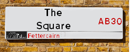
The Square is a street located in the village of Fettercairn. It uses the postcode AB30 1YA. The street has a length of approximately 205 metres.
The Square is located within the Aberdeenshire Council's jurisdiction. They provide various services, like refuse collection, and manage council tax collection. It's situated in the (pseudo) Scotland region of the UK.
The Square is located within the county of Kincardineshire, situated in the (pseudo) Scotland region of the UK. It's 383.23 miles North from central London., 27.1 miles South West from Aberdeen, 31.14 miles North East from Dundee and 66.87 miles North from Edinburgh.

Do you know why this road is called The Square?
What's it like to live here?
Ask the community a question about The Square.
Do you have any questions, memories to share or know any facts about The Square? We'd love to know more.
Also on streetlist.co.uk, can you help?
Swing Swang Lane
28th April 2024
I am trying to find out why the lane is named Swing Swang?
It has been known known this since at least 1905 when hedge making contents used to be held here.
Swing Swang is often used to describe a fairground ride. I remember Swing Boats. Were they a bit like this or is Swing Swang another name for swings?
Swing Swangs are also mentioned in connection to orchards. Or were orchards just good places to have swings?
Estate Agents near The Square
| Name | Address | Website |
|---|---|---|
| Savills | 12 Clerk Street, Brechin, DD9 6AE | Visit Website |
| Your Move | 51 Murray Street, Montrose, DD10 8JZ | Visit Website |
| Find My Buyer Ltd | 2 Lower Hall Street, Montrose,DD10 8JW | Visit Website |
We have found 1 postcode for The Square
Location Details
| The Square | |
|---|---|

| |
| Latitude | 56.852153 |
| Longitude | -2.574151 |
| OS Easting (X): | 364987 |
| OS Northing (Y): | 773543 |
| OS Grid Reference: | NO650735 |
Neighbourhood Policing |
| Police Force: Scotland |
| Find a Local Neighbourhood Watch Scheme |
Frequently asked Questions for The Square
What Council (Local Authority) is The Square in?
The Square is located within the local authority area of Aberdeenshire Council which is a Scottish unitary authority.
What Parish Council is The Square in?
The Square is in an unparished area.
What Electoral Ward is The Square in?
The Square is located within the ward of Mearns.
What County is The Square in?
The Square is located within the ceremonial county of Kincardineshire.
What Constituency is The Square in?
The Square is located within the constituency of West Aberdeenshire and Kincardine.
What Part of the UK is The Square in?
The Square is located within the historic nation of Scotland.
What County Council area is The Square in?
The Square is not in a County Council area.
What Police Force area is The Square in?
The Square is located within the Scotland Police area.
Roads that have a Junction with The Square
| Street | Junction Type |
|---|---|
| School Road | junction |
| Main Street (B966) | roundabout |
| Old Military Road (B974) | pseudo node |
Sunset and Sunrise times for The Square , AB30 1YA
| Sunrise | 04:52 |
|---|---|
| Sunset | 21:20 |
Latest Weather Conditions for The Square, AB30 1YA
| Observed at Weather Station: | Inverbervie 13 May 2024 at 01:00 (11.72 miles away) |
|---|---|
| Current Weather: | Light rain |
| Temperature and Humidity: | 9.4°C (100.0%) |
| Wind Direction and Speed: | SSE (5 mph) |
Population Statistics
| ONS Area Code | S00091337 |
|---|---|
| ONS Area Name | Outer City Hardship |
| LSOA Code: | S01006802 |
|---|---|
| LSOA Name: | Mearns and Laurencekirk - 02 |
| SOA Code: | 2c |
| SOA Name: | |
| MSOA Code: | S02001287 |
| MSOA Name: | Mearns and Laurencekirk |
Nearest Supermarkets
| Tesco Brechin Esso Express |
|---|
| Clerk St, Brechin, DD9 6AZ |
| 0345 675 6960 |
| Distance: 8.78 Miles |
| Directions from The Square to Tesco Brechin Esso Express |
| Tesco Montrose Superstore |
|---|
| Western Rd, Montrose, DD10 8LW |
| 0345 677 9478 |
| Distance: 10.51 Miles |
| Directions from The Square to Tesco Montrose Superstore |
| Morrisons Banchory |
|---|
| North Deeside Road, Banchory AB31 5YR |
| 01330 820140 |
| Distance: 14.45 Miles |
| Directions from The Square to Morrisons Banchory |
| Tesco Banchory Superstore |
|---|
| Hill Of Banchory E, Banchory, AB31 5QA |
| 0345 026 9618 |
| Distance: 14.94 Miles |
| Directions from The Square to Tesco Banchory Superstore |
Telephone Information
| Area Code |
|---|
| Area Code: 01561 - Laurencekirk |
| Area Code: 01356 - Brechin |
Broadband Information
| Speed | Average Speed | Median Speed | Maximum Speed | Next-generation access (NGA) | Number of Connections |
|---|---|---|---|---|---|
| Greater than 2 Mbps | 7.4 | 8.1 | 8.1 | N | 5 |
Local Government
| Local Council Details |
|---|
| Within the area of Aberdeenshire |
| Visit the Council's Website |
| Woodhill House, Westburn Road, Aberdeen, Aberdeenshire &AB16 5GB |
| Telephone Number: 0845 608 1207 |
| Local Member of Parliament |
|---|
| Within the Westminster Parliamentary Constituency of West Aberdeenshire and Kincardine |
| The Member of Parliament is Andrew Bowie |
| Details for the MP Andrew Bowie on parliament.uk |
| Details for the MP Andrew Bowie on theyworkforyou.com |
| In the 2019 General Election Andrew Bowie won with a majority of 843 the result was Con hold. The total electorate was 72,640 |
| Wards, Parish Councils and County Councils |
|---|
| Ward: Mearns Ward |
| Ceremonial County: Kincardineshire |
Nearest Schools
Scotland Primary Schools
Luthermuir School
Address: Luthermuir School, Luthermuir, Laurencekirk, KINCARDINESHIRE, AB30 1QA
Distance: 3.00 miles
Contact: 01674 902465
Fettercairn School
Address: Fettercairn School, Distillery Road, Fettercairn Laurencekirk, KINCARDINESHIRE, AB30 1YB
Distance: 0.19 miles
Contact: 01561 400675
Nearest Hospitals
| Name | Address | Postcode | Distance | Map |
|---|---|---|---|---|
| Stracathro Hospital | By Brechin | DD9 7QA | 8.91 Km | View Directions |
| Brechin Infirmary | Infirmary Street, Brechin | DD9 7AN | 13.95 Km | View Directions |
| Montrose Royal Infirmary | Bridge Street, Montrose | DD10 8AJ | 17.21 Km | View Directions |
Nearest Dentists
Dentists near The Square
| Name | Address | Postcode | Distance | Map |
|---|---|---|---|---|
| ESK DENTAL CARE | 1 St James Place, Brechin | DD9 6ED | 14.27 Km | View Directions |
| 1 CASTLE STREET | Brechin, Angus | DD9 6JW | 14.53 Km | View Directions |
| HIGH STREET DENTAL CENTRE | 4 High Street, Montrose,angus | DD108JL | 16.72 Km | View Directions |
Nearest GP Surgeries
Doctors near The Square
LAURENCEKIRK MEDICAL GROUP
Address: LAURENCEKIRK HEALTHCARE CENTRE, BLACKIEMUIR AVE, LAURENCEKIRK, KINCARDINESHIRE, AB30 1GX
Distance: 3.98 miles
Contact: tel: 03453 373356
EDZELL HEALTH CENTRE
Address: HIGH STREET, EDZELL, BRECHIN, DD9 7TA
Distance: 4.22 miles
Contact: tel: 01356 648209
AUCHENBLAE MEDICAL CENTRE
Address: MACKENZIE AVENUE, AUCHENBLAE, LAURENCEKIRK, AB30 1XU
Distance: 5.79 miles
Contact: tel: 01561 320202
BRECHIN MEDICAL PRACTICE
Address: BRECHIN HEALTH CENTRE, INFIRMARY STREET, BRECHIN, ANGUS, DD9 7AN
Distance: 8.68 miles
Contact: tel: 01356 624411
TOWNHEAD PRACTICE
Address: LINKS HEALTH CENTRE, FRANK WOOD WAY, MONTROSE, ANGUS, DD10 8TY
Distance: 10.78 miles
Contact: tel: 01674 676161
CASTLEGAIT SURGERY
Address: LINKS HEALTH CENTRE, FRANK WOOD WAY, MONTROSE, ANGUS, DD10 8TY
Distance: 10.78 miles
Contact: tel: 01674 672554
Nearest Dispensing Chemists
Pharmacies near The Square
| Name | Address | Postcode | Telephone | Map | Distance in Km |
|---|---|---|---|---|---|
| JMF Healthcare Ltd | 42 High Street, Edzell, Angus, | DD9 7TA | 01356 648302 | View Directions | |
| Charles Michie | 24 High Street, Laurencekirk, Aberdeenshire, | AB30 1AB | 01561 377417 | View Directions | |
| Boots Uk Limited | 1-7 St David Street, Brechin | DD9 6EQ | 01356 622057 | View Directions |
Nearest Opticians
Opticians near The Square
BOOTS OPTICIANS (ARBROATH)
Address: 215 HIGH STREET, ARBROATH, ANGUS, DD11 1DZ
Distance: 20.13 miles
Contact: :
4637 PORTLETHEN
Address: ASDA STORES LTD, MUIREND ROAD, PORTLETHEN, ABERDEEN, ABERDEENSHIRE, AB12 4XP
Distance: 22.03 miles
Contact: :
COSTCO WHOLESALE UK LTD - MANDELA WAY
Address: COSTCO, ENDEAVOUR DRIVE, ARNHALL BUSINESS PARK, WESTHILL, ABERDEENSHIRE, AB32 6UF
Distance: 23.29 miles
Contact: :
ASDA OPTICIANS (BRIDGE OF DEE)
Address: ASDA STORES LTD, GARTHDEE ROAD, BRIDGE OF DEE, ABERDEEN, ABERDEENSHIRE, AB10 7QA
Distance: 25.34 miles
Contact: :
OPTIMAX LASER EYE CLINIC
Address: 2 GOLDEN SQUARE, ABERDEEN, ABERDEENSHIRE, AB10 1RD
Distance: 26.92 miles
Contact: :
ABERDEEN DOMICILIARY SPECSAVERS LIMITED
Address: 56-58 UNION STREET, ABERDEEN, ABERDEENSHIRE, AB10 1BB
Distance: 27.16 miles
Contact: :
Transport
Nearest Rail Stations
Laurencekirk Station is 3.96 miles away.
Address: Laurencekirk station, Station Road, Laurencekirk, Aberdeenshire, AB30 1BE
Laurencekirk is situated on the Glasgow to Aberdeen line|Edinburgh to Aberdeen line and is managed by ScotRail.
Laurencekirk Station is an unstaffed station.
Montrose Station is 10.38 miles away.
Address: Montrose station, off The A92, Basin View, Montrose, Angus, DD10 8LW
Montrose is situated on the Glasgow to Aberdeen line|Edinburgh to Aberdeen line and is managed by ScotRail.
Montrose Station is staffed on a part time basis.