Map of Ramsay Road
| Postcodes | ||
|---|---|---|
| Icon | Postcodes for Ramsay Road | |
| Walking Distances | ||
| Distance Info | Green Circle = 10 Minutes Walk (800 metres) | |
About Ramsay Road
Ramsay Road is a street located in Banchory. The street has a length of approximately 833 metres.
Ramsay Road is located within the Aberdeenshire Council's jurisdiction. They provide various services, like refuse collection, and manage council tax collection. It's situated in the (pseudo) Scotland region of the UK.
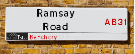
Ramsay Road has the postcodes of AB31 5TT, AB31 5TS and AB31 5PS.
Ramsay Road is located within the county of Kincardineshire, situated in the (pseudo) Scotland region of the UK. It's 395.9 miles North from central London., 16.55 miles West from Aberdeen, 44.83 miles North East from Dundee and 70.87 miles South East from Inverness.
Ramsay Road is within the Post Town of BANCHORY

Do you know why this road is called Ramsay Road?
What's it like to live here?
Ask the community a question about Ramsay Road.
Do you have any questions, memories to share or know any facts about Ramsay Road? We'd love to know more.
Also on streetlist.co.uk, can you help?
Swing Swang Lane
28th April 2024
I am trying to find out why the lane is named Swing Swang?
It has been known known this since at least 1905 when hedge making contents used to be held here.
Swing Swang is often used to describe a fairground ride. I remember Swing Boats. Were they a bit like this or is Swing Swang another name for swings?
Swing Swangs are also mentioned in connection to orchards. Or were orchards just good places to have swings?
Estate Agents near Ramsay Road
| Name | Address | Website |
|---|---|---|
| Strutt & Parker - Lettings, Banchory | 68 Station Road, Banchory, AB31 5YJ | Visit Website |
| Kirkwood Homes | Banchory, Aberdeenshire, AB31 4BR | Visit Website |
| Stonehouse Lettings | 20 High Street, Kemnay, AB51 5NB | Visit Website |
Location Details
| Ramsay Road | |
|---|---|

| |
| Latitude | 57.053357 |
| Longitude | -2.501570 |
| OS Easting (X): | 369577 |
| OS Northing (Y): | 795902 |
| OS Grid Reference: | NO696959 |
Neighbourhood Policing |
| Police Force: Scotland |
| Find a Local Neighbourhood Watch Scheme |
Frequently asked Questions for Ramsay Road
What Council (Local Authority) is Ramsay Road in?
Ramsay Road is located within the local authority area of Aberdeenshire Council which is a Scottish unitary authority.
What Parish Council is Ramsay Road in?
Ramsay Road is in an unparished area.
What Electoral Ward is Ramsay Road in?
Ramsay Road is located within the ward of Banchory and Mid Deeside.
What County is Ramsay Road in?
Ramsay Road is located within the ceremonial county of Kincardineshire.
What Constituency is Ramsay Road in?
Ramsay Road is located within the constituency of West Aberdeenshire and Kincardine.
What Part of the UK is Ramsay Road in?
Ramsay Road is located within the historic nation of Scotland.
What County Council area is Ramsay Road in?
Ramsay Road is not in a County Council area.
What Police Force area is Ramsay Road in?
Ramsay Road is located within the Scotland Police area.
Roads that have a Junction with Ramsay Road
| Street | Junction Type |
|---|---|
| Mount Street | junction |
| Lawson Avenue | junction |
| Arbeadie Road | junction |
Sunset and Sunrise times for Ramsay Road
| Sunrise | 04:51 |
|---|---|
| Sunset | 21:21 |
Latest Weather Conditions for Ramsay Road
| Observed at Weather Station: | Aboyne 13 May 2024 at 09:00 (12.67 miles away) |
|---|---|
| Current Weather: | Overcast |
| Temperature and Humidity: | 12.7°C (91.2%) |
| Wind Direction and Speed: | E (7 mph) |
Population Statistics
| ONS Area Code | S00091567 & S00091552 |
|---|---|
| ONS Area Name | Ageing in Suburbia & Older Farming Communities |
| LSOA Code: | S01006865 |
|---|---|
| LSOA Name: | Banchory West - 01 |
| SOA Code: | 2a |
| SOA Name: | |
| MSOA Code: | S02001298 |
| MSOA Name: | Banchory West |
Nearest Supermarkets
| Morrisons Banchory |
|---|
| North Deeside Road, Banchory AB31 5YR |
| 01330 820140 |
| Distance: 0.86 Miles |
| Directions from Ramsay Road to Morrisons Banchory |
| Tesco Banchory Superstore |
|---|
| Hill Of Banchory E, Banchory, AB31 5QA |
| 0345 026 9618 |
| Distance: 1.4 Miles |
| Directions from Ramsay Road to Tesco Banchory Superstore |
| Tesco Westhill Superstore |
|---|
| Endeavour Dr, Arnhall Business Park, Westhill, AB32 6UF |
| 0345 671 9428 |
| Distance: 10.79 Miles |
| Directions from Ramsay Road to Tesco Westhill Superstore |
| Tesco Aberdeen North Dees Express |
|---|
| 393 North Deeside Rd, Cults, Aberdeen, AB15 9SX |
| 0345 671 9314 |
| Distance: 12.94 Miles |
| Directions from Ramsay Road to Tesco Aberdeen North Dees Express |
Telephone Information
| Area Code |
|---|
| Area Code: 01330 - Banchory |
Broadband Information
| Speed | Average Speed | Median Speed | Maximum Speed | Next-generation access (NGA) | Number of Connections |
|---|---|---|---|---|---|
| Greater than 2 Mbps | 17.9 | 19.8 | 23.8 | N | 30 |
Local Government
| Local Council Details |
|---|
| Within the area of Aberdeenshire |
| Visit the Council's Website |
| Woodhill House, Westburn Road, Aberdeen, Aberdeenshire &AB16 5GB |
| Telephone Number: 0845 608 1207 |
| Local Member of Parliament |
|---|
| Within the Westminster Parliamentary Constituency of West Aberdeenshire and Kincardine |
| The Member of Parliament is Andrew Bowie |
| Details for the MP Andrew Bowie on parliament.uk |
| Details for the MP Andrew Bowie on theyworkforyou.com |
| In the 2019 General Election Andrew Bowie won with a majority of 843 the result was Con hold. The total electorate was 72,640 |
| Wards, Parish Councils and County Councils |
|---|
| Ward: Banchory and Mid Deeside Ward |
| Ceremonial County: Kincardineshire |
Nearest Schools
Scotland Primary Schools
Hill of Banchory School
Address: Hill of Banchory School, Firbrae, Hill of Banchory South, BANCHORY, AB31 5ZT
Distance: 0.93 miles
Contact: 01330 700380
Banchory Primary School
Address: Banchory Primary School, Arbeadie Road, Banchory, KINCARDINESHIRE, AB31 4EH
Distance: 0.30 miles
Contact: 01330 700370
Scotland Secondary Schools
Banchory Academy
Address: Banchory Academy, Raemoir Road, Banchory, KINCARDINESHIRE, AB31 5UJ
Distance: 0.44 miles
Contact: 01330 700450
Nearest Hospitals
| Name | Address | Postcode | Distance | Map |
|---|---|---|---|---|
| Glen O'dee Hospital | Banchory | AB31 5SA | 1.45 Km | View Directions |
| Inverurie Hospital | Upperboat Road, Inverurie | AB51 3UL | 25.82 Km | View Directions |
Nearest Dentists
Dentists near Ramsay Road
| Name | Address | Postcode | Distance | Map |
|---|---|---|---|---|
| DEESIDE DENTAL CARE | 75 High Street, Banchory, Aberdeenshire | AB315TJ | 0.22 Km | View Directions |
| BANCHORY DENTAL PRACTICE | 9 Station Road, Banchory | AB315XX | 0.39 Km | View Directions |
| FOUNTAIN DENTAL GROUP-BANCHORY | Station Road, Banchory | AB315YA | 1.09 Km | View Directions |
Nearest GP Surgeries
Doctors near Ramsay Road
BANCHORY GROUP PRACTICE
Address: BELLFIELD, BANCHORY, KINCARDINESHIRE, AB31 5XS
Distance: 0.18 miles
Contact: tel: 03450 130750
TORPHINS MEDICAL PRACTICE
Address: ST MARNAN ROAD, TORPHINS, BANCHORY, AB31 4JQ
Distance: 5.82 miles
Contact: tel: 01339 882221
PETERCULTER MEDICAL PRACTICE
Address: PETERCULTER HEALTH CENTRE, CORONATION ROAD, PETERCULTER, ABERDEENSHIRE, AB14 0RP
Distance: 9.67 miles
Contact: tel: 01224 733535
ABOYNE HEALTH CENTRE
Address: BELLWOOD ROAD, ABOYNE, ABERDEENSHIRE, AB34 5HQ
Distance: 10.13 miles
Contact: tel: 03453 379955
SKENE MEDICAL GROUP
Address: SKENE HEALTHCARE CENTRE, DISCOVERY DRIVE, ARNHALL BUSINESS PARK, WESTHILL, ABERDEENSHIRE, AB32 6FG
Distance: 10.69 miles
Contact: tel: 01224 849400
AUCHENBLAE MEDICAL CENTRE
Address: MACKENZIE AVENUE, AUCHENBLAE, LAURENCEKIRK, AB30 1XU
Distance: 10.76 miles
Contact: tel: 01561 320202
Nearest Dispensing Chemists
Pharmacies near Ramsay Road
| Name | Address | Postcode | Telephone | Map | Distance in Km |
|---|---|---|---|---|---|
| Davidsons Chemists | 61 High Street, Banchory, Aberdeenshire, | AB31 5TJ | 01330 822542 | View Directions | |
| Ingasetter Ltd | 67 High Street, Banchory | AB31 5TJ | 01330 822524 | View Directions | |
| Torphins Pharmacy Ltd | 1 Beltie Road, Torphins, Aberdeenshire, | AB31 4JP | 01339 882071 | View Directions |
Nearest Opticians
Opticians near Ramsay Road
COSTCO WHOLESALE UK LTD - MANDELA WAY
Address: COSTCO, ENDEAVOUR DRIVE, ARNHALL BUSINESS PARK, WESTHILL, ABERDEENSHIRE, AB32 6UF
Distance: 10.63 miles
Contact: :
4637 PORTLETHEN
Address: ASDA STORES LTD, MUIREND ROAD, PORTLETHEN, ABERDEEN, ABERDEENSHIRE, AB12 4XP
Distance: 13.68 miles
Contact: :
ASDA OPTICIANS (BRIDGE OF DEE)
Address: ASDA STORES LTD, GARTHDEE ROAD, BRIDGE OF DEE, ABERDEEN, ABERDEENSHIRE, AB10 7QA
Distance: 15.03 miles
Contact: :
OPTIMAX LASER EYE CLINIC
Address: 2 GOLDEN SQUARE, ABERDEEN, ABERDEENSHIRE, AB10 1RD
Distance: 16.23 miles
Contact: :
VISION EXPRESS (ABERDEEN)
Address: UNIT 32, BON ACCORD CENTRE, GEORGE STREET, ABERDEEN, ABERDEENSHIRE, AB25 1HZ
Distance: 16.45 miles
Contact: :
BOOTS OPTICIANS (ABERDEEN - BON ACCORD CENTRE)
Address: BON ACCORD CENTRE, GEORGE STREET, ABERDEEN, ABERDEENSHIRE, AB25 1HZ
Distance: 16.45 miles
Contact: :
Transport
Nearest Rail Stations
Stonehaven Station is 11.99 miles away.
Address: Stonehaven station, Station Road, Stonehaven, Aberdeenshire, AB39 2NE
Stonehaven is situated on the Glasgow to Aberdeen line|Edinburgh to Aberdeen line and is managed by ScotRail.
Stonehaven Station is staffed on a part time basis.
Portlethen Station is 14.10 miles away.
Address: Portlethen station, Bruntland Road, Portlethen, Aberdeenshire, AB12 4JS
Portlethen is situated on the Glasgow to Aberdeen line|Edinburgh to Aberdeen line and is managed by ScotRail.
Portlethen Station is an unstaffed station.