Map of Park Lane
| Postcodes | ||
|---|---|---|
| Icon | Postcodes for Park Lane | |
| Walking Distances | ||
| Distance Info | Green Circle = 10 Minutes Walk (800 metres) | |
About Park Lane
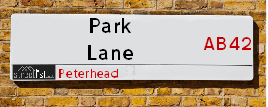
Park Lane is a street located in Peterhead. It uses the postcode AB42 1JG. The street has a length of approximately 44 metres.
Park Lane is located within the Aberdeenshire Council's jurisdiction. They provide various services, like refuse collection, and manage council tax collection. It's situated in the (pseudo) Scotland region of the UK.
Park Lane is located within the county of Aberdeenshire, situated in the (pseudo) Scotland region of the UK. It's 420.56 miles North from central London., 27.7 miles North East from Aberdeen, 85.33 miles North East from Dundee and 91.11 miles East from Inverness.
Park Lane is within the Post Town of PETERHEAD

Do you know why this road is called Park Lane?
What's it like to live here?
Ask the community a question about Park Lane.
Do you have any questions, memories to share or know any facts about Park Lane? We'd love to know more.
Also on streetlist.co.uk, can you help?
Swing Swang Lane
28th April 2024
I am trying to find out why the lane is named Swing Swang?
It has been known known this since at least 1905 when hedge making contents used to be held here.
Swing Swang is often used to describe a fairground ride. I remember Swing Boats. Were they a bit like this or is Swing Swang another name for swings?
Swing Swangs are also mentioned in connection to orchards. Or were orchards just good places to have swings?
Estate Agents near Park Lane
| Name | Address | Website |
|---|---|---|
| Stewart & Watson | 35 Queen Street, Peterhead,AB42 1TP | Visit Website |
| Stewart & Watson | 4 North Street, Mintlaw,AB42 5HH | Visit Website |
We have found 1 postcode for Park Lane
Location Details
| Park Lane | |
|---|---|

| |
| Latitude | 57.505354 |
| Longitude | -1.775631 |
| OS Easting (X): | 413443 |
| OS Northing (Y): | 846125 |
| OS Grid Reference: | NK134461 |
Neighbourhood Policing |
| Police Force: Scotland |
| Find a Local Neighbourhood Watch Scheme |
Frequently asked Questions for Park Lane
What Council (Local Authority) is Park Lane in?
Park Lane is located within the local authority area of Aberdeenshire Council which is a Scottish unitary authority.
What Parish Council is Park Lane in?
Park Lane is in an unparished area.
What Electoral Ward is Park Lane in?
Park Lane is located within the ward of Peterhead North and Rattray.
What County is Park Lane in?
Park Lane is located within the ceremonial county of Aberdeenshire.
What Constituency is Park Lane in?
Park Lane is located within the constituency of Banff and Buchan.
What Part of the UK is Park Lane in?
Park Lane is located within the historic nation of Scotland.
What County Council area is Park Lane in?
Park Lane is not in a County Council area.
What Police Force area is Park Lane in?
Park Lane is located within the Scotland Police area.
Roads that have a Junction with Park Lane
| Street | Junction Type |
|---|---|
| Longate | junction |
Sunset and Sunrise times for Park Lane , AB42 1JG
| Sunrise | 04:43 |
|---|---|
| Sunset | 21:23 |
Latest Weather Conditions for Park Lane, AB42 1JG
| Observed at Weather Station: | Aberdeen Airport 14 May 2024 at 14:00 (26.08 miles away) |
|---|---|
| Current Weather: | Mist |
| Temperature and Humidity: | 14.1°C (84.3%) |
| Wind Direction and Speed: | ESE (8 mph) |
Population Statistics
| ONS Area Code | S00091964 |
|---|---|
| ONS Area Name | Eastern European Communities |
| LSOA Code: | S01007086 |
|---|---|
| LSOA Name: | Peterhead Harbour - 06 |
| SOA Code: | 4b |
| SOA Name: | |
| MSOA Code: | S02001336 |
| MSOA Name: | Peterhead Harbour |
Nearest Supermarkets
| Iceland Peterhead |
|---|
| 25/31 Marischal Street, Peterhead, Grampian, AB42 1BS |
| 01779473456 |
| Distance: 0.13 Miles |
| Directions from Park Lane to Iceland Peterhead |
| Morrisons Peterhead |
|---|
| Queen Street, Peterhead AB42 1HG |
| 01779 490987 |
| Distance: 0.65 Miles |
| Directions from Park Lane to Morrisons Peterhead |
| Asda Peterhead |
|---|
| Longside Road, Peterhead, AB42 2FY |
| 01779 484000 |
| Distance: 1.59 Miles |
| Directions from Park Lane to Asda Peterhead |
| Tesco Ellon Superstore |
|---|
| Castle Rd, Ellon, AB41 9RY |
| 0345 026 9495 |
| Distance: 13.8 Miles |
| Directions from Park Lane to Tesco Ellon Superstore |
Telephone Information
| Area Code |
|---|
| Area Code: 01779 - Peterhead |
Broadband Information
| Speed | Average Speed | Median Speed | Maximum Speed | Next-generation access (NGA) | Number of Connections |
|---|---|---|---|---|---|
| Greater than 2 Mbps | 21.7 | 22 | 22 | N | 3 |
Local Government
| Local Council Details |
|---|
| Within the area of Aberdeenshire |
| Visit the Council's Website |
| Woodhill House, Westburn Road, Aberdeen, Aberdeenshire &AB16 5GB |
| Telephone Number: 0845 608 1207 |
| Local Member of Parliament |
|---|
| Within the Westminster Parliamentary Constituency of Banff and Buchan |
| The Member of Parliament is David Duguid |
| Details for the MP David Duguid on parliament.uk |
| Details for the MP David Duguid on theyworkforyou.com |
| In the 2019 General Election David Duguid won with a majority of 4,118 the result was Con hold. The total electorate was 66,655 |
| Wards, Parish Councils and County Councils |
|---|
| Ward: Peterhead North and Rattray Ward |
| Ceremonial County: Aberdeenshire |
Nearest Schools
Scotland Primary Schools
Meethill School
Address: Meethill School, School Road, Peterhead, ABERDEENSHIRE, AB42 2BF
Distance: 1.08 miles
Contact: 01779 474920
Peterhead Central School
Address: Peterhead Central School, St Peter Street, Peterhead, ABERDEENSHIRE, AB42 1QD
Distance: 0.26 miles
Contact: 01779 403650
Buchanhaven School
Address: Buchanhaven School, Hope Street, Peterhead, ABERDEENSHIRE, AB42 1HD
Distance: 0.90 miles
Contact: 01779 403665
Dales Park School
Address: Dales Park School, Berryden Road, Peterhead, ABERDEENSHIRE, AB42 2GD
Distance: 1.33 miles
Contact: 01779 477133
Burnhaven School
Address: Burnhaven School, South Road, Peterhead, ABERDEENSHIRE, AB42 0YX
Distance: 1.34 miles
Contact: 01779 403655
Clerkhill School
Address: Clerkhill School, Cairntrodlie, Peterhead, ABERDEENSHIRE, AB42 2AX
Distance: 1.03 miles
Contact: 01779 403660
Scotland Secondary Schools
Peterhead Academy
Address: Peterhead Academy, Prince Street, Peterhead, ABERDEENSHIRE, AB42 1SY
Distance: 0.53 miles
Contact: 01779 403800
Nearest Hospitals
| Name | Address | Postcode | Distance | Map |
|---|---|---|---|---|
| Peterhead Community Hospital | Links Terrace, Peterhead | AB42 2XB | 1.12 Km | View Directions |
| Ugie Hospital | Ugie Road, Peterhead | AB42 1LZ | 1.50 Km | View Directions |
Nearest Dentists
Dentists near Park Lane
| Name | Address | Postcode | Distance | Map |
|---|---|---|---|---|
| T/A BUPA DENTAL CARE | 44 Marischal Street, Peterhead | AB421HS | 0.23 Km | View Directions |
| QUEEN STREET DENTAL CENTRE | 95 Queen Street, Peterhead | AB421UA | 0.66 Km | View Directions |
| BUCHAN BRAES DENTAL CLINIC | Unit2,buchan Braes Business Park, Station Ave, Boddam | AB423AR | 4.01 Km | View Directions |
Nearest GP Surgeries
Doctors near Park Lane
THE HEALTH CENTRE
Address: PO BOX 18698, PETERHEAD, ABERDEENSHIRE, AB42 9AR
Distance: 0.40 miles
Contact: tel: 01224 556522
PETERHEAD HEALTH CENTRE
Address: LINKS TERRACE, PETERHEAD, ABERDEENSHIRE, AB42 2XA
Distance: 0.72 miles
Contact: tel: 03450 130710
CRUDEN MEDICAL GROUP
Address: MAIN STREET, HATTON, PETERHEAD, ABERDEENSHIRE, AB42 0QQ
Distance: 7.71 miles
Contact: tel: 01779 841208
CRIMOND MEDICAL CENTRE
Address: CRIMOND MEDICAL AND COMMUNITY HUB, LOGIE AVENUE WEST, CRIMOND, FRASERBURGH, AB43 8QJ
Distance: 8.38 miles
Contact: tel: 01346 532215
ADEN HEALTH CENTRE
Address: NEWLANDS ROAD, MINTLAW, PETERHEAD, AB42 5GP
Distance: 8.79 miles
Contact: tel: 01771 624070
ELLON GROUP PRACTICE
Address: ELLON HEALTH CENTRE, SCHOOLHILL, ELLON, ABERDEENSHIRE, AB41 9AH
Distance: 14.61 miles
Contact: tel: 03453 371150
Nearest Dispensing Chemists
Pharmacies near Park Lane
| Name | Address | Postcode | Telephone | Map | Distance in Km |
|---|---|---|---|---|---|
| Boots The Chemists Ltd | 21/23 Marischal Street, Peterhead | AB42 1BS | 01779 478100 | View Directions | |
| Steven F Webster | 7/9 Queen Street, Peterhead | AB42 1TN | 01779 473449 | View Directions | |
| Peterhead Health Centre Consortium | Links Terrace, Peterhead, Aberdeenshire, | AB42 2XA | 01779 482561 | View Directions |
Nearest Opticians
Opticians near Park Lane
VISION EXPRESS (ABERDEEN)
Address: UNIT 32, BON ACCORD CENTRE, GEORGE STREET, ABERDEEN, ABERDEENSHIRE, AB25 1HZ
Distance: 27.44 miles
Contact: :
BOOTS OPTICIANS (ABERDEEN - BON ACCORD CENTRE)
Address: BON ACCORD CENTRE, GEORGE STREET, ABERDEEN, ABERDEENSHIRE, AB25 1HZ
Distance: 27.44 miles
Contact: :
ABERDEEN DOMICILIARY SPECSAVERS LIMITED
Address: 56-58 UNION STREET, ABERDEEN, ABERDEENSHIRE, AB10 1BB
Distance: 27.50 miles
Contact: :
OPTIMAX LASER EYE CLINIC
Address: 2 GOLDEN SQUARE, ABERDEEN, ABERDEENSHIRE, AB10 1RD
Distance: 27.70 miles
Contact: :
ASDA OPTICIANS (BRIDGE OF DEE)
Address: ASDA STORES LTD, GARTHDEE ROAD, BRIDGE OF DEE, ABERDEEN, ABERDEENSHIRE, AB10 7QA
Distance: 29.33 miles
Contact: :
COSTCO WHOLESALE UK LTD - MANDELA WAY
Address: COSTCO, ENDEAVOUR DRIVE, ARNHALL BUSINESS PARK, WESTHILL, ABERDEENSHIRE, AB32 6UF
Distance: 30.99 miles
Contact: :
Transport
Nearest Rail Stations
Dyce Station is 25.89 miles away.
Address: Dyce station, Station Road, Dyce, Aberdeenshire, AB21 7EQ
Dyce is situated on the Aberdeen to Inverness line|Edinburgh to Aberdeen line and is managed by ScotRail.
Dyce Station is an unstaffed station.
Inverurie Station is 26.92 miles away.
Address: Inverurie station, Station Road, Inverurie, Aberdeenshire, AB51 4TN
Inverurie is situated on the Aberdeen to Inverness line|Edinburgh to Aberdeen line and is managed by ScotRail.
Inverurie Station is staffed on a part time basis.