Map of King Street
| Postcodes | ||
|---|---|---|
| Icon | Postcodes for King Street | |
| Walking Distances | ||
| Distance Info | Green Circle = 10 Minutes Walk (800 metres) | |
About King Street
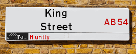
King Street is a street located in Huntly. The street has a length of approximately 459 metres.
King Street is located within the Aberdeenshire Council's jurisdiction. They provide various services, like refuse collection, and manage council tax collection. It's situated in the (pseudo) Scotland region of the UK.
King Street has the postcodes of AB54 8HP, AB54 8DH and AB54 8DG.
King Street is located within the county of Aberdeenshire, situated in the (pseudo) Scotland region of the UK. It's 424.98 miles North from central London., 33.43 miles North West from Aberdeen, 53.36 miles East from Inverness and 68.62 miles North from Dundee.
King Street is within the Post Town of HUNTLY

Do you know why this road is called King Street?
What's it like to live here?
Ask the community a question about King Street.
Do you have any questions, memories to share or know any facts about King Street? We'd love to know more.
Also on streetlist.co.uk, can you help?
Swing Swang Lane
28th April 2024
I am trying to find out why the lane is named Swing Swang?
It has been known known this since at least 1905 when hedge making contents used to be held here.
Swing Swang is often used to describe a fairground ride. I remember Swing Boats. Were they a bit like this or is Swing Swang another name for swings?
Swing Swangs are also mentioned in connection to orchards. Or were orchards just good places to have swings?
Estate Agents near King Street
| Name | Address | Website |
|---|---|---|
| Stewart & Watson | 17-19 Duke Street, Huntly,AB54 8DL | Visit Website |
| Peterkins Solicitors | 186 Mid St, Keith,AB55 5BQ | Visit Website |
Location Details
| King Street | |
|---|---|

| |
| Latitude | 57.446254 |
| Longitude | -2.791366 |
| OS Easting (X): | 352508 |
| OS Northing (Y): | 839800 |
| OS Grid Reference: | NJ525398 |
Neighbourhood Policing |
| Police Force: Scotland |
| Find a Local Neighbourhood Watch Scheme |
Frequently asked Questions for King Street
What Council (Local Authority) is King Street in?
King Street is located within the local authority area of Aberdeenshire Council which is a Scottish unitary authority.
What Parish Council is King Street in?
King Street is in an unparished area.
What Electoral Ward is King Street in?
King Street is located within the ward of Huntly &Strathbogie and Howe of Alford.
What County is King Street in?
King Street is located within the ceremonial county of Aberdeenshire.
What Constituency is King Street in?
King Street is located within the constituency of Gordon.
What Part of the UK is King Street in?
King Street is located within the historic nation of Scotland.
What County Council area is King Street in?
King Street is not in a County Council area.
What Police Force area is King Street in?
King Street is located within the Scotland Police area.
Roads that have a Junction with King Street
| Street | Junction Type |
|---|---|
| Deveron Street (A920) | junction |
| Scott Drive | junction |
| Torry Road | junction |
| Gordon Court | junction |
| Littlejohn Street | junction |
| Depot Road | junction |
Sunset and Sunrise times for King Street
| Sunrise | 04:52 |
|---|---|
| Sunset | 21:22 |
Latest Weather Conditions for King Street
| Observed at Weather Station: | Aboyne 12 May 2024 at 02:00 (25.57 miles away) |
|---|---|
| Current Weather: | Overcast |
| Temperature and Humidity: | 9.7°C (88.4%) |
| Wind Direction and Speed: | E (8 mph) |
Population Statistics
| ONS Area Code | S00091860, S00091859 & S00091841 |
|---|---|
| ONS Area Name | Ageing Rural Industry Workers, Renting Rural Retirement & Ageing Communities and Families |
| LSOA Code: | S01007008 &S01007011 |
|---|---|
| LSOA Name: | Huntly - 01 &Huntly - 04 |
| SOA Code: | 5e &4b |
| SOA Name: | |
| MSOA Code: | S02001321 |
| MSOA Name: | Huntly |
Nearest Supermarkets
| Asda Huntly |
|---|
| Steven Road, Huntly, AB54 8SX |
| 01466 795500 |
| Distance: 0.31 Miles |
| Directions from King Street to Asda Huntly |
| Tesco Huntly Superstore |
|---|
| Deveron Rd, Huntly, AB54 8TS |
| 0345 026 9499 |
| Distance: 0.49 Miles |
| Directions from King Street to Tesco Huntly Superstore |
| Tesco Keith Moss St Superstore |
|---|
| Moss St, Keith, AB55 5HB |
| 0345 671 9357 |
| Distance: 8.7 Miles |
| Directions from King Street to Tesco Keith Moss St Superstore |
| Tesco Turriff Superstore |
|---|
| 32 High Steet, Turriff, AB53 4EN |
| 0345 675 7122 |
| Distance: 13.71 Miles |
| Directions from King Street to Tesco Turriff Superstore |
Telephone Information
| Area Code |
|---|
| Area Code: 01466 - Huntly |
| Area Code: 01542 - Keith |
Broadband Information
| Speed | Average Speed | Median Speed | Maximum Speed | Next-generation access (NGA) | Number of Connections |
|---|---|---|---|---|---|
| Greater than 2 Mbps | 14.8 | 14.8 | 21.3 | N | 16 |
Local Government
| Local Council Details |
|---|
| Within the area of Aberdeenshire |
| Visit the Council's Website |
| Woodhill House, Westburn Road, Aberdeen, Aberdeenshire &AB16 5GB |
| Telephone Number: 0845 608 1207 |
| Local Member of Parliament |
|---|
| Within the Westminster Parliamentary Constituency of Gordon |
| The Member of Parliament is Richard Thomson |
| Details for the MP Richard Thomson on parliament.uk |
| Details for the MP Richard Thomson on theyworkforyou.com |
| In the 2019 General Election Richard Thomson won with a majority of 819 the result was SNP gain from Con. The total electorate was 79,629 |
| Wards, Parish Councils and County Councils |
|---|
| Ward: Huntly &Strathbogie and Howe of Alford Ward |
| Ceremonial County: Aberdeenshire |
Nearest Schools
Scotland Secondary Schools
The Gordon Schools
Address: The Gordon Schools, Castle Street, Huntly, ABERDEENSHIRE, AB54 4SE
Distance: 0.38 miles
Contact: 01466 405990
Scotland Primary Schools
Gordon Primary School
Address: Gordon Primary School, Huntly, Aberdeenshire, AB54 4SE
Distance: 0.38 miles
Contact: 01466 405910
Nearest Hospitals
| Name | Address | Postcode | Distance | Map |
|---|---|---|---|---|
| Jubilee Hospital | Bleachfield Street, Huntly | AB54 8EX | 0.34 Km | View Directions |
Nearest Dentists
Dentists near King Street
| Name | Address | Postcode | Distance | Map |
|---|---|---|---|---|
| DEVERON DENTAL CENTRE | Ogilivie Avenue, Huntly | AB548AT | 0.45 Km | View Directions |
| HUNTLY DENTAL PRACTICE | 41 Duke Street, Huntly | AB548DT | 0.45 Km | View Directions |
| YOUNG SMILE DENTAL CARE | Unit 1, Haughton Court, Main St, Alford | AB338DW | 24.33 Km | View Directions |
Nearest GP Surgeries
Doctors near King Street
BYDAND MEDICAL GROUP
Address: HUNTLY HEALTH CENTRE, BLEACHFIELD STREET, HUNTLY, AB54 8EX
Distance: 0.21 miles
Contact: tel: 01466 792116
KEITH MEDICAL GROUP
Address: TURNER STREET, KEITH, BANFFSHIRE, AB55 5DJ
Distance: 8.95 miles
Contact: tel: 03453 379944
INSCH MEDICAL PRACTICE
Address: INSCH HEALTH CENTRE, RANNES STREET, INSCH, ABERDEENSHIRE, AB52 6JJ
Distance: 9.87 miles
Contact: tel: 03453 376310
RINNES MEDICAL GROUP
Address: HEALTH CENTRE, MOUNT STREET, DUFFTOWN, KEITH, AB55 4FJ
Distance: 12.37 miles
Contact: tel: 01340 820888
TURRIFF MEDICAL PRACTICE
Address: TURRIFF HEALTH CENTRE, BALMELLIE ROAD, TURRIFF, ABERDEENSHIRE, AB53 4DQ
Distance: 14.07 miles
Contact: tel: 03453 376320
FOCHABERS MEDICAL PRACTICE
Address: 12 HIGH STREET, FOCHABERS, IV32 7EP
Distance: 16.01 miles
Contact: tel: 01343 820247
Nearest Dispensing Chemists
Pharmacies near King Street
| Name | Address | Postcode | Telephone | Map | Distance in Km |
|---|---|---|---|---|---|
| Largue Pharmacy Ltd | 10-12 Gordon Street, Huntly, Aberdeenshire, | AB54 8AJ | 01466 792728 | View Directions | |
| Largue Pharmacy Ltd | 26 Duke Street, Huntly, Aberdeenshire, | AB54 8DL | 01466 792141 | View Directions | |
| N S Wilson Ltd | 34-36 Main Street, Alford, Aberdeenshire, | AB33 8PX | 01975 562225 | View Directions |
Nearest Opticians
Opticians near King Street
BOOTS OPTICIANS (ELGIN)
Address: 169 HIGH STREET, ELGIN, IV30 1DW
Distance: 24.00 miles
Contact: :
COSTCO WHOLESALE UK LTD - MANDELA WAY
Address: COSTCO, ENDEAVOUR DRIVE, ARNHALL BUSINESS PARK, WESTHILL, ABERDEENSHIRE, AB32 6UF
Distance: 28.11 miles
Contact: :
VISION EXPRESS (ABERDEEN)
Address: UNIT 32, BON ACCORD CENTRE, GEORGE STREET, ABERDEEN, ABERDEENSHIRE, AB25 1HZ
Distance: 32.98 miles
Contact: :
BOOTS OPTICIANS (ABERDEEN - BON ACCORD CENTRE)
Address: BON ACCORD CENTRE, GEORGE STREET, ABERDEEN, ABERDEENSHIRE, AB25 1HZ
Distance: 32.98 miles
Contact: :
OPTIMAX LASER EYE CLINIC
Address: 2 GOLDEN SQUARE, ABERDEEN, ABERDEENSHIRE, AB10 1RD
Distance: 33.00 miles
Contact: :
ABERDEEN DOMICILIARY SPECSAVERS LIMITED
Address: 56-58 UNION STREET, ABERDEEN, ABERDEENSHIRE, AB10 1BB
Distance: 33.15 miles
Contact: :
Transport
Nearest Rail Stations
Huntly Station is 0.57 miles away.
Address: Huntly station, off Bogie St, Huntly, Aberdeenshire, AB54 5HS
Huntly is situated on the Aberdeen to Inverness line and is managed by ScotRail.
Huntly Station is staffed on a part time basis.
Keith Station is 9.42 miles away.
Address: Keith station, Station Road, Keith, Moray, AB55 3DR
Keith is situated on the Aberdeen to Inverness line and is managed by ScotRail.
Keith Station is staffed on a part time basis.