Map of Cluny Square
| Postcodes | ||
|---|---|---|
| Icon | Postcodes for Cluny Square | |
| Walking Distances | ||
| Distance Info | Green Circle = 10 Minutes Walk (800 metres) | |
About Cluny Square
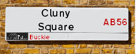
Cluny Square is a street located in Buckie. The street has a length of approximately 271 metres.
Cluny Square is located within the West Moray &North East Moray Council's jurisdiction. They provide various services, like refuse collection, and manage council tax collection. It's situated in the (pseudo) Scotland region of the UK.
Cluny Square has the postcodes of AB56 1HA, AB56 1AJ and AB56 1AH.
Cluny Square is located within the county of Banffshire, situated in the (pseudo) Scotland region of the UK. It's 441.94 miles North from central London., 48.71 miles East from Inverness, 48.97 miles North West from Aberdeen and 84.1 miles North from Dundee.
Cluny Square is within the Post Town of BUCKIE

Do you know why this road is called Cluny Square?
What's it like to live here?
Ask the community a question about Cluny Square.
Do you have any questions, memories to share or know any facts about Cluny Square? We'd love to know more.
Also on streetlist.co.uk, can you help?
Swing Swang Lane
28th April 2024
I am trying to find out why the lane is named Swing Swang?
It has been known known this since at least 1905 when hedge making contents used to be held here.
Swing Swang is often used to describe a fairground ride. I remember Swing Boats. Were they a bit like this or is Swing Swang another name for swings?
Swing Swangs are also mentioned in connection to orchards. Or were orchards just good places to have swings?
Eldroth Road
15th April 2024
I wondered if anyone has any old pictures of Wenning Bank House in the 1940’s and also Lane Side before of the same era .. we visited today with my Mum in law as she used to live at both these properties. Also any photos of the schools around that time .. thank you.
Can You Help?Napps Way
15th April 2024
Why is the road called Napps Way (belonging to Napp, but minus an
apostrophe as is usual with such nomenclature)? Moreover, who or
what is, or was, “Napp” in the respective, possessive case?
Several years ago, I met an elderly man (probably in his late-eighties)
who lives on Bentham Drive, Liverpool 16, and during a conversation
with him whilst in a Northwest Passenger Transport Ambulance on the
way to the former RLUH (Royal Liverpool University Hospital), he told
me that he could remember (when he was a boy, living in Childwall,
Liverpool 16) that, “Where Napps Way is now, during WW2, there was
a two-man gun emplacement on the, then, open land to protect the
railway line passing over Childwall Valley Road - next to the railway
bridge - when suddenly, as they were loading a live “shell” into the gun’s
breach, the aforementioned “shell” accidentally exploded in the gun’s
breach killing both of the two soldiers, that had been manning the gun,
instantly! (Very sad, of course, but could - perhaps - two ghosts relating
to those two, very unfortunately and prematurely-killed soldiers have
haunted that place of their deaths ever since - and have any residents
of Napps Way - formerly and in its latest incarnation - seen two, WW2
(uniformed) soldiers unexpectedly appear in or near their homes?)
Estate Agents near Cluny Square
| Name | Address | Website |
|---|---|---|
| Grant Smith Law Practice Ltd | 16 East Church Street, Buckie,AB56 1AE | Visit Website |
| Stewart & Watson | 42-44 East Church Street, Buckie,AB56 1AB | Visit Website |
| Springfield - North Scotland, Inchgower | Seafield Circle, off Barhill Road, Buckie, AB56 5AD | Visit Website |
Location Details
| Cluny Square | |
|---|---|

| |
| Latitude | 57.674972 |
| Longitude | -2.962198 |
| OS Easting (X): | 342617 |
| OS Northing (Y): | 865391 |
| OS Grid Reference: | NJ426654 |
Neighbourhood Policing |
| Police Force: Scotland |
| Find a Local Neighbourhood Watch Scheme |
Frequently asked Questions for Cluny Square
What Council (Local Authority) is Cluny Square in?
Cluny Square is located within the local authority area of West Moray &North East Moray Council which is a Scottish unitary authority.
What Parish Council is Cluny Square in?
Cluny Square is in an unparished area.
What Electoral Ward is Cluny Square in?
Cluny Square is located within the ward of Buckie.
What County is Cluny Square in?
Cluny Square is located within the ceremonial county of Banffshire.
What Constituency is Cluny Square in?
Cluny Square is located within the constituency of Moray.
What Part of the UK is Cluny Square in?
Cluny Square is located within the historic nation of Scotland.
What County Council area is Cluny Square in?
Cluny Square is not in a County Council area.
What Police Force area is Cluny Square in?
Cluny Square is located within the Scotland Police area.
Roads that have a Junction with Cluny Square
| Street | Junction Type |
|---|---|
| West Church Street | junction |
| High Street (A942) | junction |
| East Church Street | junction |
Sunset and Sunrise times for Cluny Square
| Sunrise | 04:55 |
|---|---|
| Sunset | 21:20 |
Latest Weather Conditions for Cluny Square
| Observed at Weather Station: | Lossiemouth 10 May 2024 at 08:00 (13.53 miles away) |
|---|---|
| Current Weather: | Overcast |
| Temperature and Humidity: | 13.8°C (85.3%) |
| Wind Direction and Speed: | W (3 mph) |
Population Statistics
| ONS Area Code | S00121525, S00121526 & S00121709 |
|---|---|
| ONS Area Name | Transitional Eastern European Neighbourhoods, Self-Sufficient Retirement & Communal Retirement |
| LSOA Code: | S01011076 &S01011079 |
|---|---|
| LSOA Name: | Buckie Central East - 04 &Buckie West and Mains of Buckie - 02 |
| SOA Code: | 5e |
| SOA Name: | |
| MSOA Code: | S02002078 &S02002079 |
| MSOA Name: | Buckie Central East &Buckie West and Mains of Buckie |
Nearest Supermarkets
| Tesco Buckie Superstore |
|---|
| Highstreet, Buckie, AB56 4AB |
| 0345 026 9628 |
| Distance: 0.58 Miles |
| Directions from Cluny Square to Tesco Buckie Superstore |
| Tesco Keith Moss St Superstore |
|---|
| Moss St, Keith, AB55 5HB |
| 0345 671 9357 |
| Distance: 9.24 Miles |
| Directions from Cluny Square to Tesco Keith Moss St Superstore |
| Asda Elgin |
|---|
| Edgar Road, Elgin, IV30 6YQ |
| 01343 564000 |
| Distance: 13.07 Miles |
| Directions from Cluny Square to Asda Elgin |
| Tesco Elgin Extra |
|---|
| Blackfriars Rd, Elgin, IV30 1TY |
| 0345 677 9792 |
| Distance: 13.39 Miles |
| Directions from Cluny Square to Tesco Elgin Extra |
Telephone Information
| Area Code |
|---|
| Area Code: 01542 - Keith |
Broadband Information
| Speed | Average Speed | Median Speed | Maximum Speed | Next-generation access (NGA) | Number of Connections |
|---|---|---|---|---|---|
| Greater than 2 Mbps | 15.1 | 21.1 | 21.7 | N | 3 |
Local Government
| Local Council Details |
|---|
| Within the area of West Moray &North East Moray |
| Visit the Council's Website |
| Council Office, High Street, Elgin, Moray &IV30 1BX |
| Telephone Number: 01343 543 451 |
| Local Member of Parliament |
|---|
| Within the Westminster Parliamentary Constituency of Moray |
| The Member of Parliament is Douglas Ross |
| Details for the MP Douglas Ross on parliament.uk |
| Details for the MP Douglas Ross on theyworkforyou.com |
| In the 2019 General Election Douglas Ross won with a majority of 513 the result was Con hold. The total electorate was 71,035 |
| Wards, Parish Councils and County Councils |
|---|
| Ward: Buckie Ward |
| Ceremonial County: Banffshire |
Nearest Schools
Scotland Primary Schools
Portessie Primary School
Address: Portessie Primary School, School Road, Portessie, BUCKIE, AB56 1TN
Distance: 1.02 miles
Contact: 01542 832288
Cluny Primary School
Address: Cluny Primary School, South Pringle Street, Buckie, MORAY, AB56 1PX
Distance: 0.25 miles
Contact: 01542 831417
Millbank Primary School
Address: Millbank Primary School, McWilliam Crescent, Buckie, MORAY, AB56 1LU
Distance: 0.33 miles
Contact: 01542 831113
St Peter's RC Primary School
Address: St Peter's RC Primary School, 37 St Peter's Terrace, Buckie, MORAY, AB56 1QN
Distance: 0.48 miles
Contact: 01542 831339
Scotland Secondary Schools
Buckie High School
Address: Buckie High School, West Cathcart Street, Buckie, MORAY, AB56 1QB
Distance: 0.35 miles
Contact: 01542 832605
Nearest Hospitals
| Name | Address | Postcode | Distance | Map |
|---|---|---|---|---|
| Buckie Day Hospital | The Bungalow, Seafield Hospital, Buckie | AB56 1SF | 1.41 Km | View Directions |
| Seafield Hospital | Barrhill Road, Buckie | AB56 1SF | 1.41 Km | View Directions |
| Turner Memorial Hospital | Turner Street, Keith | AB55 5DJ | 14.80 Km | View Directions |
Nearest Dentists
Dentists near Cluny Square
| Name | Address | Postcode | Distance | Map |
|---|---|---|---|---|
| 8 TO 8 DENTAL | 32 West Church Street, Buckie | AB561HL | 0.42 Km | View Directions |
| BUCKIE DENTAL PRACTICE | 93 West Church Street, Buckie | AB561BS | 0.61 Km | View Directions |
| 8TO8 DENTAL | 1 Westerton Rd North, Keith | AB555FL | 14.85 Km | View Directions |
Nearest GP Surgeries
Doctors near Cluny Square
ARDACH HEALTH CENTRE
Address: HIGHFIELD ROAD, BUCKIE, BANFFSHIRE, AB56 1JE
Distance: 0.27 miles
Contact: tel: 03450 997200
SEAFIELD & CULLEN MEDICAL GROUP
Address: BARHILL ROAD, BUCKIE, AB56 1FP
Distance: 0.90 miles
Contact: tel: 01542 835577
FOCHABERS MEDICAL PRACTICE
Address: 12 HIGH STREET, FOCHABERS, IV32 7EP
Distance: 6.47 miles
Contact: tel: 01343 820247
KEITH MEDICAL GROUP
Address: TURNER STREET, KEITH, BANFFSHIRE, AB55 5DJ
Distance: 9.21 miles
Contact: tel: 03453 379944
AN CAORANN MEDICAL PRACTICE
Address: PORTSOY SURGERY, 16 SEAFIELD TERRACE, PORTSOY, BANFF, BANFFSHIRE, AB45 2GB
Distance: 9.82 miles
Contact: tel: 03453 379966
LINKWOOD MEDICAL
Address: THE GLASSGREEN CENTRE, 2 THORNHILL DRIVE, ELGIN, MORAYSHIRE, IV30 6GQ
Distance: 12.53 miles
Contact: tel: 03453 376350
Nearest Dispensing Chemists
Pharmacies near Cluny Square
| Name | Address | Postcode | Telephone | Map | Distance in Km |
|---|---|---|---|---|---|
| Norvik Pharmacies Ltd | 1 High Street, Buckie | AB56 1AL | 01542 831116 | View Directions | |
| Normac Pharmacy Services Ltd | Ardach Health Centre, Highfield Road, Buckie, | AB56 1JE | 01542 831147 | View Directions | |
| Norvick Pharmacies Ltd | 12 St Andrews Square, Buckie, Moray, | AB56 1BU | 01542 833321 | View Directions |
Nearest Opticians
Opticians near Cluny Square
BOOTS OPTICIANS (ELGIN)
Address: 169 HIGH STREET, ELGIN, IV30 1DW
Distance: 13.26 miles
Contact: :
COSTCO WHOLESALE UK LTD - MANDELA WAY
Address: COSTCO, ENDEAVOUR DRIVE, ARNHALL BUSINESS PARK, WESTHILL, ABERDEENSHIRE, AB32 6UF
Distance: 44.40 miles
Contact: :
VISION EXPRESS (ABERDEEN)
Address: UNIT 32, BON ACCORD CENTRE, GEORGE STREET, ABERDEEN, ABERDEENSHIRE, AB25 1HZ
Distance: 48.48 miles
Contact: :
BOOTS OPTICIANS (ABERDEEN - BON ACCORD CENTRE)
Address: BON ACCORD CENTRE, GEORGE STREET, ABERDEEN, ABERDEENSHIRE, AB25 1HZ
Distance: 48.48 miles
Contact: :
OPTIMAX LASER EYE CLINIC
Address: 2 GOLDEN SQUARE, ABERDEEN, ABERDEENSHIRE, AB10 1RD
Distance: 48.54 miles
Contact: :
BOOTS OPTICIANS (EASTGATE)
Address: 16-28 EASTGATE, INVERNESS, INVERNESS-SHIRE, IV2 3NA
Distance: 48.61 miles
Contact: :
Transport
Nearest Rail Stations
Keith Station is 8.58 miles away.
Address: Keith station, Station Road, Keith, Moray, AB55 3DR
Keith is situated on the Aberdeen to Inverness line and is managed by ScotRail.
Keith Station is staffed on a part time basis.
Elgin Station is 13.09 miles away.
Address: Elgin station, Station Road, Elgin, Moray, IV30 1QP
Elgin is situated on the Aberdeen to Inverness line and is managed by ScotRail.
Elgin Station is staffed on a part time basis.