The BA11 4 postcode sector is within the county of Somerset.
Did you know? According to the 2021 Census, the BA11 4 postcode sector is home to a bustling 6,263 residents!
Given that each sector allows for 400 unique postcode combinations. Letters C, I, K, M, O and V are not allowed in the last two letters of a postcode. With 189 postcodes already in use, this leaves 211 units available.
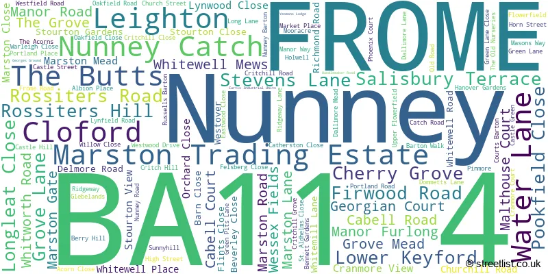
The largest settlement in the BA11 4 postal code is FROME followed by Nunney, and Marston Trading Estate.
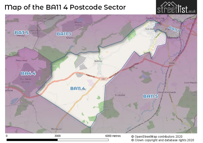
The BA11 4 Postcode shares a border with BA4 4 (SHEPTON MALLET, Pilton, Doulting), BA11 1 (FROME), BA11 5 (FROME, Witham Friary, Trudoxhill) and BA11 3 (FROME, Mells, Chantry).
The sector is within the post town of FROME.
BA11 4 is a postcode sector within the BA1 postcode district which is within the BA Bath postcode area.
The Royal Mail delivery office for the BA11 4 postal sector is the Bath Delivery Office.
The area of the BA11 4 postcode sector is 7.01 square miles which is 18.16 square kilometres or 4,488.50 square acres.

Map of the BA11 4 Postcode Sector
Explore the BA11 4 postcode sector by using our free interactive map.
| B | A | 1 | 1 | - | 4 | X | X |
| B | A | 1 | 1 | Space | 4 | Letter | Letter |
Official List of Streets
FROME (76 Streets)
Nunney (24 Streets)
Marston Trading Estate (1 Streets)
Unofficial Streets or Alternative Spellings
FROME
BROADWAY BUTTS HILL LITTLE KEYFORD LANE MOUNT PLEASANT QUEENS ROAD ROBINS LANE SOMERSET ROAD WEYMOUTH ROAD ALICE STREET BACK STREET BULLMEAD LANE CAXTON ROAD CHOVEL LANE DONKEY LANE FULWELL LANE HOLWELL HILL LONGTHORNS NUNNEY CATCH ROUNDABOUT PADDLES LANE PRIMROSE HILL SANDYS HILL LANE TADLEY MEADOW THE MARKET PLACE WEAVERS COURTNunney
BERRY HILLTrudoxhill
MARL PITS LANEWeather Forecast for BA11 4
Press Button to Show Forecast for West Woodlands
| Time Period | Icon | Description | Temperature | Rain Probability | Wind |
|---|---|---|---|---|---|
| 12:00 to 15:00 | Cloudy | 15.0°C (feels like 15.0°C) | 10.00% | SE 4 mph | |
| 15:00 to 18:00 | Light rain | 15.0°C (feels like 14.0°C) | 84.00% | NNW 7 mph | |
| 18:00 to 21:00 | Heavy rain | 12.0°C (feels like 11.0°C) | 92.00% | NW 7 mph | |
| 21:00 to 00:00 | Heavy rain | 11.0°C (feels like 10.0°C) | 91.00% | NNW 7 mph |
Press Button to Show Forecast for West Woodlands
| Time Period | Icon | Description | Temperature | Rain Probability | Wind |
|---|---|---|---|---|---|
| 00:00 to 03:00 | Overcast | 11.0°C (feels like 10.0°C) | 53.00% | NW 9 mph | |
| 03:00 to 06:00 | Heavy rain | 11.0°C (feels like 10.0°C) | 87.00% | NNW 9 mph | |
| 06:00 to 09:00 | Heavy rain | 11.0°C (feels like 10.0°C) | 81.00% | N 7 mph | |
| 09:00 to 12:00 | Light rain shower (day) | 12.0°C (feels like 11.0°C) | 37.00% | NNW 7 mph | |
| 12:00 to 15:00 | Overcast | 14.0°C (feels like 12.0°C) | 17.00% | NW 9 mph | |
| 15:00 to 18:00 | Cloudy | 14.0°C (feels like 12.0°C) | 14.00% | WNW 11 mph | |
| 18:00 to 21:00 | Cloudy | 12.0°C (feels like 10.0°C) | 14.00% | WNW 11 mph | |
| 21:00 to 00:00 | Light rain | 11.0°C (feels like 8.0°C) | 44.00% | W 11 mph |
Press Button to Show Forecast for West Woodlands
| Time Period | Icon | Description | Temperature | Rain Probability | Wind |
|---|---|---|---|---|---|
| 00:00 to 03:00 | Overcast | 10.0°C (feels like 8.0°C) | 16.00% | W 11 mph | |
| 03:00 to 06:00 | Overcast | 10.0°C (feels like 7.0°C) | 20.00% | W 11 mph | |
| 06:00 to 09:00 | Cloudy | 10.0°C (feels like 8.0°C) | 16.00% | W 11 mph | |
| 09:00 to 12:00 | Cloudy | 11.0°C (feels like 9.0°C) | 13.00% | W 13 mph | |
| 12:00 to 15:00 | Cloudy | 13.0°C (feels like 11.0°C) | 10.00% | W 13 mph | |
| 15:00 to 18:00 | Cloudy | 14.0°C (feels like 12.0°C) | 8.00% | W 11 mph | |
| 18:00 to 21:00 | Partly cloudy (day) | 13.0°C (feels like 11.0°C) | 6.00% | W 9 mph | |
| 21:00 to 00:00 | Clear night | 9.0°C (feels like 8.0°C) | 4.00% | W 7 mph |
Press Button to Show Forecast for West Woodlands
| Time Period | Icon | Description | Temperature | Rain Probability | Wind |
|---|---|---|---|---|---|
| 00:00 to 03:00 | Clear night | 8.0°C (feels like 6.0°C) | 3.00% | WSW 7 mph | |
| 03:00 to 06:00 | Clear night | 7.0°C (feels like 5.0°C) | 4.00% | SW 4 mph | |
| 06:00 to 09:00 | Cloudy | 8.0°C (feels like 7.0°C) | 7.00% | SSW 4 mph | |
| 09:00 to 12:00 | Cloudy | 12.0°C (feels like 11.0°C) | 8.00% | SW 9 mph | |
| 12:00 to 15:00 | Light rain | 14.0°C (feels like 12.0°C) | 43.00% | SW 11 mph | |
| 15:00 to 18:00 | Cloudy | 15.0°C (feels like 13.0°C) | 20.00% | SSW 11 mph | |
| 18:00 to 21:00 | Cloudy | 14.0°C (feels like 12.0°C) | 16.00% | SSW 9 mph | |
| 21:00 to 00:00 | Overcast | 11.0°C (feels like 10.0°C) | 13.00% | SSW 7 mph |
Schools and Places of Education Within the BA11 4 Postcode Sector
Critchill Special School
Academy special converter
Nunney Road, Frome, Somerset, BA11 4LB
Head: Mrs Emma West
Ofsted Rating: Good
Inspection: 2023-06-28 (308 days ago)
Website: Visit Critchill Special School Website
Phone: 01373464148
Number of Pupils: 89
Nunney First School
Academy sponsor led
Catch Road, Frome, Somerset, BA11 4NE
Head: Miss Anna Hind
Ofsted Rating: Good
Inspection: 2019-04-03 (1855 days ago)
Website: Visit Nunney First School Website
Phone: 01373836429
Number of Pupils: 74
Oakfield Academy
Academy converter
Oakfield Road, Frome, Somerset, BA11 4JF
Head: Miss Emma Wilkes
Ofsted Rating: Requires improvement
Inspection: 2021-09-29 (945 days ago)
Website: Visit Oakfield Academy Website
Phone: 01373462539
Number of Pupils: 608
Trinity Church of England First School
Voluntary controlled school
Nunney Road, Frome, Somerset, BA11 4LB
Head: Mrs Amanda Seager
Ofsted Rating: Good
Inspection: 2023-09-13 (231 days ago)
Website: Visit Trinity Church of England First School Website
Phone: 01373461949
Number of Pupils: 287
Wessex Lodge School
Other independent special school
Nunney Road, Frome, Somerset, BA11 4LA
Head: Ms Kate Stradling
Ofsted Rating: Good
Inspection: 2022-03-10 (783 days ago)
Website: Visit Wessex Lodge School Website
Phone: 01373453414
Number of Pupils: 46
House Prices in the BA11 4 Postcode Sector
| Type of Property | 2018 Average | 2018 Sales | 2017 Average | 2017 Sales | 2016 Average | 2016 Sales | 2015 Average | 2015 Sales |
|---|---|---|---|---|---|---|---|---|
| Detached | £385,111 | 18 | £382,750 | 24 | £370,059 | 17 | £327,113 | 26 |
| Semi-Detached | £288,999 | 52 | £273,149 | 66 | £234,891 | 29 | £221,098 | 20 |
| Terraced | £270,868 | 40 | £252,698 | 49 | £232,324 | 34 | £203,033 | 35 |
| Flats | £172,333 | 3 | £139,945 | 11 | £120,707 | 14 | £115,409 | 11 |
Important Postcodes BA11 4 in the Postcode Sector
BA11 4BS is the postcode for Colliers Court, Manor Road, and Somerset County Council, Colliers Court, Manor Road
BA11 4JF is the postcode for Oakfield Middle School, Oakfield Road, OAKFIELD MIDDLE SCHOOL, OAKFIELD ROAD, FROME, and Oakfield Academy, Oakfield Road
BA11 4LB is the postcode for Trinity First School, Nunney Road, and Critchill School, Nunney Road
BA11 4NE is the postcode for Nunney First School, Catch Road, and Nunney First School, Catch Road, Nunney
| The BA11 4 Sector is within these Local Authorities |
|
|---|---|
| The BA11 4 Sector is within these Counties |
|
| The BA11 4 Sector is within these Water Company Areas |
|