The BA16 9 postcode sector is within the county of Somerset.
Did you know? According to the 2021 Census, the BA16 9 postcode sector is home to a bustling 2,579 residents!
Given that each sector allows for 400 unique postcode combinations. Letters C, I, K, M, O and V are not allowed in the last two letters of a postcode. With 80 postcodes already in use, this leaves 320 units available.
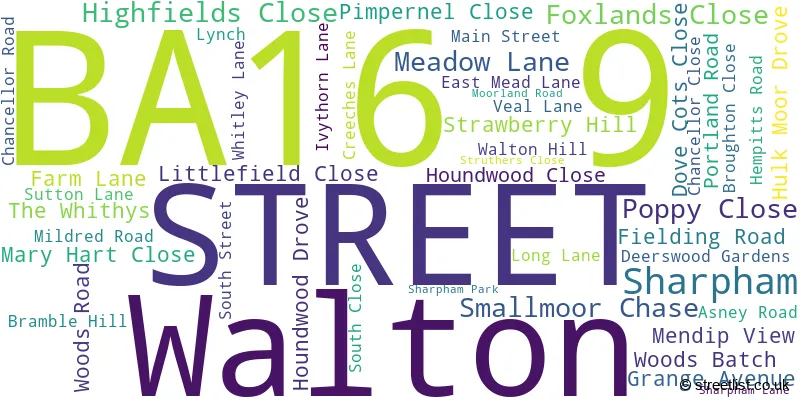
The largest settlement in the BA16 9 postal code is STREET followed by Walton, and Sharpham.
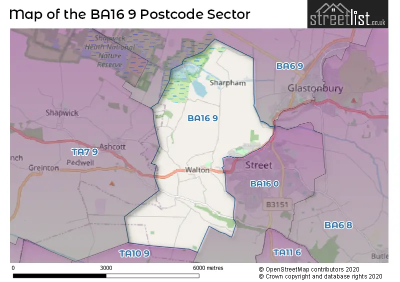
The BA16 9 Postcode shares a border with TA7 9 (Ashcott, Chilton Polden, Catcott), TA10 9 (LANGPORT, Long Sutton, Pitney), BA16 0 (STREET) and BA6 9 (GLASTONBURY, Meare, Westhay).
The sector is within the post town of STREET.
BA16 9 is a postcode sector within the BA1 postcode district which is within the BA Bath postcode area.
The Royal Mail delivery office for the BA16 9 postal sector is the Bath Delivery Office.
The area of the BA16 9 postcode sector is 7.09 square miles which is 18.36 square kilometres or 4,535.77 square acres.
Waterways within the BA16 9 postcode sector include the River Ho.

Map of the BA16 9 Postcode Sector
Explore the BA16 9 postcode sector by using our free interactive map.
| B | A | 1 | 6 | - | 9 | X | X |
| B | A | 1 | 6 | Space | 9 | Letter | Letter |
Official List of Streets
Walton (22 Streets)
STREET (20 Streets)
Sharpham (1 Streets)
Unofficial Streets or Alternative Spellings
GLASTONBURY
PORCHESTALL DROVE STREET ROADSTREET
QUARRY BATCHAshcott
BATH ROAD BERHILL BRADLEY STREAM ROAD STAGMAN LANEWeather Forecast for BA16 9
Press Button to Show Forecast for Street
| Time Period | Icon | Description | Temperature | Rain Probability | Wind |
|---|---|---|---|---|---|
| 12:00 to 15:00 | Cloudy | 14.0°C (feels like 14.0°C) | 7.00% | WNW 2 mph | |
| 15:00 to 18:00 | Cloudy | 13.0°C (feels like 12.0°C) | 50.00% | NW 9 mph | |
| 18:00 to 21:00 | Heavy rain | 11.0°C (feels like 9.0°C) | 91.00% | WNW 7 mph | |
| 21:00 to 00:00 | Heavy rain | 10.0°C (feels like 8.0°C) | 93.00% | WNW 9 mph |
Press Button to Show Forecast for Street
| Time Period | Icon | Description | Temperature | Rain Probability | Wind |
|---|---|---|---|---|---|
| 00:00 to 03:00 | Heavy rain | 11.0°C (feels like 9.0°C) | 92.00% | NW 11 mph | |
| 03:00 to 06:00 | Heavy rain | 11.0°C (feels like 9.0°C) | 89.00% | NW 13 mph | |
| 06:00 to 09:00 | Heavy rain | 11.0°C (feels like 9.0°C) | 90.00% | NW 9 mph | |
| 09:00 to 12:00 | Light rain | 12.0°C (feels like 9.0°C) | 50.00% | NW 11 mph | |
| 12:00 to 15:00 | Overcast | 12.0°C (feels like 10.0°C) | 19.00% | NW 13 mph | |
| 15:00 to 18:00 | Light rain shower (day) | 13.0°C (feels like 11.0°C) | 32.00% | WNW 16 mph | |
| 18:00 to 21:00 | Cloudy | 12.0°C (feels like 10.0°C) | 15.00% | WNW 13 mph | |
| 21:00 to 00:00 | Cloudy | 11.0°C (feels like 9.0°C) | 15.00% | W 11 mph |
Press Button to Show Forecast for Street
| Time Period | Icon | Description | Temperature | Rain Probability | Wind |
|---|---|---|---|---|---|
| 00:00 to 03:00 | Cloudy | 11.0°C (feels like 8.0°C) | 15.00% | W 11 mph | |
| 03:00 to 06:00 | Cloudy | 10.0°C (feels like 8.0°C) | 14.00% | W 11 mph | |
| 06:00 to 09:00 | Cloudy | 10.0°C (feels like 8.0°C) | 14.00% | W 11 mph | |
| 09:00 to 12:00 | Cloudy | 12.0°C (feels like 10.0°C) | 11.00% | WNW 13 mph | |
| 12:00 to 15:00 | Cloudy | 14.0°C (feels like 11.0°C) | 9.00% | WNW 13 mph | |
| 15:00 to 18:00 | Cloudy | 14.0°C (feels like 11.0°C) | 7.00% | WNW 13 mph | |
| 18:00 to 21:00 | Partly cloudy (day) | 13.0°C (feels like 11.0°C) | 5.00% | WNW 11 mph | |
| 21:00 to 00:00 | Clear night | 10.0°C (feels like 9.0°C) | 4.00% | W 7 mph |
Press Button to Show Forecast for Street
| Time Period | Icon | Description | Temperature | Rain Probability | Wind |
|---|---|---|---|---|---|
| 00:00 to 03:00 | Clear night | 8.0°C (feels like 7.0°C) | 4.00% | SW 7 mph | |
| 03:00 to 06:00 | Clear night | 7.0°C (feels like 6.0°C) | 4.00% | SSW 7 mph | |
| 06:00 to 09:00 | Cloudy | 9.0°C (feels like 7.0°C) | 7.00% | S 7 mph | |
| 09:00 to 12:00 | Cloudy | 13.0°C (feels like 11.0°C) | 8.00% | SSW 9 mph | |
| 12:00 to 15:00 | Light rain | 14.0°C (feels like 12.0°C) | 42.00% | SSW 11 mph | |
| 15:00 to 18:00 | Cloudy | 15.0°C (feels like 13.0°C) | 12.00% | SSW 11 mph | |
| 18:00 to 21:00 | Partly cloudy (day) | 14.0°C (feels like 12.0°C) | 6.00% | SSW 9 mph | |
| 21:00 to 00:00 | Overcast | 11.0°C (feels like 10.0°C) | 11.00% | SSW 7 mph |
Schools and Places of Education Within the BA16 9 Postcode Sector
Walton Church of England Voluntary Controlled Primary School
Voluntary controlled school
Meadow Lane, Street, Somerset, BA16 9LA
Head: Mrs Rachel Toal
Ofsted Rating: Good
Inspection: 2023-10-19 (195 days ago)
Website: Visit Walton Church of England Voluntary Controlled Primary School Website
Phone: 01458443675
Number of Pupils: 140
House Prices in the BA16 9 Postcode Sector
| Type of Property | 2018 Average | 2018 Sales | 2017 Average | 2017 Sales | 2016 Average | 2016 Sales | 2015 Average | 2015 Sales |
|---|---|---|---|---|---|---|---|---|
| Detached | £320,135 | 10 | £311,000 | 5 | £235,167 | 6 | £255,650 | 10 |
| Semi-Detached | £215,496 | 13 | £212,740 | 10 | £195,418 | 14 | £189,294 | 17 |
| Terraced | £177,375 | 16 | £177,643 | 20 | £170,453 | 16 | £149,250 | 10 |
| Flats | £96,000 | 3 | £0 | 0 | £110,475 | 2 | £89,333 | 3 |
Important Postcodes BA16 9 in the Postcode Sector
BA16 9LA is the postcode for Walton Primary School, Meadow Lane, Walton
| The BA16 9 Sector is within these Local Authorities |
|
|---|---|
| The BA16 9 Sector is within these Counties |
|
| The BA16 9 Sector is within these Water Company Areas |
|