Map of Mill Lane
| Postcodes | ||
|---|---|---|
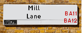
| Icon | Postcodes for Mill Lane | |
| Walking Distances | ||
| Distance Info | Green Circle = 10 Minutes Walk (800 metres) | |
About Mill Lane
Mill Lane is a street located near the village of Lane End. It uses the postcode BA12 7PQ. The street has a length of approximately 1,305 metres.
Mill Lane is located within the Wiltshire and Mendip District Council's jurisdiction. They provide various services, like refuse collection, and manage council tax collection. It's situated in the South West region of the UK.
Mill Lane has been assigned the Unique Street Reference Numbers of 43800262, 25005363 and 43800180 in the National Street Gazetteer.
Mill Lane is located within the county of Wiltshire, situated in the South West region of the UK. It's 95.98 miles West from central London., 8.22 miles South from Trowbridge, 21.77 miles South East from Bristol and 23.12 miles North West from Salisbury.

Do you know why this road is called Mill Lane?
What's it like to live here?
Ask the community a question about Mill Lane.
Do you have any questions, memories to share or know any facts about Mill Lane? We'd love to know more.
Also on streetlist.co.uk, can you help?
Swing Swang Lane
28th April 2024
I am trying to find out why the lane is named Swing Swang?
It has been known known this since at least 1905 when hedge making contents used to be held here.
Swing Swang is often used to describe a fairground ride. I remember Swing Boats. Were they a bit like this or is Swing Swang another name for swings?
Swing Swangs are also mentioned in connection to orchards. Or were orchards just good places to have swings?
Eldroth Road
15th April 2024
I wondered if anyone has any old pictures of Wenning Bank House in the 1940’s and also Lane Side before of the same era .. we visited today with my Mum in law as she used to live at both these properties. Also any photos of the schools around that time .. thank you.
Can You Help?Napps Way
15th April 2024
Why is the road called Napps Way (belonging to Napp, but minus an
apostrophe as is usual with such nomenclature)? Moreover, who or
what is, or was, “Napp” in the respective, possessive case?
Several years ago, I met an elderly man (probably in his late-eighties)
who lives on Bentham Drive, Liverpool 16, and during a conversation
with him whilst in a Northwest Passenger Transport Ambulance on the
way to the former RLUH (Royal Liverpool University Hospital), he told
me that he could remember (when he was a boy, living in Childwall,
Liverpool 16) that, “Where Napps Way is now, during WW2, there was
a two-man gun emplacement on the, then, open land to protect the
railway line passing over Childwall Valley Road - next to the railway
bridge - when suddenly, as they were loading a live “shell” into the gun’s
breach, the aforementioned “shell” accidentally exploded in the gun’s
breach killing both of the two soldiers, that had been manning the gun,
instantly! (Very sad, of course, but could - perhaps - two ghosts relating
to those two, very unfortunately and prematurely-killed soldiers have
haunted that place of their deaths ever since - and have any residents
of Napps Way - formerly and in its latest incarnation - seen two, WW2
(uniformed) soldiers unexpectedly appear in or near their homes?)
Estate Agents near Mill Lane
| Name | Address | Website |
|---|---|---|
| Acorn Property Group | Caxton Road, Frome, BA11 1NE | Visit Website |
| Forest Marble | 4 Harris Close, Elworthy Park, Frome, BA11 5JY | Visit Website |
| lettings-r-us | 8 Harris Close, Frome, BA11 5JY |
We have found 1 postcode for Mill Lane
Location Details
| Mill Lane | |
|---|---|

| |
| Latitude | 51.209019 |
| Longitude | -2.276960 |
| OS Easting (X): | 380655 |
| OS Northing (Y): | 145628 |
| OS Grid Reference: | ST807456 |
Neighbourhood Policing |
| Police Force: Wiltshire |
 View Neighbourhood Crime and Policing View Neighbourhood Crime and Policing |
| Find a Local Neighbourhood Watch Scheme |
Frequently asked Questions for Mill Lane
What Council (Local Authority) is Mill Lane in?
Mill Lane is located within the local authority area of Wiltshire Council which is a Unitary Authority.
What Parish Council is Mill Lane in?
Mill Lane is located within the area of Corsley Parish Council.
What Electoral Ward is Mill Lane in?
Mill Lane is located within the ward of Warminster North & Rural.
What County is Mill Lane in?
Mill Lane is located within the ceremonial county of Wiltshire.
What Constituency is Mill Lane in?
Mill Lane is located within the constituency of South West Wiltshire.
What Part of the UK is Mill Lane in?
Mill Lane is located within the South West (England) region of the United Kingdom.
What County Council area is Mill Lane in?
Mill Lane is located within the Wiltshire Council area.
What Police Force area is Mill Lane in?
Mill Lane is located within the Wiltshire Police area.
Roads that have a Junction with Mill Lane
| Street | Junction Type |
|---|---|
| Geys Hill | junction |
| Lanes End Hill (A362) | junction |
| Friggle Street | junction |
Sunset and Sunrise times for Mill Lane , BA12 7PQ
| Sunrise | 05:26 |
|---|---|
| Sunset | 20:44 |
Latest Weather Conditions for Mill Lane, BA12 7PQ
| Observed at Weather Station: | Larkhill 8 May 2024 at 04:00 (20.44 miles away) |
|---|---|
| Current Weather: | Overcast |
| Temperature and Humidity: | 10.7°C (92.8%) |
| Wind Direction and Speed: | E (3 mph) |
Population Statistics
| ONS Area Code | E00163483 |
|---|---|
| ONS Area Name | Established Farming Communities |
| Average Age | 47.14 |
| Area Population | 1324.00 |
| Male Population | 641.00 (48%) |
| Female Population | 683.00 (52%) |
| Benefit Claimants | 7 (1%) |
| LSOA Code: | E01032051 |
|---|---|
| LSOA Name: | Wiltshire 047A |
| SOA Code: | 2b |
| SOA Name: | |
| MSOA Code: | E02006695 |
| MSOA Name: | Wiltshire 047 |
Nearest Supermarkets
| Asda Frome |
|---|
| Warminster Road, Frome, BA11 5LA |
| 01373 475200 |
| Distance: 1.64 Miles |
| Directions from Mill Lane to Asda Frome |
| Iceland Frome |
|---|
| 16 Market Place, Frome, Somerset, BA11 1AN |
| 01373462642 |
| Distance: 2.44 Miles |
| Directions from Mill Lane to Iceland Frome |
| Sainsburys Frome |
|---|
| Wessex Fields, Frome, England, BA11 4DH |
| 01373 453554 |
| Distance: 2.5 Miles |
| Directions from Mill Lane to Sainsburys Frome |
| Tesco Frome Express |
|---|
| 90 Forest Rd, Frome, BA11 2TU |
| 0345 610 2945 |
| Distance: 2.54 Miles |
| Directions from Mill Lane to Tesco Frome Express |
Telephone Information
| Area Code |
|---|
| Area Code: 01373 - Frome |
| Area Code: 01985 - Warminster |
Local Government
| Local Council Details |
|---|
| Within the area of Wiltshire |
| Visit the Council's Website |
| County Hall, Bythesea Road, Trowbridge, Wiltshire &BA14 8JN |
| Send email |
| Telephone Number: 0300 456 0100 |
| Local Member of Parliament |
|---|
| Within the Westminster Parliamentary Constituency of South West Wiltshire |
| The Member of Parliament is Andrew Murrison |
| Details for the MP Andrew Murrison on parliament.uk |
| Details for the MP Andrew Murrison on theyworkforyou.com |
| In the 2019 General Election Andrew Murrison won with a majority of 21,630 the result was Con hold. The total electorate was 77,969 |
| Wards, Parish Councils and County Councils |
|---|
| Ward: Warminster North & Rural Ward |
| Ceremonial County: Wiltshire |
Nearest Schools
Nearest Hospitals
| Name | Address | Postcode | Distance | Map |
|---|
Nearest Dentists
Dentists near Mill Lane
| Name | Address | Postcode | Distance | Map |
|---|
Nearest GP Surgeries
Doctors near Mill Lane
LOCKS HILL SURGERY
Address: 95 LOCKS HILL, FROME, SOMERSET, BA11 1NG
Distance: 2.15 miles
Contact: :
FROME MEDICAL CENTRE
Address: ENOS WAY, FROME, SOMERSET, BA11 2FH
Distance: 2.46 miles
Contact: tel: 01373 301300
DR BROOKS, BECKINGTON/FROMEFIELD
Address: FROMEFIELD SURGERY, 8 BATH ROAD, FROME, SOMERSET, BA11 2HD
Distance: 2.53 miles
Contact: :
BECKINGTON FAMILY PRACTICE
Address: ST. LUKES ROAD, BECKINGTON, FROME, SOMERSET, BA11 6SE
Distance: 3.98 miles
Contact: tel: 01373 830316
AVENUE SURGERY
Address: 14 THE AVENUE, WARMINSTER, WILTSHIRE, BA12 9AA
Distance: 4.26 miles
Contact: tel: 01985 224600
THE WHITE HORSE HEALTH CENTRE - COVID LOCAL VACCINATION SERVICE 2
Address: MANE WAY, WESTBURY, BA13 3FQ
Distance: 4.39 miles
Contact: :
Nearest Dispensing Chemists
Pharmacies near Mill Lane
| Name | Address | Postcode | Telephone | Map | Distance in Km |
|---|
Nearest Opticians
Opticians near Mill Lane
BOOTS OPTICIANS (FROME)
Address: 3 CHEAP STREET, FROME, SOMERSET, BA11 1BN
Distance: 2.43 miles
Contact: :
EYE-TECH OPTICIANS
Address: 25 MARKET PLACE, FROME, SOMERSET, BA11 1AH
Distance: 2.45 miles
Contact: :
O'TOID OPTICIANS (FROME)
Address: 5 THE BRIDGE, FROME, SOMERSET, BA11 1AR
Distance: 2.46 miles
Contact: :
EYE-TECH OPTICIANS
Address: ENOS WAY, FROME, SOMERSET, BA11 2FH
Distance: 2.46 miles
Contact: :
SPECSAVERS (FROME)
Address: 19 WESTWAY CENTRE, FROME, SOMERSET, BA11 1BS
Distance: 2.50 miles
Contact: :
VISION EXPRESS (WARMINSTER)
Address: 21 MARKET PLACE, WARMINSTER, WILTSHIRE, BA12 9AY
Distance: 4.15 miles
Contact: :
Transport
Nearest Rail Stations
Frome Station is 1.91 miles away.
Address: Frome station, Station Approach, off Wallbridge, Frome, Somerset, BA11 1RE
Frome is situated on the Reading to Taunton Line and is managed by Great Western Railway.
Frome Station is staffed on a part time basis.
Dilton Marsh Station is 4.04 miles away.
Address: Dilton Marsh station, High Street, Dilton Marsh, Wiltshire, BA13 4DF
Dilton Marsh is situated on the Wessex Main Line and is managed by Great Western Railway.
Dilton Marsh Station is an unstaffed station.