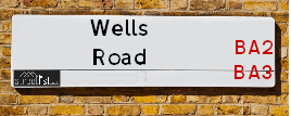
Map of Wells Road
| Postcodes | ||
|---|---|---|
| Icon | Postcodes for Wells Road | |
| Walking Distances | ||
| Distance Info | Green Circle = 10 Minutes Walk (800 metres) | |
About Wells Road
Wells Road is a street located in the village of Chilcompton and near the village of Chilcompton. The street has a length of approximately 2,441 metres.
Wells Road is located within the Mendip District Council's jurisdiction. They provide various services, like refuse collection, and manage council tax collection. It's situated in the South West region of the UK.
Wells Road has been assigned the Unique Street Reference Number of 25003987 and 25008144 in the National Street Gazetteer.
Wells Road is located within the county of Somerset, situated in the South West region of the UK. It's 104.49 miles West from central London., 13 miles West from Trowbridge, 13.75 miles South from Bristol and 23.12 miles North from Yeovil.

Do you know why this road is called Wells Road?
What's it like to live here?
Ask the community a question about Wells Road.
Do you have any questions, memories to share or know any facts about Wells Road? We'd love to know more.
Also on streetlist.co.uk, can you help?
Swing Swang Lane
28th April 2024
I am trying to find out why the lane is named Swing Swang?
It has been known known this since at least 1905 when hedge making contents used to be held here.
Swing Swang is often used to describe a fairground ride. I remember Swing Boats. Were they a bit like this or is Swing Swang another name for swings?
Swing Swangs are also mentioned in connection to orchards. Or were orchards just good places to have swings?
Eldroth Road
15th April 2024
I wondered if anyone has any old pictures of Wenning Bank House in the 1940’s and also Lane Side before of the same era .. we visited today with my Mum in law as she used to live at both these properties. Also any photos of the schools around that time .. thank you.
Can You Help?Napps Way
15th April 2024
Why is the road called Napps Way (belonging to Napp, but minus an
apostrophe as is usual with such nomenclature)? Moreover, who or
what is, or was, “Napp” in the respective, possessive case?
Several years ago, I met an elderly man (probably in his late-eighties)
who lives on Bentham Drive, Liverpool 16, and during a conversation
with him whilst in a Northwest Passenger Transport Ambulance on the
way to the former RLUH (Royal Liverpool University Hospital), he told
me that he could remember (when he was a boy, living in Childwall,
Liverpool 16) that, “Where Napps Way is now, during WW2, there was
a two-man gun emplacement on the, then, open land to protect the
railway line passing over Childwall Valley Road - next to the railway
bridge - when suddenly, as they were loading a live “shell” into the gun’s
breach, the aforementioned “shell” accidentally exploded in the gun’s
breach killing both of the two soldiers, that had been manning the gun,
instantly! (Very sad, of course, but could - perhaps - two ghosts relating
to those two, very unfortunately and prematurely-killed soldiers have
haunted that place of their deaths ever since - and have any residents
of Napps Way - formerly and in its latest incarnation - seen two, WW2
(uniformed) soldiers unexpectedly appear in or near their homes?)
Estate Agents near Wells Road
| Name | Address | Website |
|---|---|---|
| Cooper & Tanner | 14 High Street, Midsomer Norton, Radstock, BA3 2HP | |
| Barons Property Centre Ltd | 124 High Street, Midsomer Norton, BA3 2DA | Visit Website |
| YOUR MOVE Bailey & Bryant | 78A High Street Midsomer Norton Radstock BA3 2DE | Visit Website |
Location Details
| Wells Road | |
|---|---|

| |
| Latitude | 51.264453 |
| Longitude | -2.494815 |
| OS Easting (X): | 365480 |
| OS Northing (Y): | 151872 |
| OS Grid Reference: | ST655519 |
Neighbourhood Policing |
| Police Force: Avon And Somerset |
 View Neighbourhood Crime and Policing View Neighbourhood Crime and Policing |
| Find a Local Neighbourhood Watch Scheme |
Frequently asked Questions for Wells Road
What Council (Local Authority) is Wells Road in?
Wells Road is located within the local authority area of Mendip Council which is a District Council.
What Parish Council is Wells Road in?
Wells Road is located within the area of Chilcompton Parish Council.
What Electoral Ward is Wells Road in?
Wells Road is located within the ward of Ashwick &Chilcompton and Stratton.
What County is Wells Road in?
Wells Road is located within the ceremonial county of Somerset.
What Constituency is Wells Road in?
Wells Road is located within the constituency of Wells.
What Part of the UK is Wells Road in?
Wells Road is located within the South West (England) region of the United Kingdom.
What County Council area is Wells Road in?
Wells Road is located within the Somerset Council area.
What Police Force area is Wells Road in?
Wells Road is located within the Avon and Somerset Police area.
Roads that have a Junction with Wells Road
| Street | Junction Type |
|---|---|
| Nursery Rise | junction |
| Bennell Close | junction |
| Fry's Well | junction |
| Downside Close | junction |
| Carters Way | junction |
| Rock Road | junction |
| Fosseway (A367) | roundabout |
| Beauchamps Drive | junction |
| Pickford Fields | junction |
Sunset and Sunrise times for Wells Road
| Sunrise | 05:23 |
|---|---|
| Sunset | 20:49 |
Latest Weather Conditions for Wells Road
| Observed at Weather Station: | Yeovilton 9 May 2024 at 23:00 (18.94 miles away) |
|---|---|
| Current Weather: | Mist |
| Temperature and Humidity: | 11.8°C (89.2%) |
| Wind Direction and Speed: | N (0 mph) |
Population Statistics
| ONS Area Code | E00147816, E00147818, E00147814 & E00147817 |
|---|---|
| ONS Area Name | Rural Life, White Suburban Communities, Older Workers and Retirement & Ageing Rural Industry Workers |
| Average Age | 42.89 |
| Area Population | 2062.00 |
| Male Population | 1029.00 (50%) |
| Female Population | 1033.00 (50%) |
| Benefit Claimants | 18 (1%) |
| LSOA Code: | E01029024 |
|---|---|
| LSOA Name: | Mendip 002A |
| SOA Code: | 2d |
| SOA Name: | |
| MSOA Code: | E02006048 |
| MSOA Name: | Mendip 002 |
Nearest Supermarkets
| Sainsburys Midsomer Norton |
|---|
| The Hollies, High Street, Midsomer Norton, Radstock, England, BA3 2DT |
| 01761 416180 |
| Distance: 1.62 Miles |
| Directions from Wells Road to Sainsburys Midsomer Norton |
| Tesco Midsomer Norton Superstore |
|---|
| Old Mills, Paulton, Bristol, BS39 7SW |
| 0345 677 9458 |
| Distance: 1.95 Miles |
| Directions from Wells Road to Tesco Midsomer Norton Superstore |
| Tesco Peasedown St John Express |
|---|
| Bath Rd, Peasedown St John, Bath, BA2 8DN |
| 0345 671 9291 |
| Distance: 4.65 Miles |
| Directions from Wells Road to Tesco Peasedown St John Express |
| Tesco Shepton Mallet Superstore |
|---|
| Townsend Shopping Park, Townsend, Shepton Mallet, BA4 5EG |
| 0345 671 9389 |
| Distance: 5.84 Miles |
| Directions from Wells Road to Tesco Shepton Mallet Superstore |
Telephone Information
| Area Code |
|---|
| Area Code: 01761 - Temple Cloud |
| Area Code: 01749 - Shepton Mallet |
| Area Code: 01373 - Frome |
Broadband Information
| Speed | Average Speed | Median Speed | Maximum Speed | Next-generation access (NGA) | Number of Connections |
|---|---|---|---|---|---|
| Greater than 2 Mbps | 5 | 4.5 | 8.1 | N | 4 |
Local Government
| Local Council Details |
|---|
| Within the area of Mendip |
| Visit the Council's Website |
| Council Offices, Cannards Grave Road, Shepton Mallet, Somerset &BA4 5BT |
| Send email |
| Telephone Number: 03333 043333 |
| Local Member of Parliament |
|---|
| Within the Westminster Parliamentary Constituency of Wells |
| The Member of Parliament is James Heappey |
| Details for the MP James Heappey on parliament.uk |
| Details for the MP James Heappey on theyworkforyou.com |
| In the 2019 General Election James Heappey won with a majority of 9,991 the result was Con hold. The total electorate was 81,898 |
| Wards, Parish Councils and County Councils |
|---|
| Ward: Ashwick &Chilcompton and Stratton Ward |
| Ceremonial County: Somerset |
Nearest Schools
England Primary Schools
Kilmersdon Church of England Primary School
Address: Kilmersdon Church of England Primary School, School Lane, Kilmersdon, Radstock, Somerset, BA3 5TE
Distance: 2.38 miles
Contact: 01761432283
Westfield Primary School
Address: Westfield Primary School, Longfellow Road, Westfield, Radstock, Avon, BA3 3XX
Distance: 1.63 miles
Contact:
Welton Primary School
Address: Welton Primary School, Radstock Road, Midsomer Norton, Radstock, Somerset, BA3 2AG
Distance: 1.98 miles
Contact: 01761413131
Welton Primary School
Address: Welton Primary School, Radstock Road, Midsomer Norton, Radstock, Somerset, BA3 2AG
Distance: 1.98 miles
Contact:
St Benedict's Catholic Primary School
Address: St Benedict's Catholic Primary School, Charlton Lane, Midsomer Norton, Radstock, Somerset, BA3 4BD
Distance: 1.29 miles
Contact: 01761418594
Norton Hill Primary School
Address: Norton Hill Primary School, Silver Street, Midsomer Norton, Somerset, BA3 2UD
Distance: 1.02 miles
Contact: 01761205630
Midsomer Norton Primary School
Address: Midsomer Norton Primary School, High Street, Midsomer Norton, Radstock, Somerset, BA3 2DR
Distance: 1.67 miles
Contact: 01761412289
Midsomer Norton Primary School
Address: Midsomer Norton Primary School, High Street, Midsomer Norton, Radstock, Somerset, BA3 2DR
Distance: 1.67 miles
Contact:
Longvernal Primary School
Address: Longvernal Primary School, Clapton Road, Midsomer Norton, Radstock, Somerset, BA3 2LP
Distance: 1.39 miles
Contact: 01761412777
Longvernal Primary School
Address: Longvernal Primary School, Clapton Road, Midsomer Norton, Radstock, Somerset, BA3 2LP
Distance: 1.39 miles
Contact:
St John's CofE Primary School
Address: St John's CofE Primary School, Redfield Road, Midsomer Norton, Radstock, Somerset, BA3 2JN
Distance: 1.43 miles
Contact: 01761412019
St Vigor and St John CofE School
Address: St Vigor and St John CofE School, Wells Road, Chilcompton, Radstock, Somerset, BA3 4EX
Distance: 0.33 miles
Contact:
England Secondary Schools
Norton Hill Academy
Address: Norton Hill Academy, Charlton Road, Midsomer Norton, Radstock, Somerset, BA3 4AD
Distance: 1.30 miles
Contact: 01761412557
Somervale Secondary School
Address: Somervale Secondary School, Redfield Road, Midsomer Norton, Radstock, Somerset, BA3 2JD
Distance: 1.40 miles
Contact: 01761414276
Nearest Hospitals
| Name | Address | Postcode | Distance | Map |
|---|
Nearest Dentists
Dentists near Wells Road
| Name | Address | Postcode | Distance | Map |
|---|
Nearest GP Surgeries
Doctors near Wells Road
CHILCOMPTON SURGERY
Address: CARTERS WAY, CHILCOMPTON, RADSTOCK, AVON, BA3 4XH
Distance: 0.50 miles
Contact: :
SOMERTON HOUSE SURGERY
Address: 79A NORTH ROAD, MIDSOMER NORTON, RADSTOCK, AVON, BA3 2QE
Distance: 1.69 miles
Contact: tel: 01761 412141
ST CHADS SURGERY
Address: GULLOCK TYNING, MIDSOMER NORTON, RADSTOCK, AVON, BA3 2UH
Distance: 1.79 miles
Contact: tel: 01761 413334
WESTFIELD SURGERY
Address: 51 WATERFORD PARK, RADSTOCK, AVON, BA3 3UJ
Distance: 2.10 miles
Contact: tel: 01761 436333
MENDIP COUNTRY PRACTICE
Address: CHURCH STREET, COLEFORD, RADSTOCK, AVON, BA3 5NQ
Distance: 2.50 miles
Contact: tel: 01373 812244
ELM HAYES SURGERY
Address: CLANDOWN ROAD, PAULTON, BRISTOL, AVON, BS39 7SF
Distance: 2.50 miles
Contact: tel: 01761 413155
Nearest Dispensing Chemists
Pharmacies near Wells Road
| Name | Address | Postcode | Telephone | Map | Distance in Km |
|---|
Nearest Opticians
Opticians near Wells Road
EYE-TECH OPTICIANS
Address: 2 THE ISLAND, MIDSOMER NORTON, RADSTOCK, AVON, BA3 2HQ
Distance: 1.52 miles
Contact: :
EDWARDS OPTICIANS LTD
Address: 2 MANSBROOK HOUSE, 15 HIGH STREET, MIDSOMER NORTON, RADSTOCK, AVON, BA3 2HW
Distance: 1.57 miles
Contact: :
SPECSAVERS MIDSOMER NORTON
Address: 119 HIGH STREET, MIDSOMER NORTON, RADSTOCK, BA3 2DA
Distance: 1.60 miles
Contact: :
SCRIVENS OPTICIANS (MIDSOMER NORTON)
Address: 26 HIGH STREET, MIDSOMER NORTON, RADSTOCK, AVON, BA3 2DW
Distance: 1.70 miles
Contact: :
LOVAT SHORT OPTOMETRISTS
Address: 2 THE STREET, RADSTOCK, AVON, BA3 3PL
Distance: 2.78 miles
Contact: :
BROCK AND HOULFORD - BISHOP SUTTON
Address: WESTWAY FARM, WICK ROAD, BISHOP SUTTON, BRISTOL, BS39 5XP
Distance: 6.58 miles
Contact: :
Transport
Nearest Rail Stations
Frome Station is 8.40 miles away.
Address: Frome station, Station Approach, off Wallbridge, Frome, Somerset, BA11 1RE
Frome is situated on the Reading to Taunton Line and is managed by Great Western Railway.
Frome Station is staffed on a part time basis.
Oldfield Park Station is 9.34 miles away.
Address: Oldfield Park station, Brook Road, Bath Spa, Somerset, BA2 3RS
Oldfield Park is situated on the Heart of Wessex Line|Wessex Main Line|Great Western Main Line and is managed by Great Western Railway.
Oldfield Park Station is staffed on a part time basis.