BN1 1AN is a postal code used within the United Kingdom for delivering mail.
Postcodes are made up of two parts. The part before the space (BN1) is called the outward code. The part after the space (1AN) is called the inward code. The letters C, I, K, M, O and V are not allowed in the inward code. In addition to the inward and outward code, the postcode can be broken up into four parts:
- Postal Area. In our case BN which means Brighton.
- Postal District. In our case BN1.
- Postal Sector. In our case BN1 1.
- Postcode Unit. The last two letters. In our case AN.
The regional mail center for the post area BN is the Princess Royal Distribution Centre, which is located at Blackmore Drive, North Circular, LONDON , NW10 7RH.
The final port of call for any post addressed to the BN1 1AN postcode is the local delivery office (DO) which is BRIGHTON DO. Here the post will be sorted ready for delivery.
The properties in the BN1 1AN postcode have the street address of Boyces Street
Did you know? According to the 2021 Census, the BN1 1AN postcode is home to a bustling 21 residents!
It is situated within the post town of BRIGHTON within the old postal county of Sussex.
BN1 1AN is within the City of Brighton.
The BN1 1AN postcode area is composed of 64.71% residential properties, 35.29% commercial properties, and 0% public properties.
According to our data. Most dwellings in BN1 1AN are houses. Of these houses, most are mid-terraced. The remainder are end-terraced.
Most properties in BN1 1AN are privately rented with the rest being owned by the occupiers.
None Domestic Buildings in BN1 1AN fall under these categories: Shops, Food And Drink and Offices.
Shops include 10, Boyces Street.
Food And Drink include 8, Full Moon 8, and The Fiddlers Elbow 11-12, Boyces Street.
Offices include 10, Boyces Street.

Interactive Mapping Showing UPRNs within the BN1 1AN Postcode Boundaries
Use the search box to search for other postcodes or places.
BN1 1AN: Points of Interest
Thai Spice Restaurant (Market)
Thai Spice Restaurant (Market) is an establishment offering meals and refreshments located at 13 Boyces Street, Brighton, BN1 1AN.
The Coal Shed Restaurant Ltd
The Coal Shed Restaurant Ltd is an establishment offering meals and refreshments located at 8 Boyces Street, Brighton, BN1 1AN.
Fiddler's Elbow (wet Sales)
Fiddler's Elbow (wet Sales) is a social venue where you can enjoy drinks, meals, and entertainment located at The Fiddlers Elbow, 11 - 12 Boyces Street, Brighton, BN1 1AN.
Piecaramba At Fiddlers Elbow
Piecaramba At Fiddlers Elbow is a social venue where you can enjoy drinks, meals, and entertainment located at The Fiddlers Elbow, 11 - 12 Boyces Street, Brighton, BN1 1AN.
The Oculist
The Oculist is a social venue where you can enjoy drinks, meals, and entertainment located at 2 Boyces Street, Brighton, BN1 1AN.
| Property Type | Percentage |
|---|---|
| Residential | 64.71% |
| Commercial | 35.29% |
| Public | 0% |
Telephone Area Code for BN1 1AN
The telephone area code for BN1 1AN is 01273 Brighton.
Map Coordinates for BN1 1AN
| Latitude | 50.8220864478 |
|---|---|
| Longitude | -0.143500116911 |

Weather Forecast for BN1 1AN
Tue 7th May
Press Button to Show Forecast for Brighton
| Time Period | Icon | Description | Temperature | Rain Probability | Wind |
|---|---|---|---|---|---|
| 15:00 to 18:00 | Cloudy | 16.0°C (feels like 15.0°C) | 5.00% | SSE 7 mph | |
| 18:00 to 21:00 | Cloudy | 15.0°C (feels like 15.0°C) | 5.00% | S 4 mph | |
| 21:00 to 00:00 | Clear night | 13.0°C (feels like 13.0°C) | 1.00% | ESE 2 mph |
Wed 8th May
Press Button to Show Forecast for Brighton
| Time Period | Icon | Description | Temperature | Rain Probability | Wind |
|---|---|---|---|---|---|
| 00:00 to 03:00 | Clear night | 10.0°C (feels like 9.0°C) | 0.00% | NE 7 mph | |
| 03:00 to 06:00 | Clear night | 9.0°C (feels like 8.0°C) | 1.00% | NNE 7 mph | |
| 06:00 to 09:00 | Mist | 10.0°C (feels like 8.0°C) | 12.00% | NE 7 mph | |
| 09:00 to 12:00 | Sunny day | 13.0°C (feels like 12.0°C) | 0.00% | NE 4 mph | |
| 12:00 to 15:00 | Sunny day | 15.0°C (feels like 14.0°C) | 0.00% | SE 7 mph | |
| 15:00 to 18:00 | Partly cloudy (day) | 15.0°C (feels like 14.0°C) | 0.00% | S 4 mph | |
| 18:00 to 21:00 | Sunny day | 13.0°C (feels like 12.0°C) | 1.00% | S 7 mph | |
| 21:00 to 00:00 | Clear night | 11.0°C (feels like 10.0°C) | 1.00% | S 4 mph |
Thu 9th May
Press Button to Show Forecast for Brighton
| Time Period | Icon | Description | Temperature | Rain Probability | Wind |
|---|---|---|---|---|---|
| 00:00 to 03:00 | Cloudy | 9.0°C (feels like 9.0°C) | 3.00% | SSE 2 mph | |
| 03:00 to 06:00 | Fog | 9.0°C (feels like 8.0°C) | 13.00% | S 2 mph | |
| 06:00 to 09:00 | Fog | 9.0°C (feels like 9.0°C) | 14.00% | ESE 2 mph | |
| 09:00 to 12:00 | Partly cloudy (day) | 15.0°C (feels like 15.0°C) | 1.00% | SSE 2 mph | |
| 12:00 to 15:00 | Cloudy | 18.0°C (feels like 17.0°C) | 4.00% | SSE 4 mph | |
| 15:00 to 18:00 | Cloudy | 19.0°C (feels like 18.0°C) | 5.00% | S 4 mph | |
| 18:00 to 21:00 | Cloudy | 16.0°C (feels like 16.0°C) | 4.00% | S 7 mph | |
| 21:00 to 00:00 | Cloudy | 12.0°C (feels like 12.0°C) | 4.00% | S 4 mph |
Fri 10th May
Press Button to Show Forecast for Brighton
| Time Period | Icon | Description | Temperature | Rain Probability | Wind |
|---|---|---|---|---|---|
| 00:00 to 03:00 | Cloudy | 10.0°C (feels like 10.0°C) | 3.00% | E 4 mph | |
| 03:00 to 06:00 | Cloudy | 9.0°C (feels like 8.0°C) | 4.00% | NE 4 mph | |
| 06:00 to 09:00 | Cloudy | 11.0°C (feels like 11.0°C) | 4.00% | ENE 4 mph | |
| 09:00 to 12:00 | Cloudy | 17.0°C (feels like 17.0°C) | 4.00% | E 4 mph | |
| 12:00 to 15:00 | Cloudy | 20.0°C (feels like 19.0°C) | 5.00% | ESE 4 mph | |
| 15:00 to 18:00 | Cloudy | 20.0°C (feels like 19.0°C) | 4.00% | SE 7 mph | |
| 18:00 to 21:00 | Cloudy | 18.0°C (feels like 18.0°C) | 4.00% | SSE 4 mph | |
| 21:00 to 00:00 | Cloudy | 14.0°C (feels like 14.0°C) | 3.00% | SE 4 mph |
Sat 11th May
Press Button to Show Forecast for Brighton
| Time Period | Icon | Description | Temperature | Rain Probability | Wind |
|---|---|---|---|---|---|
| 00:00 to 03:00 | Clear night | 12.0°C (feels like 11.0°C) | 1.00% | E 4 mph | |
| 03:00 to 06:00 | Clear night | 10.0°C (feels like 10.0°C) | 0.00% | NNE 4 mph | |
| 06:00 to 09:00 | Sunny day | 12.0°C (feels like 12.0°C) | 1.00% | NE 4 mph | |
| 09:00 to 12:00 | Sunny day | 18.0°C (feels like 18.0°C) | 0.00% | ENE 4 mph | |
| 12:00 to 15:00 | Partly cloudy (day) | 21.0°C (feels like 20.0°C) | 1.00% | SE 7 mph | |
| 15:00 to 18:00 | Sunny day | 21.0°C (feels like 20.0°C) | 2.00% | SSE 7 mph | |
| 18:00 to 21:00 | Sunny day | 19.0°C (feels like 19.0°C) | 1.00% | SSE 7 mph | |
| 21:00 to 00:00 | Clear night | 14.0°C (feels like 13.0°C) | 1.00% | SE 7 mph |
What are the Broadband Speeds like in the BN1 1AN Postcode?
Download Speeds For BN1 1AN

| Average Mbps | 10.200 |
|---|---|
| Median Mbps | 12.500 |
| Maximum Mbps | 16.110 |
BN1 1AN has an average download speed of 10.2 Megabits per second (Mbps).
197 other postcode units have the same broadband speed.
1% of postcodes (13,830) have slower broadband speeds.
99% of postcodes (1,170,614) have faster broadband speeds.
Upload Speeds For BN1 1AN
| Average Mbps | 1.200 |
|---|---|
| Median Mbps | 1.200 |
| Maximum Mbps | 1.260 |
BN1 1AN has an average upload speed of 1.2 Megabits per second (Mbps).
2,807 other postcode units have the same upload speed.
2% of postcodes (24,916) have slower upload speeds.
98% of postcodes (1,156,918) have faster upload speeds.
Schools within a five minute drive of BN1 1AN Postcode
England Primary Schools
St Luke's Primary School
Address: St Luke's Primary School, Queens Park Rise, Brighton, East Sussex, BN2 9ZF
Distance: 1.08 miles
Contact: 01273675080
St John the Baptist Catholic Primary School
Address: St John the Baptist Catholic Primary School, Whitehawk Hill Road, Brighton, East Sussex, BN2 0AH
Distance: 1.21 miles
Contact: 01273607924
St Mark's CofE Primary School
Address: St Mark's CofE Primary School, Manor Road, Brighton, East Sussex, BN2 5EA
Distance: 1.42 miles
Contact: 01273605588
Queen's Park Primary School
Address: Queen's Park Primary School, Park Street, Brighton, East Sussex, BN2 0BN
Distance: 0.78 miles
Contact: 01273686822
Carlton Hill Primary School
Address: Carlton Hill Primary School, Sussex Street, BRIGHTON, East Sussex, BN2 9HS
Distance: 0.53 miles
Contact: 01273604966
St Bartholomew's CofE Primary School
Address: St Bartholomew's CofE Primary School, Ann Street, Brighton, East Sussex, BN1 4GP
Distance: 0.63 miles
Contact: 01273692463
St Paul's CofE Primary School
Address: St Paul's CofE Primary School, St Nicholas Road, Brighton, East Sussex, BN1 3LP
Distance: 0.31 miles
Contact: 01273721001
St Mary Magdalen Catholic Primary School
Address: St Mary Magdalen Catholic Primary School, Spring Street, Brighton, East Sussex, BN1 3EF
Distance: 0.32 miles
Contact: 01273327533
Middle Street Primary School
Address: Middle Street Primary School, 37 Middle Street, Middle Street Primary School, Brighton, East Sussex, BN1 1AL
Distance: 0.06 miles
Contact: 01273323184
Brunswick Primary School
Address: Brunswick Primary School, Somerhill Road, Hove, East Sussex, BN3 1RP
Distance: 0.90 miles
Contact: 01273711816
Nearest Dentists
Dentists near BN1 1AN
DUKE STREET (DENTAL SURGERY)
Address: 28 DUKE STREET, BRIGHTON, EAST SUSSEX, BN1 1AG
Distance: 0.06 miles
Contact: :
THE DENTAL HEALTH SPA
Address: 14-15 QUEENS ROAD, BRIGHTON, BN1 3WA
Distance: 0.17 miles
Contact: :
BRIGHTON WHITE DENTAL STUDIO
Address: 2 HAMPTON PLACE, BRIGHTON, BN1 3DD
Distance: 0.38 miles
Contact: :
HAMPTON PLACE (DENTAL SURGERY)
Address: 2 HAMPTON PLACE, BRIGHTON, EAST SUSSEX, BN1 3DD
Distance: 0.38 miles
Contact: :
DENTAL SURGERY
Address: THE UPPER PARTS 46, 47 SYDNEY STREET, BRIGHTON, EAST SUSSEX, BN1 4EP
Distance: 0.45 miles
Contact: :
DENTAL SURGERY
Address: 38 MONTPELIER ROAD, BRIGHTON, EAST SUSSEX, BN1 3BA
Distance: 0.47 miles
Contact: :
Nearest Chemists
Pharmacies near BN1 1AN
BOOTS
Address: 129 NORTH STREET, BRIGHTON, EAST SUSSEX, BN1 2BE
Distance: 0.12 miles
Contact: tel: 01273 207461
SUPERDRUG PHARMACY
Address: 77-78 WESTERN ROAD, BRIGHTON, EAST SUSSEX, BN1 2HA
Distance: 0.31 miles
Contact: tel: 01273 327402
KAMSONS PHARMACY
Address: 128 ST. JAMES'S STREET, BRIGHTON, EAST SUSSEX, BN2 1TH
Distance: 0.37 miles
Contact: tel: 01273 604335
BRIGHTON COMMUNITY PHARMACY
Address: 24 ST JAMES'S STREET, BRIGHTON, BN2 1RF
Distance: 0.42 miles
Contact: tel: 01273 681715
BOOTS
Address: 17-19 ST. JAMES'S STREET, BRIGHTON, EAST SUSSEX, BN2 1RF
Distance: 0.42 miles
Contact: tel: 01273 682308
GUNNS PHARMACY
Address: 108 WESTERN ROAD, BRIGHTON, EAST SUSSEX, BN1 2AA
Distance: 0.49 miles
Contact: tel: 01273 734227
Nearest Opticians
Opticians near BN1 1AN
EYESITE (BRIGHTON)
Address: 47-48 NORTH STREET, BRIGHTON, EAST SUSSEX, BN1 1RH
Distance: 0.09 miles
Contact: :
SPECSAVERS (BRIGHTON)
Address: 49 NORTH STREET, BRIGHTON, EAST SUSSEX, BN1 1RH
Distance: 0.09 miles
Contact: :
VISION EXPRESS (CHURCHILL SQ, BRIGHTON)
Address: UNIT 60, CHURCHILL SQUARE, BRIGHTON, EAST SUSSEX, BN1 2TE
Distance: 0.12 miles
Contact: :
BOOTS OPTICIANS (NORTH STREET, BRIGHTON)
Address: 129 NORTH STREET, BRIGHTON, EAST SUSSEX, BN1 2BE
Distance: 0.12 miles
Contact: :
DAVID CLULOW OPTICIANS (BRIGHTON)
Address: 25 EAST STREET, BRIGHTON, EAST SUSSEX, BN1 1HL
Distance: 0.19 miles
Contact: :
OPTICAL EXPRESS [BRIGHTON]
Address: QUEENSBURY HOUSE, 103- 109 QUEENS ROAD, BRIGHTON, EAST SUSSEX, BN1 3XF
Distance: 0.31 miles
Contact: :
Nearest GP Surgeries
Doctors near BN1 1AN
SHIP STREET SURGERY
Address: 65-67 SHIP STREET, BRIGHTON, EAST SUSSEX, BN1 1AE
Distance: 0.09 miles
Contact: tel: 01273 778622
REGENCY SURGERY
Address: 4 OLD STEINE, BRIGHTON, EAST SUSSEX, BN1 1FZ
Distance: 0.32 miles
Contact: tel: 01273 600103
PAVILION SURGERY
Address: 2 OLD STEINE, BRIGHTON, EAST SUSSEX, BN1 1EJ
Distance: 0.32 miles
Contact: tel: 01273 685588
BRIGHTON STATION HEALTH CENTRE
Address: ASPECT HOUSE, 84-87 QUEENS ROAD, BRIGHTON, EAST SUSSEX, BN1 3XE
Distance: 0.42 miles
Contact: tel: 0333 3210946
MONTPELIER SURGERY
Address: 2 VICTORIA ROAD, BRIGHTON, EAST SUSSEX, BN1 3FS
Distance: 0.43 miles
Contact: tel: 01273 328950
ARDINGLY COURT SURGERY
Address: 1 ARDINGLY STREET, BRIGHTON, EAST SUSSEX, BN2 1SS
Distance: 0.47 miles
Contact: tel: 01273 688333
Transport Links near BN1 1AN
Train Stations
Nearest stations for postcode: BN1 1AN
- Brighton
Brighton station, Queens Road, Brighton, East Sussex, BN1 3XPDistance: 0.53 milesDriving Time: 1.72 minutes - London Road (Brighton)
London Road (Brighton) station, Shaftesbury Place, Brighton, East Sussex, BN1 4QSDistance: 1.49 milesDriving Time: 4.79 minutes - Hove
Hove station, Goldstone Villas, Hove, East Sussex, BN3 3RUDistance: 1.74 milesDriving Time: 5.61 minutes - Preston Park
Preston Park station, Clermont Road, Preston Park, Brighton, BN1 6SGDistance: 2.34 milesDriving Time: 6.52 minutes - Aldrington
Aldrington station, Amhurst Crescent, Aldrington, East Sussex, BN3 5AEDistance: 2.50 milesDriving Time: 6.54 minutes
Distances represent the quickest route by car.
Motorway Junctions near BN1 1AN
Train Stations
Motorway Junctions near BN1 1AN
Distances represent the quickest route by car.
Who are my Elected Representatives in the BN1 1AN Postcode?
| Westminster Constituency | Brighton, Pavilion Boro Const |
|---|---|
| Member or Parliament | 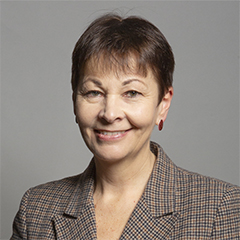 |
| Contact Details | Contact Caroline Lucas |
| Political Party | Green Party |
What Council is the BN1 1AN Postcode in?
The Council for this Postcode is The City of Brighton and Hove Council, who are a Unitary authority. This means that they are responsible for providing education, libraries and maintaining highways as well as normal council duties such as council tax, rubbish collection, housing, environmental health and planning.
You can visit the website for The City of Brighton and Hove at the following link The City of Brighton and Hove.How much is the Council Tax?
The City of Brighton and Hove Council is responsible for collecting council tax. This will vary depending on which council tax band the property falls within. You can check the council tax band at the gov.uk website.
Once you know the council tax band you can view how much The City of Brighton and Hove charge for that band by visiting the The Council Tax section of their website.
Planning Applications
When moving house to a new post code it is worth checking out what will be built in the neighbourhood.
Few people want to live next door to a building site, have their garden overlooked or have the views from their property ruined.
Visit the local planning department and search for planning applications in this postcode granted within the last three years or still awaiting a decision. This will give an indication of what could still be built.
Where can I find out where the nearest Library to the BN1 1AN Postcode is?
Libraries are the responsibility of Brighton and Hove council
Visit the link for more information. Please note that some councils outsource library services to private companies and community groups ran by volunteers.
Libraries, leisure and artsHouse Sales in BN1 1AN
| Year | High | Low | Average | Sales |
|---|---|---|---|---|
| 2011 | £130,000 | £130,000 | £130,000 | 1 |
| 2020 | £850,000 | £850,000 | £850,000 | 1 |
Contains HM Land Registry data © Crown copyright and database right 2024. This data is licensed under the Open Government Licence v3.0.
Postcodes near the BN1 1AN Postcode
What Popular Supermarkets are near the BN1 1AN Postcode?
| Supermarket | Distance | Directions |
|---|---|---|
| Morrisons, St. James's Street, BRIGHTON, BN2 1RE | 0.59 miles | Directions from BN1 1AN to Morrisons |
| Waitrose, Western Road, BRIGHTON, BN1 2LA | 0.63 miles | Directions from BN1 1AN to Waitrose |
| Aldi, London Road, BRIGHTON, BN1 4JA | 1.03 miles | Directions from BN1 1AN to Aldi |
| Iceland, London Road, BRIGHTON, BN1 4JA | 1.03 miles | Directions from BN1 1AN to Iceland |
| Sainsburys, New England Street, BRIGHTON, BN1 4GQ | 1.08 miles | Directions from BN1 1AN to Sainsburys |
What Popular Restaurants are near the BN1 1AN Postcode?
| Burger King | Distance | Directions |
|---|---|---|
| 63-65 North Street, Brighton, BN1 1RH | 0.09 miles | Directions from BN1 1AN to 63-65 North Street |
| 43-45 Kings Road, Brighton, BN1 1NA | 0.11 miles | Directions from BN1 1AN to 43-45 Kings Road |
| Goldstone Retail Park, Hove, BN3 7PN | 1.72 miles | Directions from BN1 1AN to Goldstone Retail Park |
| Jobs Lane, Hickstead, RH17 5NZ | 10.22 miles | Directions from BN1 1AN to Jobs Lane |
| Mcdonald's | Distance | Directions |
|---|---|---|
| McDonald's, Churchill Square, BRIGHTON, BN1 2TE | 0.12 miles | Directions from BN1 1AN to McDonald's, Churchill Square, BRIGHTON, BN1 2TE |
| McDonald's, Western Road, BRIGHTON, BN1 2BB | 0.28 miles | Directions from BN1 1AN to McDonald's, Western Road, BRIGHTON, BN1 2BB |
| McDonald's, London Road, BRIGHTON, BN1 4JH | 0.64 miles | Directions from BN1 1AN to McDonald's, London Road, BRIGHTON, BN1 4JH |
| McDonald's, Brighton Marina Village, BRIGHTON, BN2 5UT | 1.81 miles | Directions from BN1 1AN to McDonald's, Brighton Marina Village, BRIGHTON, BN2 5UT |
| Restaurant | Distance | Directions |
|---|---|---|
| KFC, Western Road, BRIGHTON, BN1 2HA | 0.31 miles | Directions from BN1 1AN to KFC Brighton - Western Road |
| KFC, London Road, BRIGHTON, BN1 4JE | 0.78 miles | Directions from BN1 1AN to KFC Brighton - London Road |
| KFC, Blatchington Road, HOVE, BN3 3YG | 1.47 miles | Directions from BN1 1AN to KFC Hove - Blatchington Road |
| KFC, Drove Road, NEWHAVEN, BN9 0AD | 8.92 miles | Directions from BN1 1AN to KFC Newhaven - Drove Road |
| KFC, Market Place, The Martlets, BURGESS HILL, RH15 9NP | 9.19 miles | Directions from BN1 1AN to KFC Burgess Hill - Market Place Shopping Centre |