Map of Cottage Lane
| Postcodes | ||
|---|---|---|
| Icon | Postcodes for Cottage Lane | |
| Walking Distances | ||
| Distance Info | Green Circle = 10 Minutes Walk (800 metres) | |
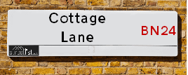
About Cottage Lane
Cottage Lane is a street located near the town of Polegate. The street has a length of approximately 281 metres.
Cottage Lane is located within the Wealden District Council's jurisdiction. They provide various services, like refuse collection, and manage council tax collection. It's situated in the South East region of the UK.
Cottage Lane has been assigned the Unique Street Reference Number of 42701307 in the National Street Gazetteer.
Cottage Lane is located within the county of East Sussex, situated in the South East region of the UK. It's 49.02 miles South from central London., 11.74 miles East from Lewes, 18.4 miles East from Brighton and 32.24 miles South from Maidstone.

Do you know why this road is called Cottage Lane?
What's it like to live here?
Ask the community a question about Cottage Lane.
Do you have any questions, memories to share or know any facts about Cottage Lane? We'd love to know more.
Also on streetlist.co.uk, can you help?
Swing Swang Lane
28th April 2024
I am trying to find out why the lane is named Swing Swang?
It has been known known this since at least 1905 when hedge making contents used to be held here.
Swing Swang is often used to describe a fairground ride. I remember Swing Boats. Were they a bit like this or is Swing Swang another name for swings?
Swing Swangs are also mentioned in connection to orchards. Or were orchards just good places to have swings?
Estate Agents near Cottage Lane
| Name | Address | Website |
|---|---|---|
| Eastbourne Property Shop | 7 Mimram Road, Stone Cross, Pevensey, Eastbourne, BN24 5DZ | Visit Website |
| Home & Castle | 4 Millfields, Station Road, Polegate, East Sussex BN26 6AS | |
| Fox & Sons | 56a High Street, Polegate, East Sussex, BN26 6AD |
Location Details
| Cottage Lane | |
|---|---|

| |
| Latitude | 50.833246 |
| Longitude | 0.277364 |
| OS Easting (X): | 560349 |
| OS Northing (Y): | 106279 |
| OS Grid Reference: | TQ603063 |
Neighbourhood Policing |
| Police Force: Sussex |
 View Neighbourhood Crime and Policing View Neighbourhood Crime and Policing |
| Find a Local Neighbourhood Watch Scheme |
Frequently asked Questions for Cottage Lane
What Council (Local Authority) is Cottage Lane in?
Cottage Lane is located within the local authority area of Wealden Council which is a District Council.
What Parish Council is Cottage Lane in?
Cottage Lane is in an unparished area.
What Electoral Ward is Cottage Lane in?
Cottage Lane is located within the ward of Stone Cross.
What County is Cottage Lane in?
Cottage Lane is located within the ceremonial county of East Sussex.
What Constituency is Cottage Lane in?
Cottage Lane is located within the constituency of Bexhill and Battle.
What Part of the UK is Cottage Lane in?
Cottage Lane is located within the South East (England) region of the United Kingdom.
What County Council area is Cottage Lane in?
Cottage Lane is located within the East Sussex Council area.
What Police Force area is Cottage Lane in?
Cottage Lane is located within the Sussex Police area.
Roads that have a Junction with Cottage Lane
| Street | Junction Type |
|---|---|
| Shepham Lane | junction |
| Glynleigh Road | junction |
Sunset and Sunrise times for Cottage Lane
| Sunrise | 05:11 |
|---|---|
| Sunset | 20:39 |
Latest Weather Conditions for Cottage Lane
| Observed at Weather Station: | Herstmonceux West End 12 May 2024 at 19:00 (4.32 miles away) |
|---|---|
| Current Weather: | Mist |
| Temperature and Humidity: | 16.8°C (75.6%) |
| Wind Direction and Speed: | S (3 mph) |
Population Statistics
| ONS Area Code | E00107746 |
|---|---|
| ONS Area Name | Agricultural Communities |
| Average Age | 39.94 |
| Area Population | 1942.00 |
| Male Population | 922.00 (47%) |
| Female Population | 1020.00 (53%) |
| Benefit Claimants | 6 (0%) |
| LSOA Code: | E01021208 |
|---|---|
| LSOA Name: | Wealden 020C |
| SOA Code: | 2b |
| SOA Name: | |
| MSOA Code: | E02004422 |
| MSOA Name: | Wealden 020 |
Nearest Supermarkets
| Tesco Stone Cross Express |
|---|
| 2 Mimram Rd, Stone Cross, Pevensey, BN24 5DZ |
| 0345 026 9057 |
| Distance: 1.27 Miles |
| Directions from Cottage Lane to Tesco Stone Cross Express |
| Tesco Polegate Esso Express |
|---|
| 94 Eastbourne Rd, Polegate, BN26 5DD |
| 0345 677 9549 |
| Distance: 1.82 Miles |
| Directions from Cottage Lane to Tesco Polegate Esso Express |
| Tesco Hailsham South Rd Express |
|---|
| South Rd, Hailsham, BN27 3JJ |
| 0345 610 2861 |
| Distance: 2.09 Miles |
| Directions from Cottage Lane to Tesco Hailsham South Rd Express |
| Tesco Willingdon Freshwater Square Express |
|---|
| 11-15 Freshwater Square, Eastbourne, BN22 0PS |
| 0345 674 6521 |
| Distance: 2.11 Miles |
| Directions from Cottage Lane to Tesco Willingdon Freshwater Square Express |
Telephone Information
| Area Code |
|---|
| Area Code: 01323 - Eastbourne |
Local Government
| Local Council Details |
|---|
| Within the area of Wealden |
| Visit the Council's Website |
| Vicarage Lane, Hailsham, East Sussex &BN27 2AX |
| Send email |
| Telephone Number: 01323 443 322 or 01892 653 311 |
| Local Member of Parliament |
|---|
| Within the Westminster Parliamentary Constituency of Bexhill and Battle |
| The Member of Parliament is Huw Merriman |
| Details for the MP Huw Merriman on parliament.uk |
| Details for the MP Huw Merriman on theyworkforyou.com |
| In the 2019 General Election Huw Merriman won with a majority of 26,059 the result was Con hold. The total electorate was 81,963 |
| Wards, Parish Councils and County Councils |
|---|
| Ward: Stone Cross Ward |
| Ceremonial County: East Sussex |
Nearest Schools
England Primary Schools
Shinewater Primary School
Address: Shinewater Primary School, Milfoil Drive, Langney, Eastbourne, East Sussex, BN23 8ED
Distance: 1.93 miles
Contact: 01323762129
Shinewater Primary School
Address: Shinewater Primary School, Milfoil Drive, Langney, Eastbourne, East Sussex, BN23 8ED
Distance: 1.93 miles
Contact:
Hankham Primary School
Address: Hankham Primary School, Hankham Road, Hankham, Pevensey, East Sussex, BN24 5AY
Distance: 1.00 miles
Contact: 01323763265
Stone Cross School
Address: Stone Cross School, Adur Drive, Stone Cross, Pevensey, East Sussex, BN24 5EF
Distance: 1.34 miles
Contact: 01323461002
England Secondary Schools
Causeway School
Address: Causeway School, Larkspur Drive, Eastbourne, East Sussex, BN23 8EJ
Distance: 1.63 miles
Contact:
Nearest Hospitals
| Name | Address | Postcode | Distance | Map |
|---|
Nearest Dentists
Dentists near Cottage Lane
| Name | Address | Postcode | Distance | Map |
|---|
Nearest GP Surgeries
Doctors near Cottage Lane
STONE CROSS SURGERY
Address: MIMRAM ROAD, STONE CROSS, PEVENSEY, EAST SUSSEX, BN24 5DZ
Distance: 1.26 miles
Contact: tel: 01323 761461
DOWNLANDS MEDICAL CENTRE
Address: 77 HIGH STREET, POLEGATE, EAST SUSSEX, BN26 6AE
Distance: 1.62 miles
Contact: tel: 01323 482323
MANOR PARK MEDICAL CENTRE
Address: HIGH STREET, POLEGATE, EAST SUSSEX, BN26 5DJ
Distance: 1.80 miles
Contact: tel: 01323 482301
PROSSER
Address: IAN GOW MEMORIAL HEALTH CENTRE, MILFOIL DRIVE, LANGNEY, EASTBOURNE, EAST SUSSEX, BN23 8BR
Distance: 2.02 miles
Contact: tel: 01323 766358
BRIDGESIDE SURGERY
Address: 1 WESTERN ROAD, HAILSHAM, EAST SUSSEX, BN27 3DG
Distance: 2.18 miles
Contact: tel: 01323 441234
HAILSHAM MEDICAL GROUP
Address: VICARAGE LANE, HAILSHAM, EAST SUSSEX, BN27 1BH
Distance: 2.23 miles
Contact: tel: 01323 848494
Nearest Dispensing Chemists
Pharmacies near Cottage Lane
| Name | Address | Postcode | Telephone | Map | Distance in Km |
|---|
Nearest Opticians
Opticians near Cottage Lane
BARRACLOUGH & STILES OPTICIANS (POLEGATE)
Address: 58A HIGH STREET, POLEGATE, EAST SUSSEX, BN26 6AD
Distance: 1.60 miles
Contact: :
FOCUS MEDICAL EYE CENTRE
Address: 18 HIGH STREET, HAILSHAM, EAST SUSSEX, BN27 1BJ
Distance: 2.20 miles
Contact: :
THE SPECTACLE SHOWROOM
Address: UNIT A3, ROPEMAKER PARK, DIPLOCKS WAY, HAILSHAM, BN27 3GU
Distance: 2.21 miles
Contact: :
BOOTS OPTICIANS (HAILSHAM)
Address: UNIT 1, VICARAGE FIELD, HAILSHAM, EAST SUSSEX, BN27 1BG
Distance: 2.25 miles
Contact: :
SPECSAVERS (HAILSHAM)
Address: 16 THE QUINTINS, NORTH STREET, HAILSHAM, EAST SUSSEX, BN27 1DP
Distance: 2.25 miles
Contact: :
BOOTS OPTICIANS (VICARAGE FIELD)
Address: 1 VICARAGE FIELD, HAILSHAM, EAST SUSSEX, BN27 1BE
Distance: 2.26 miles
Contact: :
Transport
Nearest Rail Stations
Polegate Station is 1.61 miles away.
Address: Polegate station, High Street, Polegate, East Sussex, BN26 6EH
Polegate is situated on the East Coastway Line and is managed by Southern.
Polegate Station is staffed on a part time basis.
Pevensey & Westham Station is 2.40 miles away.
Address: Pevensey & Westham station, Eastbourne Road, Westham, East Sussex, BN24 5ND
Pevensey & Westham is situated on the East Coastway Line and is managed by Southern.
Pevensey & Westham Station is staffed on a part time basis.
Directions from Cottage Lane to Pevensey & Westham Rail Station