BN44 3FY is a postal code used within the United Kingdom for delivering mail.
Postcodes are made up of two parts. The part before the space (BN44) is called the outward code. The part after the space (3FY) is called the inward code. The letters C, I, K, M, O and V are not allowed in the inward code. In addition to the inward and outward code, the postcode can be broken up into four parts:
- Postal Area. In our case BN which means Brighton.
- Postal District. In our case BN44.
- Postal Sector. In our case BN44 3.
- Postcode Unit. The last two letters. In our case FY.
The regional mail center for the post area BN is the Princess Royal Distribution Centre, which is located at Blackmore Drive, North Circular, LONDON , NW10 7RH.
The final port of call for any post addressed to the BN44 3FY postcode is the local delivery office (DO) which is STEYNING DO. Here the post will be sorted ready for delivery.
The properties in the BN44 3FY postcode have the street address of Goring Road
Did you know? According to the 2021 Census, the BN44 3FY postcode is home to a bustling 23 residents!
It is situated within the post town of STEYNING within the old postal county of Sussex.
BN44 3FY is within the town of Steyning.
The BN44 3FY postcode area is composed of 100% residential properties, 0% commercial properties, and 0% public properties.
According to our data. Most dwellings in BN44 3FY are flats. Of these flats, most are end-terraced. The remainder are enclosed mid-terrace, detached, enclosed end-terraced, mid-terraced, semi-detached and unknown.
Most properties in BN44 3FY are owned by the occupiers with the rest being privately rented.

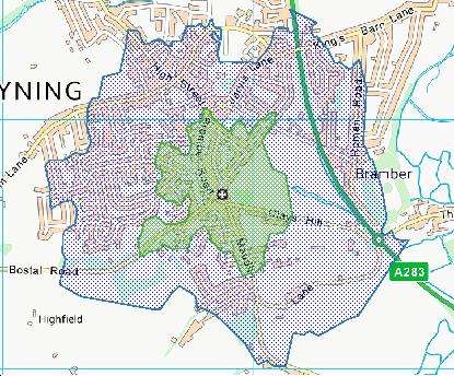
Interactive Mapping Showing UPRNs within the BN44 3FY Postcode Boundaries
Use the search box to search for other postcodes or places.
| Property Type | Percentage |
|---|---|
| Residential | 100% |
| Commercial | 0% |
| Public | 0% |
Telephone Area Code for BN44 3FY
The telephone area code for BN44 3FY is 01903 Worthing.
Map Coordinates for BN44 3FY
| Latitude | 50.8837482973 |
|---|---|
| Longitude | -0.32563918292 |
Ordnance Survey Maps for BN44 3FY
| Map Series | Amazon | Ordnance Survey |
| Explorer 1:25,000 ol11 Brighton & Hove | Check Price on Amazon | Buy Direct from the Ordnance Survey |
| Landranger 1:50,000 198 Brighton & Lewes | Check Price on Amazon |
Weather Forecast for BN44 3FY
Sun 28th Apr
Press Button to Show Forecast for Steyning
| Time Period | Icon | Description | Temperature | Rain Probability | Wind |
|---|---|---|---|---|---|
| 15:00 to 18:00 | Cloudy | 11.0°C (feels like 9.0°C) | 9.00% | WSW 9 mph | |
| 18:00 to 21:00 | Sunny day | 11.0°C (feels like 8.0°C) | 2.00% | SW 11 mph | |
| 21:00 to 00:00 | Clear night | 8.0°C (feels like 6.0°C) | 0.00% | SW 7 mph |
Mon 29th Apr
Press Button to Show Forecast for Steyning
| Time Period | Icon | Description | Temperature | Rain Probability | Wind |
|---|---|---|---|---|---|
| 00:00 to 03:00 | Clear night | 8.0°C (feels like 6.0°C) | 0.00% | SW 7 mph | |
| 03:00 to 06:00 | Clear night | 8.0°C (feels like 6.0°C) | 0.00% | SW 7 mph | |
| 06:00 to 09:00 | Sunny day | 10.0°C (feels like 8.0°C) | 0.00% | SSW 9 mph | |
| 09:00 to 12:00 | Sunny day | 12.0°C (feels like 9.0°C) | 0.00% | SSW 13 mph | |
| 12:00 to 15:00 | Sunny day | 13.0°C (feels like 11.0°C) | 0.00% | S 13 mph | |
| 15:00 to 18:00 | Sunny day | 14.0°C (feels like 11.0°C) | 0.00% | S 13 mph | |
| 18:00 to 21:00 | Sunny day | 13.0°C (feels like 11.0°C) | 0.00% | SSE 7 mph | |
| 21:00 to 00:00 | Clear night | 10.0°C (feels like 9.0°C) | 0.00% | SE 7 mph |
Tue 30th Apr
Press Button to Show Forecast for Steyning
| Time Period | Icon | Description | Temperature | Rain Probability | Wind |
|---|---|---|---|---|---|
| 00:00 to 03:00 | Clear night | 10.0°C (feels like 8.0°C) | 0.00% | SSE 7 mph | |
| 03:00 to 06:00 | Clear night | 9.0°C (feels like 7.0°C) | 0.00% | SSE 7 mph | |
| 06:00 to 09:00 | Sunny day | 10.0°C (feels like 8.0°C) | 1.00% | SE 7 mph | |
| 09:00 to 12:00 | Partly cloudy (day) | 13.0°C (feels like 11.0°C) | 4.00% | SSE 11 mph | |
| 12:00 to 15:00 | Cloudy | 14.0°C (feels like 12.0°C) | 8.00% | SSE 11 mph | |
| 15:00 to 18:00 | Cloudy | 15.0°C (feels like 13.0°C) | 11.00% | SSE 11 mph | |
| 18:00 to 21:00 | Partly cloudy (day) | 14.0°C (feels like 13.0°C) | 7.00% | SE 9 mph | |
| 21:00 to 00:00 | Cloudy | 11.0°C (feels like 10.0°C) | 11.00% | SE 7 mph |
Wed 1st May
Press Button to Show Forecast for Steyning
| Time Period | Icon | Description | Temperature | Rain Probability | Wind |
|---|---|---|---|---|---|
| 00:00 to 03:00 | Cloudy | 10.0°C (feels like 10.0°C) | 9.00% | SSE 4 mph | |
| 03:00 to 06:00 | Cloudy | 9.0°C (feels like 8.0°C) | 8.00% | SSE 4 mph | |
| 06:00 to 09:00 | Mist | 10.0°C (feels like 9.0°C) | 19.00% | NNE 4 mph | |
| 09:00 to 12:00 | Cloudy | 13.0°C (feels like 13.0°C) | 15.00% | NE 4 mph | |
| 12:00 to 15:00 | Cloudy | 16.0°C (feels like 15.0°C) | 18.00% | ENE 7 mph | |
| 15:00 to 18:00 | Light rain shower (day) | 16.0°C (feels like 15.0°C) | 41.00% | WNW 7 mph | |
| 18:00 to 21:00 | Cloudy | 15.0°C (feels like 13.0°C) | 20.00% | SW 9 mph | |
| 21:00 to 00:00 | Cloudy | 13.0°C (feels like 11.0°C) | 19.00% | NW 9 mph |
Thu 2nd May
Press Button to Show Forecast for Steyning
| Time Period | Icon | Description | Temperature | Rain Probability | Wind |
|---|---|---|---|---|---|
| 00:00 to 03:00 | Light rain | 12.0°C (feels like 10.0°C) | 49.00% | NW 9 mph | |
| 03:00 to 06:00 | Light rain | 11.0°C (feels like 10.0°C) | 46.00% | NNW 7 mph | |
| 06:00 to 09:00 | Overcast | 11.0°C (feels like 10.0°C) | 15.00% | NNW 7 mph | |
| 09:00 to 12:00 | Overcast | 13.0°C (feels like 12.0°C) | 17.00% | NW 9 mph | |
| 12:00 to 15:00 | Cloudy | 16.0°C (feels like 15.0°C) | 12.00% | NW 9 mph | |
| 15:00 to 18:00 | Cloudy | 18.0°C (feels like 16.0°C) | 14.00% | NW 9 mph | |
| 18:00 to 21:00 | Partly cloudy (day) | 16.0°C (feels like 15.0°C) | 9.00% | NW 9 mph | |
| 21:00 to 00:00 | Cloudy | 13.0°C (feels like 12.0°C) | 11.00% | WNW 7 mph |
What are the Broadband Speeds like in the BN44 3FY Postcode?
Download Speeds For BN44 3FY

| Average Mbps | 52.000 |
|---|---|
| Median Mbps | 54.800 |
| Maximum Mbps | 76.280 |
BN44 3FY has an average download speed of 52 Megabits per second (Mbps).
1,517 other postcode units have the same broadband speed.
29% of postcodes (340,219) have slower broadband speeds.
71% of postcodes (842,905) have faster broadband speeds.
Upload Speeds For BN44 3FY

| Average Mbps | 12.600 |
|---|---|
| Median Mbps | 11.300 |
| Maximum Mbps | 20.000 |
BN44 3FY has an average upload speed of 12.6 Megabits per second (Mbps).
10,401 other postcode units have the same upload speed.
42% of postcodes (493,451) have slower upload speeds.
57% of postcodes (680,789) have faster upload speeds.
Schools within a five minute drive of BN44 3FY Postcode
England Primary Schools
Upper Beeding Primary School
Address: Upper Beeding Primary School, School Road, Upper Beeding, Steyning, West Sussex, BN44 3HY
Distance: 1.02 miles
Contact: 01903812288
Steyning CofE Primary School
Address: Steyning CofE Primary School, Shooting Field, Steyning, West Sussex, BN44 3RQ
Distance: 0.64 miles
Contact: 01903813420
England Secondary Schools
Steyning Grammar School
Address: Steyning Grammar School, Shooting Field, Steyning, West Sussex, BN44 3RX
Distance: 0.68 miles
Contact:
Nearest Dentists
Dentists near BN44 3FY
DENTAL SURGERY
Address: 4 HIGH STREET, STEYNING, WEST SUSSEX, BN44 3GG
Distance: 0.25 miles
Contact: :
DENTAL SURGERY
Address: 17 CHURCH STREET, STEYNING, WEST SUSSEX, BN44 3YB
Distance: 0.36 miles
Contact: :
STEYNING DENTAL CARE LTD
Address: 2ND FLOOR, STEYNING HEALTH CENTRE, TANYARD LANE, STEYNING, WEST SUSSEX, BN44 3RJ
Distance: 0.51 miles
Contact: :
DENTAL SURGERY
Address: 43 BUSTICLE LANE, SOMPTING, LANCING, WEST SUSSEX, BN15 0DJ
Distance: 3.36 miles
Contact: :
CRAIGWEIL DENTAL PRACTICE
Address: CRAIGWEIL, GRAND AVENUE, LANCING, WEST SUSSEX, BN15 9PS
Distance: 3.55 miles
Contact: :
SOMPTING ROAD (DENTAL SURGERY)
Address: 104 SOMPTING ROAD, LANCING, WEST SUSSEX, BN15 9LQ
Distance: 3.83 miles
Contact: :
Nearest Chemists
Pharmacies near BN44 3FY
PAYDENS PHARMACY
Address: STEYNING HEALTH CENTRE, TANYARD LANE, STEYNING, WEST SUSSEX, BN44 3RJ
Distance: 0.51 miles
Contact: tel: 01903 815615
UPPER BEEDING PHARMACY
Address: HIGH STREET, UPPER BEEDING, STEYNING, WEST SUSSEX, BN44 3HZ
Distance: 0.87 miles
Contact: tel: 01903 813218
COKEHAM PHARMACY
Address: 2-3 INGLECROFT COURT, COKEHAM ROAD, SOMPTING, LANCING, WEST SUSSEX, BN15 0AN
Distance: 3.53 miles
Contact: tel: 01903 753454
WILMSHURST CHEMIST
Address: 58 CRABTREE LANE, LANCING, WEST SUSSEX, BN15 9PJ
Distance: 3.58 miles
Contact: tel: 01903 753168
BOOTS
Address: DOWNLAND BUSINESS PARK, LYONS WAY, WORTHING, WEST SUSSEX, BN14 9LA
Distance: 3.68 miles
Contact: tel: 01903 205834
ROWLANDS PHARMACY
Address: 31 NORTH ROAD, LANCING, WEST SUSSEX, BN15 9AH
Distance: 3.87 miles
Contact: tel: 01903 752330
Nearest Opticians
Opticians near BN44 3FY
ROBINSON OPTICIANS
Address: 78 HIGH STREET, STEYNING, WEST SUSSEX, BN44 3RD
Distance: 0.44 miles
Contact: :
ROGER TABBERER, BEVERLEY TABBERER & PENELOPE SHRUBB
Address: 16 QUEENS PARADE, NORTH ROAD, LANCING, WEST SUSSEX, BN15 9BA
Distance: 3.76 miles
Contact: :
BOURNEMOUTH 5 DOMICILIARY SPECSAVERS LIMITED
Address: 7 TURNER ROAD, WORTHING, WEST SUSSEX, BN14 8PX
Distance: 3.87 miles
Contact: :
LANCING EYECARE
Address: 6 STATION PARADE, SOUTH STREET, LANCING, WEST SUSSEX, BN15 8AA
Distance: 3.94 miles
Contact: :
HENFIELD EYECARE
Address: 3 BISHOP CROFT, HIGH STREET, HENFIELD, WEST SUSSEX, BN5 9DA
Distance: 3.97 miles
Contact: :
THOMAS H COLLISON LTD (SHOREHAM)
Address: 33 BRUNSWICK ROAD, SHOREHAM-BY-SEA, WEST SUSSEX, BN43 5WA
Distance: 4.14 miles
Contact: :
Nearest GP Surgeries
Doctors near BN44 3FY
STEYNING HEALTH CENTRE
Address: TANYARD LANE, STEYNING, WEST SUSSEX, BN44 3RJ
Distance: 0.51 miles
Contact: tel: 01903 497227
14 DAWN CLOSE, UPPER BEEDING
Address: 14 DAWN CLOSE, UPPER BEEDING, STEYNING, WEST SUSSEX, BN44 3WG
Distance: 1.05 miles
Contact: tel: 01903 816107
LANCING COLLEGE SANATORIUM
Address: LANCING COLLEGE, LANCING, WEST SUSSEX, BN15 0RW
Distance: 2.79 miles
Contact: :
BALL TREE SURGERY
Address: WESTERN ROAD NORTH, SOMPTING, LANCING, WEST SUSSEX, BN15 9UX
Distance: 3.64 miles
Contact: tel: 01903 752200
THE KINGFISHER FAMILY PRACTICE
Address: 19-21 CULVER ROAD, LANCING, WEST SUSSEX, BN15 9AX
Distance: 3.79 miles
Contact: :
BALL TREE SURGERY - KINGFISHER SITE- COVID LOCAL VACCINATION SERVICE
Address: 19-21 CULVER ROAD, LANCING, BN15 9AX
Distance: 3.79 miles
Contact: :
Transport Links near BN44 3FY
Train Stations
Nearest stations for postcode: BN44 3FY
- Shoreham-by-Sea
Shoreham-by-sea station, Station Approach, Shoreham-by-sea, West Sussex, BN43 5WXDistance: 5.05 milesDriving Time: 7.99 minutes - Lancing
Lancing station, South Street, Lancing, West Sussex, BN15 8AGDistance: 6.28 milesDriving Time: 8.45 minutes - Southwick
Southwick station, Station Road, Southwick, West Sussex, BN42 4AEDistance: 6.71 milesDriving Time: 8.81 minutes - East Worthing
East Worthing station, Dominion Road, Worthing, West Sussex, BN14 8JXDistance: 8.88 milesDriving Time: 12.13 minutes - Worthing
Worthing station, Railway Approach, Worthing, West Sussex, BN11 1URDistance: 9.44 milesDriving Time: 13.01 minutes
Distances represent the quickest route by car.
Motorway Junctions near BN44 3FY
Train Stations
Motorway Junctions near BN44 3FY
Distances represent the quickest route by car.
Who are my Elected Representatives in the BN44 3FY Postcode?
| Westminster Constituency | Arundel and South Downs Co Const |
|---|---|
| Member or Parliament |  |
| Contact Details | Contact Andrew Griffith |
| Political Party | Conservative |
What Council is the BN44 3FY Postcode in?
The Local Council for this Postcode is Horsham District Council and the County Council is West Sussex County Council.
West Sussex County Council is responsible for providing education, libraries and maintaining highways.
Horsham District Council is responsible for duties such as council tax, rubbish collection, housing, environmental health and planning.
You can visit the website for Horsham District at the following link Horsham District.How much is the Council Tax?
Horsham District Council is responsible for collecting council tax. This will vary depending on which council tax band the property falls within. You can check the council tax band at the gov.uk website.
Once you know the council tax band you can view how much Horsham District charge for that band by visiting the The Council Tax section of their website.
Planning Applications
When moving house to a new post code it is worth checking out what will be built in the neighbourhood.
Few people want to live next door to a building site, have their garden overlooked or have the views from their property ruined.
Visit the local planning department and search for planning applications in this postcode granted within the last three years or still awaiting a decision. This will give an indication of what could still be built.
Where can I find out where the nearest Library to the BN44 3FY Postcode is?
Libraries are the responsibility of West Sussex County Council
Visit the link for more information. Please note that some councils outsource library services to private companies and community groups ran by volunteers.
Libraries - West Sussex County CouncilHouse Sales in BN44 3FY
| Year | High | Low | Average | Sales |
|---|---|---|---|---|
| 2010 | £79,500 | £79,500 | £79,500 | 1 |
| 2011 | £75,000 | £82,000 | £75,667 | 3 |
| 2012 | £71,500 | £73,500 | £72,500 | 3 |
| 2013 | £100,000 | £80,000 | £90,500 | 3 |
| 2014 | £88,000 | £88,000 | £88,000 | 1 |
| 2015 | £87,000 | £98,000 | £89,250 | 4 |
| 2016 | £79,000 | £110,000 | £93,222 | 9 |
| 2017 | £115,000 | £115,000 | £115,000 | 1 |
| 2018 | £159,000 | £120,000 | £139,500 | 2 |
| 2019 | £134,000 | £134,000 | £134,000 | 1 |
| 2020 | £109,000 | £145,000 | £127,000 | 2 |
| 2021 | £102,500 | £115,000 | £114,625 | 4 |
| 2022 | £140,000 | £140,000 | £140,000 | 1 |
Contains HM Land Registry data © Crown copyright and database right 2024. This data is licensed under the Open Government Licence v3.0.
Postcodes near the BN44 3FY Postcode
What Popular Supermarkets are near the BN44 3FY Postcode?
| Supermarket | Distance | Directions |
|---|---|---|
| Sainsburys, Downland Business Park, Lyons Way, WORTHING, BN14 9LA | 5.91 miles | Directions from BN44 3FY to Sainsburys |
| Asda, South Street, LANCING, BN15 8AG | 6.40 miles | Directions from BN44 3FY to Asda |
| Lidl, Brighton Road, SHOREHAM-BY-SEA, BN43 6RJ | 7.36 miles | Directions from BN44 3FY to Lidl |
| Morrisons, Newland Street, WORTHING, BN11 1JU | 7.92 miles | Directions from BN44 3FY to Morrisons |
| Lidl, North Street, WORTHING, BN11 1DU | 8.24 miles | Directions from BN44 3FY to Lidl |
What Popular Restaurants are near the BN44 3FY Postcode?
| Burger King | Distance | Directions |
|---|---|---|
| Goldstone Retail Park, Hove, BN3 7PN | 7.35 miles | Directions from BN44 3FY to Goldstone Retail Park |
| Jobs Lane, Hickstead, RH17 5NZ | 8.16 miles | Directions from BN44 3FY to Jobs Lane |
| 63-65 North Street, Brighton, BN1 1RH | 8.98 miles | Directions from BN44 3FY to 63-65 North Street |
| 43-45 Kings Road, Brighton, BN1 1NA | 9.08 miles | Directions from BN44 3FY to 43-45 Kings Road |
| Mcdonald's | Distance | Directions |
|---|---|---|
| McDonald's, Upper Shoreham Road, SHOREHAM-BY-SEA, BN43 6TD | 4.31 miles | Directions from BN44 3FY to McDonald's, Upper Shoreham Road, SHOREHAM-BY-SEA, BN43 6TD |
| McDonald's, Eastern Avenue, SHOREHAM-BY-SEA, BN43 6PW | 4.39 miles | Directions from BN44 3FY to McDonald's, Eastern Avenue, SHOREHAM-BY-SEA, BN43 6PW |
| McDonald's, Liverpool Road, WORTHING, BN11 1SX | 5.42 miles | Directions from BN44 3FY to McDonald's, Liverpool Road, WORTHING, BN11 1SX |
| McDonald's, Worthing Road, West Grinstead, HORSHAM, RH13 8LW | 7.47 miles | Directions from BN44 3FY to McDonald's, Worthing Road, West Grinstead, HORSHAM, RH13 8LW |
| Restaurant | Distance | Directions |
|---|---|---|
| KFC, Cricketers Parade, Broadwater Street West, WORTHING, BN14 9DB | 4.33 miles | Directions from BN44 3FY to KFC Worthing - Broadwater Street West |
| KFC, Chapel Road, WORTHING, BN11 1BE | 5.25 miles | Directions from BN44 3FY to KFC Worthing - Chapel Road |
| KFC, Goring Road, Goring-by-Sea, WORTHING, BN12 4NX | 6.50 miles | Directions from BN44 3FY to KFC Goring - Goring Road |
| KFC, Blatchington Road, HOVE, BN3 3YG | 7.54 miles | Directions from BN44 3FY to KFC Hove - Blatchington Road |
| KFC, Western Road, BRIGHTON, BN1 2HA | 8.70 miles | Directions from BN44 3FY to KFC Brighton - Western Road |