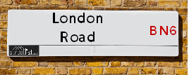
Map of London Road
| Postcodes | ||
|---|---|---|
| Icon | Postcodes for London Road | |
| Walking Distances | ||
| Distance Info | Green Circle = 10 Minutes Walk (800 metres) | |
About London Road
London Road is a street located in the City of Brighton and near the City of Brighton and near the village of Hurstpierpoint and in the village of Pyecombe and near the village of Pyecombe. The street has a length of approximately 9,644 metres.
London Road is located within the Mid Sussex District and The City of Brighton and Hove (B) Council's jurisdiction. They provide various services, like refuse collection, and manage council tax collection. It's situated in the South East region of the UK.
London Road has been assigned the Unique Street Reference Numbers of 25602184, 4402037, 4402822, 4405126, 25600403, 25600020, 25600013, 25600008, 4404327, 25600019, 25609068, 4402032, 4404328, 25600012, 25600009 and 25602185 in the National Street Gazetteer.
London Road is located within the county of East Sussex, situated in the South East region of the UK. It's 42.39 miles South from central London., 4.74 miles North from Brighton, 8.23 miles West from Lewes and 26.81 miles East from Chichester.

Do you know why this road is called London Road?
What's it like to live here?
Ask the community a question about London Road.
Do you have any questions, memories to share or know any facts about London Road? We'd love to know more.
Also on streetlist.co.uk, can you help?
Swing Swang Lane
28th April 2024
I am trying to find out why the lane is named Swing Swang?
It has been known known this since at least 1905 when hedge making contents used to be held here.
Swing Swang is often used to describe a fairground ride. I remember Swing Boats. Were they a bit like this or is Swing Swang another name for swings?
Swing Swangs are also mentioned in connection to orchards. Or were orchards just good places to have swings?
Eldroth Road
15th April 2024
I wondered if anyone has any old pictures of Wenning Bank House in the 1940’s and also Lane Side before of the same era .. we visited today with my Mum in law as she used to live at both these properties. Also any photos of the schools around that time .. thank you.
Can You Help?Napps Way
15th April 2024
Why is the road called Napps Way (belonging to Napp, but minus an
apostrophe as is usual with such nomenclature)? Moreover, who or
what is, or was, “Napp” in the respective, possessive case?
Several years ago, I met an elderly man (probably in his late-eighties)
who lives on Bentham Drive, Liverpool 16, and during a conversation
with him whilst in a Northwest Passenger Transport Ambulance on the
way to the former RLUH (Royal Liverpool University Hospital), he told
me that he could remember (when he was a boy, living in Childwall,
Liverpool 16) that, “Where Napps Way is now, during WW2, there was
a two-man gun emplacement on the, then, open land to protect the
railway line passing over Childwall Valley Road - next to the railway
bridge - when suddenly, as they were loading a live “shell” into the gun’s
breach, the aforementioned “shell” accidentally exploded in the gun’s
breach killing both of the two soldiers, that had been manning the gun,
instantly! (Very sad, of course, but could - perhaps - two ghosts relating
to those two, very unfortunately and prematurely-killed soldiers have
haunted that place of their deaths ever since - and have any residents
of Napps Way - formerly and in its latest incarnation - seen two, WW2
(uniformed) soldiers unexpectedly appear in or near their homes?)
Estate Agents near London Road
| Name | Address | Website |
|---|---|---|
| Mansell McTaggart | 138 Old London Road, Patcham, Brighton. BN1 8YA | Visit Website |
| Spencer & Leigh | 108 Old London Road, Patcham, Brighton, BN1 8YA | Visit Website |
| Cubitt & West | 58 Ladies Mile Road, Patcham, Brighton, East Sussex, BN1 8QF | Visit Website |
We have found 31 postcodes for London Road
Location Details
| London Road | |
|---|---|

| |
| Latitude | 50.887908 |
| Longitude | -0.170089 |
| OS Easting (X): | 528696 |
| OS Northing (Y): | 111481 |
| OS Grid Reference: | TQ287115 |
Neighbourhood Policing |
| Police Force: Sussex |
 View Neighbourhood Crime and Policing View Neighbourhood Crime and Policing |
| Find a Local Neighbourhood Watch Scheme |
Frequently asked Questions for London Road
What Council (Local Authority) is London Road in?
London Road is located within the local authority area of Brighton and Hove &Mid Sussex Council which is a Unitary Authority &District Council.
What Parish Council is London Road in?
London Road is located within the area of Pyecombe, Albourne, Poynings & Newtimber Parish Council.
What Electoral Ward is London Road in?
London Road is located within the ward of Withdean, Patcham, Hurstpierpoint and Downs &Bolney.
What County is London Road in?
London Road is located within the ceremonial county of East Sussex.
What Constituency is London Road in?
London Road is located within the constituency of Brighton, Pavilion, Arundel and South Downs &Mid Sussex.
What Part of the UK is London Road in?
London Road is located within the South East (England) region of the United Kingdom.
What County Council area is London Road in?
London Road is located within the Brighton and Hove &West Sussex Council area.
What Police Force area is London Road in?
London Road is located within the Sussex Police area.
Roads that have a Junction with London Road
| Street | Junction Type |
|---|---|
| Brighton Road (B2117) | junction |
| Dale Hill (A23) | pseudo node |
| Dale Hill (A23) | junction |
| Mill Road | roundabout |
| Mill Road | roundabout |
| Church Hill | junction |
| Patcham By Pass (A23) | junction |
| Brangwyn Drive | junction |
| Carden Avenue | junction |
| Peacock Lane | junction |
| Tongdean Lane | junction |
| Withdean Court Avenue | junction |
| The Approach | junction |
| Cedars Gardens | junction |
| Leahurst Court Road | junction |
| Varndean Road | junction |
| Elms Lea Avenue | junction |
| Cliveden Court | junction |
| Towergate | junction |
| Preston Road (A23) | junction |
Sunset and Sunrise times for London Road
| Sunrise | 05:15 |
|---|---|
| Sunset | 20:38 |
Latest Weather Conditions for London Road
| Observed at Weather Station: | Shoreham 10 May 2024 at 17:00 (6.41 miles away) |
|---|---|
| Current Weather: | Clear night |
| Temperature and Humidity: | 16.8°C (68.8%) |
| Wind Direction and Speed: | SE (8 mph) |
Population Statistics
| ONS Area Code | E00085880, E00085852, E00085879, E00085884, E00085883, E00085882, E00085878, E00085850, E00085848, E00085431, E00085872, E00085440, E00162005, E00161632 & E00162004 |
|---|---|
| ONS Area Name | Professional Service Cosmopolitans, Delayed Retirement, Urban Cultural Mix, Families in Terraces and Flats, Migrant Families, Self-Sufficient Retirement, Rural White-Collar Workers & Established Farming Communities |
| Average Age | 42.26, 38.56, 38.19, 44.70, 44.24, 43.45, 44.57, 43.55 & 40.79 |
| Area Population | 1703.00, 1647.00, 1688.00, 1722.00, 1504.00, 1586.00, 1602.00, 1666.00 & 1668.00 |
| Male Population | 838.00, 779.00, 855.00, 833.00, 730.00, 752.00, 775.00, 805.00 & 844.00 (49%) |
| Female Population | 865.00, 868.00, 833.00, 889.00, 774.00, 834.00, 827.00, 861.00 & 824.00 (51%) |
| Benefit Claimants | 18, 7, 21, 10, 4, 11, 8, 9 & 3 (1%) |
| LSOA Code: | E01017002, E01017003, E01017004, E01017000, E01017001, E01016923, E01016928, E01031770 &E01031698 |
|---|---|
| LSOA Name: | Brighton and Hove 011B, Brighton and Hove 004D, Brighton and Hove 011C, Brighton and Hove 003E, Brighton and Hove 004C, Brighton and Hove 003A, Brighton and Hove 003B, Mid Sussex 016D &Mid Sussex 016A |
| SOA Code: | 3c, 8a &2b |
| SOA Name: | |
| MSOA Code: | E02003501, E02003494, E02003493 &E02006619 |
| MSOA Name: | Brighton and Hove 011, Brighton and Hove 004, Brighton and Hove 003 &Mid Sussex 016 |
Nearest Supermarkets
| Sainsburys Brighton Carden Avenue Local |
|---|
| 189 Carden Avenue, Brighton, England, BN1 8LE |
| 1273559954 |
| Distance: 2.32 Miles |
| Directions from London Road to Sainsburys Brighton Carden Avenue Local |
| Asda Brighton Hollingbury |
|---|
| Unit 1 Crowhurst Road, off Carden Avenue, Brighton, BN1 8AS |
| 01273 541166 |
| Distance: 2.41 Miles |
| Directions from London Road to Asda Brighton Hollingbury |
| Sainsburys Hassocks Keymer Road Local |
|---|
| 22 - 24 Keymer Road, Hassocks, England, BN6 8AN |
| 1273842430 |
| Distance: 2.77 Miles |
| Directions from London Road to Sainsburys Hassocks Keymer Road Local |
| Waitrose Hove |
|---|
| Nevill Road, Hove, Sussex, BN3 7BZ |
| 01273 329901 |
| Distance: 3.08 Miles |
| Directions from London Road to Waitrose Hove |
Telephone Information
| Area Code |
|---|
| Area Code: 01273 - Brighton |
| Area Code: 01444 - Haywards Heath |
Local Government
| Local Council Details |
|---|
| Within the area of Brighton and Hove &Mid Sussex |
| Visit the Council's Website |
| Visit the Council's Website |
| Kings House, Grand Avenue, Hove, East Sussex, BN3 2LS, Oaklands, Oaklands Road, Haywards Heath, West Sussex &RH16 1SS |
| Send email |
| Telephone Number: 01273 290000 &01444 458 166 |
| Local Member of Parliament |
|---|
| Within the Westminster Parliamentary Constituency of Brighton, Pavilion, Arundel and South Downs &Mid Sussex |
| The Member of Parliament is Caroline Lucas, Andrew Griffith &Mims Davies |
| Details for the MP Caroline Lucas, Andrew Griffith &Mims Davies on parliament.uk |
| Details for the MP Caroline Lucas, Andrew Griffith &Mims Davies on theyworkforyou.com |
| In the 2019 General Election Caroline Lucas, Andrew Griffith &Mims Davies won with a majority of 19,940 the result was Green hold &Con hold. The total electorate was 79,057 |
| Wards, Parish Councils and County Councils |
|---|
| Ward: Withdean, Patcham, Hurstpierpoint and Downs &Bolney Ward |
| Ceremonial County: East Sussex |
Nearest Schools
Nearest Hospitals
| Name | Address | Postcode | Distance | Map |
|---|
Nearest Dentists
Dentists near London Road
| Name | Address | Postcode | Distance | Map |
|---|
Nearest GP Surgeries
Doctors near London Road
THE DENEWAY SURGERY
Address: LIONSDENE, 11 THE DENEWAY, BRIGHTON, EAST SUSSEX, BN1 8QR
Distance: 2.26 miles
Contact: tel: 01273 540490
CARDEN SURGERY
Address: COUNTY OAK MEDICAL CENTRE, CARDEN HILL, BRIGHTON, EAST SUSSEX, BN1 8DD
Distance: 2.60 miles
Contact: tel: 01273 500155
WARMDENE SURGERY
Address: COUNTY OAK MEDICAL CENTRE, CARDEN HILL, BRIGHTON, EAST SUSSEX, BN1 8DD
Distance: 2.60 miles
Contact: tel: 01273 508811
BURWASH MEDICAL CENTRE
Address: 14 BURWASH ROAD, HOVE, BN3 8GQ
Distance: 2.67 miles
Contact: :
HASSOCKS HEALTH CENTRE
Address: HASSOCKS HEALTH CENTRE, WINDMILL AVENUE, HASSOCKS, WEST SUSSEX, BN6 8LY
Distance: 2.70 miles
Contact: tel: 01273 844242
NEW LARCHWOOD
Address: WALDRON AVENUE, BRIGHTON, EAST SUSSEX, BN1 9EZ
Distance: 2.98 miles
Contact: :
Nearest Dispensing Chemists
Pharmacies near London Road
| Name | Address | Postcode | Telephone | Map | Distance in Km |
|---|
Nearest Opticians
Opticians near London Road
EYES AT HOME (HOVE)
Address: 87 WOODLAND AVENUE, HOVE, EAST SUSSEX, BN3 6BJ
Distance: 2.43 miles
Contact: :
4646 BRIGHTON HOLLINGBURY
Address: ASDA STORES LTD, 1 CROWHURST ROAD, HOLLINGBURY, BRIGHTON, EAST SUSSEX, BN1 8AS
Distance: 2.44 miles
Contact: :
HASSOCKS (KEYMER ROAD)
Address: 17 KEYMER ROAD, HASSOCKS, BN6 8AD
Distance: 2.79 miles
Contact: :
PORTSLADE SPECSAVERS LTD
Address: 58-59 BOUNDARY ROAD, HOVE, EAST SUSSEX, BN3 5TD
Distance: 4.03 miles
Contact: :
SPECSAVERS (HOVE)
Address: 84 GEORGE STREET, HOVE, EAST SUSSEX, BN3 3YE
Distance: 4.04 miles
Contact: :
THOMAS H COLLISON LTD (BRIGHTON)
Address: 57B LONDON ROAD, BRIGHTON, EAST SUSSEX, BN1 4JE
Distance: 4.04 miles
Contact: :
Transport
Nearest Rail Stations
Hassocks Station is 2.75 miles away.
Address: Hassocks station, Station Approach West, Hassocks, West Sussex, BN6 8JD
Hassocks is situated on the Brighton Main Line and is managed by Southern.
Hassocks Station is staffed on a part time basis.
Preston Park Station is 2.97 miles away.
Address: Preston Park station, Clermont Road, Preston Park, Brighton, BN1 6SG
Preston Park is situated on the Brighton Main Line and is managed by Southern.
Preston Park Station is staffed on a part time basis.