The CA25 postcode district is a postal district located in the CA Carlisle postcode area with a population of 5,911 residents according to the 2021 England and Wales Census.
The area of the CA25 postcode district is 4.78 square miles which is 12.37 square kilometres or 3,057.44 acres.
Currently, the CA25 district has about 226 postcode units spread across 1 geographic postcode sectors.
Given that each sector allows for 400 unique postcode combinations, the district has a capacity of 400 postcodes. With 226 postcodes already in use, this leaves 174 units available.
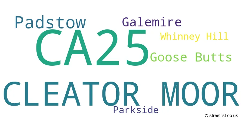
The largest settlements in the CA25 postal code are CLEATOR MOOR and Padstow.
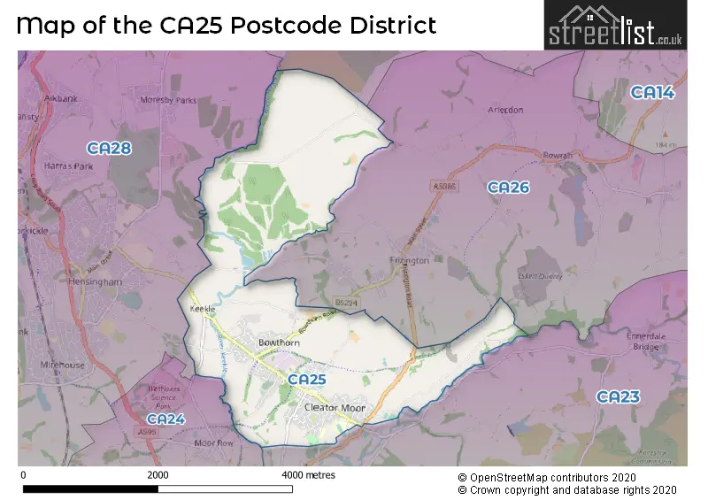
The CA25 Postcode shares a border with CA23 (CLEATOR, Ennerdale, Kinniside), CA24 (MOOR ROW, Westlakes Science & Technology Park, Linethwaite), CA26 (FRIZINGTON, Arlecdon, Kirkland) and CA28 (WHITEHAVEN, Hensingham, Moresby Parks).
The primary settlement in the CA25 postcode district is Cleator Moor, which is located in the county of Cumbria. Other significant settlements in the district include Galemire, Goose Butts, Padstow, Parkside, and Whinney Hill, all of which are also part of Cleator Moor. The most significant post town in the district is Cleator Moor.
For the district CA25, we have data on 1 postcode sectors. Here's a breakdown: The sector CA25 5, covers Cleator Moor in Cumbria.
CA25 Postcode Sectors

Map of the CA25 Postcode District
Explore the CA25 postcode district by using our free interactive map.
When it comes to local government, postal geography often disregards political borders. However, for a breakdown in the CA25 District: the district mostly encompasses the Cumberland area with a total of 227 postcodes.
Where is the CA25 Postcode District?
The postcode district CA25 is located in Cleator Moor. Cleator Moor is a district town in Cumbria, England. It is surrounded by several nearby towns, with Frizington located to the east at a distance of 0.81 miles, Moor Row to the southwest at a distance of 1.77 miles, Cleator to the south at a distance of 1.90 miles, Whitehaven to the west at a distance of 2.35 miles, and Workington to the north at a distance of 6.89 miles. Furthermore, Cleator Moor is approximately 252.52 miles away from the center of London.
The district is within the post town of CLEATOR MOOR.
The sector has postcodes within the nation of England.
The CA25 Postcode District is in the West Cumbria region of Cumbria within the North West (England).
Postcode Sectors within the CA25 District
| Postcode Sector | Delivery Office |
|---|---|
| CA25 5 | Egremont Delivery Office |
| C | A | 2 | 5 | - | X | X | X |
| C | A | 2 | 5 | Space | Numeric | Letter | Letter |
Current Monthly Rental Prices
| # Bedrooms | Min Price | Max Price | Avg Price |
|---|---|---|---|
| 2 | £525 | £650 | £588 |
| 3 | £550 | £550 | £550 |
Current House Prices
| # Bedrooms | Min Price | Max Price | Avg Price |
|---|---|---|---|
| £59,995 | £400,000 | £184,998 | |
| 2 | £30,000 | £99,950 | £74,421 |
| 3 | £69,950 | £299,950 | £128,964 |
| 7 | £900,000 | £900,000 | £900,000 |
Estate Agents who Operate in the CA25 District
| Logo | Name | Brand Name | Address | Contact Number | Total Properties |
|---|---|---|---|---|---|
 | Lillyhall | First Choice Move | Gate House, Hallwood Road, Lillyhall, Workington, CA14 4JR | 01946 552543 | 7 |
 | Whitehaven | Grisdales Estate Agents | 46/47 King Street Whitehaven CA28 7JH | 01946 550907 | 4 |
 | Whitehaven | Lillingtons Estate Agents | 58 Lowther Street, Whitehaven, CA28 7DP | 01946 590412 | 3 |
 | Carlisle | Belvoir | 2 The Crescent, Carlisle, CA1 1QN | 01228 582031 | 1 |
 | Carlisle | Hunters | 56 Warwick Road, Carlisle, Cumbria, CA1 1DR | 01228 582073 | 1 |
| Type of Property | 2018 Average | 2018 Sales | 2017 Average | 2017 Sales | 2016 Average | 2016 Sales | 2015 Average | 2015 Sales |
|---|---|---|---|---|---|---|---|---|
| Detached | £262,175 | 20 | £240,773 | 20 | £237,331 | 24 | £215,211 | 18 |
| Semi-Detached | £148,797 | 18 | £134,789 | 19 | £129,720 | 27 | £121,459 | 27 |
| Terraced | £77,798 | 31 | £70,177 | 31 | £73,126 | 44 | £75,623 | 39 |
| Flats | £64,950 | 1 | £118,000 | 1 | £94,000 | 1 | £0 | 0 |