CB1 3AS is a postal code used within the United Kingdom for delivering mail.
Postcodes are made up of two parts. The part before the space (CB1) is called the outward code. The part after the space (3AS) is called the inward code. The letters C, I, K, M, O and V are not allowed in the inward code. In addition to the inward and outward code, the postcode can be broken up into four parts:
- Postal Area. In our case CB which means Cambridge.
- Postal District. In our case CB1.
- Postal Sector. In our case CB1 3.
- Postcode Unit. The last two letters. In our case AS.
The regional mail center for the post area CB is the National Distribution Centre, which is located at Danes Way, NORTHAMPTON, NN6 7DD.
The final port of call for any post addressed to the CB1 3AS postcode is the local delivery office (DO) which is CAMBRIDGE DO. Here the post will be sorted ready for delivery.
The properties in the CB1 3AS postcode have the street address of Thoday Street
Did you know? According to the 2021 Census, the CB1 3AS postcode is home to a bustling 128 residents!
It is situated within the post town of CAMBRIDGE within the old postal county of Cambridgeshire.
CB1 3AS is within the city of Cambridge.
The CB1 3AS postcode area is composed of 98.65% residential properties, 1.35% commercial properties, and 0% public properties.
According to our data. Most dwellings in CB1 3AS are houses. The remainder of residential properties consist of flats. Of these houses, most are mid-terraced. The remainder are semi-detached, end-terraced and detached. Of these flats, most are end-terraced. The remainder are semi-detached, detached and mid-terraced.
Most properties in CB1 3AS are owned by the occupiers with the rest being privately rented.
None Domestic Buildings in CB1 3AS fall under these categories: Shops.
Shops include 2A, Thoday Street.

Interactive Mapping Showing UPRNs within the CB1 3AS Postcode Boundaries
Use the search box to search for other postcodes or places.
| Property Type | Percentage |
|---|---|
| Residential | 98.65% |
| Commercial | 1.35% |
| Public | 0% |
Telephone Area Code for CB1 3AS
The telephone area code for CB1 3AS is 01223 Cambridge.
Map Coordinates for CB1 3AS
| Latitude | 52.1982131025 |
|---|---|
| Longitude | 0.146742825784 |
Ordnance Survey Maps for CB1 3AS
| Map Series | Amazon | Ordnance Survey |
| Explorer 1:25,000 209 Cambridge, Royston, Duxford & Linton | Check Price on Amazon | |
| Landranger 1:50,000 154 Cambridge & Newmarket | Check Price on Amazon | Buy Direct from the Ordnance Survey |

Weather Forecast for CB1 3AS
Sun 28th Apr
Press Button to Show Forecast for Cambridge Youth Hostel
| Time Period | Icon | Description | Temperature | Rain Probability | Wind |
|---|---|---|---|---|---|
| 09:00 to 12:00 | Cloudy | 11.0°C (feels like 9.0°C) | 57.00% | SW 11 mph | |
| 12:00 to 15:00 | Light rain | 9.0°C (feels like 5.0°C) | 52.00% | W 16 mph | |
| 15:00 to 18:00 | Light rain | 8.0°C (feels like 5.0°C) | 49.00% | WSW 16 mph | |
| 18:00 to 21:00 | Cloudy | 9.0°C (feels like 7.0°C) | 10.00% | SW 11 mph | |
| 21:00 to 00:00 | Clear night | 7.0°C (feels like 5.0°C) | 1.00% | SSW 9 mph |
Mon 29th Apr
Press Button to Show Forecast for Cambridge Youth Hostel
| Time Period | Icon | Description | Temperature | Rain Probability | Wind |
|---|---|---|---|---|---|
| 00:00 to 03:00 | Clear night | 6.0°C (feels like 3.0°C) | 1.00% | SSW 9 mph | |
| 03:00 to 06:00 | Clear night | 5.0°C (feels like 2.0°C) | 0.00% | SSW 7 mph | |
| 06:00 to 09:00 | Sunny day | 6.0°C (feels like 4.0°C) | 0.00% | S 7 mph | |
| 09:00 to 12:00 | Partly cloudy (day) | 12.0°C (feels like 9.0°C) | 1.00% | SSW 11 mph | |
| 12:00 to 15:00 | Partly cloudy (day) | 14.0°C (feels like 11.0°C) | 4.00% | S 13 mph | |
| 15:00 to 18:00 | Partly cloudy (day) | 15.0°C (feels like 12.0°C) | 1.00% | S 13 mph | |
| 18:00 to 21:00 | Sunny day | 14.0°C (feels like 11.0°C) | 1.00% | S 11 mph | |
| 21:00 to 00:00 | Clear night | 9.0°C (feels like 7.0°C) | 0.00% | SSE 9 mph |
Tue 30th Apr
Press Button to Show Forecast for Cambridge Youth Hostel
| Time Period | Icon | Description | Temperature | Rain Probability | Wind |
|---|---|---|---|---|---|
| 00:00 to 03:00 | Clear night | 8.0°C (feels like 6.0°C) | 1.00% | SE 9 mph | |
| 03:00 to 06:00 | Clear night | 8.0°C (feels like 6.0°C) | 1.00% | SE 7 mph | |
| 06:00 to 09:00 | Sunny day | 9.0°C (feels like 7.0°C) | 1.00% | ESE 9 mph | |
| 09:00 to 12:00 | Sunny day | 14.0°C (feels like 13.0°C) | 3.00% | SE 9 mph | |
| 12:00 to 15:00 | Partly cloudy (day) | 17.0°C (feels like 14.0°C) | 10.00% | SE 11 mph | |
| 15:00 to 18:00 | Partly cloudy (day) | 17.0°C (feels like 15.0°C) | 6.00% | SE 11 mph | |
| 18:00 to 21:00 | Cloudy | 15.0°C (feels like 14.0°C) | 8.00% | SE 9 mph | |
| 21:00 to 00:00 | Cloudy | 12.0°C (feels like 11.0°C) | 15.00% | ESE 7 mph |
Wed 1st May
Press Button to Show Forecast for Cambridge Youth Hostel
| Time Period | Icon | Description | Temperature | Rain Probability | Wind |
|---|---|---|---|---|---|
| 00:00 to 03:00 | Cloudy | 11.0°C (feels like 10.0°C) | 17.00% | ESE 7 mph | |
| 03:00 to 06:00 | Cloudy | 11.0°C (feels like 10.0°C) | 16.00% | ESE 4 mph | |
| 06:00 to 09:00 | Cloudy | 11.0°C (feels like 10.0°C) | 13.00% | ESE 4 mph | |
| 09:00 to 12:00 | Cloudy | 15.0°C (feels like 14.0°C) | 13.00% | SE 4 mph | |
| 12:00 to 15:00 | Cloudy | 17.0°C (feels like 17.0°C) | 14.00% | E 7 mph | |
| 15:00 to 18:00 | Cloudy | 18.0°C (feels like 17.0°C) | 13.00% | NE 7 mph | |
| 18:00 to 21:00 | Cloudy | 16.0°C (feels like 15.0°C) | 11.00% | NE 7 mph | |
| 21:00 to 00:00 | Cloudy | 12.0°C (feels like 11.0°C) | 9.00% | NE 7 mph |
What are the Broadband Speeds like in the CB1 3AS Postcode?
Download Speeds For CB1 3AS

| Average Mbps | 116.600 |
|---|---|
| Median Mbps | 107.000 |
| Maximum Mbps | 331.000 |
CB1 3AS has an average download speed of 116.6 Megabits per second (Mbps).
628 other postcode units have the same broadband speed.
77% of postcodes (913,875) have slower broadband speeds.
23% of postcodes (270,138) have faster broadband speeds.
Upload Speeds For CB1 3AS

| Average Mbps | 13.000 |
|---|---|
| Median Mbps | 10.000 |
| Maximum Mbps | 36.000 |
CB1 3AS has an average upload speed of 13 Megabits per second (Mbps).
10,716 other postcode units have the same upload speed.
45% of postcodes (535,563) have slower upload speeds.
54% of postcodes (638,362) have faster upload speeds.
Schools within a five minute drive of CB1 3AS Postcode
England Secondary Schools
St Bede's Inter-Church School
Address: St Bede's Inter-Church School, Birdwood Road, Cambridge, Cambridgeshire, CB1 3TD
Distance: 0.85 miles
Contact: 01223568816
Coleridge Community College
Address: Coleridge Community College, Radegund Road, Cambridge, Cambridgeshire, CB1 3RJ
Distance: 0.43 miles
Contact: 01223712300
Parkside Community College
Address: Parkside Community College, Parkside, Cambridge, Cambridgeshire, CB1 1EH
Distance: 0.88 miles
Contact: 01223712600
England Primary Schools
Abbey Meadows Primary School
Address: Abbey Meadows Primary School, Galfrid Road, Cambridge, Cambridgeshire, CB5 8ND
Distance: 0.91 miles
Contact:
Ridgefield Primary School
Address: Ridgefield Primary School, Radegund Road, Cambridge, CB1 3RL
Distance: 0.40 miles
Contact: 01223712418
St Philip's CofE Aided Primary School
Address: St Philip's CofE Aided Primary School, 2 Vinery Way, Cambridge, Cambridgeshire, CB1 3DR
Distance: 0.38 miles
Contact: 01223508707
Morley Memorial Primary School
Address: Morley Memorial Primary School, Blinco Grove, Cambridge, Cambridgeshire, CB1 7TX
Distance: 0.81 miles
Contact: 01223508786
St Matthew's Primary School
Address: St Matthew's Primary School, 19 Norfolk Street, Cambridge, Cambridgeshire, CB1 2LD
Distance: 0.62 miles
Contact: 01223568838
St Pauls CofE VA Primary School
Address: St Pauls CofE VA Primary School, Coronation Street, Cambridge, Cambridgeshire, CB2 1HJ
Distance: 0.84 miles
Contact: 01223568840
St Alban's Catholic Primary School
Address: St Alban's Catholic Primary School, Lensfield Road, Cambridge, Cambridgeshire, CB2 1EN
Distance: 0.98 miles
Contact: 01223712148
England Higher Schools
Hills Road Sixth Form College
Address: Hills Road Sixth Form College, Hills Road, Cambridge, Cambridgeshire, CB2 8PE
Distance: 0.85 miles
Contact: 01223247251
Nearest Dentists
Dentists near CB1 3AS
BROOKFIELDS HEALTH CENTRE
Address: SEYMOUR STREET, CAMBRIDGE, CAMBRIDGESHIRE, CB1 3DQ
Distance: 0.32 miles
Contact: :
ANTWERP HOUSE DENTAL PRACTICE
Address: 36 BROOKFIELDS, CAMBRIDGE, CAMBRIDGESHIRE, CB1 3NW
Distance: 0.38 miles
Contact: :
DENTAL SURGERY
Address: 97-99 BURNSIDE, CAMBRIDGE, CAMBRIDGESHIRE, CB1 3PA
Distance: 0.51 miles
Contact: :
NORFOLK STREET DENTAL SURGERY
Address: 24 NORFOLK STREET, CAMBRIDGE, CAMBRIDGESHIRE, CB1 2LF
Distance: 0.58 miles
Contact: :
CAMBRIDGE DENCARE
Address: 45 GLISSON ROAD, CAMBRIDGE, CAMBRIDGESHIRE, CB1 2HA
Distance: 0.66 miles
Contact: :
HOMERTON STREET (DENTAL SURGERY)
Address: 6 HOMERTON STREET, CAMBRIDGE, CB2 8NX
Distance: 0.79 miles
Contact: :
Nearest Chemists
Pharmacies near CB1 3AS
WELL
Address: 183 MILL ROAD, CAMBRIDGE, CB1 3AN
Distance: 0.06 miles
Contact: tel: 01223 210662
PETERSFIELD PHARMACY
Address: 56 MILL ROAD, CAMBRIDGE, CAMBRIDGESHIRE, CB1 2AS
Distance: 0.49 miles
Contact: tel: 01223 354383
ASDA PHARMACY
Address: UNIT 9, BEEHIVE CENTRE, COLDHAMS LANE, CAMBRIDGE, CAMBRIDGESHIRE, CB1 3ER
Distance: 0.54 miles
Contact: tel: 01223 531610
WELL
Address: YORK STREET HEALTH CENTRE, 144 YORK STREET, CAMBRIDGE, CAMBRIDGESHIRE, CB1 2PY
Distance: 0.55 miles
Contact: tel: 01223 356644
NUMARK PHARMACY
Address: 102 CHERRY HINTON ROAD, CAMBRIDGE, CB1 7AJ
Distance: 0.72 miles
Contact: tel: 01223 517073
GFT DAVIES & CO.
Address: 50 HILLS ROAD, CAMBRIDGE, CAMBRIDGESHIRE, CB2 1LA
Distance: 0.75 miles
Contact: tel: 01223 352086
Nearest Opticians
Opticians near CB1 3AS
TAANK OPTOMETRISTS (MILL ROAD)
Address: 92A MILL ROAD, CAMBRIDGE, CAMBRIDGESHIRE, CB1 2BD
Distance: 0.40 miles
Contact: :
ANGLIA RUSKIN UNIVERSITY OPTOMETRY CLINIC
Address: EAST ROAD, CAMBRIDGE, CAMBRIDGESHIRE, CB1 1PT
Distance: 0.63 miles
Contact: :
D H THOMAS OPTOMETRISTS
Address: 162 HILLS ROAD, CAMBRIDGE, CAMBRIDGESHIRE, CB2 8PB
Distance: 0.79 miles
Contact: :
DAVID MURPHY OPTICIANS
Address: 34 NEWMARKET ROAD, CAMBRIDGE, CAMBRIDGESHIRE, CB5 8DT
Distance: 0.87 miles
Contact: :
SPECSAVERS (FITZROY ST, CAMBRIDGE)
Address: 13 FITZROY STREET, CAMBRIDGE, CAMBRIDGESHIRE, CB1 1ER
Distance: 0.91 miles
Contact: :
CLAMP OPTOMETRISTS
Address: 7 ST. ANDREWS STREET, CAMBRIDGE, CAMBRIDGESHIRE, CB2 3AX
Distance: 1.11 miles
Contact: :
Nearest GP Surgeries
Doctors near CB1 3AS
MILL ROAD SURGERY
Address: 279-281 MILL ROAD, CAMBRIDGE, CAMBRIDGESHIRE, CB1 3DG
Distance: 0.18 miles
Contact: tel: 01223 247812
BROOKFIELDS HEALTH CENTRE
Address: SEYMOUR STREET, CAMBRIDGE, CAMBRIDGESHIRE, CB1 3DQ
Distance: 0.32 miles
Contact: tel: 01223 723160
YORK STREET MEDICAL PRACTICE
Address: 146-148 YORK STREET, CAMBRIDGE, CAMBRIDGESHIRE, CB1 2PY
Distance: 0.55 miles
Contact: tel: 01223 364116
PETERSFIELD MEDICAL PRACTICE
Address: 25 MILL ROAD, CAMBRIDGE, CAMBRIDGESHIRE, CB1 2AB
Distance: 0.59 miles
Contact: tel: 01223 350647
ANGLIA POLYTECHNIC UNIVERSITY
Address: THE MEDICAL CENTRE, RUSKIN LOUNGE, EAST ROAD, CAMBRIDGE, CAMBRIDGESHIRE, CB1 1PT
Distance: 0.63 miles
Contact: tel: 01223 363271
CAMBRIDGE ACCESS SURGERY
Address: 125 NEWMARKET ROAD, CAMBRIDGE, CAMBRIDGESHIRE, CB5 8HB
Distance: 0.80 miles
Contact: tel: 01223 358961
Transport Links near CB1 3AS
Train Stations
Nearest stations for postcode: CB1 3AS
- Cambridge
Cambridge station, Station Road, Cambridge, Cambridgeshire, CB1 2JWDistance: 0.93 milesDriving Time: 3.07 minutes - Cambridge North
Cambridge North Station, Cowley Road, Cambridge, Cambridgeshire, CB4 0WZDistance: 4.07 milesDriving Time: 10.19 minutes - Shelford (Cambs)
Shelford station, Station Road, Shelford, Cambridgeshire, CB22 5LRDistance: 4.47 milesDriving Time: 9.05 minutes - Waterbeach
Waterbeach station, Station Road, Waterbeach, Cambridgeshire, CB25 9HTDistance: 5.88 milesDriving Time: 10.94 minutes - Whittlesford Parkway
Whittlesford Parkway station, Station Road, Whittlesford, Cambridgeshire, CB22 4NLDistance: 9.87 milesDriving Time: 15.51 minutes
Distances represent the quickest route by car.
Motorway Junctions near CB1 3AS
Train Stations
Motorway Junctions near CB1 3AS
Distances represent the quickest route by car.
Who are my Elected Representatives in the CB1 3AS Postcode?
| Westminster Constituency | Cambridge Boro Const |
|---|---|
| Member or Parliament | 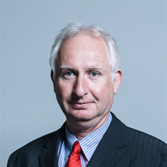 |
| Contact Details | Contact Daniel Zeichner |
| Political Party | Labour |
What Council is the CB1 3AS Postcode in?
The Local Council for this Postcode is Cambridge District Council and the County Council is Cambridgeshire County Council.
Cambridgeshire County Council is responsible for providing education, libraries and maintaining highways.
Cambridge District Council is responsible for duties such as council tax, rubbish collection, housing, environmental health and planning.
You can visit the website for Cambridge District at the following link Cambridge District.How much is the Council Tax?
Cambridge District Council is responsible for collecting council tax. This will vary depending on which council tax band the property falls within. You can check the council tax band at the gov.uk website.
Once you know the council tax band you can view how much Cambridge District charge for that band by visiting the The Council Tax section of their website.
Planning Applications
When moving house to a new post code it is worth checking out what will be built in the neighbourhood.
Few people want to live next door to a building site, have their garden overlooked or have the views from their property ruined.
Visit the local planning department and search for planning applications in this postcode granted within the last three years or still awaiting a decision. This will give an indication of what could still be built.
Where can I find out where the nearest Library to the CB1 3AS Postcode is?
Libraries are the responsibility of Cambridgeshire County Council
Visit the link for more information. Please note that some councils outsource library services to private companies and community groups ran by volunteers.
Libraries - Cambridgeshire County CouncilHouse Sales in CB1 3AS
| Year | High | Low | Average | Sales |
|---|---|---|---|---|
| 2010 | £272,000 | £299,500 | £294,000 | 5 |
| 2011 | £285,000 | £307,000 | £296,000 | 2 |
| 2013 | £160,500 | £360,000 | £306,833 | 3 |
| 2015 | £435,000 | £482,600 | £433,150 | 4 |
| 2016 | £475,000 | £475,000 | £475,000 | 1 |
| 2018 | £455,500 | £455,500 | £455,500 | 1 |
| 2019 | £475,000 | £390,000 | £425,000 | 4 |
| 2021 | £499,950 | £460,000 | £468,590 | 5 |
Contains HM Land Registry data © Crown copyright and database right 2024. This data is licensed under the Open Government Licence v3.0.
Postcodes near the CB1 3AS Postcode
What Popular Supermarkets are near the CB1 3AS Postcode?
| Supermarket | Distance | Directions |
|---|---|---|
| Sainsburys, Brooks Road, CAMBRIDGE, CB1 3HP | 0.69 miles | Directions from CB1 3AS to Sainsburys |
| Asda, Beehive Centre, Coldhams Lane, CAMBRIDGE, CB1 3ER | 0.86 miles | Directions from CB1 3AS to Asda |
| Lidl, Cambridge Retail Park, Newmarket Road, CAMBRIDGE, CB5 8WR | 1.26 miles | Directions from CB1 3AS to Lidl |
| Aldi, Newmarket Road, CAMBRIDGE, CB5 8JG | 1.53 miles | Directions from CB1 3AS to Aldi |
| Tesco, Cheddars Lane, CAMBRIDGE, CB5 8LD | 1.55 miles | Directions from CB1 3AS to Tesco |
What Popular Restaurants are near the CB1 3AS Postcode?
| Burger King | Distance | Directions |
|---|---|---|
| Unit 3-4 Restwell House, Cambridge, CB1 3EW | 0.71 miles | Directions from CB1 3AS to Unit 3-4 Restwell House |
| Food Court, Hospital Main Concourse, Cambridge, CB2 0QQ | 1.61 miles | Directions from CB1 3AS to Food Court, Hospital Main Concourse |
| Fourwentways, A11, Fourwent Ways, Abington, CB21 6AP | 5.88 miles | Directions from CB1 3AS to Fourwentways, A11, Fourwent Ways |
| Oaks Drive, Fordham Road, Newmarket, CB8 7SX | 11.51 miles | Directions from CB1 3AS to Oaks Drive, Fordham Road |
| Mcdonald's | Distance | Directions |
|---|---|---|
| McDonald's, Newmarket Road, CAMBRIDGE, CB5 8WL | 1.23 miles | Directions from CB1 3AS to McDonald's, Newmarket Road, CAMBRIDGE, CB5 8WL |
| McDonald's, Rose Crescent, CAMBRIDGE, CB2 3LL | 1.31 miles | Directions from CB1 3AS to McDonald's, Rose Crescent, CAMBRIDGE, CB2 3LL |
| McDonald's, Pampisford, CAMBRIDGE, CB22 3HD | 6.60 miles | Directions from CB1 3AS to McDonald's, Pampisford, CAMBRIDGE, CB22 3HD |
| McDonald's, Boxworth, CAMBRIDGE, CB23 4WU | 8.19 miles | Directions from CB1 3AS to McDonald's, Boxworth, CAMBRIDGE, CB23 4WU |
| Restaurant | Distance | Directions |
|---|---|---|
| KFC, East Road, CAMBRIDGE, CB1 1BG | 0.73 miles | Directions from CB1 3AS to KFC Cambridge - East Road |
| KFC, Boxworth, CAMBRIDGE, CB23 4WU | 8.19 miles | Directions from CB1 3AS to KFC Cambridge - A14 Services |
| KFC, Lordscroft Lane, HAVERHILL, CB9 0ER | 14.72 miles | Directions from CB1 3AS to KFC Haverhill - Ehringhausen Way |
| KFC, Downham Road, ELY, CB6 2SH | 15.28 miles | Directions from CB1 3AS to KFC Ely - Leisure Village |
| KFC, Tower Fields, HUNTINGDON, PE29 7EG | 17.38 miles | Directions from CB1 3AS to KFC Huntingdon - Tower Field |