CB5 8DH is a postal code used within the United Kingdom for delivering mail.
Postcodes are made up of two parts. The part before the space (CB5) is called the outward code. The part after the space (8DH) is called the inward code. The letters C, I, K, M, O and V are not allowed in the inward code. In addition to the inward and outward code, the postcode can be broken up into four parts:
- Postal Area. In our case CB which means Cambridge.
- Postal District. In our case CB5.
- Postal Sector. In our case CB5 8.
- Postcode Unit. The last two letters. In our case DH.
The regional mail center for the post area CB is the National Distribution Centre, which is located at Danes Way, NORTHAMPTON, NN6 7DD.
The final port of call for any post addressed to the CB5 8DH postcode is the local delivery office (DO) which is CAMBRIDGE DO. Here the post will be sorted ready for delivery.
The properties in the CB5 8DH postcode have the street address of Brunswick Walk.
Did you know? According to the 2021 Census, the CB5 8DH postcode is home to a bustling 27 residents!
It is situated within the post town of CAMBRIDGE within the old postal county of Cambridgeshire.
CB5 8DH is within the city of Cambridge.
The CB5 8DH postcode area is composed of 100% residential properties, 0% commercial properties, and 0% public properties.
According to our data. Most dwellings in CB5 8DH are houses. Of these houses, most are mid-terraced. The remainder are end-terraced.
Most properties in CB5 8DH are owned by the occupiers with the rest being privately rented.

Interactive Mapping Showing UPRNs within the CB5 8DH Postcode Boundaries
Use the search box to search for other postcodes or places.
| Property Type | Percentage |
|---|---|
| Residential | 100% |
| Commercial | 0% |
| Public | 0% |
Telephone Area Code for CB5 8DH
The telephone area code for CB5 8DH is 01223 Cambridge.
Map Coordinates for CB5 8DH
| Latitude | 52.2086136836 |
|---|---|
| Longitude | 0.129548395502 |

Weather Forecast for CB5 8DH
Thu 9th May
Press Button to Show Forecast for Cambridge
| Time Period | Icon | Description | Temperature | Rain Probability | Wind |
|---|---|---|---|---|---|
| 00:00 to 03:00 | Cloudy | 12.0°C (feels like 10.0°C) | 4.00% | SSE 7 mph | |
| 03:00 to 06:00 | Cloudy | 12.0°C (feels like 11.0°C) | 4.00% | S 7 mph | |
| 06:00 to 09:00 | Partly cloudy (day) | 13.0°C (feels like 12.0°C) | 2.00% | SSW 7 mph | |
| 09:00 to 12:00 | Sunny day | 17.0°C (feels like 16.0°C) | 1.00% | SW 4 mph | |
| 12:00 to 15:00 | Cloudy | 20.0°C (feels like 19.0°C) | 4.00% | SSW 4 mph | |
| 15:00 to 18:00 | Cloudy | 21.0°C (feels like 21.0°C) | 4.00% | SW 4 mph | |
| 18:00 to 21:00 | Partly cloudy (day) | 20.0°C (feels like 20.0°C) | 1.00% | ESE 4 mph | |
| 21:00 to 00:00 | Cloudy | 15.0°C (feels like 14.0°C) | 3.00% | SE 4 mph |
Fri 10th May
Press Button to Show Forecast for Cambridge
| Time Period | Icon | Description | Temperature | Rain Probability | Wind |
|---|---|---|---|---|---|
| 00:00 to 03:00 | Cloudy | 13.0°C (feels like 12.0°C) | 3.00% | SSE 4 mph | |
| 03:00 to 06:00 | Cloudy | 11.0°C (feels like 10.0°C) | 4.00% | S 4 mph | |
| 06:00 to 09:00 | Cloudy | 12.0°C (feels like 12.0°C) | 4.00% | S 4 mph | |
| 09:00 to 12:00 | Cloudy | 18.0°C (feels like 18.0°C) | 4.00% | SSE 2 mph | |
| 12:00 to 15:00 | Cloudy | 20.0°C (feels like 20.0°C) | 4.00% | SE 4 mph | |
| 15:00 to 18:00 | Cloudy | 21.0°C (feels like 20.0°C) | 4.00% | SE 7 mph | |
| 18:00 to 21:00 | Cloudy | 19.0°C (feels like 18.0°C) | 4.00% | SE 7 mph | |
| 21:00 to 00:00 | Cloudy | 14.0°C (feels like 13.0°C) | 3.00% | SE 7 mph |
Sat 11th May
Press Button to Show Forecast for Cambridge
| Time Period | Icon | Description | Temperature | Rain Probability | Wind |
|---|---|---|---|---|---|
| 00:00 to 03:00 | Clear night | 12.0°C (feels like 11.0°C) | 1.00% | SSE 4 mph | |
| 03:00 to 06:00 | Clear night | 10.0°C (feels like 9.0°C) | 0.00% | SE 4 mph | |
| 06:00 to 09:00 | Sunny day | 12.0°C (feels like 12.0°C) | 0.00% | ESE 4 mph | |
| 09:00 to 12:00 | Sunny day | 18.0°C (feels like 18.0°C) | 0.00% | ESE 4 mph | |
| 12:00 to 15:00 | Partly cloudy (day) | 21.0°C (feels like 20.0°C) | 1.00% | SE 7 mph | |
| 15:00 to 18:00 | Partly cloudy (day) | 22.0°C (feels like 20.0°C) | 1.00% | SE 9 mph | |
| 18:00 to 21:00 | Sunny day | 20.0°C (feels like 18.0°C) | 1.00% | SE 9 mph | |
| 21:00 to 00:00 | Clear night | 15.0°C (feels like 14.0°C) | 0.00% | ESE 7 mph |
Sun 12th May
Press Button to Show Forecast for Cambridge
| Time Period | Icon | Description | Temperature | Rain Probability | Wind |
|---|---|---|---|---|---|
| 00:00 to 03:00 | Clear night | 13.0°C (feels like 12.0°C) | 0.00% | ESE 7 mph | |
| 03:00 to 06:00 | Clear night | 12.0°C (feels like 11.0°C) | 0.00% | ESE 7 mph | |
| 06:00 to 09:00 | Partly cloudy (day) | 14.0°C (feels like 13.0°C) | 1.00% | ESE 7 mph | |
| 09:00 to 12:00 | Partly cloudy (day) | 19.0°C (feels like 18.0°C) | 1.00% | ESE 7 mph | |
| 12:00 to 15:00 | Cloudy | 22.0°C (feels like 20.0°C) | 6.00% | SE 11 mph | |
| 15:00 to 18:00 | Cloudy | 22.0°C (feels like 20.0°C) | 8.00% | SE 11 mph | |
| 18:00 to 21:00 | Cloudy | 20.0°C (feels like 18.0°C) | 7.00% | SE 9 mph | |
| 21:00 to 00:00 | Cloudy | 16.0°C (feels like 15.0°C) | 6.00% | SE 7 mph |
What are the Broadband Speeds like in the CB5 8DH Postcode?
Download Speeds For CB5 8DH

| Average Mbps | 146.200 |
|---|---|
| Median Mbps | 107.000 |
| Maximum Mbps | 460.000 |
CB5 8DH has an average download speed of 146.2 Megabits per second (Mbps).
422 other postcode units have the same broadband speed.
89% of postcodes (1,058,971) have slower broadband speeds.
11% of postcodes (125,248) have faster broadband speeds.
Upload Speeds For CB5 8DH

| Average Mbps | 13.600 |
|---|---|
| Median Mbps | 10.000 |
| Maximum Mbps | 36.000 |
CB5 8DH has an average upload speed of 13.6 Megabits per second (Mbps).
11,586 other postcode units have the same upload speed.
51% of postcodes (603,420) have slower upload speeds.
48% of postcodes (569,635) have faster upload speeds.
Schools within a five minute drive of CB5 8DH Postcode
England Primary Schools
St Philip's CofE Aided Primary School
Address: St Philip's CofE Aided Primary School, 2 Vinery Way, Cambridge, Cambridgeshire, CB1 3DR
Distance: 1.14 miles
Contact: 01223508707
St Matthew's Primary School
Address: St Matthew's Primary School, 19 Norfolk Street, Cambridge, Cambridgeshire, CB1 2LD
Distance: 0.41 miles
Contact: 01223568838
St Pauls CofE VA Primary School
Address: St Pauls CofE VA Primary School, Coronation Street, Cambridge, Cambridgeshire, CB2 1HJ
Distance: 0.83 miles
Contact: 01223568840
Milton Road Primary School
Address: Milton Road Primary School, Ascham Road, Cambridge, Cambridgeshire, CB4 2BD
Distance: 0.68 miles
Contact: 01223712333
St Alban's Catholic Primary School
Address: St Alban's Catholic Primary School, Lensfield Road, Cambridge, Cambridgeshire, CB2 1EN
Distance: 0.79 miles
Contact: 01223712148
Chesterton Primary School
Address: Chesterton Primary School, Green End Road, Chesterton, Cambridge, Cambridgeshire, CB4 1RW
Distance: 1.15 miles
Contact: 01223728392
Arbury Primary School
Address: Arbury Primary School, Carlton Way, Arbury Primary School, Cambridge, Cambridgeshire, CB4 2DE
Distance: 1.10 miles
Contact: 01223359568
St Luke's CofE Primary School
Address: St Luke's CofE Primary School, French's Road, Cambridge, Cambridgeshire, CB4 3JZ
Distance: 0.88 miles
Contact:
Park Street CofE Primary School
Address: Park Street CofE Primary School, Lower Park Street, Cambridge, Cambridgeshire, CB5 8AR
Distance: 0.40 miles
Contact: 01223576922
Mayfield Primary School
Address: Mayfield Primary School, Warwick Road, Cambridge, Cambridgeshire, CB4 3HN
Distance: 1.23 miles
Contact: 01223712127
England Higher Schools
Hills Road Sixth Form College
Address: Hills Road Sixth Form College, Hills Road, Cambridge, Cambridgeshire, CB2 8PE
Distance: 1.45 miles
Contact: 01223247251
England Secondary Schools
Parkside Community College
Address: Parkside Community College, Parkside, Cambridge, Cambridgeshire, CB1 1EH
Distance: 0.29 miles
Contact: 01223712600
North Cambridge Academy
Address: North Cambridge Academy, Arbury Road, Kings Hedges, Cambridge, Cambridgeshire, CB4 2JF
Distance: 1.09 miles
Contact: 01223491500
Chesterton Community College
Address: Chesterton Community College, Gilbert Road, Cambridge, Cambridgeshire, CB4 3NY
Distance: 0.74 miles
Contact: 01223712150
Nearest Dentists
Dentists near CB5 8DH
NEW SQUARE DENTAL PRACTICE
Address: 35 NEW SQUARE, CAMBRIDGE, CB1 1EZ
Distance: 0.13 miles
Contact: :
NEWMARKET ROAD (DENTAL SURGERY)
Address: 20 NEWMARKET ROAD, CAMBRIDGE, CAMBRIDGESHIRE, CB5 8DT
Distance: 0.19 miles
Contact: :
VICTORIA BRIDGE DENTAL PRACTICE
Address: 13-13A VICTORIA AVENUE, CAMBRIDGE, CAMBRIDGESHIRE, CB4 1EG
Distance: 0.40 miles
Contact: :
CHESTERTON ROAD DENTAL SURGERY
Address: 36 CHESTERTON ROAD, CAMBRIDGE, CAMBRIDGESHIRE, CB4 1EN
Distance: 0.41 miles
Contact: :
DENTAL SURGERY
Address: 165-167 NEWMARKET ROAD, CAMBRIDGE, CB5 8HA
Distance: 0.41 miles
Contact: :
NORFOLK STREET DENTAL SURGERY
Address: 24 NORFOLK STREET, CAMBRIDGE, CAMBRIDGESHIRE, CB1 2LF
Distance: 0.45 miles
Contact: :
Nearest Chemists
Pharmacies near CB5 8DH
SUPERDRUG PHARMACY
Address: 38 FITZROY STREET, CAMBRIDGE, CAMBRIDGESHIRE, CB1 1EW
Distance: 0.15 miles
Contact: tel: 01223 366376
BOOTS
Address: GRAFTON CENTRE, CAMBRIDGE, CAMBRIDGESHIRE, CB1 1PS
Distance: 0.20 miles
Contact: tel: 01223 302576
BOOTS
Address: 68 CHESTERTON ROAD, CAMBRIDGE, CAMBRIDGESHIRE, CB4 1EP
Distance: 0.42 miles
Contact: tel: 01223 355055
SUPERDRUG PHARMACY
Address: 59 SIDNEY STREET, CAMBRIDGE, CAMBRIDGESHIRE, CB2 3HX
Distance: 0.42 miles
Contact: tel: 01223 353002
BOOTS
Address: 28 PETTY CURY, CAMBRIDGE, CAMBRIDGESHIRE, CB2 3ND
Distance: 0.43 miles
Contact: :
WELL
Address: YORK STREET HEALTH CENTRE, 144 YORK STREET, CAMBRIDGE, CAMBRIDGESHIRE, CB1 2PY
Distance: 0.55 miles
Contact: tel: 01223 356644
Nearest Opticians
Opticians near CB5 8DH
SPECSAVERS (FITZROY ST, CAMBRIDGE)
Address: 13 FITZROY STREET, CAMBRIDGE, CAMBRIDGESHIRE, CB1 1ER
Distance: 0.12 miles
Contact: :
DAVID MURPHY OPTICIANS
Address: 34 NEWMARKET ROAD, CAMBRIDGE, CAMBRIDGESHIRE, CB5 8DT
Distance: 0.19 miles
Contact: :
A & I LASK
Address: 42 CHESTERTON ROAD, CAMBRIDGE, CAMBRIDGESHIRE, CB4 1EN
Distance: 0.41 miles
Contact: :
CLAMP OPTOMETRISTS
Address: 7 ST. ANDREWS STREET, CAMBRIDGE, CAMBRIDGESHIRE, CB2 3AX
Distance: 0.42 miles
Contact: :
ANGLIA RUSKIN UNIVERSITY OPTOMETRY CLINIC
Address: EAST ROAD, CAMBRIDGE, CAMBRIDGESHIRE, CB1 1PT
Distance: 0.42 miles
Contact: :
DAVID CLULOW OPTICIANS (CAMBRIDGE)
Address: UNIT C, 59 SIDNEY STREET, CAMBRIDGE, CAMBRIDGESHIRE, CB2 3HX
Distance: 0.42 miles
Contact: :
Nearest GP Surgeries
Doctors near CB5 8DH
CAMBRIDGE ACCESS SURGERY
Address: 125 NEWMARKET ROAD, CAMBRIDGE, CAMBRIDGESHIRE, CB5 8HB
Distance: 0.39 miles
Contact: tel: 01223 358961
ANGLIA POLYTECHNIC UNIVERSITY
Address: THE MEDICAL CENTRE, RUSKIN LOUNGE, EAST ROAD, CAMBRIDGE, CAMBRIDGESHIRE, CB1 1PT
Distance: 0.42 miles
Contact: tel: 01223 363271
NEWNHAM WALK SURGERY AT BOOTS CAMBRIDGE
Address: 28 PETTY CURY, CAMBRIDGE, CAMBRIDGESHIRE, CB2 3ND
Distance: 0.43 miles
Contact: :
RED HOUSE SURGERY
Address: 96 CHESTERTON ROAD, CAMBRIDGE, CAMBRIDGESHIRE, CB4 1ER
Distance: 0.44 miles
Contact: tel: 01223 365555
BRIDGE STREET MEDICAL CENTRE
Address: 2 ALL SAINTS PASSAGE, OFF BRIDGE ST, CAMBRIDGE, CAMBRIDGESHIRE, CB2 3LS
Distance: 0.45 miles
Contact: tel: 01223 652671
PETERSFIELD MEDICAL PRACTICE
Address: 25 MILL ROAD, CAMBRIDGE, CAMBRIDGESHIRE, CB1 2AB
Distance: 0.52 miles
Contact: tel: 01223 350647
Transport Links near CB5 8DH
Train Stations
Nearest stations for postcode: CB5 8DH
- Cambridge
Cambridge station, Station Road, Cambridge, Cambridgeshire, CB1 2JWDistance: 1.89 milesDriving Time: 4.71 minutes - Cambridge North
Cambridge North Station, Cowley Road, Cambridge, Cambridgeshire, CB4 0WZDistance: 3.14 milesDriving Time: 7.71 minutes - Shelford (Cambs)
Shelford station, Station Road, Shelford, Cambridgeshire, CB22 5LRDistance: 5.49 milesDriving Time: 11.06 minutes - Waterbeach
Waterbeach station, Station Road, Waterbeach, Cambridgeshire, CB25 9HTDistance: 5.71 milesDriving Time: 10.69 minutes - Foxton
Foxton station, Royston Road, Foxton, Cambridgeshire, CB22 6SEDistance: 8.04 milesDriving Time: 14.80 minutes
Distances represent the quickest route by car.
Motorway Junctions near CB5 8DH
Train Stations
Motorway Junctions near CB5 8DH
Distances represent the quickest route by car.
Who are my Elected Representatives in the CB5 8DH Postcode?
| Westminster Constituency | Cambridge Boro Const |
|---|---|
| Member or Parliament | 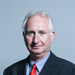 |
| Contact Details | Contact Daniel Zeichner |
| Political Party | Labour |
What Council is the CB5 8DH Postcode in?
The Local Council for this Postcode is Cambridge District Council and the County Council is Cambridgeshire County Council.
Cambridgeshire County Council is responsible for providing education, libraries and maintaining highways.
Cambridge District Council is responsible for duties such as council tax, rubbish collection, housing, environmental health and planning.
You can visit the website for Cambridge District at the following link Cambridge District.How much is the Council Tax?
Cambridge District Council is responsible for collecting council tax. This will vary depending on which council tax band the property falls within. You can check the council tax band at the gov.uk website.
Once you know the council tax band you can view how much Cambridge District charge for that band by visiting the The Council Tax section of their website.
Planning Applications
When moving house to a new post code it is worth checking out what will be built in the neighbourhood.
Few people want to live next door to a building site, have their garden overlooked or have the views from their property ruined.
Visit the local planning department and search for planning applications in this postcode granted within the last three years or still awaiting a decision. This will give an indication of what could still be built.
Where can I find out where the nearest Library to the CB5 8DH Postcode is?
Libraries are the responsibility of Cambridgeshire County Council
Visit the link for more information. Please note that some councils outsource library services to private companies and community groups ran by volunteers.
Libraries - Cambridgeshire County CouncilHouse Sales in CB5 8DH
| Year | High | Low | Average | Sales |
|---|---|---|---|---|
| 2010 | £499,758 | £499,758 | £499,758 | 1 |
| 2011 | £1,200,000 | £392,500 | £796,250 | 2 |
| 2012 | £540,000 | £540,000 | £540,000 | 1 |
| 2013 | £855,000 | £660,000 | £757,500 | 2 |
| 2014 | £1,600,000 | £1,600,000 | £1,600,000 | 1 |
| 2019 | £695,000 | £675,000 | £685,000 | 2 |
| 2020 | £1,100,000 | £835,000 | £967,500 | 2 |
Contains HM Land Registry data © Crown copyright and database right 2024. This data is licensed under the Open Government Licence v3.0.
Postcodes near the CB5 8DH Postcode
What Popular Supermarkets are near the CB5 8DH Postcode?
| Supermarket | Distance | Directions |
|---|---|---|
| Sainsburys, Sidney Street, CAMBRIDGE, CB2 3HX | 0.68 miles | Directions from CB5 8DH to Sainsburys |
| Asda, Beehive Centre, Coldhams Lane, CAMBRIDGE, CB1 3ER | 1.12 miles | Directions from CB5 8DH to Asda |
| Tesco, Cheddars Lane, CAMBRIDGE, CB5 8LD | 1.16 miles | Directions from CB5 8DH to Tesco |
| Lidl, Cambridge Retail Park, Newmarket Road, CAMBRIDGE, CB5 8WR | 1.17 miles | Directions from CB5 8DH to Lidl |
| Aldi, Newmarket Road, CAMBRIDGE, CB5 8JG | 1.31 miles | Directions from CB5 8DH to Aldi |
What Popular Restaurants are near the CB5 8DH Postcode?
| Burger King | Distance | Directions |
|---|---|---|
| Unit 3-4 Restwell House, Cambridge, CB1 3EW | 0.82 miles | Directions from CB5 8DH to Unit 3-4 Restwell House |
| Food Court, Hospital Main Concourse, Cambridge, CB2 0QQ | 2.34 miles | Directions from CB5 8DH to Food Court, Hospital Main Concourse |
| Fourwentways, A11, Fourwent Ways, Abington, CB21 6AP | 6.88 miles | Directions from CB5 8DH to Fourwentways, A11, Fourwent Ways |
| Oaks Drive, Fordham Road, Newmarket, CB8 7SX | 11.94 miles | Directions from CB5 8DH to Oaks Drive, Fordham Road |
| Mcdonald's | Distance | Directions |
|---|---|---|
| McDonald's, Rose Crescent, CAMBRIDGE, CB2 3LL | 0.49 miles | Directions from CB5 8DH to McDonald's, Rose Crescent, CAMBRIDGE, CB2 3LL |
| McDonald's, Newmarket Road, CAMBRIDGE, CB5 8WL | 1.46 miles | Directions from CB5 8DH to McDonald's, Newmarket Road, CAMBRIDGE, CB5 8WL |
| McDonald's, Boxworth, CAMBRIDGE, CB23 4WU | 7.18 miles | Directions from CB5 8DH to McDonald's, Boxworth, CAMBRIDGE, CB23 4WU |
| McDonald's, Pampisford, CAMBRIDGE, CB22 3HD | 7.47 miles | Directions from CB5 8DH to McDonald's, Pampisford, CAMBRIDGE, CB22 3HD |
| Restaurant | Distance | Directions |
|---|---|---|
| KFC, East Road, CAMBRIDGE, CB1 1BG | 0.31 miles | Directions from CB5 8DH to KFC Cambridge - East Road |
| KFC, Boxworth, CAMBRIDGE, CB23 4WU | 7.18 miles | Directions from CB5 8DH to KFC Cambridge - A14 Services |
| KFC, Downham Road, ELY, CB6 2SH | 14.83 miles | Directions from CB5 8DH to KFC Ely - Leisure Village |
| KFC, Lordscroft Lane, HAVERHILL, CB9 0ER | 15.72 miles | Directions from CB5 8DH to KFC Haverhill - Ehringhausen Way |
| KFC, Tower Fields, HUNTINGDON, PE29 7EG | 16.37 miles | Directions from CB5 8DH to KFC Huntingdon - Tower Field |