CR0 7AG is a postal code used within the United Kingdom for delivering mail.
Postcodes are made up of two parts. The part before the space (CR0) is called the outward code. The part after the space (7AG) is called the inward code. The letters C, I, K, M, O and V are not allowed in the inward code. In addition to the inward and outward code, the postcode can be broken up into four parts:
- Postal Area. In our case CR which means Croydon.
- Postal District. In our case CR0.
- Postal Sector. In our case CR0 2.
- Postcode Unit. The last two letters. In our case AG.
The regional mail center for the post area CR is the Princess Royal Distribution Centre, which is located at Blackmore Drive, North Circular, LONDON , NW10 7RH.
The final port of call for any post addressed to the CR0 7AG postcode is the local delivery office (DO) which is . Here the post will be sorted ready for delivery.
The properties in the CR0 7AG postcode have the street address of Lower Addiscombe Road
Did you know? According to the 2021 Census, the CR0 7AG postcode is home to a bustling 68 residents!
It is situated within the post town of CROYDON within the old postal county of Surrey.
CR0 7AG is within Woodside.
Looking at our data the CR0 7AG is mostly residential but does contain some commercial properties.
The CR0 7AG postcode area is composed of 92.59% residential properties, 7.41% commercial properties, and 0% public properties.
According to our data. Most dwellings in CR0 7AG are houses. The remainder of residential properties consist of flats. Of these houses, most are mid-terraced. The remainder are semi-detached and end-terraced. Of these flats, most are semi-detached. The remainder are end-terraced and mid-terraced. Of these maisonettes, most are semi-detached.
Most properties in CR0 7AG are owned by the occupiers with the rest being privately rented.
None Domestic Buildings in CR0 7AG fall under these categories: Clinic.
Clinic include 416, Lower Addiscombe Road.

Interactive Mapping Showing UPRNs within the CR0 7AG Postcode Boundaries
Use the search box to search for other postcodes or places.
Map of the CR0 7AG Postcode

| Property Type | Percentage |
|---|---|
| Residential | 92.59% |
| Commercial | 7.41% |
| Public | 0% |
Telephone Area Code for CR0 7AG
The telephone area code for CR0 7AG is 020 London.
Map Coordinates for CR0 7AG
| Latitude | 51.3841915611 |
|---|---|
| Longitude | -0.0641762542063 |
Ordnance Survey Maps for CR0 7AG
| Map Series | Amazon | Ordnance Survey |
| Explorer 1:25,000 161 London South, Westminster, Greenwich, Croydon, Esher & Twickenham | Check Price on Amazon | Buy Direct from the Ordnance Survey |
| Landranger 1:50,000 176 West London | Check Price on Amazon | Buy Direct from the Ordnance Survey |
| Landranger 1:50,000 177 East London | Check Price on Amazon | Buy Direct from the Ordnance Survey |

Weather Forecast for CR0 7AG
Tue 30th Apr
Press Button to Show Forecast for Robert Fitzroy Academy
| Time Period | Icon | Description | Temperature | Rain Probability | Wind |
|---|---|---|---|---|---|
| 12:00 to 15:00 | Cloudy | 17.0°C (feels like 14.0°C) | 8.00% | SSE 11 mph | |
| 15:00 to 18:00 | Cloudy | 16.0°C (feels like 14.0°C) | 10.00% | SSE 11 mph | |
| 18:00 to 21:00 | Cloudy | 15.0°C (feels like 13.0°C) | 10.00% | SSE 7 mph | |
| 21:00 to 00:00 | Partly cloudy (night) | 12.0°C (feels like 11.0°C) | 8.00% | SSE 7 mph |
Wed 1st May
Press Button to Show Forecast for Robert Fitzroy Academy
| Time Period | Icon | Description | Temperature | Rain Probability | Wind |
|---|---|---|---|---|---|
| 00:00 to 03:00 | Cloudy | 11.0°C (feels like 10.0°C) | 8.00% | SE 4 mph | |
| 03:00 to 06:00 | Cloudy | 11.0°C (feels like 10.0°C) | 9.00% | SSE 4 mph | |
| 06:00 to 09:00 | Cloudy | 11.0°C (feels like 10.0°C) | 10.00% | S 2 mph | |
| 09:00 to 12:00 | Cloudy | 13.0°C (feels like 13.0°C) | 11.00% | NE 4 mph | |
| 12:00 to 15:00 | Overcast | 16.0°C (feels like 15.0°C) | 27.00% | ENE 4 mph | |
| 15:00 to 18:00 | Cloudy | 17.0°C (feels like 16.0°C) | 15.00% | NE 7 mph | |
| 18:00 to 21:00 | Cloudy | 16.0°C (feels like 15.0°C) | 12.00% | NE 7 mph | |
| 21:00 to 00:00 | Cloudy | 13.0°C (feels like 12.0°C) | 13.00% | NNW 7 mph |
Thu 2nd May
Press Button to Show Forecast for Robert Fitzroy Academy
| Time Period | Icon | Description | Temperature | Rain Probability | Wind |
|---|---|---|---|---|---|
| 00:00 to 03:00 | Light rain shower (night) | 11.0°C (feels like 10.0°C) | 46.00% | N 7 mph | |
| 03:00 to 06:00 | Cloudy | 11.0°C (feels like 10.0°C) | 12.00% | NNW 7 mph | |
| 06:00 to 09:00 | Cloudy | 11.0°C (feels like 10.0°C) | 12.00% | NW 7 mph | |
| 09:00 to 12:00 | Overcast | 13.0°C (feels like 12.0°C) | 15.00% | NW 7 mph | |
| 12:00 to 15:00 | Cloudy | 17.0°C (feels like 16.0°C) | 7.00% | NW 7 mph | |
| 15:00 to 18:00 | Partly cloudy (day) | 19.0°C (feels like 17.0°C) | 6.00% | NNW 9 mph | |
| 18:00 to 21:00 | Cloudy | 17.0°C (feels like 16.0°C) | 8.00% | NNW 9 mph | |
| 21:00 to 00:00 | Partly cloudy (night) | 14.0°C (feels like 13.0°C) | 5.00% | NW 9 mph |
What are the Broadband Speeds like in the CR0 7AG Postcode?
Download Speeds For CR0 7AG

| Average Mbps | 118.600 |
|---|---|
| Median Mbps | 72.200 |
| Maximum Mbps | 593.000 |
CR0 7AG has an average download speed of 118.6 Megabits per second (Mbps).
645 other postcode units have the same broadband speed.
78% of postcodes (926,504) have slower broadband speeds.
22% of postcodes (257,492) have faster broadband speeds.
Upload Speeds For CR0 7AG
| Average Mbps | 15.300 |
|---|---|
| Median Mbps | 18.500 |
| Maximum Mbps | 39.000 |
CR0 7AG has an average upload speed of 15.3 Megabits per second (Mbps).
11,213 other postcode units have the same upload speed.
68% of postcodes (804,433) have slower upload speeds.
31% of postcodes (368,995) have faster upload speeds.
Schools within a five minute drive of CR0 7AG Postcode
England Higher Schools
Croydon College
Address: Croydon College, Fairfield Campus, College Road, Croydon, Surrey, CR9 1DX
Distance: 1.53 miles
Contact: 02086865700
England Primary Schools
Balgowan Primary School
Address: Balgowan Primary School, Balgowan Road, Beckenham, Kent, BR3 4HJ
Distance: 1.74 miles
Contact: 02086586374
Harris Primary Academy Benson
Address: Harris Primary Academy Benson, West Way, Shirley, Croydon, Surrey, CR0 8RQ
Distance: 1.20 miles
Contact: 02087771572
Stewart Fleming Primary School
Address: Stewart Fleming Primary School, Witham Road, Anerley, London, SE20 7YB
Distance: 1.32 miles
Contact: 02087781043
Oasis Academy Ryelands
Address: Oasis Academy Ryelands, Oakley Road, South Norwood, London, SE25 4XG
Distance: 0.66 miles
Contact: 02086564165
St Mark's Church of England Primary Academy
Address: St Mark's Church of England Primary Academy, Albert Road, South Norwood, London, SE25 4JD
Distance: 1.08 miles
Contact: 02086543570
St Thomas Becket Catholic Primary School
Address: St Thomas Becket Catholic Primary School, Becket Close, Birchanger Road, South Norwood, London, SE25 5BN
Distance: 0.44 miles
Contact: 02086543006
Robert Fitzroy Academy
Address: Robert Fitzroy Academy, 80 Brampton Road, Croydon, CR0 6JN
Distance: 0.79 miles
Contact: 02086629700
Davidson Primary School
Address: Davidson Primary School, Dartnell Road, Croydon, Surrey, CR0 6JA
Distance: 0.70 miles
Contact:
Whitehorse Manor Junior School
Address: Whitehorse Manor Junior School, Whitehorse Road, Thornton Heath, Surrey, CR7 8SB
Distance: 1.51 miles
Contact: 02086843929
Whitehorse Manor Infant School
Address: Whitehorse Manor Infant School, Whitehorse Road, Thornton Heath, Surrey, CR7 8SB
Distance: 1.51 miles
Contact: 02086897679
Ark Oval Primary Academy
Address: Ark Oval Primary Academy, 98 Cherry Orchard Road, Croydon, Surrey, CR0 6BA
Distance: 1.18 miles
Contact: 02086883000
St Mary's Catholic Infant School
Address: St Mary's Catholic Infant School, Bedford Park, Croydon, Surrey, CR0 2AQ
Distance: 1.53 miles
Contact:
Broadmead Primary School
Address: Broadmead Primary School, 366 Sydenham Road, Croydon, Surrey, CR0 2EA
Distance: 1.19 miles
Contact: 02086844003
Chestnut Park Primary School
Address: Chestnut Park Primary School, 49 St James Road, Croydon, Surrey, CR0 2UR
Distance: 1.76 miles
Contact: 02037506090
Orchard Way Primary School
Address: Orchard Way Primary School, Orchard Way, Shirley, Croydon, Surrey, CR0 7NJ
Distance: 1.03 miles
Contact:
Churchfields Primary School
Address: Churchfields Primary School, Churchfields Road, Beckenham, Kent, BR3 4QY
Distance: 1.66 miles
Contact:
Marian Vian Primary School
Address: Marian Vian Primary School, Shirley Crescent, Elmers End, Beckenham, Kent, BR3 4AZ
Distance: 1.09 miles
Contact: 02086586524
St John's CofE Primary School
Address: St John's CofE Primary School, Spring Park Road, Shirley, Croydon, Surrey, CR0 5EL
Distance: 1.01 miles
Contact: 02086542260
St Anthony's Catholic Primary School
Address: St Anthony's Catholic Primary School, Genoa Road, Anerley, London, SE20 8ES
Distance: 1.80 miles
Contact: 02087787681
St Anthony's Roman Catholic Primary School
Address: St Anthony's Roman Catholic Primary School, Genoa Road, Anerley, London, SE20 8ES
Distance: 1.80 miles
Contact:
Monks Orchard School
Address: Monks Orchard School, The Glade, Shirley, Croydon, Surrey, CR0 7UF
Distance: 0.80 miles
Contact:
The South Norwood Academy
Address: The South Norwood Academy, 34 Crowther Road, South Norwood, London, SE25 5QP
Distance: 0.86 miles
Contact:
St Thomas Becket Catholic Primary School
Address: St Thomas Becket Catholic Primary School, Becket Close, Birchanger Road, London, SE25 5BN
Distance: 0.44 miles
Contact:
Cypress Primary School
Address: Cypress Primary School, Cypress Road, London, SE25 4AU
Distance: 1.77 miles
Contact: 02086532618
Cypress Primary School
Address: Cypress Primary School, Cypress Road, London, SE25 4AU
Distance: 1.77 miles
Contact:
Woodside Primary School
Address: Woodside Primary School, Morland Road, Croydon, Surrey, CR0 6NF
Distance: 0.45 miles
Contact: 02086545333
Woodside Primary School and Children's Centre
Address: Woodside Primary School and Children's Centre, Morland Road, Croydon, Surrey, CR0 6NF
Distance: 0.45 miles
Contact:
John Wood School & Nursery
Address: John Wood School & Nursery, Dartnell Road, Croydon, Surrey, CR0 6JA
Distance: 0.70 miles
Contact: 02086541460
Heavers Farm Primary School
Address: Heavers Farm Primary School, 58 Dinsdale Gardens, South Norwood, London, SE25 6LT
Distance: 1.07 miles
Contact: 02086535434
St Chad's Catholic Primary School
Address: St Chad's Catholic Primary School, Alverston Gardens, South Norwood, London, SE25 6LR
Distance: 1.09 miles
Contact: 02087713470
Whitehorse Manor Infant School
Address: Whitehorse Manor Infant School, Whitehorse Road, Thornton Heath, Surrey, CR7 8SB
Distance: 1.51 miles
Contact:
St Mary's Catholic Infant School
Address: St Mary's Catholic Infant School, Bedford Park, Croydon, Surrey, CR0 2AQ
Distance: 1.53 miles
Contact: 02086882891
Park Hill Junior School
Address: Park Hill Junior School, Stanhope Road, Croydon, Surrey, CR0 5NS
Distance: 1.52 miles
Contact: 02086868623
Park Hill Infant School
Address: Park Hill Infant School, Stanhope Road, Croydon, Surrey, CR0 5NS
Distance: 1.52 miles
Contact: 02086800747
Park Hill Junior School
Address: Park Hill Junior School, Stanhope Road, Croydon, Surrey, CR0 5NS
Distance: 1.52 miles
Contact:
St. Mary's Catholic Junior School
Address: St. Mary's Catholic Junior School, Sydenham Road, Croydon, Surrey, CR0 2EW
Distance: 1.36 miles
Contact: 02086884893
England Secondary Schools
Edenham High School
Address: Edenham High School, Orchard Way, Shirley, Croydon, Surrey, CR0 7NJ
Distance: 1.03 miles
Contact:
Coloma Convent Girls' School
Address: Coloma Convent Girls' School, Upper Shirley Road, Croydon, Surrey, CR9 5AS
Distance: 1.14 miles
Contact:
Shirley High School Performing Arts College
Address: Shirley High School Performing Arts College, Shirley Church Road, Croydon, Surrey, CR0 5EF
Distance: 1.07 miles
Contact: 02086569755
Oasis Academy Arena
Address: Oasis Academy Arena, Albert Road, South Norwood, London, SE25 4QL
Distance: 0.61 miles
Contact: 02082406700
Oasis Academy Shirley Park
Address: Oasis Academy Shirley Park, Shirley Road, Croydon, Surrey, CR9 7AL
Distance: 0.10 miles
Contact: 02086560222
Harris Academy South Norwood
Address: Harris Academy South Norwood, Cumberlow Avenue, London, SE25 6AE
Distance: 1.19 miles
Contact: 02084055070
Archbishop Tenison's CofE High School
Address: Archbishop Tenison's CofE High School, Selborne Road, Croydon, Surrey, CR0 5JQ
Distance: 1.34 miles
Contact: 02086884014
St Mary's Catholic High School
Address: St Mary's Catholic High School, Woburn Road, Croydon, Surrey, CR9 2EE
Distance: 1.48 miles
Contact: 02086863837
Orchard Park High School
Address: Orchard Park High School, Orchard Way, Shirley, Croydon, Surrey, CR0 7NJ
Distance: 1.03 miles
Contact: 02087760220
Eden Park High School
Address: Eden Park High School, Balmoral Avenue, Beckenham, Kent, BR3 3RD
Distance: 1.38 miles
Contact: 02039483864
Ark Blake Academy
Address: Ark Blake Academy, 6 Morland Road, Croydon, CR0 6NA
Distance: 0.86 miles
Contact: 02034439000
Nearest Dentists
Dentists near CR0 7AG
ROSEWOOD DENTAL CARE
Address: 355 LOWER ADDISCOMBE ROAD, CROYDON, SURREY, CR0 6RG
Distance: 0.20 miles
Contact: :
CROYDON DENTAL PRACTICE
Address: 202 LOWER ADDISCOMBE ROAD, CROYDON, SURREY, CR0 7AB
Distance: 0.37 miles
Contact: :
THE FAMILY DENTAL PRACTICE
Address: 262 PORTLAND ROAD, LONDON, GREATER LONDON, SE25 4SL
Distance: 0.45 miles
Contact: :
SHIRLEY CLINIC
Address: 135 SHIRLEY ROAD, CROYDON, GREATER LONDON, CR0 7LR
Distance: 0.48 miles
Contact: :
DENTAL SURGERY
Address: 6 BYWOOD AVENUE, CROYDON, SURREY, CR0 7RA
Distance: 0.58 miles
Contact: :
DENTAL SURGERY
Address: 357 ADDISCOMBE ROAD, CROYDON, SURREY, CR0 7LG
Distance: 0.58 miles
Contact: :
Nearest Chemists
Pharmacies near CR0 7AG
ADDISCOMBE PHARMACY
Address: 331 LOWER ADDISCOMBE ROAD, CROYDON, SURREY, CR0 7AE
Distance: 0.24 miles
Contact: tel: 020 86541542
BOOTS
Address: 257 LOWER ADDISCOMBE ROAD, CROYDON, SURREY, CR0 6RD
Distance: 0.42 miles
Contact: :
MEDIBANK PHARMACY
Address: 263 MORLAND ROAD, CROYDON, SURREY, CR0 6HE
Distance: 0.50 miles
Contact: tel: 020 79989040
LARCHWOOD PHARMACY
Address: 215 LOWER ADDISCOMBE ROAD, CROYDON, SURREY, CR0 6RB
Distance: 0.52 miles
Contact: tel: 020 86541149
SHIRLEY PHARMACY
Address: 175 SHIRLEY ROAD, CROYDON, SURREY, CR0 8SS
Distance: 0.56 miles
Contact: tel: 020 86541065
GREENCHEM PHARMACY
Address: UNICHEM CHEMISTS, 20 BYWOOD AVENUE, CROYDON, SURREY, CR0 7RA
Distance: 0.58 miles
Contact: tel: 020 86548576
Nearest Opticians
Opticians near CR0 7AG
DAY LEWIS OPTICIANS (CROYDON)
Address: 305 LOWER ADDISCOMBE ROAD, CROYDON, SURREY, CR0 6RF
Distance: 0.28 miles
Contact: :
CROYDON VISION CARE LTD
Address: 44A LOWER ADDISCOMBE ROAD, CROYDON, SURREY, CR0 6AA
Distance: 1.05 miles
Contact: :
CLEMENTS THE OPTICIANS
Address: 1 PORTLAND ROAD, LONDON, GREATER LONDON, SE25 4UG
Distance: 1.08 miles
Contact: :
TESCO OPTICIANS (BECKENHAM)
Address: CROYDON ROAD, BECKENHAM, KENT, BR3 4AA
Distance: 1.11 miles
Contact: :
ELMERS END
Address: CROYDON ROAD, BECKENHAM, KENT, BR3 4AA
Distance: 1.11 miles
Contact: :
DERMOTT OPTICAL OPTICIANS
Address: 147 CROYDON ROAD, BECKENHAM, KENT, BR3 3RB
Distance: 1.40 miles
Contact: :
Nearest GP Surgeries
Doctors near CR0 7AG
ASHBURTON PARK MEDICAL CENTRE
Address: ASHBURTON PARK M.PRACTICE, 416 LOWER ADDISCOMBE ROAD, ADDISCOMBE, CROYDON, SURREY, CR0 7AG
Distance: 0.00 miles
Contact: tel: 020 37146868
ADDISCOMBE ROAD SURGERY
Address: 395A ADDISCOMBE ROAD, CROYDON, SURREY, CR0 7LJ
Distance: 0.55 miles
Contact: tel: 020 86542200
PORTLAND MEDICAL CENTRE
Address: 184 PORTLAND ROAD, SOUTH NORWOOD, LONDON, GREATER LONDON, SE25 4QB
Distance: 0.58 miles
Contact: tel: 020 86621233
STOVELL HOUSE SURGERY - COVID LOCAL VACCINATION SERVICE
Address: 188 LOWER ADDISCOMBE ROAD, CROYDON, CR0 6AH
Distance: 0.61 miles
Contact: :
STOVELL HOUSE SURGERY
Address: 188 LOWER ADDISCOMBE ROAD, ADDISCOMBE, CROYDON, SURREY, CR0 6AH
Distance: 0.61 miles
Contact: tel: 020 86541427
WOODSIDE HEALTH CENTRE - COVID LOCAL VACCINATION SERVICE
Address: 3 ENMORE ROAD, LONDON, SE25 5NT
Distance: 0.63 miles
Contact: :
Transport Links near CR0 7AG
Train Stations
Nearest stations for postcode: CR0 7AG
- Norwood Junction
Norwood Junction station, Station Road, South Norwood, Greater London, SE25 5AGDistance: 1.49 milesDriving Time: 3.31 minutes - Elmers End
Elmers End station, Elmers End Road, Elmers End, Greater London, BR3 4EJDistance: 1.53 milesDriving Time: 3.08 minutes - East Croydon
East Croydon station, Station Approach, Croydon, London, CR0 1LFDistance: 1.61 milesDriving Time: 4.71 minutes - Birkbeck
Birkbeck station, Elmers End Road, Birkbeck, London, BR3 4TADistance: 1.86 milesDriving Time: 3.54 minutes - Selhurst
Selhurst station, Selhurst Road, Selhurst, London, SE25 6LHDistance: 1.92 milesDriving Time: 3.92 minutes
Distances represent the quickest route by car.
Motorway Junctions near CR0 7AG
Train Stations
Motorway Junctions near CR0 7AG
Distances represent the quickest route by car.
Who are my Elected Representatives in the CR0 7AG Postcode?
| Westminster Constituency | Croydon Central Boro Const |
|---|---|
| Member or Parliament | 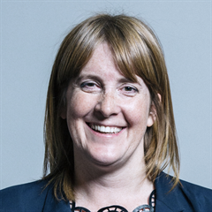 |
| Contact Details | Contact Sarah Jones |
| Political Party | Labour |
What Council is the CR0 7AG Postcode in?
The Local Council for this Postcode is Croydon London Boro Council and the County Council is Greater London Authority Council.
Greater London Authority Council is responsible for providing education, libraries and maintaining highways.
Croydon London Boro Council is responsible for duties such as council tax, rubbish collection, housing, environmental health and planning.
You can visit the website for Croydon London Boro at the following link Croydon London Boro.How much is the Council Tax?
Croydon London Boro Council is responsible for collecting council tax. This will vary depending on which council tax band the property falls within. You can check the council tax band at the gov.uk website.
Once you know the council tax band you can view how much Croydon London Boro charge for that band by visiting the The Council Tax section of their website.
Planning Applications
When moving house to a new post code it is worth checking out what will be built in the neighbourhood.
Few people want to live next door to a building site, have their garden overlooked or have the views from their property ruined.
Visit the local planning department and search for planning applications in this postcode granted within the last three years or still awaiting a decision. This will give an indication of what could still be built.
Where can I find out where the nearest Library to the CR0 7AG Postcode is?
Libraries are the responsibility of Croydon council
Visit the link for more information. Please note that some councils outsource library services to private companies and community groups ran by volunteers.
Libraries | Croydon CouncilHouse Sales in CR0 7AG
| Year | High | Low | Average | Sales |
|---|---|---|---|---|
| 2010 | £300,000 | £300,000 | £300,000 | 1 |
| 2011 | £343,500 | £343,500 | £343,500 | 1 |
| 2013 | £345,000 | £345,000 | £345,000 | 1 |
| 2015 | £355,000 | £355,000 | £355,000 | 1 |
| 2018 | £465,000 | £465,000 | £465,000 | 1 |
| 2020 | £475,000 | £530,000 | £502,500 | 2 |
| 2022 | £496,000 | £496,000 | £496,000 | 1 |
Contains HM Land Registry data © Crown copyright and database right 2024. This data is licensed under the Open Government Licence v3.0.
Postcodes near the CR0 7AG Postcode
What Popular Supermarkets are near the CR0 7AG Postcode?
| Supermarket | Distance | Directions |
|---|---|---|
| Aldi, Station Road, Croydon, LONDON, SE25 5AJ | 1.74 miles | Directions from CR0 7AG to Aldi |
| Tesco, Croydon Road, BECKENHAM, BR3 4AA | 1.78 miles | Directions from CR0 7AG to Tesco |
| Sainsburys, Whitehorse Lane, Croydon, LONDON, SE25 6XB | 2.26 miles | Directions from CR0 7AG to Sainsburys |
| Lidl, Whitehorse Road, CROYDON, CR0 2LG | 2.30 miles | Directions from CR0 7AG to Lidl |
| Waitrose, George Street, CROYDON, CR0 1LG | 2.46 miles | Directions from CR0 7AG to Waitrose |
What Popular Restaurants are near the CR0 7AG Postcode?
| Burger King | Distance | Directions |
|---|---|---|
| East Croydon Rail Station, Croydon, CR0 1LF | 1.40 miles | Directions from CR0 7AG to East Croydon Rail Station |
| 41 Church Street, Croydon, CR0 1RH | 1.82 miles | Directions from CR0 7AG to 41 Church Street |
| Unit 1 Valley Park Leisure Complex, Croydon, CR0 4XP | 2.61 miles | Directions from CR0 7AG to Unit 1 Valley Park Leisure Complex |
| 115-117 High Street, Bromley, BR1 1JQ | 3.68 miles | Directions from CR0 7AG to 115-117 High Street |
| Mcdonald's | Distance | Directions |
|---|---|---|
| McDonald's, Swan Close, CROYDON, CR0 2DZ | 1.06 miles | Directions from CR0 7AG to McDonald's, Swan Close, CROYDON, CR0 2DZ |
| McDonald's, Wickham Road, CROYDON, CR0 8DN | 1.44 miles | Directions from CR0 7AG to McDonald's, Wickham Road, CROYDON, CR0 8DN |
| McDonald's, George Street, CROYDON, CR0 1LG | 1.53 miles | Directions from CR0 7AG to McDonald's, George Street, CROYDON, CR0 1LG |
| McDonald's, North End, CROYDON, CR0 1UJ | 1.69 miles | Directions from CR0 7AG to McDonald's, North End, CROYDON, CR0 1UJ |
| Restaurant | Distance | Directions |
|---|---|---|
| KFC, Lower Addiscombe Road, CROYDON, CR0 6RD | 0.42 miles | Directions from CR0 7AG to KFC Croydon - Lower Addiscombe Road |
| KFC, Crown Hill, Church Street, CROYDON, CR0 1RY | 1.75 miles | Directions from CR0 7AG to KFC Croydon - Church Street |
| KFC, London Road, CROYDON, CR0 2RE | 1.75 miles | Directions from CR0 7AG to KFC Croydon - London Road |
| KFC, High Street, WEST WICKHAM, BR4 0LZ | 1.91 miles | Directions from CR0 7AG to KFC West Wickham - Wickham Road |
| KFC, High Street, Bromley, LONDON, SE20 7EX | 2.16 miles | Directions from CR0 7AG to KFC Penge - High Street |