CR0 5RD is a postal code used within the United Kingdom for delivering mail.
Postcodes are made up of two parts. The part before the space (CR0) is called the outward code. The part after the space (5RD) is called the inward code. The letters C, I, K, M, O and V are not allowed in the inward code. In addition to the inward and outward code, the postcode can be broken up into four parts:
- Postal Area. In our case CR which means Croydon.
- Postal District. In our case CR0.
- Postal Sector. In our case CR2 7.
- Postcode Unit. The last two letters. In our case RD.
The regional mail center for the post area CR is the Princess Royal Distribution Centre, which is located at Blackmore Drive, North Circular, LONDON , NW10 7RH.
The final port of call for any post addressed to the CR0 5RD postcode is the local delivery office (DO) which is . Here the post will be sorted ready for delivery.
The properties in the CR0 5RD postcode have the street address of Coombe Road
Did you know? According to the 2021 Census, the CR0 5RD postcode is home to a bustling 27 residents!
It is situated within the post town of CROYDON within the old postal county of Surrey.
CR0 5RD is within Croydon.
Our data shows that CR0 5RD is a residential postcode.
The CR0 5RD postcode area is composed of 83.33% residential properties, 6.67% commercial properties, and 10% public properties.
According to our data. Most dwellings in CR0 5RD are flats. The remainder of residential properties consist of houses. Of these flats, most are detached. The remainder are semi-detached and mid-terraced. Of these houses, most are detached. Of these bungalows, most are detached.
Most properties in CR0 5RD are owned by the occupiers with the rest being unknown.

Interactive Mapping Showing UPRNs within the CR0 5RD Postcode Boundaries
Use the search box to search for other postcodes or places.
Map of the CR0 5RD Postcode

| Property Type | Percentage |
|---|---|
| Residential | 83.33% |
| Commercial | 6.67% |
| Public | 10% |
Telephone Area Code for CR0 5RD
The telephone area code for CR0 5RD is 020 London.
Map Coordinates for CR0 5RD
| Latitude | 51.3637636405 |
|---|---|
| Longitude | -0.071487740622 |

What are the Broadband Speeds like in the CR0 5RD Postcode?
Download Speeds For CR0 5RD

| Average Mbps | 36.300 |
|---|---|
| Median Mbps | 35.000 |
| Maximum Mbps | 57.450 |
CR0 5RD has an average download speed of 36.3 Megabits per second (Mbps).
926 other postcode units have the same broadband speed.
12% of postcodes (142,882) have slower broadband speeds.
88% of postcodes (1,040,833) have faster broadband speeds.
Upload Speeds For CR0 5RD
| Average Mbps | 8.100 |
|---|---|
| Median Mbps | 7.300 |
| Maximum Mbps | 14.870 |
CR0 5RD has an average upload speed of 8.1 Megabits per second (Mbps).
4,189 other postcode units have the same upload speed.
15% of postcodes (180,534) have slower upload speeds.
84% of postcodes (999,918) have faster upload speeds.
Schools within a five minute drive of CR0 5RD Postcode
England Primary Schools
St John's CofE Primary School
Address: St John's CofE Primary School, Spring Park Road, Shirley, Croydon, Surrey, CR0 5EL
Distance: 1.13 miles
Contact: 02086542260
St Peter's Primary School
Address: St Peter's Primary School, Normanton Road, South Croydon, Surrey, CR2 7AR
Distance: 0.85 miles
Contact:
Park Hill Infant School
Address: Park Hill Infant School, Stanhope Road, Croydon, Surrey, CR0 5NS
Distance: 0.84 miles
Contact: 02086800747
Park Hill Junior School
Address: Park Hill Junior School, Stanhope Road, Croydon, Surrey, CR0 5NS
Distance: 0.84 miles
Contact:
Howard Primary School
Address: Howard Primary School, Dering Place, Croydon, Surrey, CR0 1DT
Distance: 1.30 miles
Contact: 02086884216
The Minster Nursery and Infant School
Address: The Minster Nursery and Infant School, Warrington Road, Croydon, Surrey, CR0 4BH
Distance: 1.67 miles
Contact:
The Minster Junior School
Address: The Minster Junior School, Warrington Road, Croydon, Surrey, CR0 4BH
Distance: 1.67 miles
Contact:
Harris Primary Academy Benson
Address: Harris Primary Academy Benson, West Way, Shirley, Croydon, Surrey, CR0 8RQ
Distance: 1.31 miles
Contact: 02087771572
Ark Oval Primary Academy
Address: Ark Oval Primary Academy, 98 Cherry Orchard Road, Croydon, Surrey, CR0 6BA
Distance: 1.25 miles
Contact: 02086883000
Park Hill Junior School
Address: Park Hill Junior School, Stanhope Road, Croydon, Surrey, CR0 5NS
Distance: 0.84 miles
Contact: 02086868623
Harris Primary Academy Haling Park
Address: Harris Primary Academy Haling Park, 50-58 Haling Road, Croydon, Surrey, CR2 6HS
Distance: 1.13 miles
Contact: 02037724560
Heathfield Academy
Address: Heathfield Academy, 7 Aberdeen Road, Croydon, Surrey, CR0 1EQ
Distance: 1.14 miles
Contact: 02083534250
Krishna Avanti Primary School
Address: Krishna Avanti Primary School, Southbridge Place, Croydon, CR0 4HA
Distance: 1.43 miles
Contact: 02083534253
St Peter's Primary School
Address: St Peter's Primary School, Normanton Road, South Croydon, Surrey, CR2 7AR
Distance: 0.85 miles
Contact: 02086885414
England Secondary Schools
Coloma Convent Girls' School
Address: Coloma Convent Girls' School, Upper Shirley Road, Croydon, Surrey, CR9 5AS
Distance: 0.89 miles
Contact:
Shirley High School Performing Arts College
Address: Shirley High School Performing Arts College, Shirley Church Road, Croydon, Surrey, CR0 5EF
Distance: 1.00 miles
Contact: 02086569755
Oasis Academy Shirley Park
Address: Oasis Academy Shirley Park, Shirley Road, Croydon, Surrey, CR9 7AL
Distance: 1.37 miles
Contact: 02086560222
Archbishop Tenison's CofE High School
Address: Archbishop Tenison's CofE High School, Selborne Road, Croydon, Surrey, CR0 5JQ
Distance: 0.65 miles
Contact: 02086884014
St Andrew's CofE School
Address: St Andrew's CofE School, Warrington Road, Croydon, Surrey, CR0 4BH
Distance: 1.67 miles
Contact:
Coombe Wood School
Address: Coombe Wood School, 30 Melville Avenue, South Croydon, CR2 7HY
Distance: 0.31 miles
Contact: 02082894745
England Higher Schools
Croydon College
Address: Croydon College, Fairfield Campus, College Road, Croydon, Surrey, CR9 1DX
Distance: 1.22 miles
Contact: 02086865700
Nearest Dentists
Dentists near CR0 5RD
DENTAL SURGERY
Address: 357 ADDISCOMBE ROAD, CROYDON, SURREY, CR0 7LG
Distance: 0.89 miles
Contact: :
CROYDON ORTHODONTIC PRACTICE
Address: 2 BLUNT ROAD, SOUTH CROYDON, SURREY, CR2 7PA
Distance: 0.98 miles
Contact: :
SMILE DENTAL PRACTICE CROYDON
Address: 79 ADDISCOMBE ROAD, CROYDON, CR0 6SE
Distance: 1.02 miles
Contact: :
DENTAL BEAUTY CROYDON
Address: 69 ADDISCOMBE ROAD, CROYDON, SURREY, CR0 6SE
Distance: 1.02 miles
Contact: :
SHIRLEY CLINIC
Address: 135 SHIRLEY ROAD, CROYDON, GREATER LONDON, CR0 7LR
Distance: 1.06 miles
Contact: :
WHITGIFT DENTAL
Address: 70 CHATSWORTH ROAD, CROYDON, SURREY, CR0 1HB
Distance: 1.08 miles
Contact: :
Nearest Chemists
Pharmacies near CR0 5RD
SHIRLEY PHARMACY
Address: 175 SHIRLEY ROAD, CROYDON, SURREY, CR0 8SS
Distance: 1.02 miles
Contact: tel: 020 86541065
LARCHWOOD PHARMACY
Address: 215 LOWER ADDISCOMBE ROAD, CROYDON, SURREY, CR0 6RB
Distance: 1.13 miles
Contact: tel: 020 86541149
SWAN PHARMACY
Address: 119 SOUTH END, CROYDON, CR0 1BJ
Distance: 1.15 miles
Contact: tel: 02086 881714
BOOTS
Address: 257 LOWER ADDISCOMBE ROAD, CROYDON, SURREY, CR0 6RD
Distance: 1.18 miles
Contact: :
MCCOIG PHARMACY
Address: 143 WICKHAM ROAD, CROYDON, SURREY, CR0 8TE
Distance: 1.19 miles
Contact: tel: 020 86541762
CROYDON PHARMACY
Address: A R DENNIS, 44 SOUTH END, CROYDON, SURREY, CR0 1DP
Distance: 1.21 miles
Contact: tel: 020 86885544
Nearest Opticians
Opticians near CR0 5RD
ISIGHT@HOME (SOUTH CROYDON)
Address: 45 ARKWRIGHT ROAD, SOUTH CROYDON, SURREY, CR2 0LP
Distance: 1.23 miles
Contact: :
DAY LEWIS OPTICIANS (CROYDON)
Address: 305 LOWER ADDISCOMBE ROAD, CROYDON, SURREY, CR0 6RF
Distance: 1.27 miles
Contact: :
OPTIMAX LASER EYE CLINIC (CROYDON)
Address: 103 HIGH STREET, CROYDON, SURREY, CR0 1QG
Distance: 1.29 miles
Contact: :
T.YOUNG OPTICIANS
Address: 12 ST. GEORGES WALK, CROYDON, SURREY, CR0 1YG
Distance: 1.35 miles
Contact: :
CROYDON VISION CARE LTD
Address: 44A LOWER ADDISCOMBE ROAD, CROYDON, SURREY, CR0 6AA
Distance: 1.35 miles
Contact: :
BASIL H BLOOM OPTOMETRIST
Address: 121 ADDINGTON ROAD, SOUTH CROYDON, SURREY, CR2 8LH
Distance: 1.42 miles
Contact: :
Nearest GP Surgeries
Doctors near CR0 5RD
BIRDHURST MEDICAL PRACTICE
Address: 1 BIRDHURST AVENUE, SOUTH CROYDON, SURREY, CR2 7DX
Distance: 0.92 miles
Contact: tel: 020 86862070
ADDISCOMBE ROAD SURGERY
Address: 395A ADDISCOMBE ROAD, CROYDON, SURREY, CR0 7LJ
Distance: 0.96 miles
Contact: tel: 020 86542200
EAST CROYDON MEDICAL CENTRE
Address: 59 ADDISCOMBE ROAD, CROYDON, CR0 6SD
Distance: 1.05 miles
Contact: tel: 020 36574170
STOVELL HOUSE SURGERY - COVID LOCAL VACCINATION SERVICE
Address: 188 LOWER ADDISCOMBE ROAD, CROYDON, CR0 6AH
Distance: 1.06 miles
Contact: :
STOVELL HOUSE SURGERY
Address: 188 LOWER ADDISCOMBE ROAD, ADDISCOMBE, CROYDON, SURREY, CR0 6AH
Distance: 1.06 miles
Contact: tel: 020 86541427
FRIENDS ROAD MEDICAL PRACTICE
Address: 49-51 FRIENDS ROAD, CROYDON, SURREY, CR0 1ED
Distance: 1.13 miles
Contact: tel: 020 86880532
Motorway Junctions near CR0 5RD
Train Stations
Motorway Junctions near CR0 5RD
Distances represent the quickest route by car.
Who are my Elected Representatives in the CR0 5RD Postcode?
| Westminster Constituency | Croydon Central Boro Const |
|---|---|
| Member or Parliament | 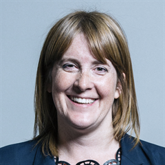 |
| Contact Details | Contact Sarah Jones |
| Political Party | Labour |
What Council is the CR0 5RD Postcode in?
The Local Council for this Postcode is Croydon London Boro Council and the County Council is Greater London Authority Council.
Greater London Authority Council is responsible for providing education, libraries and maintaining highways.
Croydon London Boro Council is responsible for duties such as council tax, rubbish collection, housing, environmental health and planning.
You can visit the website for Croydon London Boro at the following link Croydon London Boro.How much is the Council Tax?
Croydon London Boro Council is responsible for collecting council tax. This will vary depending on which council tax band the property falls within. You can check the council tax band at the gov.uk website.
Once you know the council tax band you can view how much Croydon London Boro charge for that band by visiting the The Council Tax section of their website.
Planning Applications
When moving house to a new post code it is worth checking out what will be built in the neighbourhood.
Few people want to live next door to a building site, have their garden overlooked or have the views from their property ruined.
Visit the local planning department and search for planning applications in this postcode granted within the last three years or still awaiting a decision. This will give an indication of what could still be built.
Where can I find out where the nearest Library to the CR0 5RD Postcode is?
Libraries are the responsibility of Croydon council
Visit the link for more information. Please note that some councils outsource library services to private companies and community groups ran by volunteers.
Libraries | Croydon CouncilWhat Popular Supermarkets are near the CR0 5RD Postcode?
| Supermarket | Distance | Directions |
|---|---|---|
| Waitrose, George Street, CROYDON, CR0 1LG | 2.09 miles | Directions from CR0 5RD to Waitrose |
| Aldi, Addington Road, SOUTH CROYDON, CR2 8LE | 2.23 miles | Directions from CR0 5RD to Aldi |
| Iceland, Addington Road, SOUTH CROYDON, CR2 8LD | 2.29 miles | Directions from CR0 5RD to Iceland |
| Iceland, Surrey Street, CROYDON, CR0 1RG | 2.32 miles | Directions from CR0 5RD to Iceland |
| Sainsburys, Whitgift Centre, CROYDON, CR0 1UP | 2.43 miles | Directions from CR0 5RD to Sainsburys |
What Popular Restaurants are near the CR0 5RD Postcode?
| Burger King | Distance | Directions |
|---|---|---|
| East Croydon Rail Station, Croydon, CR0 1LF | 1.21 miles | Directions from CR0 5RD to East Croydon Rail Station |
| 41 Church Street, Croydon, CR0 1RH | 1.49 miles | Directions from CR0 5RD to 41 Church Street |
| Unit 1 Valley Park Leisure Complex, Croydon, CR0 4XP | 2.48 miles | Directions from CR0 5RD to Unit 1 Valley Park Leisure Complex |
| 115-117 High Street, Bromley, BR1 1JQ | 4.65 miles | Directions from CR0 5RD to 115-117 High Street |
| Mcdonald's | Distance | Directions |
|---|---|---|
| McDonald's, George Street, CROYDON, CR0 1LG | 1.30 miles | Directions from CR0 5RD to McDonald's, George Street, CROYDON, CR0 1LG |
| McDonald's, Church Street, CROYDON, CR0 1RH | 1.49 miles | Directions from CR0 5RD to McDonald's, Church Street, CROYDON, CR0 1RH |
| McDonald's, North End, CROYDON, CR0 1UJ | 1.53 miles | Directions from CR0 5RD to McDonald's, North End, CROYDON, CR0 1UJ |
| McDonald's, Swan Close, CROYDON, CR0 2DZ | 1.62 miles | Directions from CR0 5RD to McDonald's, Swan Close, CROYDON, CR0 2DZ |
| Restaurant | Distance | Directions |
|---|---|---|
| KFC, Lower Addiscombe Road, CROYDON, CR0 6RD | 1.18 miles | Directions from CR0 5RD to KFC Croydon - Lower Addiscombe Road |
| KFC, Crown Hill, Church Street, CROYDON, CR0 1RY | 1.43 miles | Directions from CR0 5RD to KFC Croydon - Church Street |
| KFC, Addington Road, SOUTH CROYDON, CR2 8LB | 1.45 miles | Directions from CR0 5RD to KFC Selsdon - Addington Road |
| KFC, London Road, CROYDON, CR0 2RE | 1.73 miles | Directions from CR0 5RD to KFC Croydon - London Road |
| KFC, High Street, WEST WICKHAM, BR4 0LZ | 2.36 miles | Directions from CR0 5RD to KFC West Wickham - Wickham Road |