The CR2 9 postcode sector stands on the Greater London and Surrey border.
Did you know? According to the 2021 Census, the CR2 9 postcode sector is home to a bustling 7,116 residents!
Given that each sector allows for 400 unique postcode combinations. Letters C, I, K, M, O and V are not allowed in the last two letters of a postcode. With 150 postcodes already in use, this leaves 250 units available.
The CR2 9 postal code covers the settlement of SOUTH CROYDON .
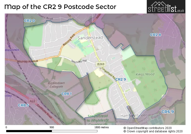
The CR2 9 Postcode shares a border with CR2 0 (SOUTH CROYDON ), CR2 8 (SOUTH CROYDON ), CR6 9 (WARLINGHAM , CHELSHAM ) and CR8 1 (PURLEY ).
The sector is within the post town of SOUTH CROYDON.
CR2 9 is a postcode sector within the CR2 postcode district which is within the CR Croydon postcode area.
The Royal Mail delivery office for the CR2 9 postal sector is the South Croydon Delivery Office.
The area of the CR2 9 postcode sector is 1.23 square miles which is 3.18 square kilometres or 786.87 square acres.

Map of the CR2 9 Postcode Sector
Explore the CR2 9 postcode sector by using our free interactive map.
| C | R | 2 | - | 9 | X | X |
| C | R | 2 | Space | 9 | Letter | Letter |
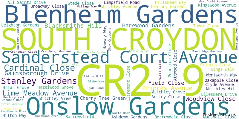
Official List of Streets
SOUTH CROYDON (66 Streets)
Unofficial Streets or Alternative Spellings
SOUTH CROYDON
ADDINGTON ROAD KINGSWOOD WAY SANDERSTEAD HILL SUNDOWN AVENUEWARLINGHAM
KINGSWOOD LANESOUTH CROYDON,
LIMPSFIELD ROAD HILLSMEADE WAY OLD SAW MILL SELSDON PARK ROADPURLEY
DUNMAIL DRIVEPURLEY,
MITCHLEY AVENUE PURLEY DOWNS ROADWeather Forecast for CR2 9
Press Button to Show Forecast for Warlingham
| Time Period | Icon | Description | Temperature | Rain Probability | Wind |
|---|---|---|---|---|---|
| 03:00 to 06:00 | Cloudy | 4.0°C (feels like 2.0°C) | 7.00% | ENE 7 mph | |
| 06:00 to 09:00 | Cloudy | 4.0°C (feels like 1.0°C) | 8.00% | ENE 9 mph | |
| 09:00 to 12:00 | Cloudy | 6.0°C (feels like 3.0°C) | 7.00% | ENE 9 mph | |
| 12:00 to 15:00 | Overcast | 8.0°C (feels like 5.0°C) | 14.00% | E 9 mph | |
| 15:00 to 18:00 | Overcast | 9.0°C (feels like 6.0°C) | 17.00% | E 9 mph | |
| 18:00 to 21:00 | Cloudy | 8.0°C (feels like 6.0°C) | 14.00% | E 9 mph | |
| 21:00 to 00:00 | Cloudy | 6.0°C (feels like 3.0°C) | 13.00% | E 9 mph |
Press Button to Show Forecast for Warlingham
| Time Period | Icon | Description | Temperature | Rain Probability | Wind |
|---|---|---|---|---|---|
| 00:00 to 03:00 | Cloudy | 6.0°C (feels like 3.0°C) | 16.00% | E 9 mph | |
| 03:00 to 06:00 | Light rain | 5.0°C (feels like 2.0°C) | 48.00% | ENE 11 mph | |
| 06:00 to 09:00 | Cloudy | 6.0°C (feels like 2.0°C) | 20.00% | ENE 11 mph | |
| 09:00 to 12:00 | Cloudy | 8.0°C (feels like 6.0°C) | 17.00% | E 11 mph | |
| 12:00 to 15:00 | Cloudy | 11.0°C (feels like 8.0°C) | 19.00% | E 11 mph | |
| 15:00 to 18:00 | Light rain shower (day) | 11.0°C (feels like 9.0°C) | 41.00% | E 11 mph | |
| 18:00 to 21:00 | Light rain | 10.0°C (feels like 8.0°C) | 54.00% | E 11 mph | |
| 21:00 to 00:00 | Light rain | 9.0°C (feels like 6.0°C) | 53.00% | ENE 11 mph |
Press Button to Show Forecast for Warlingham
| Time Period | Icon | Description | Temperature | Rain Probability | Wind |
|---|---|---|---|---|---|
| 00:00 to 03:00 | Light rain | 8.0°C (feels like 6.0°C) | 53.00% | ENE 11 mph | |
| 03:00 to 06:00 | Light rain | 8.0°C (feels like 5.0°C) | 53.00% | ESE 11 mph | |
| 06:00 to 09:00 | Heavy rain shower (day) | 8.0°C (feels like 5.0°C) | 57.00% | ESE 11 mph | |
| 09:00 to 12:00 | Light rain shower (day) | 10.0°C (feels like 7.0°C) | 43.00% | SSE 13 mph | |
| 12:00 to 15:00 | Heavy rain shower (day) | 11.0°C (feels like 9.0°C) | 57.00% | SSE 13 mph | |
| 15:00 to 18:00 | Heavy rain shower (day) | 12.0°C (feels like 10.0°C) | 57.00% | SW 13 mph | |
| 18:00 to 21:00 | Light rain shower (day) | 11.0°C (feels like 9.0°C) | 36.00% | SW 11 mph | |
| 21:00 to 00:00 | Clear night | 9.0°C (feels like 7.0°C) | 8.00% | S 11 mph |
Schools and Places of Education Within the CR2 9 Postcode Sector
Atwood Primary School
Academy converter
Limpsfield Road, South Croydon, Surrey, CR2 9EE
Head: Mr Paul Robins
Ofsted Rating: Good
Inspection: 2023-11-08 (170 days ago)
Website: Visit Atwood Primary School Website
Phone: 02086577374
Number of Pupils: 457
Gresham Primary School
Community school
Limpsfield Road, South Croydon, Surrey, CR2 9EA
Head: Ms Karen Steele
Ofsted Rating: Good
Inspection: 2023-10-12 (197 days ago)
Website: Visit Gresham Primary School Website
Phone: 02086571807
Number of Pupils: 247
House Prices in the CR2 9 Postcode Sector
| Type of Property | 2018 Average | 2018 Sales | 2017 Average | 2017 Sales | 2016 Average | 2016 Sales | 2015 Average | 2015 Sales |
|---|---|---|---|---|---|---|---|---|
| Detached | £703,752 | 31 | £624,418 | 29 | £627,000 | 30 | £555,240 | 31 |
| Semi-Detached | £504,731 | 45 | £511,292 | 55 | £464,038 | 43 | £418,938 | 39 |
| Terraced | £493,982 | 7 | £425,222 | 9 | £450,111 | 10 | £346,750 | 4 |
| Flats | £335,950 | 6 | £241,275 | 4 | £222,625 | 4 | £250,438 | 8 |
Important Postcodes CR2 9 in the Postcode Sector
CR2 9EA is the postcode for Gresham School, Limpsfield Road, and Gresham Primary School, Limpsfield Road
CR2 9EE is the postcode for Atwood Primary Academy, Limpsfield Road
CR2 9JN is the postcode for 40, Rectory Park
| The CR2 9 Sector is within these Local Authorities |
|
|---|---|
| The CR2 9 Sector is within these Counties |
|
| The CR2 9 Sector is within these Water Company Areas |
|