The HU11 5 postcode sector is within the county of East Riding of Yorkshire.
Did you know? According to the 2021 Census, the HU11 5 postcode sector is home to a bustling 4,075 residents!
Given that each sector allows for 400 unique postcode combinations. Letters C, I, K, M, O and V are not allowed in the last two letters of a postcode. With 163 postcodes already in use, this leaves 237 units available.
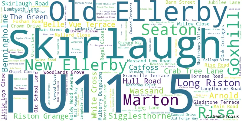
The largest settlement in the HU11 5 postal code is Skirlaugh followed by Seaton, and Long Riston.
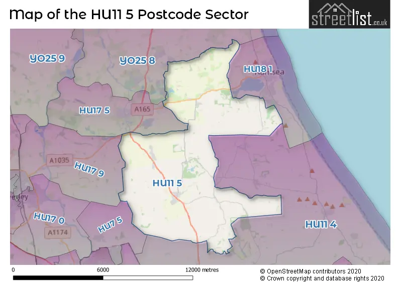
The HU11 5 Postcode shares a border with YO25 8 (Skipsea, Brandesburton, Beeford), HU7 5 (Bransholme, Wawne, Sutton-on-Hull), HU11 4 (Bilton, Aldbrough, Sproatley), HU18 1 (HORNSEA, Rolston, Mappleton), HU17 9 (BEVERLEY, Tickton, Routh) and HU17 5 (Leven, Catwick).
The sector is within the post town of HULL.
HU11 5 is a postcode sector within the HU11 postcode district which is within the HU Hull postcode area.
The Royal Mail delivery office for the HU11 5 postal sector is the Beverley Delivery Office and Skirlaugh Scale Payment Delivery Office and Seaton Scale Payment Delivery Office.
The area of the HU11 5 postcode sector is 31.32 square miles which is 81.11 square kilometres or 20,042.08 square acres.

Map of the HU11 5 Postcode Sector
Explore the HU11 5 postcode sector by using our free interactive map.
| H | U | 1 | 1 | - | 5 | X | X |
| H | U | 1 | 1 | Space | 5 | Letter | Letter |
Official List of Streets
Catfoss (3 Streets)
Long Riston (21 Streets)
Arnold (3 Streets)
Sigglesthorne (15 Streets)
Seaton (17 Streets)
Skirlaugh (38 Streets)
Old Ellerby (4 Streets)
Marton (1 Streets)
New Ellerby (4 Streets)
Rise (4 Streets)
Goxhill (1 Streets)
Riston Grange (1 Streets)
Unofficial Streets or Alternative Spellings
Aldbrough
CARLTON ROADHORNSEA
HULL ROAD SEATON ROADGreat Hatfield
HORNSEA ROAD HULL ROADWithernwick
BEVERLEY ROADCatwick
RISTON ROADBrandesburton
CATWICK LANELeven
BEVERLEY ROADWeather Forecast for HU11 5
Press Button to Show Forecast for Hornsea Freeport
| Time Period | Icon | Description | Temperature | Rain Probability | Wind |
|---|---|---|---|---|---|
| 09:00 to 12:00 | Cloudy | 7.0°C (feels like 5.0°C) | 7.00% | NE 7 mph | |
| 12:00 to 15:00 | Cloudy | 8.0°C (feels like 5.0°C) | 8.00% | ENE 9 mph | |
| 15:00 to 18:00 | Partly cloudy (day) | 8.0°C (feels like 5.0°C) | 3.00% | ENE 9 mph | |
| 18:00 to 21:00 | Sunny day | 7.0°C (feels like 5.0°C) | 2.00% | E 7 mph | |
| 21:00 to 00:00 | Partly cloudy (night) | 6.0°C (feels like 4.0°C) | 1.00% | E 7 mph |
Press Button to Show Forecast for Hornsea Freeport
| Time Period | Icon | Description | Temperature | Rain Probability | Wind |
|---|---|---|---|---|---|
| 00:00 to 03:00 | Cloudy | 5.0°C (feels like 4.0°C) | 5.00% | ENE 4 mph | |
| 03:00 to 06:00 | Cloudy | 5.0°C (feels like 2.0°C) | 8.00% | ENE 7 mph | |
| 06:00 to 09:00 | Cloudy | 6.0°C (feels like 4.0°C) | 8.00% | ENE 9 mph | |
| 09:00 to 12:00 | Cloudy | 8.0°C (feels like 5.0°C) | 9.00% | E 11 mph | |
| 12:00 to 15:00 | Cloudy | 9.0°C (feels like 6.0°C) | 13.00% | E 11 mph | |
| 15:00 to 18:00 | Cloudy | 9.0°C (feels like 6.0°C) | 13.00% | ENE 13 mph | |
| 18:00 to 21:00 | Cloudy | 8.0°C (feels like 5.0°C) | 12.00% | ENE 13 mph | |
| 21:00 to 00:00 | Cloudy | 8.0°C (feels like 4.0°C) | 11.00% | ENE 13 mph |
Press Button to Show Forecast for Hornsea Freeport
| Time Period | Icon | Description | Temperature | Rain Probability | Wind |
|---|---|---|---|---|---|
| 00:00 to 03:00 | Cloudy | 8.0°C (feels like 4.0°C) | 16.00% | NE 16 mph | |
| 03:00 to 06:00 | Cloudy | 8.0°C (feels like 4.0°C) | 23.00% | NE 18 mph | |
| 06:00 to 09:00 | Heavy rain | 8.0°C (feels like 4.0°C) | 78.00% | NE 18 mph | |
| 09:00 to 12:00 | Heavy rain | 9.0°C (feels like 5.0°C) | 80.00% | NE 18 mph | |
| 12:00 to 15:00 | Light rain | 10.0°C (feels like 6.0°C) | 51.00% | NE 16 mph | |
| 15:00 to 18:00 | Heavy rain shower (day) | 9.0°C (feels like 6.0°C) | 57.00% | E 18 mph | |
| 18:00 to 21:00 | Overcast | 9.0°C (feels like 6.0°C) | 21.00% | NE 13 mph | |
| 21:00 to 00:00 | Partly cloudy (night) | 8.0°C (feels like 5.0°C) | 8.00% | SSW 11 mph |
Schools and Places of Education Within the HU11 5 Postcode Sector
Riston Church of England Primary Academy
Academy converter
Main Street, Hull, East Yorkshire, HU11 5JF
Head: Mrs Jennifer Marsden
Ofsted Rating: Good
Inspection: 2023-01-11 (471 days ago)
Website: Visit Riston Church of England Primary Academy Website
Phone: 01964562422
Number of Pupils: 85
Sigglesthorne Church of England Primary Academy
Academy sponsor led
Main Street, Hull, , HU11 5QA
Head: Headteacher Jennifer Marsden
Ofsted Rating: Good
Inspection: 2019-10-23 (1647 days ago)
Website: Visit Sigglesthorne Church of England Primary Academy Website
Phone: 01964533770
Number of Pupils: 55
Skirlaugh Church of England Voluntary Controlled Primary School
Voluntary controlled school
Dorset Avenue, Hull, , HU11 5EB
Head: Mr Philip Hardcastle
Ofsted Rating: Good
Inspection: 2020-03-03 (1515 days ago)
Website: Visit Skirlaugh Church of England Voluntary Controlled Primary School Website
Phone: 01964562454
Number of Pupils: 146
House Prices in the HU11 5 Postcode Sector
| Type of Property | 2018 Average | 2018 Sales | 2017 Average | 2017 Sales | 2016 Average | 2016 Sales | 2015 Average | 2015 Sales |
|---|---|---|---|---|---|---|---|---|
| Detached | £270,430 | 51 | £259,263 | 49 | £230,070 | 40 | £228,130 | 32 |
| Semi-Detached | £150,228 | 38 | £142,549 | 38 | £145,239 | 31 | £131,192 | 19 |
| Terraced | £125,195 | 10 | £109,568 | 15 | £110,625 | 12 | £112,475 | 10 |
| Flats | £0 | 0 | £0 | 0 | £0 | 0 | £0 | 0 |
Important Postcodes HU11 5 in the Postcode Sector
HU11 5EB is the postcode for Skirlaugh C of E School, Dorset Avenue
HU11 5HN is the postcode for East Riding of Yorkshire Council, Council Offices, Main Road, Skirlaugh, and East Riding of Yorkshire Council, Council Offices, Main Road
HU11 5JF is the postcode for RISTON C OF E PRIMARY SCHOOL, MAIN STREET, LONG RISTON, and Riston C of E School, Main Street
HU11 5QA is the postcode for Sigglesthorne C of E Primary School, Main Street
| The HU11 5 Sector is within these Local Authorities |
|
|---|---|
| The HU11 5 Sector is within these Counties |
|
| The HU11 5 Sector is within these Water Company Areas |
|