IV1 3ZG is a postal code used within the United Kingdom for delivering mail.
Postcodes are made up of two parts. The part before the space (IV1) is called the outward code. The part after the space (3ZG) is called the inward code. The letters C, I, K, M, O and V are not allowed in the inward code. In addition to the inward and outward code, the postcode can be broken up into four parts:
- Postal Area. In our case IV which means Inverness.
- Postal District. In our case IV1.
- Postal Sector. In our case IV1 3.
- Postcode Unit. The last two letters. In our case ZG.
The regional mail center for the post area IV is the Scottish Distribution Centre, which is located at Canyon Road, Excelsior Park, Netherton Industrial Est, WISHAW, ML2 0XX.
The final port of call for any post addressed to the IV1 3ZG postcode is the local delivery office (DO) which is INVERNESS DO. Here the post will be sorted ready for delivery.
It is situated within the post town of INVERNESS within the old postal county of Inverness-shire.
IV1 3ZG is within North Kessock.
Interactive Mapping Showing UPRNs within the IV1 3ZG Postcode Boundaries
Use the search box to search for other postcodes or places.
IV1 3ZG: Points of Interest
Owl Lodge B&B
Owl Lodge B&B is an accommodation provider offering lodging services located at CARETAKERS CABIN, CRAIGBECK WOOD, NORTH KESSOCK, IV1 3ZG.
Map Coordinates for IV1 3ZG
| Latitude | 57.5178954844 |
|---|---|
| Longitude | -4.22126671088 |

Weather Forecast for IV1 3ZG
Wed 15th May
Press Button to Show Forecast for Inverness Caledonian Thistle Fc
| Time Period | Icon | Description | Temperature | Rain Probability | Wind |
|---|---|---|---|---|---|
| 06:00 to 09:00 | Partly cloudy (day) | 13.0°C (feels like 13.0°C) | 1.00% | NNE 4 mph | |
| 09:00 to 12:00 | Sunny day | 16.0°C (feels like 15.0°C) | 0.00% | NE 7 mph | |
| 12:00 to 15:00 | Sunny day | 18.0°C (feels like 16.0°C) | 3.00% | NE 11 mph | |
| 15:00 to 18:00 | Partly cloudy (day) | 18.0°C (feels like 17.0°C) | 6.00% | NE 11 mph | |
| 18:00 to 21:00 | Sunny day | 18.0°C (feels like 16.0°C) | 7.00% | ENE 9 mph | |
| 21:00 to 00:00 | Clear night | 14.0°C (feels like 14.0°C) | 1.00% | NE 4 mph |
Thu 16th May
Press Button to Show Forecast for Inverness Caledonian Thistle Fc
| Time Period | Icon | Description | Temperature | Rain Probability | Wind |
|---|---|---|---|---|---|
| 00:00 to 03:00 | Clear night | 12.0°C (feels like 11.0°C) | 1.00% | NNE 7 mph | |
| 03:00 to 06:00 | Clear night | 11.0°C (feels like 9.0°C) | 5.00% | NNE 7 mph | |
| 06:00 to 09:00 | Sunny day | 12.0°C (feels like 11.0°C) | 3.00% | NNE 7 mph | |
| 09:00 to 12:00 | Sunny day | 14.0°C (feels like 13.0°C) | 1.00% | NE 9 mph | |
| 12:00 to 15:00 | Sunny day | 16.0°C (feels like 14.0°C) | 4.00% | NE 11 mph | |
| 15:00 to 18:00 | Sunny day | 17.0°C (feels like 15.0°C) | 6.00% | NE 11 mph | |
| 18:00 to 21:00 | Sunny day | 17.0°C (feels like 15.0°C) | 5.00% | NE 11 mph | |
| 21:00 to 00:00 | Clear night | 14.0°C (feels like 13.0°C) | 1.00% | NE 7 mph |
Fri 17th May
Press Button to Show Forecast for Inverness Caledonian Thistle Fc
| Time Period | Icon | Description | Temperature | Rain Probability | Wind |
|---|---|---|---|---|---|
| 00:00 to 03:00 | Clear night | 12.0°C (feels like 11.0°C) | 1.00% | NE 7 mph | |
| 03:00 to 06:00 | Clear night | 11.0°C (feels like 9.0°C) | 3.00% | NNE 7 mph | |
| 06:00 to 09:00 | Partly cloudy (day) | 12.0°C (feels like 11.0°C) | 4.00% | NNE 4 mph | |
| 09:00 to 12:00 | Sunny day | 14.0°C (feels like 13.0°C) | 5.00% | NNE 7 mph | |
| 12:00 to 15:00 | Sunny day | 15.0°C (feels like 14.0°C) | 7.00% | NE 9 mph | |
| 15:00 to 18:00 | Partly cloudy (day) | 16.0°C (feels like 14.0°C) | 9.00% | NNE 9 mph | |
| 18:00 to 21:00 | Partly cloudy (day) | 15.0°C (feels like 13.0°C) | 10.00% | NNE 9 mph | |
| 21:00 to 00:00 | Partly cloudy (night) | 13.0°C (feels like 12.0°C) | 11.00% | N 7 mph |
Sat 18th May
Press Button to Show Forecast for Inverness Caledonian Thistle Fc
| Time Period | Icon | Description | Temperature | Rain Probability | Wind |
|---|---|---|---|---|---|
| 00:00 to 03:00 | Partly cloudy (night) | 11.0°C (feels like 11.0°C) | 10.00% | NNW 4 mph | |
| 03:00 to 06:00 | Cloudy | 11.0°C (feels like 10.0°C) | 11.00% | NNW 4 mph | |
| 06:00 to 09:00 | Overcast | 12.0°C (feels like 11.0°C) | 12.00% | NNW 4 mph | |
| 09:00 to 12:00 | Overcast | 13.0°C (feels like 13.0°C) | 12.00% | NNE 4 mph | |
| 12:00 to 15:00 | Partly cloudy (day) | 15.0°C (feels like 14.0°C) | 6.00% | NE 7 mph | |
| 15:00 to 18:00 | Partly cloudy (day) | 16.0°C (feels like 14.0°C) | 6.00% | NNE 7 mph | |
| 18:00 to 21:00 | Sunny day | 15.0°C (feels like 13.0°C) | 6.00% | NNE 9 mph | |
| 21:00 to 00:00 | Partly cloudy (night) | 12.0°C (feels like 11.0°C) | 3.00% | NNE 7 mph |
What are the Broadband Speeds like in the IV1 3ZG Postcode?
Download Speeds For IV1 3ZG

| Average Mbps | 5.200 |
|---|---|
| Median Mbps | 4.500 |
| Maximum Mbps | 12.810 |
IV1 3ZG has an average download speed of 5.2 Megabits per second (Mbps).
189 other postcode units have the same broadband speed.
0% of postcodes (5,388) have slower broadband speeds.
100% of postcodes (1,179,064) have faster broadband speeds.
Upload Speeds For IV1 3ZG
| Average Mbps | 0.800 |
|---|---|
| Median Mbps | 0.900 |
| Maximum Mbps | 1.170 |
IV1 3ZG has an average upload speed of 0.8 Megabits per second (Mbps).
2,647 other postcode units have the same upload speed.
0% of postcodes (5,855) have slower upload speeds.
99% of postcodes (1,176,139) have faster upload speeds.
Schools within a five minute drive of IV1 3ZG Postcode
Scotland Primary Schools
North Kessock Primary School
Address: North Kessock Primary School, North Kessock, Ferry Brae, IV1 3WX
Distance: 1.66 miles
Contact: 01463 731667
Nearest Opticians
Opticians near IV1 3ZG
BOOTS OPTICIANS (EASTGATE)
Address: 16-28 EASTGATE, INVERNESS, INVERNESS-SHIRE, IV2 3NA
Distance: 2.75 miles
Contact: :
BOOTS OPTICIANS (INVERNESS - HIGH ST)
Address: 17-19 HIGH STREET, INVERNESS, INVERNESS-SHIRE, IV1 1HY
Distance: 2.77 miles
Contact: :
BOOTS OPTICIANS (ELGIN)
Address: 169 HIGH STREET, ELGIN, IV30 1DW
Distance: 34.67 miles
Contact: :
Nearest GP Surgeries
Doctors near IV1 3ZG
NHS HIGHLAND POLICE CUSTODY SUITES
Address: BURNETT ROAD POLICE STATION, BURNETT ROAD, INVERNESS, IV1 1RL
Distance: 2.36 miles
Contact: tel: 01463 228425
FAIRFIELD MEDICAL PRACTICE
Address: 22A ABBAN STREET, INVERNESS, INVERNESS-SHIRE, IV3 8HH
Distance: 2.57 miles
Contact: tel: 01463 713939
BROOK SEXUAL HEALTH SERVICE
Address: 77 CHURCH STREET, INVERNESS, IV1 1ES
Distance: 2.66 miles
Contact: tel: 01349 869211
MUNLOCHY SURGERY
Address: BRAE TERRACE, MUNLOCHY, IV8 8NG
Distance: 2.69 miles
Contact: tel: 01463 811200
CROWN MEDICAL PRACTICE
Address: 12 CROWN AVENUE, INVERNESS, INVERNESS-SHIRE, IV2 3NF
Distance: 2.73 miles
Contact: tel: 01463 214450
KINGSMILLS MEDICAL PRACTICE
Address: 18 SOUTHSIDE ROAD, INVERNESS, INVERNESS-SHIRE, IV2 3BG
Distance: 3.01 miles
Contact: tel: 01463 235245
Transport Links near IV1 3ZG
Train Stations
Nearest stations for postcode: IV1 3ZG
- Inverness
Inverness station, Academy Street, Inverness, Highland, IV2 3PYDistance: 5.45 milesDriving Time: 7.88 minutes - Muir of Ord
Muir of Ord station, Corry Road, Muir of Ord, Highland, IV6 7STDistance: 10.60 milesDriving Time: 13.78 minutes - Conon Bridge
Conon Bridge station, Station Road, Conon Bridge, Highland, IV7 8AADistance: 11.30 milesDriving Time: 13.36 minutes - Beauly
Beauly station, Station Road, Beauly, Highland, IV4 7EFDistance: 12.78 milesDriving Time: 16.48 minutes - Dingwall
Dingwall station, Station Road, Dingwall, Highland, IV15 9PZDistance: 13.02 milesDriving Time: 15.74 minutes
Distances represent the quickest route by car.
Motorway Junctions near IV1 3ZG
Train Stations
Motorway Junctions near IV1 3ZG
Distances represent the quickest route by car.
Who are my Elected Representatives in the IV1 3ZG Postcode?
| Westminster Constituency | Ross, Skye and Lochaber Co Const |
|---|---|
| Member or Parliament | 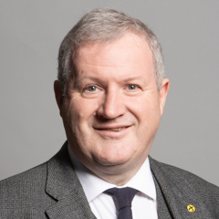 |
| Contact Details | Contact Ian Blackford |
| Political Party | Scottish National Party |
What Council is the IV1 3ZG Postcode in?
The Council for this Postcode is Highland Council, who are a Unitary authority. This means that they are responsible for providing education, libraries and maintaining highways as well as normal council duties such as council tax, rubbish collection, housing, environmental health and planning.
You can visit the website for Highland at the following link Highland.How much is the Council Tax?
Highland Council is responsible for collecting council tax. This will vary depending on which council tax band the property falls within. You can check the council tax band at the gov.uk website.
Once you know the council tax band you can view how much Highland charge for that band by visiting the The Council Tax section of their website.
Planning Applications
When moving house to a new post code it is worth checking out what will be built in the neighbourhood.
Few people want to live next door to a building site, have their garden overlooked or have the views from their property ruined.
Visit the local planning department and search for planning applications in this postcode granted within the last three years or still awaiting a decision. This will give an indication of what could still be built.
Where can I find out where the nearest Library to the IV1 3ZG Postcode is?
Libraries are the responsibility of Highland council
Visit the link for more information. Please note that some councils outsource library services to private companies and community groups ran by volunteers.
LibrariesPostcodes near the IV1 3ZG Postcode
What Popular Supermarkets are near the IV1 3ZG Postcode?
| Supermarket | Distance | Directions |
|---|---|---|
| Iceland, Rose Street, INVERNESS, IV1 1NQ | 4.03 miles | Directions from IV1 3ZG to Iceland |
| Aldi, Friars Bridge, INVERNESS, IV3 5JP | 4.22 miles | Directions from IV1 3ZG to Aldi |
| Morrisons, Millburn Road, INVERNESS, IV2 3PX | 4.24 miles | Directions from IV1 3ZG to Morrisons |
| Tesco, Tomnahurich Street, INVERNESS, IV3 5DD | 4.65 miles | Directions from IV1 3ZG to Tesco |
| Aldi, Inshes Retail Park, INVERNESS, IV2 3TW | 5.75 miles | Directions from IV1 3ZG to Aldi |
What Popular Restaurants are near the IV1 3ZG Postcode?
| Burger King | Distance | Directions |
|---|---|---|
| Unit 5 Falcon Square, Inverness, IV2 3PP | 2.64 miles | Directions from IV1 3ZG to Unit 5 Falcon Square |
| Inverness Retail Park, Inverness, IV2 7GD | 2.93 miles | Directions from IV1 3ZG to Inverness Retail Park |
| Mcdonald's | Distance | Directions |
|---|---|---|
| McDonald's, High Street, INVERNESS, IV1 1JQ | 2.78 miles | Directions from IV1 3ZG to McDonald's, High Street, INVERNESS, IV1 1JQ |
| McDonald's, Inshes Retail Park, INVERNESS, IV2 3TW | 3.58 miles | Directions from IV1 3ZG to McDonald's, Inshes Retail Park, INVERNESS, IV2 3TW |
| Restaurant | Distance | Directions |
|---|---|---|
| KFC, Millburn Road, INVERNESS, IV2 3TR | 2.57 miles | Directions from IV1 3ZG to KFC Inverness - Milburn Road |