The LS16 7 postcode sector is within the county of West Yorkshire.
Did you know? According to the 2021 Census, the LS16 7 postcode sector is home to a bustling 11,176 residents!
Given that each sector allows for 400 unique postcode combinations. Letters C, I, K, M, O and V are not allowed in the last two letters of a postcode. With 244 postcodes already in use, this leaves 156 units available.
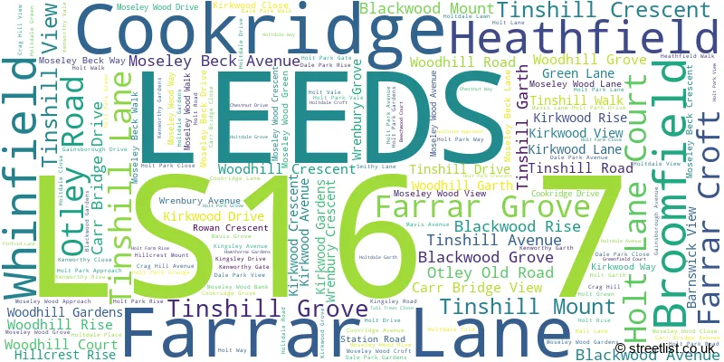
The largest settlements in the LS16 7 postal code are LEEDS and Cookridge.
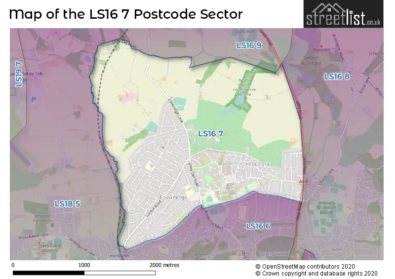
The LS16 7 Postcode shares a border with LS16 9 (Bramhope), LS18 5 (Horsforth), LS16 6 (LEEDS, Adel, West Park) and LS16 8 (LEEDS, Adel, Eccup).
The sector is within the post town of LEEDS.
LS16 7 is a postcode sector within the LS1 postcode district which is within the LS Leeds postcode area.
The Royal Mail delivery office for the LS16 7 postal sector is the Leeds City Delivery Office.
The area of the LS16 7 postcode sector is 2.29 square miles which is 5.93 square kilometres or 1,466.23 square acres.

Map of the LS16 7 Postcode Sector
Explore the LS16 7 postcode sector by using our free interactive map.
| L | S | 1 | 6 | - | 7 | X | X |
| L | S | 1 | 6 | Space | 7 | Letter | Letter |
Official List of Streets
LEEDS (154 Streets)
Unofficial Streets or Alternative Spellings
Adel
CHURCH LANELEEDS
GROVE FARM DRIVE HOLLY AVENUE HOLLY DRIVE RAYNEL WAY BLACK WOOD GROVE BLACK WOOD MOUNT BLACK WOOD RISE CARR BRIDGE STEPS HOLT CRESCENT HOLT VIEW KEN WORTHY GARTH LEEDS COUNTRY WAY MEANWOOD VALLEY TRAIL TINSHILL CLOSEHeadingley
OTLEY ROADHorsforth
OTLEY OLD ROADBramhope
LEEDS ROADSchools and Places of Education Within the LS16 7 Postcode Sector
Cookridge Holy Trinity Church of England Primary School
Voluntary aided school
Green Lane, Leeds, West Yorkshire, LS16 7EZ
Head: Ms Cath Hellings
Ofsted Rating: Good
Inspection: 2023-05-18 (384 days ago)
Website: Visit Cookridge Holy Trinity Church of England Primary School Website
Phone: 01132253040
Number of Pupils: 414
Cookridge Primary School
Foundation school
Tinshill Drive, Leeds, West Yorkshire, LS16 7DH
Head: Mrs Lynne Hunter
Ofsted Rating: Good
Inspection: 2023-11-08 (210 days ago)
Website: Visit Cookridge Primary School Website
Phone: 01133862500
Number of Pupils: 312
Ralph Thoresby School
Foundation school
Holtdale Approach, Leeds, West Yorkshire, LS16 7RX
Head: Mr Will Carr
Ofsted Rating: Good
Inspection: 2023-10-26 (223 days ago)
Website: Visit Ralph Thoresby School Website
Phone: 01133979911
Number of Pupils: 1042
House Prices in the LS16 7 Postcode Sector
| Type of Property | 2018 Average | 2018 Sales | 2017 Average | 2017 Sales | 2016 Average | 2016 Sales | 2015 Average | 2015 Sales |
|---|---|---|---|---|---|---|---|---|
| Detached | £389,518 | 51 | £365,232 | 37 | £327,486 | 39 | £321,291 | 40 |
| Semi-Detached | £255,563 | 118 | £254,874 | 103 | £235,239 | 133 | £221,821 | 107 |
| Terraced | £147,106 | 16 | £138,350 | 10 | £155,570 | 10 | £142,132 | 11 |
| Flats | £95,193 | 15 | £92,917 | 10 | £116,261 | 9 | £86,917 | 12 |
Important Postcodes LS16 7 in the Postcode Sector
LS16 7BF is the postcode for West Yorkshire Fire & Rescue Service, Cookridge Fire Station, Otley Old Road
LS16 7DH is the postcode for Cookridge Primary School, Tinshill Drive, and COOKRIDGE PRIMARY SCHOOL, TINSHILL DRIVE, COOKRIDGE
LS16 7EZ is the postcode for Holy Trinity C of E Primary School, Green Lane, and Cookridge Holy Trinity C of E Primary, Green Lane, Cookridge
LS16 7NQ is the postcode for Ralph Thoresby School, Holtdale Approach
LS16 7QD is the postcode for North West Leeds Primary Care Trust, Holt Park Health Centre, Holt Road, and Holt Park Leisure Centre, Holt Road
LS16 7RX is the postcode for Ralph Thoresby School, Holtdale Approach
| The LS16 7 Sector is within these Local Authorities |
|
|---|---|
| The LS16 7 Sector is within these Counties |
|
| The LS16 7 Sector is within these Water Company Areas |
|