The LS17 9 postcode sector stands on the North Yorkshire and West Yorkshire border.
Did you know? According to the 2021 Census, the LS17 9 postcode sector is home to a bustling 4,365 residents!
Given that each sector allows for 400 unique postcode combinations. Letters C, I, K, M, O and V are not allowed in the last two letters of a postcode. With 165 postcodes already in use, this leaves 235 units available.
The largest settlement in the LS17 9 postal code is Bardsey followed by Harewood, and East Keswick.
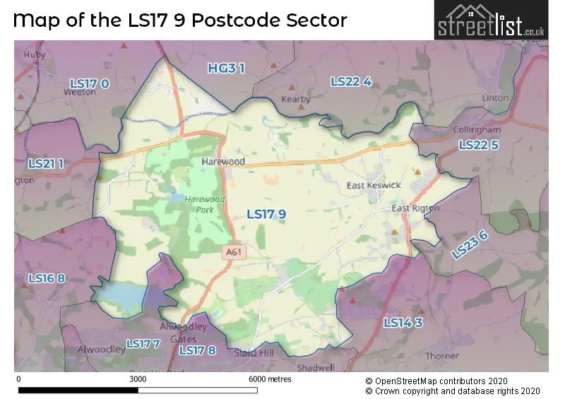
The LS17 9 Postcode shares a border with HG3 1 (Pannal, Beckwithshaw, Spofforth), LS21 1 (OTLEY, Pool In Wharfedale, Arthington), LS22 4 (Linton, Sicklinghall, Kirk Deighton), LS23 6 (Boston Spa, Bramham, Clifford), LS22 5 (Collingham, WETHERBY, Bickerton), LS14 3 (Thorner, Scarcroft, LEEDS), LS16 8 (LEEDS, Adel, Eccup), LS17 0 (Huby, North Rigton, Weeton), LS17 7 (LEEDS, Alwoodley) and LS17 8 (LEEDS, Shadwell, Moortown).
The sector is within the post town of LEEDS.
LS17 9 is a postcode sector within the LS1 postcode district which is within the LS Leeds postcode area.
The Royal Mail delivery office for the LS17 9 postal sector is the unknown.
The area of the LS17 9 postcode sector is 16.32 square miles which is 42.27 square kilometres or 10,445.67 square acres.
Waterways within the LS17 9 postcode sector include the River Wharfe, Gill Beck, Sturdy Beck, Collingham Beck.


Map of the LS17 9 Postcode Sector
Explore the LS17 9 postcode sector by using our free interactive map.
| L | S | 1 | 7 | - | 9 | X | X |
| L | S | 1 | 7 | Space | 9 | Letter | Letter |
Official List of Streets
Bardsey (46 Streets)
East Keswick (24 Streets)
Wike (7 Streets)
Harewood (19 Streets)
LEEDS (19 Streets)
Unofficial Streets or Alternative Spellings
Collingham
COMPTON LANE HAREWOOD ROAD ARENA PARK BRIDGE COURT CHIPPYS CORNER CLARKS CORNER COUNTRY ESSES FARMHOUSE BEND FITTS LANE HAREWOOD BRIDGE HAREWOOD VILLAS HIGH WEARDLEY LANE HOLDGATE FARM HOTTEN ROAD LADY BRIDGE ORCHARD QUARRY SANDY GATE SLEIGHTS LANE THE MIKE KEMPLEY WAY THE ORCHARDS WALLSIDE PLANTATION WALK WILLOW WOODHALL BRIDGEEast Keswick
BROOKLANDSScarcroft
BAY HORSE LANE LING LANE SYKE LANELEEDS
ECCUP LANE GOODRICK LANE PLANTATION GARDENS WIGTON CHASE WIGTON LANEWike
KESWICK LANEKirkby Overblow
SWINDON LANEArthington
ARTHINGTON LANE BEDLAM LANE RAWDEN HILLWothersome
HOLME FARM LANESchools and Places of Education Within the LS17 9 Postcode Sector
Harewood Church of England Voluntary Controlled Primary School
Voluntary controlled school
Harrogate Road, Leeds, West Yorkshire, LS17 9LH
Head: Mr Alistair Ratcliffe
Ofsted Rating: Good
Inspection: 2022-09-22 (622 days ago)
Website: Visit Harewood Church of England Voluntary Controlled Primary School Website
Phone: 01132886394
Number of Pupils: 101
House Prices in the LS17 9 Postcode Sector
| Type of Property | 2018 Average | 2018 Sales | 2017 Average | 2017 Sales | 2016 Average | 2016 Sales | 2015 Average | 2015 Sales |
|---|---|---|---|---|---|---|---|---|
| Detached | £530,857 | 43 | £499,814 | 51 | £537,822 | 59 | £589,693 | 56 |
| Semi-Detached | £311,933 | 27 | £358,197 | 15 | £307,498 | 20 | £347,220 | 21 |
| Terraced | £328,277 | 9 | £290,143 | 7 | £347,389 | 9 | £287,318 | 19 |
| Flats | £195,000 | 1 | £167,500 | 2 | £245,567 | 6 | £0 | 0 |
Important Postcodes LS17 9 in the Postcode Sector
LS17 9DG is the postcode for UPPER SCHOOL, Bardsey Primary School, Woodacre Lane, LOWER SCHOOL, Bardsey Primary School, Woodacre Lane, and Bardsey Primary School, Woodacre Lane
LS17 9LH is the postcode for Harewood C of E Primary School, Harrogate Road
| The LS17 9 Sector is within these Local Authorities |
|
|---|---|
| The LS17 9 Sector is within these Counties |
|
| The LS17 9 Sector is within these Water Company Areas |
|