The OX17 3 postcode sector stands on the Northamptonshire and Oxfordshire border.
Did you know? According to the 2021 Census, the OX17 3 postcode sector is home to a bustling 6,762 residents!
Given that each sector allows for 400 unique postcode combinations. Letters C, I, K, M, O and V are not allowed in the last two letters of a postcode. With 233 postcodes already in use, this leaves 167 units available.
The largest settlement in the OX17 3 postal code is Adderbury followed by Kings Sutton, and Twyford.
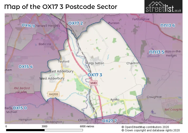
The OX17 3 Postcode shares a border with NN13 5 (Croughton, Helmdon, Syresham), OX15 0 (Deddington, Barford St. Michael, Hempton), OX15 4 (Bloxham, Bodicote, Milcombe), OX17 2 (Middleton Cheney, Greatworth, Chacombe) and OX27 7 (Fritwell, Ardley, Souldern).
The sector is within the post town of BANBURY.
OX17 3 is a postcode sector within the OX1 postcode district which is within the OX Oxford postcode area.
The Royal Mail delivery office for the OX17 3 postal sector is the Oxford Delivery Office.
The area of the OX17 3 postcode sector is 16.66 square miles which is 43.16 square kilometres or 10,664.46 square acres.
The OX17 3 postcode sector is crossed by the M40 motorway.
Waterways within the OX17 3 postcode sector include the Oxford Canal, River Cherwell, Cherwell, Sor Brook.

Map of the OX17 3 Postcode Sector
Explore the OX17 3 postcode sector by using our free interactive map.
| O | X | 1 | 7 | - | 3 | X | X |
| O | X | 1 | 7 | Space | 3 | Letter | Letter |
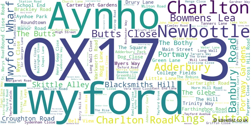
Official List of Streets
Adderbury (49 Streets)
Kings Sutton (41 Streets)
Aynho (22 Streets)
Charlton (9 Streets)
Twyford (15 Streets)
Schools and Places of Education Within the OX17 3 Postcode Sector
Kings Sutton Primary Academy
Academy converter
Richmond Street, Banbury, Oxfordshire, OX17 3RT
Head: Mrs Laura Wade
Ofsted Rating: Good
Inspection: 2022-03-24 (794 days ago)
Website: Visit Kings Sutton Primary Academy Website
Phone: 01295811289
Number of Pupils: 130
Newbottle and Charlton Church of England Primary School
Voluntary aided school
Green Lane, Banbury, Oxfordshire, OX17 3DN
Head: Mr Peter Smith
Ofsted Rating: Requires improvement
Inspection: 2023-04-19 (403 days ago)
Website: Visit Newbottle and Charlton Church of England Primary School Website
Phone: 01295811480
Number of Pupils: 109
House Prices in the OX17 3 Postcode Sector
| Type of Property | 2018 Average | 2018 Sales | 2017 Average | 2017 Sales | 2016 Average | 2016 Sales | 2015 Average | 2015 Sales |
|---|---|---|---|---|---|---|---|---|
| Detached | £546,504 | 51 | £520,862 | 65 | £508,780 | 70 | £434,485 | 50 |
| Semi-Detached | £344,301 | 31 | £330,748 | 27 | £322,738 | 32 | £317,931 | 35 |
| Terraced | £330,934 | 19 | £317,385 | 14 | £311,184 | 22 | £261,077 | 39 |
| Flats | £199,417 | 6 | £177,083 | 6 | £151,083 | 6 | £202,988 | 8 |
Important Postcodes OX17 3 in the Postcode Sector
OX17 3DN is the postcode for Newbottle & Charlton Primary School, Green Lane
OX17 3NH is the postcode for Christopher Rawlins C of E School, Aynho Road
OX17 3RT is the postcode for Kings Sutton Cp School, Richmond Street
| The OX17 3 Sector is within these Local Authorities |
|
|---|---|
| The OX17 3 Sector is within these Counties |
|
| The OX17 3 Sector is within these Water Company Areas |
|