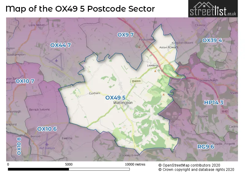
The OX49 5 postcode sector stands on the Buckinghamshire and Oxfordshire border.
Did you know? According to the 2021 Census, the OX49 5 postcode sector is home to a bustling 4,204 residents!
Given that each sector allows for 400 unique postcode combinations. Letters C, I, K, M, O and V are not allowed in the last two letters of a postcode. With 216 postcodes already in use, this leaves 184 units available.
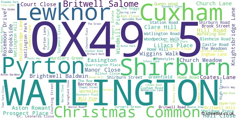
The largest settlement in the OX49 5 postal code is WATLINGTON followed by Lewknor, and Aston Rowant.
The OX49 5 Postcode shares a border with OX9 7 (Tetsworth, Postcombe, Stoke Talmage), OX10 6 (Benson, Ewelme, Ipsden), OX39 4 (CHINNOR, Kingston Blount, Sydenham), OX44 7 (Chalgrove, Stadhampton, Great Milton), RG9 6 (Hambleden, Frieth, Fawley) and HP14 3 (Stokenchurch, Lane End, Piddington).
The sector is within the post town of WATLINGTON.
OX49 5 is a postcode sector within the OX49 postcode district which is within the OX Oxford postcode area.
The Royal Mail delivery office for the OX49 5 postal sector is the Watlington (ox49) Delivery Office.
The area of the OX49 5 postcode sector is 23.27 square miles which is 60.27 square kilometres or 14,894.06 square acres.
The OX49 5 postcode sector is crossed by the M40 motorway.

Map of the OX49 5 Postcode Sector
Explore the OX49 5 postcode sector by using our free interactive map.
| O | X | 4 | 9 | - | 5 | X | X |
| O | X | 4 | 9 | Space | 5 | Letter | Letter |
Official List of Streets
WATLINGTON (59 Streets)
Aston Rowant (11 Streets)
Lewknor (16 Streets)
Shirburn (4 Streets)
Brightwell Baldwin (3 Streets)
Pyrton (7 Streets)
Christmas Common (4 Streets)
Cuxham (2 Streets)
Britwell Salome (2 Streets)
Unofficial Streets or Alternative Spellings
Swyncombe
COATES LANEPostcombe
CHALFORD ROADClare
STONEY LANEWeather Forecast for OX49 5
Press Button to Show Forecast for Watlington
| Time Period | Icon | Description | Temperature | Rain Probability | Wind |
|---|---|---|---|---|---|
| 06:00 to 09:00 | Cloudy | 4.0°C (feels like 1.0°C) | 5.00% | ENE 7 mph | |
| 09:00 to 12:00 | Partly cloudy (day) | 7.0°C (feels like 5.0°C) | 3.00% | ENE 9 mph | |
| 12:00 to 15:00 | Cloudy | 9.0°C (feels like 8.0°C) | 9.00% | ENE 7 mph | |
| 15:00 to 18:00 | Overcast | 10.0°C (feels like 9.0°C) | 15.00% | ENE 4 mph | |
| 18:00 to 21:00 | Cloudy | 9.0°C (feels like 8.0°C) | 12.00% | NE 4 mph | |
| 21:00 to 00:00 | Cloudy | 6.0°C (feels like 4.0°C) | 13.00% | ENE 7 mph |
Press Button to Show Forecast for Watlington
| Time Period | Icon | Description | Temperature | Rain Probability | Wind |
|---|---|---|---|---|---|
| 00:00 to 03:00 | Cloudy | 4.0°C (feels like 2.0°C) | 12.00% | ENE 7 mph | |
| 03:00 to 06:00 | Cloudy | 3.0°C (feels like 1.0°C) | 18.00% | ENE 7 mph | |
| 06:00 to 09:00 | Cloudy | 4.0°C (feels like 2.0°C) | 22.00% | ENE 7 mph | |
| 09:00 to 12:00 | Overcast | 8.0°C (feels like 5.0°C) | 22.00% | ENE 9 mph | |
| 12:00 to 15:00 | Cloudy | 11.0°C (feels like 8.0°C) | 17.00% | ENE 11 mph | |
| 15:00 to 18:00 | Cloudy | 11.0°C (feels like 9.0°C) | 19.00% | ENE 11 mph | |
| 18:00 to 21:00 | Light rain | 10.0°C (feels like 8.0°C) | 51.00% | ENE 9 mph | |
| 21:00 to 00:00 | Light rain | 8.0°C (feels like 5.0°C) | 52.00% | NE 11 mph |
Press Button to Show Forecast for Watlington
| Time Period | Icon | Description | Temperature | Rain Probability | Wind |
|---|---|---|---|---|---|
| 00:00 to 03:00 | Heavy rain | 7.0°C (feels like 4.0°C) | 77.00% | NE 11 mph | |
| 03:00 to 06:00 | Heavy rain | 7.0°C (feels like 5.0°C) | 75.00% | NE 9 mph | |
| 06:00 to 09:00 | Heavy rain | 8.0°C (feels like 6.0°C) | 75.00% | ENE 7 mph | |
| 09:00 to 12:00 | Heavy rain shower (day) | 10.0°C (feels like 8.0°C) | 56.00% | ESE 9 mph | |
| 12:00 to 15:00 | Light rain | 11.0°C (feels like 9.0°C) | 54.00% | SSE 11 mph | |
| 15:00 to 18:00 | Light rain shower (day) | 11.0°C (feels like 9.0°C) | 40.00% | W 11 mph | |
| 18:00 to 21:00 | Light rain shower (day) | 10.0°C (feels like 8.0°C) | 34.00% | W 9 mph | |
| 21:00 to 00:00 | Partly cloudy (night) | 8.0°C (feels like 6.0°C) | 4.00% | WSW 7 mph |
Schools and Places of Education Within the OX49 5 Postcode Sector
Aston Rowant Church of England Primary School
Voluntary controlled school
School Lane, Watlington, Oxfordshire, OX49 5SU
Head: Mrs Helen France
Ofsted Rating: Good
Inspection: 2022-05-24 (703 days ago)
Website: Visit Aston Rowant Church of England Primary School Website
Phone: 01844351671
Number of Pupils: 78
Icknield Community College
Academy converter
Love Lane, Watlington, Oxfordshire, OX49 5RB
Head: Mr Mat Hunter
Ofsted Rating: Good
Inspection: 2019-03-12 (1872 days ago)
Website: Visit Icknield Community College Website
Phone: 01491612691
Number of Pupils: 743
Lewknor Church of England Primary School
Voluntary controlled school
High Street, Watlington, Oxfordshire, OX49 5TH
Head: Mrs Deborah Cole
Ofsted Rating: Good
Inspection: 2020-02-05 (1542 days ago)
Website: Visit Lewknor Church of England Primary School Website
Phone: 01844351542
Number of Pupils: 76
House Prices in the OX49 5 Postcode Sector
| Type of Property | 2018 Average | 2018 Sales | 2017 Average | 2017 Sales | 2016 Average | 2016 Sales | 2015 Average | 2015 Sales |
|---|---|---|---|---|---|---|---|---|
| Detached | £975,563 | 16 | £752,309 | 22 | £767,509 | 27 | £564,357 | 14 |
| Semi-Detached | £406,292 | 12 | £450,365 | 26 | £431,265 | 17 | £366,257 | 20 |
| Terraced | £414,375 | 12 | £380,467 | 15 | £416,382 | 22 | £342,283 | 23 |
| Flats | £212,500 | 2 | £178,333 | 6 | £178,313 | 4 | £123,498 | 2 |
Important Postcodes OX49 5 in the Postcode Sector
OX49 5RB is the postcode for ART & HISTORY BLOCK, Icknield Community College, Love Lane, B BLOCK, Icknield Community School, Love Lane, FOUNDATION BUILDING, Watlington Primary School, Love Lane, A BLOCK, Icknield Community School, Love Lane, Watlington Primary School, Love Lane, WATLINGTON PRIMARY SCHOOL, LOVE LANE, WATLINGTON, and Icknield Community School, Love Lane
| The OX49 5 Sector is within these Local Authorities |
|
|---|---|
| The OX49 5 Sector is within these Counties |
|
| The OX49 5 Sector is within these Water Company Areas |
|