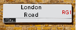
Map of London Road
| Postcodes | ||
|---|---|---|
| Icon | Postcodes for London Road | |
| Walking Distances | ||
| Distance Info | Green Circle = 10 Minutes Walk (800 metres) | |
About London Road
London Road is a street located in the town of Reading and in the town of Woodley. The street has a length of approximately 6,383 metres.
London Road is located within the Wokingham (B) and Reading (B) Council's jurisdiction. They provide various services, like refuse collection, and manage council tax collection. It's situated in the South East region of the UK.
London Road has been assigned the Unique Street Reference Numbers of 44701402, 44700934, 44700102, 31000818, 31010004, 44701401, 44702325, 31001511 and 31010002 in the National Street Gazetteer.
London Road is located within the county of Berkshire, situated in the South East region of the UK. It's 228.31 miles North West from central London., 19.29 miles North West from Lancaster, 42.53 miles South from Carlisle and 60.69 miles North from Liverpool.
London Road is within the Post Town of READING

Do you know why this road is called London Road?
What's it like to live here?
Ask the community a question about London Road.
Do you have any questions, memories to share or know any facts about London Road? We'd love to know more.
Also on streetlist.co.uk, can you help?
Swing Swang Lane
28th April 2024
I am trying to find out why the lane is named Swing Swang?
It has been known known this since at least 1905 when hedge making contents used to be held here.
Swing Swang is often used to describe a fairground ride. I remember Swing Boats. Were they a bit like this or is Swing Swang another name for swings?
Swing Swangs are also mentioned in connection to orchards. Or were orchards just good places to have swings?
Estate Agents near London Road
| Name | Address | Website |
|---|---|---|
| Ewemove Reading East | 400 Thames Valley Park Drive, Thames Valley Park, Reading,RG6 1PT | |
| Mr Sales and Lettings | 34 Wokingham Road, Earley, Reading, RG6 1JH | Visit Website |
| SPACE | 49 Wokingham Road, Reading, RG6 1LG | Visit Website |
We have found 42 postcodes for London Road
Location Details
| London Road | |
|---|---|

| |
| Latitude | 54.283098 |
| Longitude | -3.051439 |
| OS Easting (X): | 331554 |
| OS Northing (Y): | 488023 |
| OS Grid Reference: | SD316880 |
Neighbourhood Policing |
| Police Force: Thames Valley |
 View Neighbourhood Crime and Policing View Neighbourhood Crime and Policing |
| Find a Local Neighbourhood Watch Scheme |
Frequently asked Questions for London Road
What Council (Local Authority) is London Road in?
London Road is located within the local authority area of Reading &Wokingham Council which is a Unitary Authority.
What Parish Council is London Road in?
London Road is located within the area of Earley & Woodley Parish Council.
What Electoral Ward is London Road in?
London Road is located within the ward of Park, Redlands, Katesgrove, Abbey, Bulmershe and Whitegates &Sonning.
What County is London Road in?
London Road is located within the ceremonial county of Berkshire.
What Constituency is London Road in?
London Road is located within the constituency of Reading East &Maidenhead.
What Part of the UK is London Road in?
London Road is located within the South East (England) region of the United Kingdom.
What County Council area is London Road in?
London Road is located within the Reading &Wokingham Council area.
What Police Force area is London Road in?
London Road is located within the Thames Valley Police area.
Roads that have a Junction with London Road
Sunset and Sunrise times for London Road
| Sunrise | 05:09 |
|---|---|
| Sunset | 21:07 |
Latest Weather Conditions for London Road
| Observed at Weather Station: | Walney Island 12 May 2024 at 02:00 (13.72 miles away) |
|---|---|
| Current Weather: | Cloudy |
| Temperature and Humidity: | 15.6°C (77.9%) |
| Wind Direction and Speed: | ESE (13 mph) |
Population Statistics
| ONS Area Code | E00082853, E00174525, E00082875, E00082908, E00082719, E00082918, E00082920, E00082919, E00082594, E00082593, E00082916, E00082917, E00083877, E00083875, E00083878, E00083879, E00084212 & E00084211 |
|---|---|
| ONS Area Name | Asian Terraces and Flats, Young Families and Students, Students and Professionals, Urban Cultural Mix, Student Digs, EU White-Collar Workers, Highly-Qualified Quaternary Workers, Multicultural Student Neighbourhoods, Achieving Minorities, Multi-Ethnic Professionals with Families & Multi-Ethnic Suburbia |
| Average Age | 31.00, 31.91, 33.77, 31.80, 29.14, 30.63, , 36.13, 40.96 & 41.62 |
| Area Population | 1602.00, 2050.00, 1610.00, 2083.00, 1637.00, 1726.00, , 1534.00, 1385.00 & 1598.00 |
| Male Population | 855.00, 1050.00, 836.00, 1113.00, 876.00, 879.00, , 757.00, 711.00 & 812.00 (52%) |
| Female Population | 747.00, 1000.00, 774.00, 970.00, 761.00, 847.00, , 777.00, 674.00 & 786.00 (48%) |
| Benefit Claimants | 27, 28, 14, 48, 23, , 12 & 13 (1%) |
| LSOA Code: | E01016406, E01016404, E01016414, E01016378, E01016416, E01016417, E01033417, E01016613, E01016614 &E01016684 |
|---|---|
| LSOA Name: | Reading 010E, Reading 010C, Reading 014F, Reading 011D, Reading 012C, Reading 012D, Reading 010F, Wokingham 006A, Wokingham 006B &Wokingham 003D |
| SOA Code: | 1a, 7b, 6a, 3b &8c |
| SOA Name: | |
| MSOA Code: | E02003398, E02003402, E02003399, E02003400, E02003444 &E02003441 |
| MSOA Name: | Reading 010, Reading 014, Reading 011, Reading 012, Wokingham 006 &Wokingham 003 |
Nearest Supermarkets
| Tesco Ulverston Express |
|---|
| 4 Market St, Ulverston, LA12 7AZ |
| 0345 671 9478 |
| Distance: 6.3 Miles |
| Directions from London Road to Tesco Ulverston Express |
| Tesco Bowness-on-windermere Express |
|---|
| 4-5 The Royal, Cumbria, Bowness-On-Windermere, LA23 3DB |
| 0345 671 9296 |
| Distance: 7.72 Miles |
| Directions from London Road to Tesco Bowness-on-windermere Express |
| Tesco Grange Over Sands Express |
|---|
| Kent Bank Rd, Grange Over Sands, LA11 7EY |
| 0345 610 6763 |
| Distance: 8.47 Miles |
| Directions from London Road to Tesco Grange Over Sands Express |
| Sainsburys Windermere Main Road Local |
|---|
| Main Road, Windermere, Windermere, England, LA23 1DX |
| 1539488843 |
| Distance: 8.77 Miles |
| Directions from London Road to Sainsburys Windermere Main Road Local |
Telephone Information
| Dialling Code | Telephone Exchange | Telephone Cabinet | Fibre to the Cabinet or Fibre to the Premises |
|---|---|---|---|
| 0118 | EARLEY - THEAR | P31 | FTTC |
Broadband Information
| Speed | Average Speed | Median Speed | Maximum Speed | Next-generation access (NGA) | Number of Connections |
|---|---|---|---|---|---|
| Greater than 2 Mbps | 18.2 | 15.7 | >=30 | Y | 6 |
Local Government
| Local Council Details |
|---|
| Within the area of Reading &Wokingham |
| Visit the Council's Website |
| Visit the Council's Website |
| Civic Centre, Reading, RG1 7AE, Civic Offices, Shute End, Wokingham, Surrey &RG40 1BN |
| Send email |
| Telephone Number: 0118 937 3737 &01189 746 000 |
| Local Member of Parliament |
|---|
| Within the Westminster Parliamentary Constituency of Reading East &Maidenhead |
| The Member of Parliament is Mathew Rodda &Theresa May |
| Details for the MP Mathew Rodda &Theresa May on parliament.uk |
| Details for the MP Mathew Rodda &Theresa May on theyworkforyou.com |
| In the 2019 General Election Mathew Rodda &Theresa May won with a majority of 5,924 the result was Lab hold &Con hold. The total electorate was 77,152 |
| Wards, Parish Councils and County Councils |
|---|
| Ward: Park, Redlands, Katesgrove, Abbey, Bulmershe and Whitegates &Sonning Ward |
| Ceremonial County: Berkshire |
Nearest Schools
Nearest Hospitals
| Name | Address | Postcode | Distance | Map |
|---|
Nearest Dentists
Dentists near London Road
| Name | Address | Postcode | Distance | Map |
|---|
Nearest GP Surgeries
Doctors near London Road
HAVERTHWAITE SURGERY
Address: HAVERTHWAITE, BACKBARROW, ULVERSTON, CUMBRIA, LA12 8QF
Distance: 3.20 miles
Contact: tel: 01539 531619
HAVERTHWAITE BRANCH SURGERY
Address: GREENODD VILLAGE HALL, GREENODD, ULVERSTON, CUMBRIA, LA12 7QZ
Distance: 3.41 miles
Contact: :
WRAYSDALE HOUSE SURGERY
Address: WRAYSDALE HOUSE, CONISTON, CUMBRIA, LA21 8ER
Distance: 5.90 miles
Contact: tel: 01539 441205
ULVERSTON COMMUNITY HEALTH CENTRE
Address: STANLEY STREET, ULVERSTON, CUMBRIA, LA12 7BT
Distance: 6.11 miles
Contact: tel: 01229 484100
ULVERSTON HEALTH CENTRE (MURRAY)
Address: ULVERSTON COMMUNITY HEALTH CENTRE, STANLEY STREET, ULVERSTON, CUMBRIA, LA12 7BT
Distance: 6.11 miles
Contact: tel: 01229 484141
ULVERSTON COMMUNITY HEALTH CENTRE - COVID LOCAL VACCINATION SERVICE 2
Address: ULVERSTON COMMUNITY HEALTH CENTRE, STANLEY STREET, ULVERSTON, LA12 7BT
Distance: 6.11 miles
Contact: :
Nearest Dispensing Chemists
Pharmacies near London Road
| Name | Address | Postcode | Telephone | Map | Distance in Km |
|---|
Nearest Opticians
Opticians near London Road
RAMSAY & ROBERTS (EYECARE EXCELLENCE)
Address: UNIT 2, 3 KING STREET, ULVERSTON, LA12 7DY
Distance: 6.27 miles
Contact: :
YORK-ANDREWS SPECTACLE LOUNGE
Address: 34 MARKET STREET, ULVERSTON, LA12 7LR
Distance: 6.28 miles
Contact: :
VISION EXPRESS (ULVERSTON)
Address: 4 MARKET PLACE, ULVERSTON, CUMBRIA, LA12 7BA
Distance: 6.30 miles
Contact: :
ROBINSON OPTICIAN
Address: 1-3 QUEEN STREET, ULVERSTON, CUMBRIA, LA12 7AF
Distance: 6.35 miles
Contact: :
EYE TESTS AT HOME LTD
Address: MUIRLANDS, KIRKBY-IN-FURNESS, CUMBRIA, LA17 7TT
Distance: 7.59 miles
Contact: :
BAGOT OPTICIANS (GRANGE-OVER-SANDS)
Address: 7 LOWTHER GARDENS, GRANGE-OVER-SANDS, CUMBRIA, LA11 7EX
Distance: 8.40 miles
Contact: :
Transport
Nearest Rail Stations
Kirkby-in-Furness Station is 6.56 miles away.
Address: Kirkby-in-Furness station, Marsh Side, Kirkby-in-Furness, Cumbria, LA17 7UB
Kirkby-in-Furness is situated on the Cumbrian Coast line and is managed by Northern.
Kirkby-in-Furness Station is an unstaffed station.
Directions from London Road to Kirkby-in-Furness Rail Station
Ulverston Station is 6.60 miles away.
Address: Ulverston station, Station Approach, off Princes Stree, Ulverston, Cumbria, LA12 0DP
Ulverston is situated on the Furness line and is managed by Northern.
Ulverston Station is staffed on a part time basis.