Map of South Road
| Postcodes | ||
|---|---|---|
| Icon | Postcodes for South Road | |
| Walking Distances | ||
| Distance Info | Green Circle = 10 Minutes Walk (800 metres) | |
About South Road
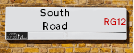
South Road is a street located near the town of Bracknell. It uses the postcode RG40 3DN. The street has a length of approximately 873 metres.
South Road is located within the Bracknell Forest (B) Council's jurisdiction. They provide various services, like refuse collection, and manage council tax collection. It's situated in the South East region of the UK.
South Road has been assigned the Unique Street Reference Number of 3801143 in the National Street Gazetteer.
South Road is located within the county of Berkshire, situated in the South East region of the UK. It's 29.96 miles West from central London., 9.46 miles South East from Reading, 10.77 miles North West from Woking and 13.96 miles North West from Guildford.

Do you know why this road is called South Road?
What's it like to live here?
Ask the community a question about South Road.
Do you have any questions, memories to share or know any facts about South Road? We'd love to know more.
Reader Comments for South Road
Also on streetlist.co.uk, can you help?
Swing Swang Lane
28th April 2024
I am trying to find out why the lane is named Swing Swang?
It has been known known this since at least 1905 when hedge making contents used to be held here.
Swing Swang is often used to describe a fairground ride. I remember Swing Boats. Were they a bit like this or is Swing Swang another name for swings?
Swing Swangs are also mentioned in connection to orchards. Or were orchards just good places to have swings?
Estate Agents near South Road
| Name | Address | Website |
|---|---|---|
| Leaders Sales, Leaders - Shared Ownership | Crowthorne House, Nine Mile Ride, Wokingham, Berkshire, RG40 3GZ | Visit Website |
| Romans | Crowthorne House Nine Mile Ride Wokingham RG40 3GZ | Visit Website |
| Romans | Crowthorne House Nine Mile Ride, Crowthorne, RG40 3GZ | Visit Website |
We have found 1 postcode for South Road
Location Details
| South Road | |
|---|---|

| |
| Latitude | 51.390275 |
| Longitude | -0.778920 |
| OS Easting (X): | 484952 |
| OS Northing (Y): | 166455 |
| OS Grid Reference: | SU850665 |
Neighbourhood Policing |
| Police Force: Thames Valley |
 View Neighbourhood Crime and Policing View Neighbourhood Crime and Policing |
| Find a Local Neighbourhood Watch Scheme |
Frequently asked Questions for South Road
What Council (Local Authority) is South Road in?
South Road is located within the local authority area of Bracknell Forest Council which is a Unitary Authority.
What Parish Council is South Road in?
South Road is in an unparished area.
What Electoral Ward is South Road in?
South Road is located within the ward of Great Hollands South.
What County is South Road in?
South Road is located within the ceremonial county of Berkshire.
What Constituency is South Road in?
South Road is located within the constituency of Bracknell.
What Part of the UK is South Road in?
South Road is located within the South East (England) region of the United Kingdom.
What County Council area is South Road in?
South Road is located within the Bracknell Forest Council area.
What Police Force area is South Road in?
South Road is located within the Thames Valley Police area.
Roads that have a Junction with South Road
| Street | Junction Type |
|---|---|
| West Road | junction |
| Nine Mile Ride (B3430) | junction |
Sunset and Sunrise times for South Road , RG40 3DN
| Sunrise | 05:10 |
|---|---|
| Sunset | 20:48 |
Latest Weather Conditions for South Road, RG40 3DN
| Observed at Weather Station: | Odiham 14 May 2024 at 14:00 (12.71 miles away) |
|---|---|
| Current Weather: | Overcast |
| Temperature and Humidity: | 16.0°C (70.8%) |
| Wind Direction and Speed: | SE (14 mph) |
Population Statistics
| ONS Area Code | E00081938 |
|---|---|
| ONS Area Name | Comfortable Suburbia |
| Average Age | 42.90 |
| Area Population | 1374.00 |
| Male Population | 670.00 (49%) |
| Female Population | 704.00 (51%) |
| Benefit Claimants | 7 (1%) |
| LSOA Code: | E01016214 |
|---|---|
| LSOA Name: | Bracknell Forest 009E |
| SOA Code: | 8c |
| SOA Name: | |
| MSOA Code: | E02003360 |
| MSOA Name: | Bracknell Forest 009 |
Nearest Supermarkets
| Tesco Crowthorne Greenwood Express |
|---|
| 21-23 Greenwood Rd, Crowthorne, RG45 6QX |
| 0345 674 6393 |
| Distance: 1.27 Miles |
| Directions from South Road to Tesco Crowthorne Greenwood Express |
| Sainsburys Bagshot Road |
|---|
| Ringmead, Bracknell, England, RG12 7SS |
| 01344 360727 |
| Distance: 1.67 Miles |
| Directions from South Road to Sainsburys Bagshot Road |
| Little Waitrose Bagshot Road- |
|---|
| Bagshot Road, Bracknell, Berkshire, RG12 9SE |
| 01344 860293 |
| Distance: 1.74 Miles |
| Directions from South Road to Little Waitrose Bagshot Road- |
| Morrisons Bracknell |
|---|
| The Peel Centre, Skimped Hill Lane, Bracknell RG12 1EN |
| 01344 862188 |
| Distance: 1.96 Miles |
| Directions from South Road to Morrisons Bracknell |
Telephone Information
| Dialling Code | Telephone Exchange | Telephone Cabinet | Fibre to the Cabinet or Fibre to the Premises |
|---|---|---|---|
| 01344 | BRACKNELL - THBK | P26 | FTTC |
Local Government
| Local Council Details |
|---|
| Within the area of Bracknell Forest |
| Visit the Council's Website |
| Time Square, Market Street, Bracknell, Berkshire &RG12 1JD |
| Send email |
| Telephone Number: 01344 352 000 |
| Local Member of Parliament |
|---|
| Within the Westminster Parliamentary Constituency of Bracknell |
| The Member of Parliament is James Sunderland |
| Details for the MP James Sunderland on parliament.uk |
| Details for the MP James Sunderland on theyworkforyou.com |
| In the 2019 General Election James Sunderland won with a majority of 19,829 the result was Con hold. The total electorate was 78,978 |
| Wards, Parish Councils and County Councils |
|---|
| Ward: Great Hollands South Ward |
| Ceremonial County: Berkshire |
Nearest Schools
England Primary Schools
Birch Hill Primary School
Address: Birch Hill Primary School, Leppington, Birch Hill Primary School, Bracknell Forest, Berkshire, RG12 7WW
Distance: 1.16 miles
Contact: 01344455815
Fox Hill Primary School
Address: Fox Hill Primary School, Pondmoor Road, Bracknell, Berkshire, RG12 7JZ
Distance: 1.48 miles
Contact: 01344421809
St Michael's Easthampstead Church of England Voluntary Aided Primary School
Address: St Michael's Easthampstead Church of England Voluntary Aided Primary School, Crowthorne Road, Easthampstead, Bracknell, Berkshire, RG12 7EH
Distance: 1.19 miles
Contact: 01344420878
Great Hollands Primary School
Address: Great Hollands Primary School, Wordsworth, Bracknell, Berkshire, RG12 8YR
Distance: 0.72 miles
Contact: 01344424911
Great Hollands Primary School
Address: Great Hollands Primary School, Wordsworth, Bracknell, Berkshire, RG12 8YR
Distance: 0.72 miles
Contact:
St Margaret Clitherow Catholic Primary School, Bracknell
Address: St Margaret Clitherow Catholic Primary School, Bracknell, Pembroke, Hanworth, Bracknell, Berkshire, RG12 7RD
Distance: 0.58 miles
Contact: 01344424030
The Pines School
Address: The Pines School, Hanworth Road, Hanworth, Bracknell, Berkshire, RG12 7WX
Distance: 0.66 miles
Contact: 01344426413
Wildmoor Heath School
Address: Wildmoor Heath School, Lower Broadmoor Road, Crowthorne, Bracknell, Berkshire, RG45 7HD
Distance: 1.75 miles
Contact:
Hatch Ride Primary School
Address: Hatch Ride Primary School, Hatch Ride, Crowthorne, Berkshire, RG45 6LP
Distance: 1.11 miles
Contact:
Oaklands Infant School
Address: Oaklands Infant School, Butler Road, Crowthorne, Berkshire, RG45 6QZ
Distance: 1.36 miles
Contact:
Oaklands Junior School
Address: Oaklands Junior School, Butler Road, Crowthorne, Berkshire, RG45 6QZ
Distance: 1.36 miles
Contact:
Crowthorne Church of England Primary School
Address: Crowthorne Church of England Primary School, Duke's Ride, Crowthorne, Berkshire, RG45 6ND
Distance: 1.49 miles
Contact: 01344772089
Saint Sebastian's Church of England Aided Primary School
Address: Saint Sebastian's Church of England Aided Primary School, Nine Mile Ride, Wokingham, Berkshire, RG40 3AT
Distance: 1.75 miles
Contact:
Nearest Hospitals
| Name | Address | Postcode | Distance | Map |
|---|
Nearest Dentists
Dentists near South Road
| Name | Address | Postcode | Distance | Map |
|---|
Nearest GP Surgeries
Doctors near South Road
GREAT HOLLANDS PRACTICE
Address: GREAT HOLLANDS SQUARE, BRACKNELL, BERKSHIRE, RG12 8WY
Distance: 0.68 miles
Contact: tel: 0844 4773867
GREAT HOLLANDS HEALTH CENTRE
Address: GREAT HOLLANDS SQUARE, BRACKNELL, RG12 8WY
Distance: 0.68 miles
Contact: :
BIRCH HILL MEDICAL PRACTICE - COVID LOCAL VACCINATION SERVICE 3
Address: BIRCH HILL MEDICAL CENTRE, BIRCH HILL, LEPPINGTON, BRACKNELL, RG12 7WW
Distance: 1.16 miles
Contact: :
BIRCH HILL MEDICAL PRACTICE - COVID LOCAL VACCINATION SERVICE 4
Address: LEPPINGTON, BRACKNELL, RG12 7WW
Distance: 1.16 miles
Contact: :
BIRCH HILL MEDICAL PRACTICE - COVID LOCAL VACCINATION SERVICE
Address: BIRCH HILL MEDICAL CENTRE, BIRCH HILL, LEPPINGTON, BRACKNELL, RG12 7WW
Distance: 1.16 miles
Contact: :
RINGMEAD MEDICAL PRACTICE
Address: LEPPINGTON, BRACKNELL, RG12 7WW
Distance: 1.16 miles
Contact: tel: 03333 320008
Nearest Dispensing Chemists
Pharmacies near South Road
| Name | Address | Postcode | Telephone | Map | Distance in Km |
|---|
Nearest Opticians
Opticians near South Road
NORMAN PRINCE CROWTHORNE LTD
Address: 85 CHURCH STREET, CROWTHORNE, RG45 7AW
Distance: 1.75 miles
Contact: :
LONDON 4 DOMICILIARY SPECSAVERS LIMITED
Address: VENTURE HOUSE, 2 ARLINGTON SQUARE, DOWNSHIRE WAY, BRACKNELL, RG12 1WA
Distance: 1.96 miles
Contact: :
INSIGHT OPTICIANS (BRACKNELL)
Address: 15B PRINCESS SQUARE, BRACKNELL, BERKSHIRE, RG12 1LS
Distance: 2.11 miles
Contact: :
SPECSAVERS (BRACKNELL)
Address: 18 PRINCESS SQUARE, BRACKNELL, BERKSHIRE, RG12 1LS
Distance: 2.11 miles
Contact: :
BOOTS OPTICIANS - BRACKNELL
Address: 19-23 BRACCAN WALK, BRACKNELL, BERKSHIRE, RG12 1BE
Distance: 2.23 miles
Contact: :
BRACKNELL V.E LTD
Address: THE LEXICON CENTRE, 26 BRACCAN WALK, BRACKNELL, BERKSHIRE, RG12 1BE
Distance: 2.23 miles
Contact: :
Transport
Nearest Rail Stations
Bracknell Station is 1.97 miles away.
Address: Bracknell station, Market Street, Bracknell, Berkshire, RG12 1HX
Bracknell is situated on the Waterloo to Reading Line (Windsor Lines) and is managed by South Western Railway.
Bracknell Station is staffed on a part time basis.
Crowthorne Station is 2.38 miles away.
Address: Crowthorne station, Dukes Ride, Crowthorne, Berkshire, RG45 0QW
Crowthorne is situated on the North Downs Line and is managed by Great Western Railway.
Crowthorne Station is staffed on a part time basis.
Please be polite and respectful.