The RG23 8 postcode sector is within the county of Hampshire.
Did you know? According to the 2021 Census, the RG23 8 postcode sector is home to a bustling 6,967 residents!
Given that each sector allows for 400 unique postcode combinations. Letters C, I, K, M, O and V are not allowed in the last two letters of a postcode. With 160 postcodes already in use, this leaves 240 units available.
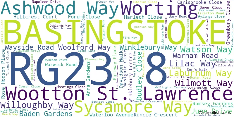
The largest settlements in the RG23 8 postal code are BASINGSTOKE and Wootton St. Lawrence.
The RG23 8 Postcode shares a border with RG21 6 (BASINGSTOKE), RG22 6 (BASINGSTOKE), RG22 5 (BASINGSTOKE), RG23 7 (Oakley, BASINGSTOKE, Dummer), RG24 9 (BASINGSTOKE, Sherborne St. John) and RG26 5 (Bramley, Baughurst, Little London).
The sector is within the post town of BASINGSTOKE.
RG23 8 is a postcode sector within the RG21 postcode district which is within the RG Reading postcode area.
The Royal Mail delivery office for the RG23 8 postal sector is the Basingstoke Delivery Office.
The area of the RG23 8 postcode sector is 3.74 square miles which is 9.70 square kilometres or 2,396.30 square acres.

Map of the RG23 8 Postcode Sector
Explore the RG23 8 postcode sector by using our free interactive map.
| R | G | 2 | 3 | - | 8 | X | X |
| R | G | 2 | 3 | Space | 8 | Letter | Letter |
Official List of Streets
BASINGSTOKE (72 Streets)
Wootton St. Lawrence (6 Streets)
Worting (2 Streets)
Unofficial Streets or Alternative Spellings
BASINGSTOKE
BRUNEL ROAD PENDENNIS COURT ROOKSDOWN AVENUE ASHWOOD WAY ROUNDABOUT CAERNAVON CLOSE COPPICE MEWS EAST VIEW FORT HILL HADRIANS WAY HAMPTON COURT HASTING CLOSE HAZELWOOD DRIVE HILLCREST WALK RINGWAY NORTH ROUNDABOUT RINGWAY WEST ROMAN WAY SHOTHANGER LANE THE CHESTNUTS THE CLOSE THE PINES WILMOT WAY WINKLEBURY GREENWAY WOODGARSTON LANE WOOTTON ONE MILE WORTING HOUSE WORTING PARKRamsdell
KINGSCLERE ROADHannington
IBWORTH LANE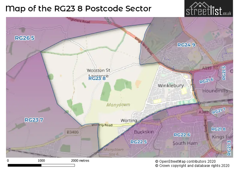
House Prices in the RG23 8 Postcode Sector
| Type of Property | 2018 Average | 2018 Sales | 2017 Average | 2017 Sales | 2016 Average | 2016 Sales | 2015 Average | 2015 Sales |
|---|---|---|---|---|---|---|---|---|
| Detached | £473,561 | 31 | £449,134 | 22 | £438,857 | 14 | £346,881 | 21 |
| Semi-Detached | £320,033 | 33 | £320,944 | 18 | £307,024 | 21 | £285,853 | 17 |
| Terraced | £258,180 | 38 | £261,535 | 54 | £241,918 | 60 | £206,902 | 49 |
| Flats | £172,250 | 1 | £180,000 | 2 | £162,000 | 2 | £133,500 | 4 |
Important Postcodes RG23 8 in the Postcode Sector
RG23 8AA is the postcode for Ashwood Education Centre, Ashwood Way
RG23 8AF is the postcode for Winklebury Junior School, Willoughby Way, WINKLEBURY COUNTY JUNIOR SCHOOL, WILLOUGHBY WAY, BASINGSTOKE, and Winklebury Infant School, Willoughby Way
RG23 8BN is the postcode for Castle Hill Junior School, Winklebury Way, and Castle Hill Infant School, Winklebury Way
RG23 8JQ is the postcode for TEACHING BLOCK, Fort Hill Community School, Kenilworth Road, MAIN BUILDING, Fort Hill Community School, Kenilworth Road, Fort Hill Community School, Kenilworth Road, BEVISBURY BLOCK, Fort Hill Community School, Kenilworth Road, and DANEBURY BLOCK, Fort Hill Community School, Kenilworth Road
| The RG23 8 Sector is within these Local Authorities |
|
|---|---|
| The RG23 8 Sector is within these Counties |
|
| The RG23 8 Sector is within these Water Company Areas |
|