Map of Totters Lane
| Postcodes | ||
|---|---|---|
| Icon | Postcodes for Totters Lane | |
| Walking Distances | ||
| Distance Info | Green Circle = 10 Minutes Walk (800 metres) | |
About Totters Lane
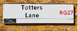
Totters Lane is a street located near the village of Phoenix Green. It uses the postcode RG27 8HX. The street has a length of approximately 1,812 metres.
Totters Lane is located within the Hart District Council's jurisdiction. They provide various services, like refuse collection, and manage council tax collection. It's situated in the South East region of the UK.
Totters Lane has been assigned the Unique Street Reference Number of 16708663 in the National Street Gazetteer.
Totters Lane is located within the county of Hampshire, situated in the South East region of the UK. It's 38.54 miles South West from central London., 6.63 miles East from Basingstoke, 11.97 miles South from Reading and 15.89 miles West from Guildford.

Do you know why this road is called Totters Lane?
What's it like to live here?
Ask the community a question about Totters Lane.
Do you have any questions, memories to share or know any facts about Totters Lane? We'd love to know more.
Also on streetlist.co.uk, can you help?
Swing Swang Lane
28th April 2024
I am trying to find out why the lane is named Swing Swang?
It has been known known this since at least 1905 when hedge making contents used to be held here.
Swing Swang is often used to describe a fairground ride. I remember Swing Boats. Were they a bit like this or is Swing Swang another name for swings?
Swing Swangs are also mentioned in connection to orchards. Or were orchards just good places to have swings?
Estate Agents near Totters Lane
| Name | Address | Website |
|---|---|---|
| Hook Homes.com | Phillips House, Station Road, Hook, RG27 9HD | Visit Website |
| Mackenzie Smith | 1 Aldridge House, Elms Road, Hook RG27 9DG | Visit Website |
| Bridges Estate Agents | 3 Fairholme Parade Station Road Hook RG27 9HE | Visit Website |
We have found 1 postcode for Totters Lane
Location Details
| Totters Lane | |
|---|---|

| |
| Latitude | 51.284001 |
| Longitude | -0.929678 |
| OS Easting (X): | 474636 |
| OS Northing (Y): | 154474 |
| OS Grid Reference: | SU746545 |
Neighbourhood Policing |
| Police Force: Hampshire |
 View Neighbourhood Crime and Policing View Neighbourhood Crime and Policing |
| Find a Local Neighbourhood Watch Scheme |
Frequently asked Questions for Totters Lane
What Council (Local Authority) is Totters Lane in?
Totters Lane is located within the local authority area of Hart Council which is a District Council.
What Parish Council is Totters Lane in?
Totters Lane is located within the area of Hook Parish Council.
What Electoral Ward is Totters Lane in?
Totters Lane is located within the ward of Hook.
What County is Totters Lane in?
Totters Lane is located within the ceremonial county of Hampshire.
What Constituency is Totters Lane in?
Totters Lane is located within the constituency of North East Hampshire.
What Part of the UK is Totters Lane in?
Totters Lane is located within the South East (England) region of the United Kingdom.
What County Council area is Totters Lane in?
Totters Lane is located within the Hampshire Council area.
What Police Force area is Totters Lane in?
Totters Lane is located within the Hampshire Police area.
Roads that have a Junction with Totters Lane
| Street | Junction Type |
|---|---|
| Potbridge Road | junction |
| London Road (A30) | junction |
Sunset and Sunrise times for Totters Lane , RG27 8HX
| Sunrise | 05:09 |
|---|---|
| Sunset | 20:50 |
Latest Weather Conditions for Totters Lane, RG27 8HX
| Observed at Weather Station: | Odiham 15 May 2024 at 01:00 (3.24 miles away) |
|---|---|
| Current Weather: | Overcast |
| Temperature and Humidity: | 12.8°C (94.2%) |
| Wind Direction and Speed: | E (6 mph) |
Population Statistics
| ONS Area Code | E00116282 |
|---|---|
| ONS Area Name | Established Farming Communities |
| Average Age | 38.39 |
| Area Population | 2365.00 |
| Male Population | 1180.00 (50%) |
| Female Population | 1185.00 (50%) |
| Benefit Claimants | 8 (0%) |
| LSOA Code: | E01022881 |
|---|---|
| LSOA Name: | Hart 006A |
| SOA Code: | 3a |
| SOA Name: | |
| MSOA Code: | E02004756 |
| MSOA Name: | Hart 006 |
Nearest Supermarkets
| Tesco Hook Superstore |
|---|
| Station Rd, Hook, RG27 9JE |
| 0345 677 9352 |
| Distance: 1.36 Miles |
| Directions from Totters Lane to Tesco Hook Superstore |
| Morrisons Fleet |
|---|
| Elvetham Heath, Fleet GU51 1GY |
| 01252 786050 |
| Distance: 3.17 Miles |
| Directions from Totters Lane to Morrisons Fleet |
| Waitrose At Fleet South Services |
|---|
| M3 Motorway, Junction 4a/5, Fleet, Hampshire, GU51 1AA |
| 01252 621656 |
| Distance: 3.25 Miles |
| Directions from Totters Lane to Waitrose At Fleet South Services |
| Waitrose At Fleet North Services |
|---|
| M3 Motorway, Junction 4a/5, Fleet, Hampshire, GU51 1AA |
| 0800 188 884 |
| Distance: 3.3 Miles |
| Directions from Totters Lane to Waitrose At Fleet North Services |
Telephone Information
| Dialling Code | Telephone Exchange | Telephone Cabinet | Fibre to the Cabinet or Fibre to the Premises |
|---|---|---|---|
| 01256 | HOOK - THH | P5 | FTTC |
Broadband Information
| Speed | Average Speed | Median Speed | Maximum Speed | Next-generation access (NGA) | Number of Connections |
|---|---|---|---|---|---|
| Greater than 2 Mbps | 5.5 | 5.7 | 8.1 | Y | 6 |
Local Government
| Local Council Details |
|---|
| Within the area of Hart |
| Visit the Council's Website |
| Civic Offices, Harlington Way, Fleet, Hants &GU51 4AE |
| Send email |
| Telephone Number: 01252 622122 |
| Local Member of Parliament |
|---|
| Within the Westminster Parliamentary Constituency of North East Hampshire |
| The Member of Parliament is Ranil Jayawardena |
| Details for the MP Ranil Jayawardena on parliament.uk |
| Details for the MP Ranil Jayawardena on theyworkforyou.com |
| In the 2019 General Election Ranil Jayawardena won with a majority of 20,211 the result was Con hold. The total electorate was 78,954 |
| Wards, Parish Councils and County Councils |
|---|
| Ward: Hook Ward |
| Ceremonial County: Hampshire |
Nearest Schools
England Primary Schools
Greenfields Junior School
Address: Greenfields Junior School, Green Lane, Hartley Wintney, Hook, Hampshire, RG27 8DQ
Distance: 1.67 miles
Contact: 01252843822
Oakwood Infant School
Address: Oakwood Infant School, Church Lane, Hartley Wintney, Hook, Hampshire, RG27 8DY
Distance: 1.69 miles
Contact: 01252842663
Buryfields Infant School
Address: Buryfields Infant School, Buryfields, Odiham, Hook, Hampshire, RG29 1NE
Distance: 2.27 miles
Contact: 01256702667
Mayhill Junior School
Address: Mayhill Junior School, The Bury, Odiham, Hook, Hampshire, RG29 1NB
Distance: 2.19 miles
Contact: 01256702973
Hook Junior School
Address: Hook Junior School, Ravenscroft, Hook, Hampshire, RG27 9NN
Distance: 1.07 miles
Contact: 01256762468
Hook Infant School
Address: Hook Infant School, Church View, Hook, Hampshire, RG27 9NR
Distance: 1.25 miles
Contact: 01256764487
Nearest Hospitals
| Name | Address | Postcode | Distance | Map |
|---|
Nearest Dentists
Dentists near Totters Lane
| Name | Address | Postcode | Distance | Map |
|---|
Nearest GP Surgeries
Doctors near Totters Lane
HOOK SURGERY
Address: READING ROAD, HOOK, HAMPSHIRE, RG27 9ED
Distance: 1.45 miles
Contact: :
WHITEWATER HEALTH
Address: THE SURGERY, 1 CHAPTER TERRACE, HARTLEY WINTNEY, HOOK, HAMPSHIRE, RG27 8QJ
Distance: 1.97 miles
Contact: tel: 01252 842087
ODIHAM HEALTH CENTRE
Address: DEER PARK VIEW, ODIHAM, HOOK, HAMPSHIRE, RG29 1JY
Distance: 2.09 miles
Contact: tel: 01256 702371
HART HEALTH PARTNERSHIP
Address: CHURCH ROAD, FLEET, HAMPSHIRE, GU51 4PE
Distance: 3.52 miles
Contact: tel: 01252 619000
BRANKSOMEWOOD H/CARE CTR
Address: BRANKSOMEWOOD ROAD, FLEET, HAMPSHIRE, GU51 4JX
Distance: 3.67 miles
Contact: tel: 01252 613624
RICHMOND SURGERY
Address: RICHMOND CLOSE, FLEET, HAMPSHIRE, GU52 7US
Distance: 3.96 miles
Contact: tel: 01252 811466
Nearest Dispensing Chemists
Pharmacies near Totters Lane
| Name | Address | Postcode | Telephone | Map | Distance in Km |
|---|
Nearest Opticians
Opticians near Totters Lane
BROWN AND WHITE OPTICIANS LTD (HOOK)
Address: BOURNE HOUSE, LONDON ROAD, HOOK, HAMPSHIRE, RG27 9DJ
Distance: 1.45 miles
Contact: :
RICHARD WARD EYECARE (HARTLEY MEWS)
Address: THE OLD BAKEHOUSE, HARTLEY MEWS, HARTLEY WINTNEY, HOOK, HAMPSHIRE, RG27 8NX
Distance: 2.10 miles
Contact: :
BROWN AND WHITE OPTICIANS LTD (FLEET)
Address: 341 FLEET ROAD, FLEET, HAMPSHIRE, GU51 3NT
Distance: 3.68 miles
Contact: :
BAYFIELDS Z LTD - FLEET
Address: 202 FLEET ROAD, FLEET, HAMPSHIRE, GU51 4BY
Distance: 3.71 miles
Contact: :
SPECSAVERS (FLEET)
Address: 231 FLEET ROAD, FLEET, HAMPSHIRE, GU51 3BN
Distance: 3.78 miles
Contact: :
LEIGHTONS OPTICIANS (FLEET)
Address: 160B FLEET ROAD, FLEET, HAMPSHIRE, GU51 4BE
Distance: 3.80 miles
Contact: :
Transport
Nearest Rail Stations
Winchfield Station is 0.98 miles away.
Address: Winchfield station, Station Road, Winchfield, Hampshire, RG27 8BX
Winchfield is situated on the South Western Main Line and is managed by South Western Railway.
Winchfield Station is staffed on a part time basis.
Hook Station is 1.41 miles away.
Address: Hook station, Station Approach / Road, Hook, Hampshire, RG27 9HS
Hook is situated on the South Western Main Line and is managed by South Western Railway.
Hook Station is staffed on a part time basis.