Map of Spring Lane
| Postcodes | ||
|---|---|---|
| Icon | Postcodes for Spring Lane | |
| Walking Distances | ||
| Distance Info | Green Circle = 10 Minutes Walk (800 metres) | |
About Spring Lane
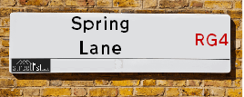
Spring Lane is a street located near the town of Reading. It uses the postcode RG4 6TZ. The street has a length of approximately 670 metres.
Spring Lane is located within the South Oxfordshire District Council's jurisdiction. They provide various services, like refuse collection, and manage council tax collection. It's situated in the South East region of the UK.
Spring Lane has been assigned the Unique Street Reference Number of 36201451 in the National Street Gazetteer.
Spring Lane is located within the county of Oxfordshire, situated in the South East region of the UK. It's 35.25 miles West from central London., 2.78 miles North East from Reading, 16.31 miles North East from Basingstoke and 19.46 miles North West from Woking.

Do you know why this road is called Spring Lane?
What's it like to live here?
Ask the community a question about Spring Lane.
Do you have any questions, memories to share or know any facts about Spring Lane? We'd love to know more.
Also on streetlist.co.uk, can you help?
Eldroth Road
15th April 2024
I wondered if anyone has any old pictures of Wenning Bank House in the 1940’s and also Lane Side before of the same era .. we visited today with my Mum in law as she used to live at both these properties. Also any photos of the schools around that time .. thank you.
Can You Help?Napps Way
15th April 2024
Why is the road called Napps Way (belonging to Napp, but minus an
apostrophe as is usual with such nomenclature)? Moreover, who or
what is, or was, “Napp” in the respective, possessive case?
Several years ago, I met an elderly man (probably in his late-eighties)
who lives on Bentham Drive, Liverpool 16, and during a conversation
with him whilst in a Northwest Passenger Transport Ambulance on the
way to the former RLUH (Royal Liverpool University Hospital), he told
me that he could remember (when he was a boy, living in Childwall,
Liverpool 16) that, “Where Napps Way is now, during WW2, there was
a two-man gun emplacement on the, then, open land to protect the
railway line passing over Childwall Valley Road - next to the railway
bridge - when suddenly, as they were loading a live “shell” into the gun’s
breach, the aforementioned “shell” accidentally exploded in the gun’s
breach killing both of the two soldiers, that had been manning the gun,
instantly! (Very sad, of course, but could - perhaps - two ghosts relating
to those two, very unfortunately and prematurely-killed soldiers have
haunted that place of their deaths ever since - and have any residents
of Napps Way - formerly and in its latest incarnation - seen two, WW2
(uniformed) soldiers unexpectedly appear in or near their homes?)
Mauritius Road
15th April 2024
Why is Mauritius Road so called, since when and by whom? Does Greenwich have any particular links with Mauritius? Very interested to know. 🤞🏼
Can You Help?Estate Agents near Spring Lane
| Name | Address | Website |
|---|---|---|
| Ewemove Reading East | 400 Thames Valley Park Drive, Thames Valley Park, Reading,RG6 1PT | |
| Fox-Beckett Independent Estate Agents | Kildare Gardens, Caversham, Reading, RG4 5JA | |
| Chaneys Chartered Surveyors | Chiltern House, Marsack Street, Caversham, Reading, Berkshire, RG4 5AP | Visit Website |
We have found 1 postcode for Spring Lane
Location Details
| Spring Lane | |
|---|---|

| |
| Latitude | 51.482458 |
| Longitude | -0.924366 |
| OS Easting (X): | 474683 |
| OS Northing (Y): | 176547 |
| OS Grid Reference: | SU747765 |
Ordnance Survey Maps for Spring Lane
If you purchase a map through the links below, we may earn an affiliate commission.
| Map Series | link | Ordnance Survey |
| Explorer 1:25,000 159 Reading, Wokingham and Pangbourne | Check Price on Amazon | Buy Direct from the Ordnance Survey |
| Landranger 1:50,000 175 Reading & Windsor | Check Price on Amazon | Buy Direct from the Ordnance Survey |
Neighbourhood Policing |
| Police Force: Thames Valley |
 View Neighbourhood Crime and Policing View Neighbourhood Crime and Policing |
| Find a Local Neighbourhood Watch Scheme |
Frequently asked Questions for Spring Lane
What Council (Local Authority) is Spring Lane in?
Spring Lane is located within the local authority area of South Oxfordshire Council which is a District Council.
What Parish Council is Spring Lane in?
Spring Lane is in an unparished area.
What Electoral Ward is Spring Lane in?
Spring Lane is located within the ward of Sonning Common.
What County is Spring Lane in?
Spring Lane is located within the ceremonial county of Oxfordshire.
What Constituency is Spring Lane in?
Spring Lane is located within the constituency of Henley.
What Part of the UK is Spring Lane in?
Spring Lane is located within the South East (England) region of the United Kingdom.
What County Council area is Spring Lane in?
Spring Lane is located within the Oxfordshire Council area.
What Police Force area is Spring Lane in?
Spring Lane is located within the Thames Valley Police area.
Roads that have a Junction with Spring Lane
| Street | Junction Type |
|---|---|
| Henley Road (A4155) | junction |
| Playhatch Road (B478) | junction |
Sunset and Sunrise times for Spring Lane , RG4 6TZ
| Sunrise | 05:42 |
|---|---|
| Sunset | 20:20 |
Latest Weather Conditions for Spring Lane, RG4 6TZ
| Observed at Weather Station: | Benson 26 April 2024 at 08:00 (12.06 miles away) |
|---|---|
| Current Weather: | Overcast |
| Temperature and Humidity: | 6.4°C (85.8%) |
| Wind Direction and Speed: | NNE (6 mph) |
Population Statistics
| ONS Area Code | E00145978 |
|---|---|
| ONS Area Name | Communal Retirement |
| Average Age | 42.32 |
| Area Population | 1760.00 |
| Male Population | 879.00 (50%) |
| Female Population | 881.00 (50%) |
| Benefit Claimants | 5 (0%) |
| LSOA Code: | E01028660 |
|---|---|
| LSOA Name: | South Oxfordshire 019B |
| SOA Code: | 2b |
| SOA Name: | |
| MSOA Code: | E02005976 |
| MSOA Name: | South Oxfordshire 019 |
Nearest Supermarkets
| Tesco Emmer Green Esso Express |
|---|
| Buckingham Dr, Emmer Green, Reading, RG4 8RZ |
| 0345 674 6504 |
| Distance: 1.78 Miles |
| Directions from Spring Lane to Tesco Emmer Green Esso Express |
| Tesco Reading Extra |
|---|
| Napier Rd, Reading, RG1 8DF |
| 0345 677 9573 |
| Distance: 2.06 Miles |
| Directions from Spring Lane to Tesco Reading Extra |
| Iceland Woodley |
|---|
| 81 Crockhamwell Road, Woodley, Reading Berkshire, RG5 3JP |
| 01189690042 |
| Distance: 2.2 Miles |
| Directions from Spring Lane to Iceland Woodley |
| Waitrose Woodley |
|---|
| 108 Crockhamwell Road, Woodley, Reading, Berkshire, RG5 3JW |
| 0118 9690438 |
| Distance: 2.27 Miles |
| Directions from Spring Lane to Waitrose Woodley |
Telephone Information
| Dialling Code | Telephone Exchange | Telephone Cabinet | Fibre to the Cabinet or Fibre to the Premises |
|---|---|---|---|
| 0118 | WOODLEY; BERKSHIRE - THWDY | P7 | FTTC |
Local Government
| Local Council Details |
|---|
| Within the area of South Oxfordshire |
| Visit the Council's Website |
| Benson Lane, Crowmarsh Gifford, Wallingford, Oxfordshire &OX10 8ED |
| Send email |
| Telephone Number: 01491 823 000 |
| Local Member of Parliament |
|---|
| Within the Westminster Parliamentary Constituency of Henley |
| The Member of Parliament is John Howell |
| Details for the MP John Howell on parliament.uk |
| Details for the MP John Howell on theyworkforyou.com |
| In the 2019 General Election John Howell won with a majority of 14,053 the result was Con hold. The total electorate was 76,646 |
| Wards, Parish Councils and County Councils |
|---|
| Ward: Sonning Common Ward |
| Ceremonial County: Oxfordshire |
Nearest Schools
England Primary Schools
Sonning Church of England Primary School
Address: Sonning Church of England Primary School, Liguge Way, Sonning, Reading, Berkshire, RG4 6XF
Distance: 1.17 miles
Contact:
Shiplake Church of England School
Address: Shiplake Church of England School, Memorial Avenue, Shiplake, Henley-on-Thames, Oxfordshire, RG9 4DN
Distance: 1.54 miles
Contact: 01189402024
St Martin's Catholic Primary School
Address: St Martin's Catholic Primary School, Pendennis Avenue, Caversham Park Village, Reading, Berkshire, RG4 6SS
Distance: 1.04 miles
Contact: 01189375544
Micklands Primary School
Address: Micklands Primary School, Micklands Road, Caversham, Reading, Berkshire, RG4 6LU
Distance: 1.26 miles
Contact: 01189375500
Caversham Park Primary School
Address: Caversham Park Primary School, Queensway, Caversham Park Village, Reading, Berkshire, RG4 6RP
Distance: 1.14 miles
Contact: 01189375433
St Anne's Catholic Primary School
Address: St Anne's Catholic Primary School, Washington Road, Caversham, St Anne's School, Reading, Berkshire, RG4 5AA
Distance: 2.07 miles
Contact: 01189375537
The Hill Primary School
Address: The Hill Primary School, Peppard Road, Emmer Green, Reading, Berkshire, RG4 8TU
Distance: 1.63 miles
Contact: 01189375560
Nearest Hospitals
| Name | Address | Postcode | Distance | Map |
|---|
Nearest Dentists
Dentists near Spring Lane
| Name | Address | Postcode | Distance | Map |
|---|
Nearest GP Surgeries
Doctors near Spring Lane
EMMER GREEN SURGERY
Address: 4 ST. BARNABAS ROAD, EMMER GREEN, READING, BERKSHIRE, RG4 8RA
Distance: 2.09 miles
Contact: tel: 0118 9486900
EMMER GREEN SURGERY - COVID LOCAL VACCINATION SERVICE
Address: 4 ST. BARNABAS ROAD, EMMER GREEN, READING, RG4 8RA
Distance: 2.09 miles
Contact: :
WOODLEY PRACTICE
Address: WOODLEY CENTRE SURGERY, 6 HEADLEY ROAD, WOODLEY, READING, BERKSHIRE, RG5 4JA
Distance: 2.19 miles
Contact: tel: 0118 9697307
WOODLEY CENTRE SURGERY - COVID LOCAL VACCINATION SERVICE 2
Address: WOODLEY CENTRE SURGERY, 6 HEADLEY ROAD, WOODLEY, READING, RG5 4JA
Distance: 2.19 miles
Contact: :
BALMORE PARK SURGERY
Address: 59A HEMDEAN ROAD, CAVERSHAM, READING, BERKSHIRE, RG4 7SS
Distance: 2.25 miles
Contact: tel: 0118 9471455
LODDON VALE PRACTICE
Address: HURRICANE WAY, WOODLEY, READING, BERKSHIRE, RG5 4UX
Distance: 2.47 miles
Contact: tel: 0118 9690160
Nearest Dispensing Chemists
Pharmacies near Spring Lane
| Name | Address | Postcode | Telephone | Map | Distance in Km |
|---|
Nearest Opticians
Opticians near Spring Lane
READING EXTRA
Address: NAPIER ROAD, READING, BERKSHIRE, RG1 8DF
Distance: 2.06 miles
Contact: :
LEIGHTONS OPTICIANS (WOODLEY)
Address: 124 CROCKHAMWELL ROAD, WOODLEY, READING, BERKSHIRE, RG5 3JP
Distance: 2.21 miles
Contact: :
SPECSAVERS (WOODLEY, READING)
Address: 176 CROCKHAMWELL ROAD, WOODLEY, READING, BERKSHIRE, RG5 3JH
Distance: 2.21 miles
Contact: :
ROBIN JAMES OPTICIANS
Address: 44 CHURCH STREET, CAVERSHAM, READING, BERKSHIRE, RG4 8AU
Distance: 2.37 miles
Contact: :
VISION EXPRESS (TWYFORD)
Address: 7 CHURCH STREET, TWYFORD, READING, BERKSHIRE, RG10 9DN
Distance: 2.54 miles
Contact: :
OPTICAL EXPRESS [READING]
Address: LOWER GROUND LEVEL, HAVELL HOUSE, 62-66 QUEEN ROAD, READING, BERKSHIRE, RG1 4AZ
Distance: 2.66 miles
Contact: :
Transport
Nearest Rail Stations
Wargrave Station is 2.33 miles away.
Address: Wargrave station, Station Road, Wargrave, Berkshire, RG10 8EU
Wargrave is situated on the Henley Branch Line and is managed by Great Western Railway.
Wargrave Station is an unstaffed station.
Reading Station is 2.62 miles away.
Address: Reading station, Station Hill, Reading, Berkshire, RG1 1LZ
Reading is situated on the Reading to Basingstoke Line|North Downs Line|Reading to Taunton Line|Waterloo to Reading Line (Windsor Lines)|Great Western Main Line.
Reading Station is staffed on a full time basis.