The WD3 4 postcode sector is within the county of Hertfordshire.
Did you know? According to the 2021 Census, the WD3 4 postcode sector is home to a bustling 4,338 residents!
Given that each sector allows for 400 unique postcode combinations. Letters C, I, K, M, O and V are not allowed in the last two letters of a postcode. With 164 postcodes already in use, this leaves 236 units available.
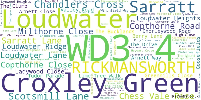
The largest settlement in the WD3 4 postal code is RICKMANSWORTH followed by LOUDWATER , and CROXLEY GREEN .
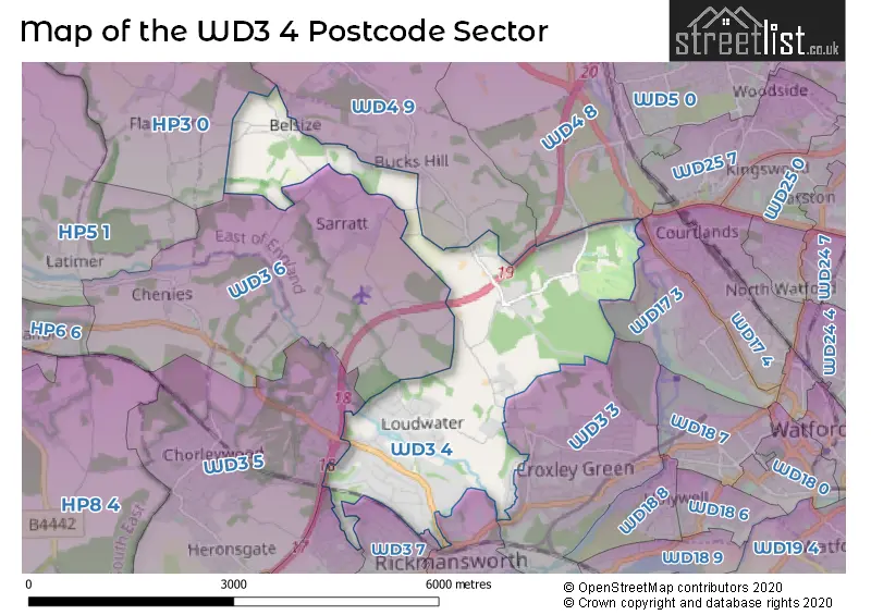
The WD3 4 Postcode shares a border with WD17 3 (WATFORD ), WD3 3 (CROXLEY GREEN ), WD3 5 (CHORLEYWOOD , HERONSGATE ), WD3 6 (SARRATT , CHENIES , CROXLEY GREEN ), WD3 7 (RICKMANSWORTH , MILL END ), WD3 8 (MILL END , RICKMANSWORTH , HAREFIELD ), WD4 9 (CHIPPERFIELD , KINGS LANGLEY , SARRATT ), HP3 0 (BOVINGDON, HEMEL HEMPSTEAD, Felden), WD3 1 (RICKMANSWORTH , MOOR PARK ), WD4 8 (KINGS LANGLEY , HUNTON BRIDGE , ABBOTS LANGLEY ) and WD17 4 (WATFORD ).
The sector is within the post town of RICKMANSWORTH.
WD3 4 is a postcode sector within the WD3 postcode district which is within the WD Watford postcode area.
The Royal Mail delivery office for the WD3 4 postal sector is the Rickmansworth Delivery Office.
The area of the WD3 4 postcode sector is 4.76 square miles which is 12.32 square kilometres or 3,043.68 square acres.
The WD3 4 postcode sector is crossed by the M25 motorway.
Waterways within the WD3 4 postcode sector include the River Chess, Grand Union Canal.

Map of the WD3 4 Postcode Sector
Explore the WD3 4 postcode sector by using our free interactive map.
| W | D | 3 | - | 4 | X | X |
| W | D | 3 | Space | 4 | Letter | Letter |
Official List of Streets
Loudwater (25 Streets)
RICKMANSWORTH (28 Streets)
Sarratt (8 Streets)
Chandlers Cross (9 Streets)
Unofficial Streets or Alternative Spellings
KINGS LANGLEY,
HEMPSTEAD ROAD CLARENDEN FIELDS DEADMANS ASH LANE FINCHES GRAND UNION CANAL GROVE HILL HUNTON CROSS SPUR MUSICAL TRAIL PENMANS HILL THE QUEENS DRIVE YORK HOUSE SCHOOLWATFORD
GROVE MILL LANEKINGS LANGLEY
LANGLEYBURY LANE QUICKMOOR LANECroxley Green
LOUDWATER LANE SCOTS HILLRICKMANSWORTH
HIGHFIELD WAY NIGHTINGALE ROAD PARK ROAD RECTORY ROADChorleywood
BERRY LANE PARK AVENUE RICKMANSWORTH ROAD SARRATT LANEMill End
CHILTERN DRIVE COOMBE HILL ROAD OAKFIELDSarratt
BOTTOM LANE MOOR LANE RED LION LANEChipperfield
DUNNY LANESchools and Places of Education Within the WD3 4 Postcode Sector
Arnett Hills Junior Mixed and Infant School
Community school
Berry Lane, Rickmansworth, Hertfordshire, WD3 4BT
Head: Mrs Holly Butcher
Ofsted Rating: Good
Inspection: 2020-01-09 (1584 days ago)
Website: Visit Arnett Hills Junior Mixed and Infant School Website
Phone: 01923720507
Number of Pupils: 207
House Prices in the WD3 4 Postcode Sector
| Type of Property | 2018 Average | 2018 Sales | 2017 Average | 2017 Sales | 2016 Average | 2016 Sales | 2015 Average | 2015 Sales |
|---|---|---|---|---|---|---|---|---|
| Detached | £1,350,567 | 41 | £1,525,514 | 35 | £1,167,623 | 35 | £1,194,857 | 49 |
| Semi-Detached | £0 | 0 | £666,000 | 2 | £567,000 | 4 | £757,500 | 2 |
| Terraced | £0 | 0 | £781,000 | 1 | £471,000 | 2 | £0 | 0 |
| Flats | £416,667 | 3 | £603,500 | 20 | £476,000 | 10 | £409,000 | 3 |
Important Postcodes WD3 4 in the Postcode Sector
WD3 4BT is the postcode for Arnett Hills JMI School, Berry Lane
| The WD3 4 Sector is within these Local Authorities |
|
|---|---|
| The WD3 4 Sector is within these Counties |
|
| The WD3 4 Sector is within these Water Company Areas |
|