Given that each sector allows for 400 unique postcode combinations. Letters C, I, K, M, O and V are not allowed in the last two letters of a postcode. With 175 postcodes already in use, this leaves 225 units available.
The largest settlement in the AB21 7 postal code is Dyce followed by Newmachar, and Wellheads Industrial Estate.
The AB21 7 Postcode shares a border with AB23 8 (Bridge Of Don, Balmedie, Potterton), AB21 0 (Newmachar, Blackburn, Dyce), AB21 9 (Bucksburn, Stoneywood, ABERDEEN) and AB22 8 (Bridge Of Don, Danestone).
The sector is within the post town of ABERDEEN.
AB21 7 is a postcode sector within the AB21 postcode district which is within the AB Aberdeen postcode area.
The Royal Mail delivery office for the AB21 7 postal sector is the Dyce Delivery Office.
The area of the AB21 7 postcode sector is 8.78 square miles which is 22.74 square kilometres or 5,618.47 square acres.


Map of the AB21 7 Postcode Sector
Explore the AB21 7 postcode sector by using our free interactive map.
| A | B | 2 | 1 | - | 7 | X | X |
| A | B | 2 | 1 | Space | 7 | Letter | Letter |
Official List of Streets
Dyce (110 Streets)
Newmachar (1 Streets)
Unofficial Streets or Alternative Spellings
Dyce
BRENT ROAD BURNSIDE DRIVE DYCE DRIVE LAWSON DRIVE PITMEDDEN ROADStoneywood
AUCHRINY CIRCLE CEDAR AVENUE POLO PARK STONEYWOOD ROAD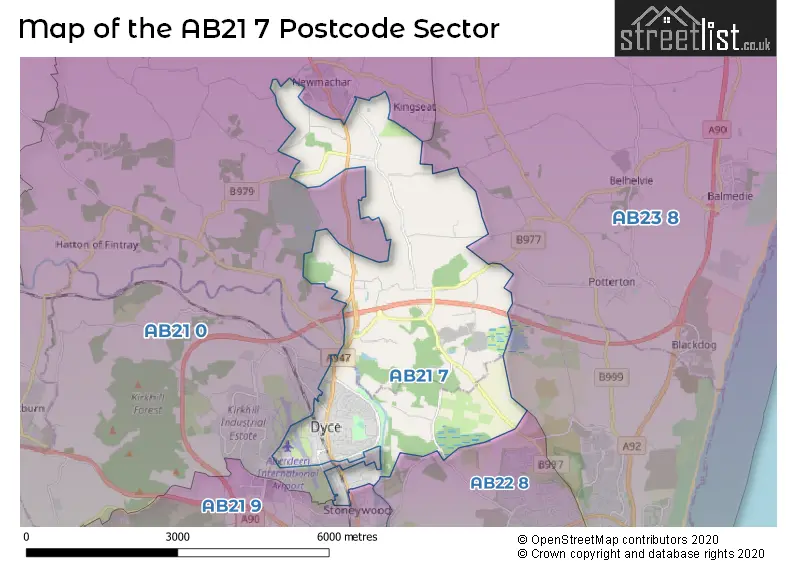
| The AB21 7 Sector is within these Local Authorities | |
|---|---|
| The AB21 7 Sector is within these Counties | |
| The AB21 7 Sector is within these Water Company Areas |