The AB21 postcode district is a postal district located in the AB Aberdeen postcode area with a population of 22,332 residents according to the 2011 Scotland Census.
The area of the AB21 postcode district is 50.62 square miles which is 131.10 square kilometres or 32,396.23 acres.
Currently, the AB21 district has about 776 postcode units spread across 3 geographic postcode sectors.
Given that each sector allows for 400 unique postcode combinations, the district has a capacity of 1,200 postcodes. With 776 postcodes already in use, this leaves 424 units available.
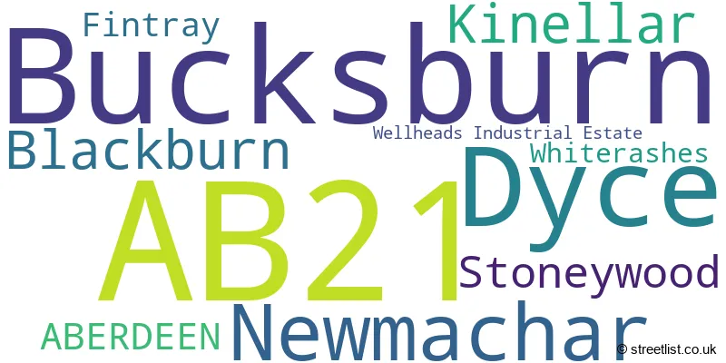
The largest settlement in the AB21 postal code is Bucksburn followed by Dyce, and Newmachar.
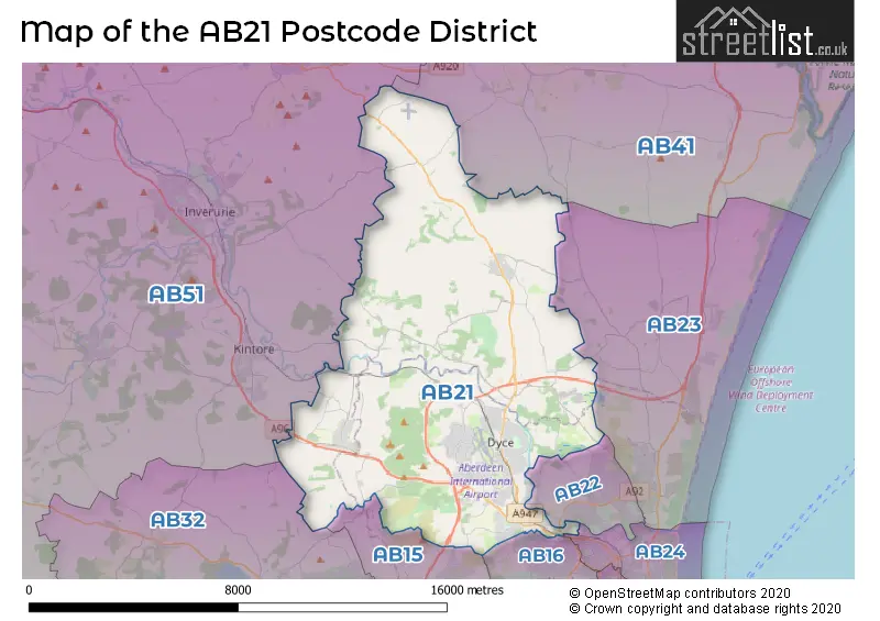
The AB21 Postcode shares a border with AB15 (ABERDEEN, Cults, Kingswells), AB23 (Bridge Of Don, Balmedie, Potterton), AB24 (ABERDEEN, Old Aberdeen, Woodside), AB41 (ELLON, Newburgh, Tarves), AB16 (ABERDEEN), AB22 (Bridge Of Don, Danestone, Grandhome), AB32 (WESTHILL, Elrick, Skene) and AB51 (INVERURIE, Kintore, Oldmeldrum).
In the AB21 postcode district, the primary settlement is Newmachar, located in the county of Aberdeenshire, Scotland. Other significant settlements include Dyce, Kinellar, and Bucksburn, all within the city of Aberdeen. The main post town for this district is Aberdeen.
For the district AB21, we have data on 4 postcode sectors. Here's a breakdown: The sector AB21 0, covers Newmachar and Blackburn and Kinellar in Aberdeenshire. The sector AB21 0, covers Dyce in City of Aberdeen. The sector AB21 1 is non-geographic. It's often designated for PO Boxes, large organisations, or special services. The sector AB21 7, covers Dyce in City of Aberdeen. The sector AB21 9, covers Bucksburn and Stoneywood in City of Aberdeen.

Map of the AB21 Postcode District
Explore the AB21 postcode district by using our free interactive map.
When it comes to local government, postal geography often disregards political borders. However, for a breakdown in the AB21 District: the district mostly encompasses the Aberdeen City (545 postcodes), and finally, the Aberdeenshire area (262 postcodes).
Weather Forecast for AB21
Press Button to Show Forecast for Aberdeen Airport
| Time Period | Icon | Description | Temperature | Rain Probability | Wind |
|---|---|---|---|---|---|
| 12:00 to 15:00 | Cloudy | 8.0°C (feels like 6.0°C) | 5.00% | SE 11 mph | |
| 15:00 to 18:00 | Sunny day | 8.0°C (feels like 6.0°C) | 1.00% | SE 11 mph | |
| 18:00 to 21:00 | Sunny day | 7.0°C (feels like 4.0°C) | 1.00% | SE 9 mph | |
| 21:00 to 00:00 | Clear night | 4.0°C (feels like 1.0°C) | 1.00% | SSE 4 mph |
Press Button to Show Forecast for Aberdeen Airport
| Time Period | Icon | Description | Temperature | Rain Probability | Wind |
|---|---|---|---|---|---|
| 00:00 to 03:00 | Cloudy | 3.0°C (feels like 1.0°C) | 5.00% | S 4 mph | |
| 03:00 to 06:00 | Partly cloudy (night) | 2.0°C (feels like 1.0°C) | 6.00% | NNE 4 mph | |
| 06:00 to 09:00 | Cloudy | 5.0°C (feels like 3.0°C) | 5.00% | NE 4 mph | |
| 09:00 to 12:00 | Cloudy | 8.0°C (feels like 5.0°C) | 9.00% | NE 9 mph | |
| 12:00 to 15:00 | Cloudy | 9.0°C (feels like 6.0°C) | 9.00% | NNE 9 mph | |
| 15:00 to 18:00 | Cloudy | 8.0°C (feels like 5.0°C) | 14.00% | N 11 mph | |
| 18:00 to 21:00 | Partly cloudy (day) | 7.0°C (feels like 5.0°C) | 9.00% | N 9 mph | |
| 21:00 to 00:00 | Partly cloudy (night) | 5.0°C (feels like 2.0°C) | 4.00% | WNW 9 mph |
Press Button to Show Forecast for Aberdeen Airport
| Time Period | Icon | Description | Temperature | Rain Probability | Wind |
|---|---|---|---|---|---|
| 00:00 to 03:00 | Clear night | 4.0°C (feels like 1.0°C) | 2.00% | WSW 9 mph | |
| 03:00 to 06:00 | Clear night | 4.0°C (feels like 1.0°C) | 1.00% | SW 7 mph | |
| 06:00 to 09:00 | Sunny day | 5.0°C (feels like 2.0°C) | 2.00% | SSW 9 mph | |
| 09:00 to 12:00 | Partly cloudy (day) | 9.0°C (feels like 7.0°C) | 3.00% | SSW 11 mph | |
| 12:00 to 15:00 | Partly cloudy (day) | 11.0°C (feels like 8.0°C) | 4.00% | S 16 mph | |
| 15:00 to 18:00 | Partly cloudy (day) | 11.0°C (feels like 7.0°C) | 6.00% | SSE 18 mph | |
| 18:00 to 21:00 | Partly cloudy (day) | 9.0°C (feels like 6.0°C) | 4.00% | SSE 16 mph | |
| 21:00 to 00:00 | Partly cloudy (night) | 8.0°C (feels like 5.0°C) | 3.00% | SSE 13 mph |
Press Button to Show Forecast for Aberdeen Airport
| Time Period | Icon | Description | Temperature | Rain Probability | Wind |
|---|---|---|---|---|---|
| 00:00 to 03:00 | Cloudy | 8.0°C (feels like 4.0°C) | 6.00% | SSE 13 mph | |
| 03:00 to 06:00 | Partly cloudy (night) | 7.0°C (feels like 4.0°C) | 3.00% | SSE 13 mph | |
| 06:00 to 09:00 | Partly cloudy (day) | 8.0°C (feels like 5.0°C) | 3.00% | SSE 13 mph | |
| 09:00 to 12:00 | Partly cloudy (day) | 10.0°C (feels like 7.0°C) | 3.00% | SSE 13 mph | |
| 12:00 to 15:00 | Partly cloudy (day) | 11.0°C (feels like 8.0°C) | 4.00% | SE 16 mph | |
| 15:00 to 18:00 | Partly cloudy (day) | 10.0°C (feels like 7.0°C) | 6.00% | SE 13 mph | |
| 18:00 to 21:00 | Sunny day | 9.0°C (feels like 6.0°C) | 8.00% | ESE 13 mph | |
| 21:00 to 00:00 | Cloudy | 8.0°C (feels like 5.0°C) | 14.00% | ESE 11 mph |
Where is the AB21 Postcode District?
The data postcode district AB21 is located in ABERDEEN. It is nearby several towns, including Westhill in the South West which is approximately 6.6 miles away, Edinburgh in the South East which is approximately 7.3 miles away, Milltimber in the South which is approximately 8 miles away, Inverurie in the North West which is approximately 8.9 miles away, and Ellon in the North East which is approximately 12.1 miles away. Additionally, AB21 is approximately 405 miles away from the centre of London.
The district is within the post town of ABERDEEN.
The sector has postcodes within the nation of Scotland.
The AB21 Postcode District is in the Aberdeen City and Aberdeenshire region of North Eastern Scotland within the Scotland.
| Postcode Sector | Delivery Office |
|---|---|
| AB21 0 | Dyce Delivery Office |
| AB21 7 | Dyce Delivery Office |
| AB21 9 | Dyce Delivery Office |
| A | B | 2 | 1 | - | X | X | X |
| A | B | 2 | 1 | Space | Numeric | Letter | Letter |
Current Monthly Rental Prices
| # Bedrooms | Min Price | Max Price | Avg Price |
|---|---|---|---|
| 1 | £530 | £595 | £558 |
| 2 | £550 | £1,010 | £794 |
| 3 | £895 | £1,650 | £1,240 |
| 4 | £1,650 | £1,850 | £1,750 |
| 7 | £2,500 | £2,500 | £2,500 |
Current House Prices
| # Bedrooms | Min Price | Max Price | Avg Price |
|---|---|---|---|
| £1,260,000 | £1,260,000 | £1,260,000 | |
| 3 | £340,000 | £355,000 | £348,750 |
| 4 | £309,995 | £455,000 | £387,799 |
| 5 | £445,000 | £580,000 | £511,154 |
| 15 | £1,950,000 | £2,700,000 | £2,325,000 |
Estate Agents who Operate in the AB21 District
| Logo | Name | Brand Name | Address | Contact Number | Total Properties |
|---|---|---|---|---|---|
 | covering Aberdeen | Purplebricks | Suite 7 First Floor Cranmore Drive Shirley Solihull B90 4RZ | 024 7542 8812 | 11 |
 | Aberdeen | Stonehouse Lettings | Neo House, Riverside Drive, Aberdeen, AB11 7DG | 020 3840 3898 | 7 |
 | Aberdeen | RE/MAX Property Marketing Centre | Westhill Business Centre Arnhall Business Park Westhill Aberdeenshire AB32 6UF | 01224 007253 | 5 |
 | Aberdeen | Aberdeen Property Leasing | 138 - 140 Rosemount Place, Aberdeen, AB25 2YU | 01224 007631 | 5 |
 | Forbes Place | Dandara Living | Dandara Living Lettings Suite, Stoneywood Brae, Aberdeen, AB21 9FA | 01224 007434 | 5 |