Map of Barons Way
| Street Crime (updated 04/05/2024) | ||
|---|---|---|
| Location Note | Central Point of Street - Not Actual Location | |
| MSOA Info | For MSOA E02005212 (Statistical Neighbourhood) | |
| Click Hint | Click on a Circle for a detailed breakdown below map. | |
| Crime Levels |
Green = Very Low Yellow = Low Orange = High Red = Very High |
|
| Postcodes | ||
| Icon | Postcodes for Barons Way | |
| Walking Distances | ||
| Distance Info | Green Circle = 10 Minutes Walk (800 metres) | |
About Barons Way
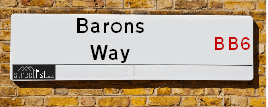
Barons Way is a street located in the town of Great Harwood. It uses the postcode BB6 7DL. The street has a length of approximately 154 metres.
The street is publicly maintained which means that the road is adopted and Lancashire is responsible for the repair and upkeep of the highway.
Barons Way is located within the Hyndburn District (B) Council's jurisdiction. They provide various services, like refuse collection, and manage council tax collection. It's situated in the North West region of the UK.
Barons Way has been assigned the Unique Street Reference Number of 17903183 in the National Street Gazetteer.
Barons Way is located within the county of Lancashire, situated in the North West region of the UK. It's 184.9 miles North West from central London., 22 miles North from Manchester, 24.4 miles South East from Lancaster and 35.08 miles West from Leeds.
Barons Way is within the Post Town of BLACKBURN

Do you know why this road is called Barons Way?
What's it like to live here?
Ask the community a question about Barons Way.
Do you have any questions, memories to share or know any facts about Barons Way? We'd love to know more.
Also on streetlist.co.uk, can you help?
Swing Swang Lane
28th April 2024
I am trying to find out why the lane is named Swing Swang?
It has been known known this since at least 1905 when hedge making contents used to be held here.
Swing Swang is often used to describe a fairground ride. I remember Swing Boats. Were they a bit like this or is Swing Swang another name for swings?
Swing Swangs are also mentioned in connection to orchards. Or were orchards just good places to have swings?
House Sales in Barons Way
| Year | High | Low | Average | Sales |
|---|---|---|---|---|
| 2019 | £115,000 | £115,000 | £115,000 | 1 |
Contains HM Land Registry data © Crown copyright and database right 2024. This data is licensed under the Open Government Licence v3.0.
Estate Agents near Barons Way
| Name | Address | Website |
|---|---|---|
| Mortimers Chartered Surveyors | 45 Queen Street, Great Harwood, BB6 7QP | Visit Website |
| H2Homes Lettings And Property Services Ltd | 1-2 Barnes Square, Clayton Le Moors, BB5 5NX | Visit Website |
| Onward Living | Spring Street, Rishton, BB1 4LP | Visit Website |
We have found 1 postcode for Barons Way
Location Details
| Barons Way | |
|---|---|

| |
| Latitude | 53.783791 |
| Longitude | -2.399251 |
| OS Easting (X): | 373696 |
| OS Northing (Y): | 432038 |
| OS Grid Reference: | SD737320 |
Neighbourhood Policing |
| Police Force: Lancashire |
 View Neighbourhood Crime and Policing View Neighbourhood Crime and Policing |
| Find a Local Neighbourhood Watch Scheme |
Frequently asked Questions for Barons Way
What Council (Local Authority) is Barons Way in?
Barons Way is located within the local authority area of Hyndburn Council which is a District Council.
What Parish Council is Barons Way in?
Barons Way is in an unparished area.
What Electoral Ward is Barons Way in?
Barons Way is located within the ward of Netherton.
What County is Barons Way in?
Barons Way is located within the ceremonial county of Lancashire.
What Constituency is Barons Way in?
Barons Way is located within the constituency of Hyndburn.
What Part of the UK is Barons Way in?
Barons Way is located within the North West (England) region of the United Kingdom.
What County Council area is Barons Way in?
Barons Way is located within the Lancashire Council area.
What Police Force area is Barons Way in?
Barons Way is located within the Lancashire Police area.
Roads that have a Junction with Barons Way
| Street | Junction Type |
|---|---|
| St Hubert's Street | junction |
| Alan Ramsbottom Way | junction |
Sunset and Sunrise times for Barons Way , BB6 7DL
| Sunrise | 05:07 |
|---|---|
| Sunset | 21:04 |
Latest Weather Conditions for Barons Way, BB6 7DL
| Observed at Weather Station: | Stonyhurst 13 May 2024 at 17:00 (5.34 miles away) |
|---|---|
| Current Weather: | Clear night |
| Temperature and Humidity: | 17.0°C (68.7%) |
| Wind Direction and Speed: | (0 mph) |
Population Statistics
| ONS Area Code | E00127200 |
|---|---|
| ONS Area Name | Deprived Blue-Collar Terraces |
| Average Age | 36.18 |
| Area Population | 1571.00 |
| Male Population | 787.00 (50%) |
| Female Population | 784.00 (50%) |
| Benefit Claimants | 45 (3%) |
| LSOA Code: | E01025062 |
|---|---|
| LSOA Name: | Hyndburn 001C |
| SOA Code: | 4b |
| SOA Name: | |
| MSOA Code: | E02005212 |
| MSOA Name: | Hyndburn 001 |
Nearest Supermarkets
| Tesco Great Harwood Superstore |
|---|
| Queen St, Great Harwood, BB6 7AT |
| 0345 671 9430 |
| Distance: 0.21 Miles |
| Directions from Barons Way to Tesco Great Harwood Superstore |
| Morrisons Great Harwood |
|---|
| Queen Street, Great Harwood, Blackburn BB6 7AL |
| 01254 886274 |
| Distance: 0.23 Miles |
| Directions from Barons Way to Morrisons Great Harwood |
| Asda Accrington |
|---|
| Hyndburn Road, Accrington, BB5 1PY |
| 01254 301111 |
| Distance: 2.18 Miles |
| Directions from Barons Way to Asda Accrington |
| Iceland Accrington |
|---|
| Unit 28 Arndale Centre, Accrington, Lancashire, BB5 1EX |
| 01254398417 |
| Distance: 2.46 Miles |
| Directions from Barons Way to Iceland Accrington |
Telephone Information
| Area Code |
|---|
| Area Code: 01254 - Blackburn |
| Area Code: 01200 - Clitheroe |
| Area Code: 01282 - Burnley |
Broadband Information
| Speed | Average Speed | Median Speed | Maximum Speed | Next-generation access (NGA) | Number of Connections |
|---|---|---|---|---|---|
| Greater than 2 Mbps | >=30 | 23 | >=30 | Y | 5 |
Local Government
| Local Council Details |
|---|
| Within the area of Hyndburn |
| Visit the Council's Website |
| Scaitcliffe House, Ormerod Street, Accrington, Lancashire &BB5 0PF |
| Send email |
| Telephone Number: 01254 388 111 |
| Local Member of Parliament |
|---|
| Within the Westminster Parliamentary Constituency of Hyndburn |
| The Member of Parliament is Sara Britcliffe |
| Details for the MP Sara Britcliffe on parliament.uk |
| Details for the MP Sara Britcliffe on theyworkforyou.com |
| In the 2019 General Election Sara Britcliffe won with a majority of 2,951 the result was Con gain from Lab. The total electorate was 70,842 |
| Wards, Parish Councils and County Councils |
|---|
| Ward: Netherton Ward |
| Parish: Unparished area |
| Ceremonial County: Lancashire |
Nearest Schools
England Primary Schools
St Mary's Roman Catholic Primary School, Clayton-le-Moors
Address: St Mary's Roman Catholic Primary School, Clayton-le-Moors, Devonshire Drive, Clayton-le-Moors, Accrington, Lancashire, BB5 5RJ
Distance: 0.93 miles
Contact: 01254231277
St Hubert's Roman Catholic Primary School, Great Harwood
Address: St Hubert's Roman Catholic Primary School, Great Harwood, Hallfield Road, Great Harwood, Blackburn, Lancashire, BB6 7SN
Distance: 0.44 miles
Contact: 01254885778
Great Harwood St Bartholomew's Parish Church of England Voluntary Aided Primary School
Address: Great Harwood St Bartholomew's Parish Church of England Voluntary Aided Primary School, Ash Street, Great Harwood, Blackburn, Lancashire, BB6 7QA
Distance: 0.49 miles
Contact: 01254884534
St Wulstan's Catholic Primary School, Great Harwood
Address: St Wulstan's Catholic Primary School, Great Harwood, Rushton Street, Great Harwood, Lancashire, BB6 7JQ
Distance: 0.53 miles
Contact: 01254884533
Great Harwood Primary School
Address: Great Harwood Primary School, Rushton Street, Great Harwood, Blackburn, Lancashire, BB6 7JQ
Distance: 0.53 miles
Contact: 01254880810
Great Harwood St John's Church of England Primary School
Address: Great Harwood St John's Church of England Primary School, St John's Street, Great Harwood, Blackburn, Lancashire, BB6 7ES
Distance: 0.32 miles
Contact: 01254885926
Rishton Methodist Primary School
Address: Rishton Methodist Primary School, George Street, Rishton, Blackburn, Lancashire, BB1 4JF
Distance: 1.30 miles
Contact: 01254887223
St Charles' RC School
Address: St Charles' RC School, Knowles Street, Rishton, Blackburn, Lancashire, BB1 4HT
Distance: 1.41 miles
Contact: 01254886110
Rishton St Peter and St Paul's Church of England Primary School
Address: Rishton St Peter and St Paul's Church of England Primary School, Arundel Street, Rishton, Blackburn, Lancashire, BB1 4DT
Distance: 1.29 miles
Contact: 01254884522
England Secondary Schools
The Hyndburn Academy
Address: The Hyndburn Academy, Stourton Street, Rishton, Blackburn, Lancashire, BB1 4ED
Distance: 1.19 miles
Contact: 01254885378
Norden High School & Sports College
Address: Norden High School & Sports College, Stourton Street, Rishton, Blackburn, Lancashire, BB1 4ED
Distance: 1.19 miles
Contact:
Nearest Hospitals
| Accrington Victoria Hospital |
|---|
| Address: Accrington Victoria Community Hospital, Haywood Road, Accrington, BB5 6AS, |
| NHS Sector |
| East Lancashire Hospitals NHS Trust |
| Telephone: 01254 359003 |
| Visit Hospital Website |
| Distance: 3.43 (miles) |
| Directions from to Accrington Victoria Hospital |
| Royal Blackburn Hospital |
|---|
| Address: Haslingden Road, Haslingden Road, Blackburn, BB2 3HH, |
| NHS Sector |
| East Lancashire Hospitals NHS Trust |
| Telephone: 01254 263555 |
| Visit Hospital Website |
| Distance: 6.79 (miles) |
| Directions from to Royal Blackburn Hospital |
| BMI The Beardwood Hospital |
|---|
| Address: Preston New Road, Blackburn, BB2 7AE, |
| Independent Sector |
| BMI Healthcare |
| Telephone: 01254 507607 |
| Visit Hospital Website |
| Distance: 8.13 (miles) |
| Directions from to BMI The Beardwood Hospital |
Nearest Dentists
Dentists near Barons Way
DENTAL SURGERY
Address: 70 QUEEN STREET, GREAT HARWOOD, BLACKBURN, LANCASHIRE, BB6 7AL
Distance: 0.23 miles
Contact: :
DENTAL SURGERY
Address: 18 GLEBE STREET, GREAT HARWOOD, BLACKBURN, LANCASHIRE, BB6 7AA
Distance: 0.28 miles
Contact: :
DENTAL SURGERY
Address: 57 PICKUP STREET, CLAYTON LE MOORS, ACCRINGTON, LANCASHIRE, BB5 5NS
Distance: 0.82 miles
Contact: :
DENTAL SURGERY
Address: 28 HIGH STREET, RISHTON, BLACKBURN, LANCASHIRE, BB1 4LA
Distance: 1.22 miles
Contact: :
GLENLYON DENTAL PRACTICE
Address: 188 WHALLEY ROAD, ACCRINGTON, LANCASHIRE, BB5 5AB
Distance: 2.08 miles
Contact: :
DENTAL SURGERY
Address: 432 BLACKBURN ROAD, ACCRINGTON, LANCASHIRE, BB5 0DE
Distance: 2.20 miles
Contact: :
Nearest GP Surgeries
Doctors near Barons Way
GREAT HARWOOD HEALTH CENTRE
Address: WATER STREET, GREAT HARWOOD, BLACKBURN, LANCASHIRE, BB6 7QR
Distance: 0.36 miles
Contact: :
THE WEAVERS PRACTICE (GREAT HARWOOD HEALTH CENTRE)
Address: GREAT HARWOOD HEALTH CENTRE, WATER STREET, GREAT HARWOOD, BLACKBURN, LANCASHIRE, BB6 7QR
Distance: 0.36 miles
Contact: :
GREAT HARWOOD MEDICAL GROUP
Address: GREAT HARWOOD HEALTH CENTRE, WATER STREET, GREAT HARWOOD, BLACKBURN, LANCASHIRE, BB6 7QR
Distance: 0.36 miles
Contact: tel: 01254 617570
THE CLAYTON MEDICAL CTR.
Address: WELLINGTON STREET, CLAYTON LE MOORS, ACCRINGTON, LANCASHIRE, BB5 5HU
Distance: 0.90 miles
Contact: tel: 0844 4771761
GREAT HARWOOD SURGERY
Address: 32 HIGH STREET, RISHTON, BLACKBURN, BB1 4LA
Distance: 1.22 miles
Contact: tel: 01254 617590
THE WEAVERS PRACTICE
Address: HIGH STREET, RISHTON, BLACKBURN, BB1 4LA
Distance: 1.22 miles
Contact: tel: 01254 884217
Nearest Dispensing Chemists
Pharmacies near Barons Way
TESCO INSTORE PHARMACY
Address: QUEEN STREET, GREAT HARWOOD, BLACKBURN, LANCASHIRE, BB6 7AL
Distance: 0.23 miles
Contact: tel: 01707 297706
BOOTS
Address: 50 QUEEN STREET, GREAT HARWOOD, BLACKBURN, LANCASHIRE, BB6 7QQ
Distance: 0.32 miles
Contact: tel: 01254 884330
MY PHARMACY
Address: HESKETH HOUSE, 1 HESKETH STREET, GREAT HARWOOD, BLACKBURN, BB6 7DW
Distance: 0.35 miles
Contact: tel: 01254 882800
E B HOLDEN PHARMACY
Address: 9-11 QUEEN STREET, GREAT HARWOOD, BLACKBURN, LANCASHIRE, BB6 7QL
Distance: 0.37 miles
Contact: tel: 01254 886178
WELL
Address: 36 PICKUP STREET, CLAYTON-LE-MOORS, ACCRINGTON, ACCRINGTON, LANCASHIRE, BB5 5NS
Distance: 0.82 miles
Contact: tel: 01254 232999
DIALACHEMIST LTD
Address: 4 PETRE ROAD, CLAYTON BUSINESS PARK, CLAYTON LE MOORS, ACCRINGTON, LANCASHIRE, BB5 5JB
Distance: 0.99 miles
Contact: tel: 01254 356799
Nearest Opticians
Opticians near Barons Way
EYES OF HARWOOD
Address: 76 QUEEN STREET, GREAT HARWOOD, BLACKBURN, LANCASHIRE, BB6 7AL
Distance: 0.23 miles
Contact: :
PAUL NUTTALL OPTOMETRISTS (GREAT HARWOOD)
Address: 49 BLACKBURN ROAD, GREAT HARWOOD, BLACKBURN, LANCASHIRE, BB6 7DF
Distance: 0.39 miles
Contact: :
OPTICAL DIRECT CLM LTD
Address: LONGTON HOUSE, BURNLEY ROAD, CLAYTON LE MOORS, ACCRINGTON, LANCASHIRE, BB5 5TW
Distance: 1.12 miles
Contact: :
UNIVISION EYE CENTRE
Address: 41 HIGH STREET, RISHTON, BLACKBURN, BB1 4JZ
Distance: 1.23 miles
Contact: :
CHEC ACCRINGTON
Address: CASTLE HOUSE, EASTGATE, ACCRINGTON, LANCASHIRE, BB5 6EU
Distance: 2.37 miles
Contact: :
BOOTS OPTICIANS (ACCRINGTON)
Address: UNIT 14, ARNDALE SHOPPING CENTRE, ACCRINGTON, LANCASHIRE, BB5 1PL
Distance: 2.45 miles
Contact: :
Transport
Nearest Rail Stations
Rishton Station is 1.64 miles away.
Address: Rishton station, Station Road, Rishton, Lancashire, BB1 4EY
Rishton is situated on the East Lancashire line and is managed by Northern.
Rishton Station is an unstaffed station.
Huncoat Station is 2.32 miles away.
Address: Huncoat station, Station Road, Huncoat, Lancashire, BB5 6LT
Huncoat is situated on the East Lancashire line and is managed by Northern.
Huncoat Station is an unstaffed station.