Map of Braemar Road
| Postcodes | ||
|---|---|---|
| Icon | Postcodes for Braemar Road | |
| Walking Distances | ||
| Distance Info | Green Circle = 10 Minutes Walk (800 metres) | |
About Braemar Road
Braemar Road is a street located in Ballater and near Ballater. The street has a length of approximately 1,382 metres.
Braemar Road is located within the Aberdeenshire Council's jurisdiction. They provide various services, like refuse collection, and manage council tax collection. It's situated in the (pseudo) Scotland region of the UK.
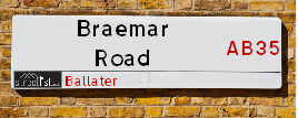
Braemar Road has the postcodes of AB35 5UX, AB35 5RQ, AB35 5RL and AB35 5XA.
Braemar Road is located within the county of Aberdeenshire, situated in the (pseudo) Scotland region of the UK. It's 401.88 miles North from central London., 36.47 miles West from Aberdeen, 41.22 miles North from Dundee and 52.89 miles South East from Inverness.
Braemar Road is within the Post Town of BALLATER

Do you know why this road is called Braemar Road?
What's it like to live here?
Ask the community a question about Braemar Road.
Do you have any questions, memories to share or know any facts about Braemar Road? We'd love to know more.
Also on streetlist.co.uk, can you help?
Swing Swang Lane
28th April 2024
I am trying to find out why the lane is named Swing Swang?
It has been known known this since at least 1905 when hedge making contents used to be held here.
Swing Swang is often used to describe a fairground ride. I remember Swing Boats. Were they a bit like this or is Swing Swang another name for swings?
Swing Swangs are also mentioned in connection to orchards. Or were orchards just good places to have swings?
Location Details
| Braemar Road | |
|---|---|

| |
| Latitude | 57.053676 |
| Longitude | -3.049346 |
| OS Easting (X): | 336353 |
| OS Northing (Y): | 796315 |
| OS Grid Reference: | NO364963 |
Neighbourhood Policing |
| Police Force: Scotland |
| Find a Local Neighbourhood Watch Scheme |
Frequently asked Questions for Braemar Road
What Council (Local Authority) is Braemar Road in?
Braemar Road is located within the local authority area of Aberdeenshire Council which is a Scottish unitary authority.
What Parish Council is Braemar Road in?
Braemar Road is in an unparished area.
What Electoral Ward is Braemar Road in?
Braemar Road is located within the ward of Aboyne &Upper Deeside and Donside.
What County is Braemar Road in?
Braemar Road is located within the ceremonial county of Aberdeenshire.
What Constituency is Braemar Road in?
Braemar Road is located within the constituency of West Aberdeenshire and Kincardine.
What Part of the UK is Braemar Road in?
Braemar Road is located within the historic nation of Scotland.
What County Council area is Braemar Road in?
Braemar Road is not in a County Council area.
What Police Force area is Braemar Road in?
Braemar Road is located within the Scotland Police area.
Roads that have a Junction with Braemar Road
| Street | Junction Type |
|---|---|
| Braemar Place | junction |
| Craigendarroch Walk | junction |
| Invercauld Road | junction |
| Provost Craig Road | junction |
Sunset and Sunrise times for Braemar Road
| Sunrise | 04:53 |
|---|---|
| Sunset | 21:23 |
Latest Weather Conditions for Braemar Road
| Observed at Weather Station: | Aboyne 13 May 2024 at 03:00 (8.18 miles away) |
|---|---|
| Current Weather: | Light rain |
| Temperature and Humidity: | 10.1°C (98.0%) |
| Wind Direction and Speed: | E (7 mph) |
Population Statistics
| ONS Area Code | S00091542 & S00091444 |
|---|---|
| ONS Area Name | Renting Rural Retirement & Ageing in Suburbia |
| LSOA Code: | S01006790 &S01006789 |
|---|---|
| LSOA Name: | East Cairngorms - 02 &East Cairngorms - 01 |
| SOA Code: | 5e &5a |
| SOA Name: | |
| MSOA Code: | S02001285 |
| MSOA Name: | East Cairngorms |
Nearest Supermarkets
| Morrisons Banchory |
|---|
| North Deeside Road, Banchory AB31 5YR |
| 01330 820140 |
| Distance: 21.44 Miles |
| Directions from Braemar Road to Morrisons Banchory |
| Tesco Banchory Superstore |
|---|
| Hill Of Banchory E, Banchory, AB31 5QA |
| 0345 026 9618 |
| Distance: 21.91 Miles |
| Directions from Braemar Road to Tesco Banchory Superstore |
| Tesco Brechin Esso Express |
|---|
| Clerk St, Brechin, DD9 6AZ |
| 0345 675 6960 |
| Distance: 26.51 Miles |
| Directions from Braemar Road to Tesco Brechin Esso Express |
| Asda Huntly |
|---|
| Steven Road, Huntly, AB54 8SX |
| 01466 795500 |
| Distance: 28.48 Miles |
| Directions from Braemar Road to Asda Huntly |
Telephone Information
| Area Code |
|---|
Broadband Information
| Speed | Average Speed | Median Speed | Maximum Speed | Next-generation access (NGA) | Number of Connections |
|---|---|---|---|---|---|
| Greater than 2 Mbps | 8.1 | 8.1 | 8.1 | N | 4 |
Local Government
| Local Council Details |
|---|
| Within the area of Aberdeenshire |
| Visit the Council's Website |
| Woodhill House, Westburn Road, Aberdeen, Aberdeenshire &AB16 5GB |
| Telephone Number: 0845 608 1207 |
| Local Member of Parliament |
|---|
| Within the Westminster Parliamentary Constituency of West Aberdeenshire and Kincardine |
| The Member of Parliament is Andrew Bowie |
| Details for the MP Andrew Bowie on parliament.uk |
| Details for the MP Andrew Bowie on theyworkforyou.com |
| In the 2019 General Election Andrew Bowie won with a majority of 843 the result was Con hold. The total electorate was 72,640 |
| Wards, Parish Councils and County Councils |
|---|
| Ward: Aboyne &Upper Deeside and Donside Ward |
| Ceremonial County: Aberdeenshire |
Nearest Schools
Scotland Primary Schools
Ballater School
Address: Ballater School, Monaltrie Crescent, Ballater, ABERDEENSHIRE, AB35 5RN
Distance: 0.30 miles
Contact: 01339 267715
Nearest Hospitals
| Name | Address | Postcode | Distance | Map |
|---|
Nearest Dentists
Dentists near Braemar Road
| Name | Address | Postcode | Distance | Map |
|---|
Nearest GP Surgeries
Doctors near Braemar Road
BALLATER CLINIC
Address: 13 PROVOST CRAIG ROAD, BALLATER, AB35 5NN
Distance: 0.39 miles
Contact: tel: 01339 755686
STRATHDON MEDICAL CENTRE
Address: NEWE, STRATHDON, AB36 8XB
Distance: 9.68 miles
Contact: tel: 01975 651209
ABOYNE HEALTH CENTRE
Address: BELLWOOD ROAD, ABOYNE, ABERDEENSHIRE, AB34 5HQ
Distance: 10.71 miles
Contact: tel: 03453 379955
BRAEMAR HEALTH CLINIC
Address: ST ANDREW'S TERRACE, BRAEMAR, BALLATER, AB35 5WR
Distance: 13.64 miles
Contact: tel: 01339 741202
TORPHINS MEDICAL PRACTICE
Address: ST MARNAN ROAD, TORPHINS, BANCHORY, AB31 4JQ
Distance: 16.53 miles
Contact: tel: 01339 882221
BANCHORY GROUP PRACTICE
Address: BELLFIELD, BANCHORY, KINCARDINESHIRE, AB31 5XS
Distance: 20.61 miles
Contact: tel: 03450 130750
Nearest Dispensing Chemists
Pharmacies near Braemar Road
| Name | Address | Postcode | Telephone | Map | Distance in Km |
|---|---|---|---|---|---|
| W Davidson & Sons Ltd | The Pharmacy, 10 Bridge Street, Ballater, | AB35 5QP | 013397 55409 | View Directions |
Nearest Opticians
Opticians near Braemar Road
COSTCO WHOLESALE UK LTD - MANDELA WAY
Address: COSTCO, ENDEAVOUR DRIVE, ARNHALL BUSINESS PARK, WESTHILL, ABERDEENSHIRE, AB32 6UF
Distance: 29.66 miles
Contact: :
4637 PORTLETHEN
Address: ASDA STORES LTD, MUIREND ROAD, PORTLETHEN, ABERDEEN, ABERDEENSHIRE, AB12 4XP
Distance: 34.25 miles
Contact: :
ASDA OPTICIANS (BRIDGE OF DEE)
Address: ASDA STORES LTD, GARTHDEE ROAD, BRIDGE OF DEE, ABERDEEN, ABERDEENSHIRE, AB10 7QA
Distance: 35.11 miles
Contact: :
OPTIMAX LASER EYE CLINIC
Address: 2 GOLDEN SQUARE, ABERDEEN, ABERDEENSHIRE, AB10 1RD
Distance: 36.04 miles
Contact: :
VISION EXPRESS (ABERDEEN)
Address: UNIT 32, BON ACCORD CENTRE, GEORGE STREET, ABERDEEN, ABERDEENSHIRE, AB25 1HZ
Distance: 36.23 miles
Contact: :
BOOTS OPTICIANS (ABERDEEN - BON ACCORD CENTRE)
Address: BON ACCORD CENTRE, GEORGE STREET, ABERDEEN, ABERDEENSHIRE, AB25 1HZ
Distance: 36.23 miles
Contact: :
Transport
Nearest Rail Stations
Insch Station is 25.42 miles away.
Address: Insch station, Gordon Terrace, Insch, Aberdeenshire, AB52 6PU
Insch is situated on the Aberdeen to Inverness line and is managed by ScotRail.
Insch Station is an unstaffed station.
Laurencekirk Station is 26.55 miles away.
Address: Laurencekirk station, Station Road, Laurencekirk, Aberdeenshire, AB30 1BE
Laurencekirk is situated on the Glasgow to Aberdeen line|Edinburgh to Aberdeen line and is managed by ScotRail.
Laurencekirk Station is an unstaffed station.