Map of Cameron Drive
| Postcodes | ||
|---|---|---|
| Icon | Postcodes for Cameron Drive | |
| Walking Distances | ||
| Distance Info | Green Circle = 10 Minutes Walk (800 metres) | |
About Cameron Drive
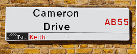
Cameron Drive is a street located in Keith. The street has a length of approximately 457 metres.
Cameron Drive is located within the West Moray &North East Moray Council's jurisdiction. They provide various services, like refuse collection, and manage council tax collection. It's situated in the (pseudo) Scotland region of the UK.
Cameron Drive has the postcodes of AB55 5BF, AB55 5BE and AB55 5BB.
Cameron Drive is located within the county of Banffshire, situated in the (pseudo) Scotland region of the UK. It's 432.87 miles North from central London., 42.24 miles North West from Aberdeen, 47.32 miles East from Inverness and 74.72 miles North from Dundee.
Cameron Drive is within the Post Town of KEITH

Do you know why this road is called Cameron Drive?
What's it like to live here?
Ask the community a question about Cameron Drive.
Do you have any questions, memories to share or know any facts about Cameron Drive? We'd love to know more.
Also on streetlist.co.uk, can you help?
Swing Swang Lane
28th April 2024
I am trying to find out why the lane is named Swing Swang?
It has been known known this since at least 1905 when hedge making contents used to be held here.
Swing Swang is often used to describe a fairground ride. I remember Swing Boats. Were they a bit like this or is Swing Swang another name for swings?
Swing Swangs are also mentioned in connection to orchards. Or were orchards just good places to have swings?
Estate Agents near Cameron Drive
| Name | Address | Website |
|---|---|---|
| Peterkins Solicitors | 186 Mid St, Keith,AB55 5BQ | Visit Website |
| Springfield - North Scotland, Inchgower | Seafield Circle, off Barhill Road, Buckie, AB56 5AD | Visit Website |
| Stewart & Watson | 17-19 Duke Street, Huntly,AB54 8DL | Visit Website |
Location Details
| Cameron Drive | |
|---|---|

| |
| Latitude | 57.539374 |
| Longitude | -2.955529 |
| OS Easting (X): | 342802 |
| OS Northing (Y): | 850292 |
| OS Grid Reference: | NJ428503 |
Neighbourhood Policing |
| Police Force: Scotland |
| Find a Local Neighbourhood Watch Scheme |
Frequently asked Questions for Cameron Drive
What Council (Local Authority) is Cameron Drive in?
Cameron Drive is located within the local authority area of West Moray &North East Moray Council which is a Scottish unitary authority.
What Parish Council is Cameron Drive in?
Cameron Drive is in an unparished area.
What Electoral Ward is Cameron Drive in?
Cameron Drive is located within the ward of Keith and Cullen.
What County is Cameron Drive in?
Cameron Drive is located within the ceremonial county of Banffshire.
What Constituency is Cameron Drive in?
Cameron Drive is located within the constituency of Moray.
What Part of the UK is Cameron Drive in?
Cameron Drive is located within the historic nation of Scotland.
What County Council area is Cameron Drive in?
Cameron Drive is not in a County Council area.
What Police Force area is Cameron Drive in?
Cameron Drive is located within the Scotland Police area.
Roads that have a Junction with Cameron Drive
| Street | Junction Type |
|---|---|
| Chapel Street | junction |
| Turner Street | junction |
| Hay Crescent | junction |
Sunset and Sunrise times for Cameron Drive
| Sunrise | 04:54 |
|---|---|
| Sunset | 21:21 |
Latest Weather Conditions for Cameron Drive
| Observed at Weather Station: | Lossiemouth 11 May 2024 at 15:00 (18.06 miles away) |
|---|---|
| Current Weather: | Sunny day |
| Temperature and Humidity: | 21.3°C (51.1%) |
| Wind Direction and Speed: | E (10 mph) |
Population Statistics
| ONS Area Code | S00121272, S00121271 & S00121779 |
|---|---|
| ONS Area Name | Ageing Rural Industry Workers, Industrious Hardship & Rural Life |
| LSOA Code: | S01011063 &S01011062 |
|---|---|
| LSOA Name: | Keith and Fife Keith - 04 &Keith and Fife Keith - 03 |
| SOA Code: | 5d &5e |
| SOA Name: | |
| MSOA Code: | S02002076 |
| MSOA Name: | Keith and Fife Keith |
Nearest Supermarkets
| Tesco Keith Moss St Superstore |
|---|
| Moss St, Keith, AB55 5HB |
| 0345 671 9357 |
| Distance: 0.45 Miles |
| Directions from Cameron Drive to Tesco Keith Moss St Superstore |
| Tesco Huntly Superstore |
|---|
| Deveron Rd, Huntly, AB54 8TS |
| 0345 026 9499 |
| Distance: 8.42 Miles |
| Directions from Cameron Drive to Tesco Huntly Superstore |
| Tesco Buckie Superstore |
|---|
| Highstreet, Buckie, AB56 4AB |
| 0345 026 9628 |
| Distance: 8.8 Miles |
| Directions from Cameron Drive to Tesco Buckie Superstore |
| Asda Huntly |
|---|
| Steven Road, Huntly, AB54 8SX |
| 01466 795500 |
| Distance: 8.99 Miles |
| Directions from Cameron Drive to Asda Huntly |
Telephone Information
| Area Code |
|---|
| Area Code: 01542 - Keith |
| Area Code: 01340 - Craigellachie |
| Area Code: 01466 - Huntly |
Broadband Information
| Speed | Average Speed | Median Speed | Maximum Speed | Next-generation access (NGA) | Number of Connections |
|---|---|---|---|---|---|
| Less than 2 Mbps | 16.1 | 21.1 | 22.7 | N | 14 |
Local Government
| Local Council Details |
|---|
| Within the area of West Moray &North East Moray |
| Visit the Council's Website |
| Council Office, High Street, Elgin, Moray &IV30 1BX |
| Telephone Number: 01343 543 451 |
| Local Member of Parliament |
|---|
| Within the Westminster Parliamentary Constituency of Moray |
| The Member of Parliament is Douglas Ross |
| Details for the MP Douglas Ross on parliament.uk |
| Details for the MP Douglas Ross on theyworkforyou.com |
| In the 2019 General Election Douglas Ross won with a majority of 513 the result was Con hold. The total electorate was 71,035 |
| Wards, Parish Councils and County Councils |
|---|
| Ward: Keith and Cullen Ward |
| Ceremonial County: Banffshire |
Nearest Schools
Scotland Secondary Schools
Keith Grammar School
Address: Keith Grammar School, School Road, Keith, MORAY, AB55 5GS
Distance: 0.55 miles
Contact: 01542 882461
Scotland Primary Schools
Keith Primary School
Address: Keith Primary School, School Road, Keith, MORAY, AB55 5ES
Distance: 0.46 miles
Contact: 01542 882802
St Thomas RC Primary School
Address: St Thomas RC Primary School, Chapel Street, Keith, MORAY, AB55 5AL
Distance: 0.10 miles
Contact: 01542 882256
Newmill Primary School
Address: Newmill Primary School, Isla Road, Newmill, KEITH, AB55 6US
Distance: 1.28 miles
Contact: 01542 882788
Nearest Hospitals
| Name | Address | Postcode | Distance | Map |
|---|---|---|---|---|
| Turner Memorial Hospital | Turner Street, Keith | AB55 5DJ | 0.29 Km | View Directions |
| Buckie Day Hospital | The Bungalow, Seafield Hospital, Buckie | AB56 1SF | 14.36 Km | View Directions |
| Seafield Hospital | Barrhill Road, Buckie | AB56 1SF | 14.36 Km | View Directions |
Nearest Dentists
Dentists near Cameron Drive
| Name | Address | Postcode | Distance | Map |
|---|---|---|---|---|
| 8TO8 DENTAL | 1 Westerton Rd North, Keith | AB555FL | 0.81 Km | View Directions |
| BUCKIE DENTAL PRACTICE | 93 West Church Street, Buckie | AB561BS | 15.00 Km | View Directions |
| 8 TO 8 DENTAL | 32 West Church Street, Buckie | AB561HL | 15.12 Km | View Directions |
Nearest GP Surgeries
Doctors near Cameron Drive
KEITH MEDICAL GROUP
Address: TURNER STREET, KEITH, BANFFSHIRE, AB55 5DJ
Distance: 0.18 miles
Contact: tel: 03453 379944
FOCHABERS MEDICAL PRACTICE
Address: 12 HIGH STREET, FOCHABERS, IV32 7EP
Distance: 7.15 miles
Contact: tel: 01343 820247
SEAFIELD & CULLEN MEDICAL GROUP
Address: BARHILL ROAD, BUCKIE, AB56 1FP
Distance: 8.94 miles
Contact: tel: 01542 835577
RINNES MEDICAL GROUP
Address: HEALTH CENTRE, MOUNT STREET, DUFFTOWN, KEITH, AB55 4FJ
Distance: 9.01 miles
Contact: tel: 01340 820888
BYDAND MEDICAL GROUP
Address: HUNTLY HEALTH CENTRE, BLEACHFIELD STREET, HUNTLY, AB54 8EX
Distance: 9.04 miles
Contact: tel: 01466 792116
ARDACH HEALTH CENTRE
Address: HIGHFIELD ROAD, BUCKIE, BANFFSHIRE, AB56 1JE
Distance: 9.15 miles
Contact: tel: 03450 997200
Nearest Dispensing Chemists
Pharmacies near Cameron Drive
| Name | Address | Postcode | Telephone | Map | Distance in Km |
|---|---|---|---|---|---|
| R M Baird Pharmacy | 144 Mid Street, Keith | AB55 5BJ | 01542 882512 | View Directions | |
| Clark's Pharmacy | 12-16 Regent Street, Keith, Moray, , Banffshire, | AB55 5DU | 01542 882533 | View Directions | |
| Normac Pharmacy Services Ltd | Ardach Health Centre, Highfield Road, Buckie, | AB56 1JE | 01542 831147 | View Directions |
Nearest Opticians
Opticians near Cameron Drive
BOOTS OPTICIANS (ELGIN)
Address: 169 HIGH STREET, ELGIN, IV30 1DW
Distance: 15.38 miles
Contact: :
COSTCO WHOLESALE UK LTD - MANDELA WAY
Address: COSTCO, ENDEAVOUR DRIVE, ARNHALL BUSINESS PARK, WESTHILL, ABERDEENSHIRE, AB32 6UF
Distance: 36.97 miles
Contact: :
VISION EXPRESS (ABERDEEN)
Address: UNIT 32, BON ACCORD CENTRE, GEORGE STREET, ABERDEEN, ABERDEENSHIRE, AB25 1HZ
Distance: 41.77 miles
Contact: :
BOOTS OPTICIANS (ABERDEEN - BON ACCORD CENTRE)
Address: BON ACCORD CENTRE, GEORGE STREET, ABERDEEN, ABERDEENSHIRE, AB25 1HZ
Distance: 41.77 miles
Contact: :
OPTIMAX LASER EYE CLINIC
Address: 2 GOLDEN SQUARE, ABERDEEN, ABERDEENSHIRE, AB10 1RD
Distance: 41.80 miles
Contact: :
ABERDEEN DOMICILIARY SPECSAVERS LIMITED
Address: 56-58 UNION STREET, ABERDEEN, ABERDEENSHIRE, AB10 1BB
Distance: 41.94 miles
Contact: :
Transport
Nearest Rail Stations
Keith Station is 0.80 miles away.
Address: Keith station, Station Road, Keith, Moray, AB55 3DR
Keith is situated on the Aberdeen to Inverness line and is managed by ScotRail.
Keith Station is staffed on a part time basis.
Huntly Station is 9.35 miles away.
Address: Huntly station, off Bogie St, Huntly, Aberdeenshire, AB54 5HS
Huntly is situated on the Aberdeen to Inverness line and is managed by ScotRail.
Huntly Station is staffed on a part time basis.