Map of Colville Place
| Postcodes | ||
|---|---|---|
| Icon | Postcodes for Colville Place | |
| Walking Distances | ||
| Distance Info | Green Circle = 10 Minutes Walk (800 metres) | |
About Colville Place
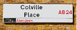
Colville Place is a street located in Aberdeen. The street has a length of approximately 101 metres.
Colville Place is located within the Aberdeen City Council's jurisdiction. They provide various services, like refuse collection, and manage council tax collection. It's situated in the (pseudo) Scotland region of the UK.
Colville Place has the postcodes of AB24 5LZ and AB24 5LY.
Colville Place is located within the county of City of Aberdeen, situated in the (pseudo) Scotland region of the UK. It's 399.03 miles North from central London., 0.73 miles North from Aberdeen, 58.56 miles North East from Dundee and 82.78 miles East from Inverness.
Colville Place is within the Post Town of ABERDEEN.

Do you know why this road is called Colville Place?
What's it like to live here?
Ask the community a question about Colville Place.
Do you have any questions, memories to share or know any facts about Colville Place? We'd love to know more.
Also on streetlist.co.uk, can you help?
Eldroth Road
15th April 2024
I wondered if anyone has any old pictures of Wenning Bank House in the 1940’s and also Lane Side before of the same era .. we visited today with my Mum in law as she used to live at both these properties. Also any photos of the schools around that time .. thank you.
Can You Help?Napps Way
15th April 2024
Why is the road called Napps Way (belonging to Napp, but minus an
apostrophe as is usual with such nomenclature)? Moreover, who or
what is, or was, “Napp” in the respective, possessive case?
Several years ago, I met an elderly man (probably in his late-eighties)
who lives on Bentham Drive, Liverpool 16, and during a conversation
with him whilst in a Northwest Passenger Transport Ambulance on the
way to the former RLUH (Royal Liverpool University Hospital), he told
me that he could remember (when he was a boy, living in Childwall,
Liverpool 16) that, “Where Napps Way is now, during WW2, there was
a two-man gun emplacement on the, then, open land to protect the
railway line passing over Childwall Valley Road - next to the railway
bridge - when suddenly, as they were loading a live “shell” into the gun’s
breach, the aforementioned “shell” accidentally exploded in the gun’s
breach killing both of the two soldiers, that had been manning the gun,
instantly! (Very sad, of course, but could - perhaps - two ghosts relating
to those two, very unfortunately and prematurely-killed soldiers have
haunted that place of their deaths ever since - and have any residents
of Napps Way - formerly and in its latest incarnation - seen two, WW2
(uniformed) soldiers unexpectedly appear in or near their homes?)
Mauritius Road
15th April 2024
Why is Mauritius Road so called, since when and by whom? Does Greenwich have any particular links with Mauritius? Very interested to know. 🤞🏼
Can You Help?Estate Agents near Colville Place
| Name | Address | Website |
|---|---|---|
| Belvoir | 24 Rosemount Place, Aberdeen, AB25 2XU | Visit Website |
| Homeguard Leasing | 115 Rosemount Place, Aberdeen, AB25 2YG | Visit Website |
| Murray & Currie | 11 Chapel Street, Aberdeen, AB10 1SS | Visit Website |
Location Details
| Colville Place | |
|---|---|

| |
| Latitude | 57.154453 |
| Longitude | -2.092567 |
| OS Easting (X): | 394400 |
| OS Northing (Y): | 807047 |
| OS Grid Reference: | NJ944070 |
Ordnance Survey Maps for Colville Place
If you purchase a map through the links below, we may earn an affiliate commission.
| Map Series | link | Ordnance Survey |
| Explorer 1:25,000 406 Aberdeen & Banchory | Check Price on Amazon | Buy Direct from the Ordnance Survey |
| Landranger 1:50,000 38 Aberdeen | Check Price on Amazon | Buy Direct from the Ordnance Survey |
Neighbourhood Policing |
| Police Force: Scotland |
| Find a Local Neighbourhood Watch Scheme |
Frequently asked Questions for Colville Place
What Council (Local Authority) is Colville Place in?
Colville Place is located within the local authority area of Aberdeen City Council which is a Scottish unitary authority.
What Parish Council is Colville Place in?
Colville Place is in an unparished area.
What Electoral Ward is Colville Place in?
Colville Place is located within the ward of George St/Harbour.
What County is Colville Place in?
Colville Place is located within the ceremonial county of City of Aberdeen.
What Constituency is Colville Place in?
Colville Place is located within the constituency of Aberdeen North.
What Part of the UK is Colville Place in?
Colville Place is located within the historic nation of Scotland.
What County Council area is Colville Place in?
Colville Place is not in a County Council area.
What Police Force area is Colville Place in?
Colville Place is located within the Scotland Police area.
Roads that have a Junction with Colville Place
| Street | Junction Type |
|---|---|
| Urquhart Road | junction |
| Jackson Terrace | pseudo node |
Sunset and Sunrise times for Colville Place
| Sunrise | 05:27 |
|---|---|
| Sunset | 20:44 |
Latest Weather Conditions for Colville Place
| Observed at Weather Station: | Aberdeen Airport 26 April 2024 at 19:00 (5.43 miles away) |
|---|---|
| Current Weather: | Light rain |
| Temperature and Humidity: | 6.0°C (78.7%) |
| Wind Direction and Speed: | S (3 mph) |
Population Statistics
| ONS Area Code | S00089479 & S00089478 |
|---|---|
| ONS Area Name | Students and Commuters |
| LSOA Code: | S01006643 |
|---|---|
| LSOA Name: | Hanover North - 03 |
| SOA Code: | 1a |
| SOA Name: | |
| MSOA Code: | S02001260 |
| MSOA Name: | Hanover North |
Nearest Supermarkets
| Morrisons Aberdeen - King Street |
|---|
| 215 King Street, Aberdeen AB24 5DA |
| 01224 624404 |
| Distance: 0.19 Miles |
| Directions from Colville Place to Morrisons Aberdeen - King Street |
| Sainsburys Aberdeen George Street Local |
|---|
| 313 George Street, Aberdeen, Scotland, AB25 1EP |
| 1224645980 |
| Distance: 0.47 Miles |
| Directions from Colville Place to Sainsburys Aberdeen George Street Local |
| Asda Aberdeen Beach |
|---|
| Unit 1, Beach Boulevard Retail Park, Aberdeen, AB11 5EJ |
| 01224 282010 |
| Distance: 0.48 Miles |
| Directions from Colville Place to Asda Aberdeen Beach |
| Sainsburys Aberdeen St Nicholas Centre Local |
|---|
| St. Nicholas Centre, Aberdeen, Scotland, AB10 1HW |
| Distance: 0.5 Miles |
| Directions from Colville Place to Sainsburys Aberdeen St Nicholas Centre Local |
Telephone Information
| Area Code |
|---|
| Area Code: 01224 - Aberdeen |
Broadband Information
| Speed | Average Speed | Median Speed | Maximum Speed | Next-generation access (NGA) | Number of Connections |
|---|---|---|---|---|---|
| Less than 2 Mbps | 8.4 | 8.5 | 15.3 | N | 10 |
Local Government
| Local Council Details |
|---|
| Within the area of Aberdeen City |
| Visit the Council's Website |
| Aberdeen City Council Customer Service Centre, Ground Floor, Marischal College, Broad Street, Aberdeen &AB10 1AB |
| Telephone Number: 0845 608 0910 |
| Local Member of Parliament |
|---|
| Within the Westminster Parliamentary Constituency of Aberdeen North |
| The Member of Parliament is Kirsty Blackman |
| Details for the MP Kirsty Blackman on parliament.uk |
| Details for the MP Kirsty Blackman on theyworkforyou.com |
| In the 2019 General Election Kirsty Blackman won with a majority of 12,670 the result was SNP hold. The total electorate was 62,489 |
| Wards, Parish Councils and County Councils |
|---|
| Ward: George St/Harbour Ward |
| Ceremonial County: City of Aberdeen |
Nearest Schools
Scotland Primary Schools
Seaton School
Address: Seaton School, Seaton Place East, Aberdeen, AB24 1XE
Distance: 1.08 miles
Contact: 01224 277920
Walker Road School
Address: Walker Road School, Walker Road, Aberdeen, AB11 8DL
Distance: 1.35 miles
Contact: 01224 879720
Hanover Street School
Address: Hanover Street School, Beach Boulevard, ABERDEEN, AB24 5HN
Distance: 0.36 miles
Contact: 01224 569880
St Peter's RC School
Address: St Peter's RC School, 74 Dunbar Street, Aberdeen, AB24 3UJ
Distance: 0.97 miles
Contact: 01224 485611
Sunnybank School
Address: Sunnybank School, Sunnybank Road, Aberdeen, AB24 3NJ
Distance: 0.52 miles
Contact: 01224 261700
Ferryhill School
Address: Ferryhill School, 31 Caledonian Place, Aberdeen, AB11 6TT
Distance: 1.17 miles
Contact: 01224 586755
Gilcomstoun School
Address: Gilcomstoun School, Skene Street, Aberdeen, AB10 1PG
Distance: 0.83 miles
Contact: 01224 642722
Skene Square School
Address: Skene Square School, 61 Skene Square, Aberdeen, AB25 2UN
Distance: 0.70 miles
Contact: 01224 630493
Kittybrewster School
Address: Kittybrewster School, Great Northern Road, Aberdeen, AB24 3QG
Distance: 1.11 miles
Contact: 01224 484451
Riverbank School
Address: Riverbank School, Dill Road, Tillydrone, ABERDEEN, AB24 2XL
Distance: 1.59 miles
Contact: 01224 483 217
Mile End School
Address: Mile End School, Mid Stocket Road, ABERDEEN, AB15 5LT
Distance: 1.50 miles
Contact: 01224 498140
Cornhill School
Address: Cornhill School, Cornhill Drive, Aberdeen, AB16 5BL
Distance: 1.69 miles
Contact: 01224 483234
Woodside School
Address: Woodside School, Clifton Road, Aberdeen, AB24 4EA
Distance: 1.81 miles
Contact: 01224 484778
Scotland Secondary Schools
Aberdeen Grammar School
Address: Aberdeen Grammar School, Skene Street, Aberdeen, AB10 1HT
Distance: 1.02 miles
Contact: 01224 642299
St Machar Academy
Address: St Machar Academy, St Machar Drive, Aberdeen, AB24 3YZ
Distance: 1.06 miles
Contact: 01224 492855
Harlaw Academy
Address: Harlaw Academy, 18/20 Albyn Place, Aberdeen, AB10 1RG
Distance: 1.25 miles
Contact: 01224 589251
Nearest Hospitals
| Name | Address | Postcode | Distance | Map |
|---|---|---|---|---|
| City Hospital | Urquhart Road, Aberdeen | AB24 5AU | 0.32 Km | View Directions |
| Aberdeen Community Health And Care Village | 50 Frederick Street, Aberdeen | AB24 5HY | 0.48 Km | View Directions |
| Woolmanhill Hospital | Skene Street, Aberdeen | AB25 1LD | 0.99 Km | View Directions |
Nearest Dentists
Dentists near Colville Place
| Name | Address | Postcode | Distance | Map |
|---|---|---|---|---|
| KING STREET DENTAL PRACTICE | 173 King Street, Aberdeen | AB245AE | 0.38 Km | View Directions |
| I-SMILE DENTAL PRACTICE | 322 George Street, Aberdeen | AB251HJ | 0.73 Km | View Directions |
| OLD TOWN DENTAL CARE | 519 King Street, Aberdeen | AB243BT | 0.87 Km | View Directions |
Nearest GP Surgeries
Doctors near Colville Place
LINKS MEDICAL PRACTICE
Address: PARK ROAD, ABERDEEN, ABERDEENSHIRE, AB24 5AU
Distance: 0.20 miles
Contact: tel: 03453 376340
OUT OF HOURS URGENT CARE (GMED)
Address: YELLOW ZONE, ABERDEEN COMMUNITY HEALTH AND CARE, 50 FREDERICK STREET, ABERDEEN, AB24 5HY
Distance: 0.30 miles
Contact: tel: 01224 558079
MARYWELL HEALTHCARE CENTRE
Address: TIMMERMARKET BUILDING, 1 EAST NORTH STREET, ABERDEEN, AB24 5HT
Distance: 0.36 miles
Contact: tel: 01224 651132
KING'S MEDICAL PRACTICE
Address: 12 SUNNYBANK ROAD, ABERDEEN, AB24 3NG
Distance: 0.56 miles
Contact: tel: 01224 486702
CALSAYSEAT MEDICAL GROUP
Address: 44 POWIS PLACE, ABERDEEN, ABERDEENSHIRE, AB25 3TX
Distance: 0.61 miles
Contact: tel: 03453 376370
OLDMACHAR MEDICAL PRACTICE
Address: 526 KING STREET, ABERDEEN, ABERDEENSHIRE, AB24 5RS
Distance: 0.65 miles
Contact: tel: 03453 370510
Nearest Dispensing Chemists
Pharmacies near Colville Place
| Name | Address | Postcode | Telephone | Map | Distance in Km |
|---|---|---|---|---|---|
| Wm Morrisons Supermarkets Plc | 215 King Street, Aberdeen | AB24 5DA | 01224 624398 | View Directions | |
| L Rowland & Co (Retail) Ltd | The City Hospital, Park Road, Aberdeen, | AB24 5AU | 01224 636597 | View Directions | |
| Boots The Chemists Ltd | Bon Accord Centre, Aberdeen | AB25 1UH | 01224 626080 | View Directions |
Nearest Opticians
Opticians near Colville Place
VISION EXPRESS (ABERDEEN)
Address: UNIT 32, BON ACCORD CENTRE, GEORGE STREET, ABERDEEN, ABERDEENSHIRE, AB25 1HZ
Distance: 0.47 miles
Contact: :
BOOTS OPTICIANS (ABERDEEN - BON ACCORD CENTRE)
Address: BON ACCORD CENTRE, GEORGE STREET, ABERDEEN, ABERDEENSHIRE, AB25 1HZ
Distance: 0.47 miles
Contact: :
ABERDEEN DOMICILIARY SPECSAVERS LIMITED
Address: 56-58 UNION STREET, ABERDEEN, ABERDEENSHIRE, AB10 1BB
Distance: 0.53 miles
Contact: :
OPTIMAX LASER EYE CLINIC
Address: 2 GOLDEN SQUARE, ABERDEEN, ABERDEENSHIRE, AB10 1RD
Distance: 0.73 miles
Contact: :
ASDA OPTICIANS (BRIDGE OF DEE)
Address: ASDA STORES LTD, GARTHDEE ROAD, BRIDGE OF DEE, ABERDEEN, ABERDEENSHIRE, AB10 7QA
Distance: 2.36 miles
Contact: :
4637 PORTLETHEN
Address: ASDA STORES LTD, MUIREND ROAD, PORTLETHEN, ABERDEEN, ABERDEENSHIRE, AB12 4XP
Distance: 6.45 miles
Contact: :
Transport
Nearest Rail Stations
Aberdeen Station is 0.81 miles away.
Address: Aberdeen station, Guild Street, Union Square, Aberdeen, AB11 6LX
Aberdeen is situated on the Aberdeen to Inverness line|Glasgow to Aberdeen line|Edinburgh to Aberdeen line and is managed by ScotRail.
Aberdeen Station is staffed on a part time basis.
Dyce Station is 5.14 miles away.
Address: Dyce station, Station Road, Dyce, Aberdeenshire, AB21 7EQ
Dyce is situated on the Aberdeen to Inverness line|Edinburgh to Aberdeen line and is managed by ScotRail.
Dyce Station is an unstaffed station.