Map of Mar Road
| Postcodes | ||
|---|---|---|
| Icon | Postcodes for Mar Road | |
| Walking Distances | ||
| Distance Info | Green Circle = 10 Minutes Walk (800 metres) | |
About Mar Road
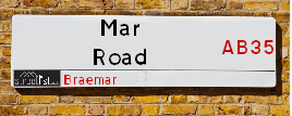
Mar Road is a street located in the village of Braemar. It uses the postcode AB35 5YL. The street has a length of approximately 329 metres.
Mar Road is located within the Aberdeenshire Council's jurisdiction. They provide various services, like refuse collection, and manage council tax collection. It's situated in the (pseudo) Scotland region of the UK.
Mar Road is located within the county of Aberdeenshire, situated in the (pseudo) Scotland region of the UK. It's 403.24 miles North from central London., 41.2 miles North from Dundee, 44.91 miles South East from Inverness and 50.13 miles West from Aberdeen.
Mar Road is within the Post Town of BALLATER

Do you know why this road is called Mar Road?
What's it like to live here?
Ask the community a question about Mar Road.
Do you have any questions, memories to share or know any facts about Mar Road? We'd love to know more.
Also on streetlist.co.uk, can you help?
Swing Swang Lane
28th April 2024
I am trying to find out why the lane is named Swing Swang?
It has been known known this since at least 1905 when hedge making contents used to be held here.
Swing Swang is often used to describe a fairground ride. I remember Swing Boats. Were they a bit like this or is Swing Swang another name for swings?
Swing Swangs are also mentioned in connection to orchards. Or were orchards just good places to have swings?
We have found 1 postcode for Mar Road
Location Details
| Mar Road | |
|---|---|

| |
| Latitude | 57.006417 |
| Longitude | -3.401296 |
| OS Easting (X): | 314900 |
| OS Northing (Y): | 791439 |
| OS Grid Reference: | NO149914 |
Neighbourhood Policing |
| Police Force: Scotland |
| Find a Local Neighbourhood Watch Scheme |
Frequently asked Questions for Mar Road
What Council (Local Authority) is Mar Road in?
Mar Road is located within the local authority area of Aberdeenshire Council which is a Scottish unitary authority.
What Parish Council is Mar Road in?
Mar Road is in an unparished area.
What Electoral Ward is Mar Road in?
Mar Road is located within the ward of Aboyne &Upper Deeside and Donside.
What County is Mar Road in?
Mar Road is located within the ceremonial county of Aberdeenshire.
What Constituency is Mar Road in?
Mar Road is located within the constituency of West Aberdeenshire and Kincardine.
What Part of the UK is Mar Road in?
Mar Road is located within the historic nation of Scotland.
What County Council area is Mar Road in?
Mar Road is not in a County Council area.
What Police Force area is Mar Road in?
Mar Road is located within the Scotland Police area.
Roads that have a Junction with Mar Road
| Street | Junction Type |
|---|---|
| Linn Of Dee Road | pseudo node |
| Invercauld Road | junction |
| Fife Brae | junction |
| Cairnadrochit | junction |
Sunset and Sunrise times for Mar Road , AB35 5YL
| Sunrise | 04:57 |
|---|---|
| Sunset | 21:22 |
Latest Weather Conditions for Mar Road, AB35 5YL
| Observed at Weather Station: | Cairnwell 12 May 2024 at 01:00 (8.83 miles away) |
|---|---|
| Current Weather: | Clear night |
| Temperature and Humidity: | 8.6°C (97.3%) |
| Wind Direction and Speed: | SSW (10 mph) |
Population Statistics
| ONS Area Code | S00092427 |
|---|---|
| ONS Area Name | Rural Employment and Retirees |
| LSOA Code: | S01006793 |
|---|---|
| LSOA Name: | East Cairngorms - 05 |
| SOA Code: | 2a |
| SOA Name: | |
| MSOA Code: | S02001285 |
| MSOA Name: | East Cairngorms |
Nearest Supermarkets
| Tesco Aviemore Metro |
|---|
| Grampian Rd, Aviemore, PH22 1RH |
| 0345 677 9017 |
| Distance: 20.46 Miles |
| Directions from Mar Road to Tesco Aviemore Metro |
| Sainsburys Blairgowrie High Street Local |
|---|
| 20 High Street, Blairgowrie, Scotland, PH10 6ET |
| 1250872391 |
| Distance: 28.7 Miles |
| Directions from Mar Road to Sainsburys Blairgowrie High Street Local |
| Tesco Blairgowrie Welton Superstore |
|---|
| Welton Rd, Blairgowrie, PH10 6NQ |
| 0345 677 9043 |
| Distance: 28.89 Miles |
| Directions from Mar Road to Tesco Blairgowrie Welton Superstore |
Telephone Information
| Area Code |
|---|
Broadband Information
| Speed | Average Speed | Median Speed | Maximum Speed | Next-generation access (NGA) | Number of Connections |
|---|---|---|---|---|---|
| Greater than 2 Mbps | 7.1 | 8 | 8.1 | N | 14 |
Local Government
| Local Council Details |
|---|
| Within the area of Aberdeenshire |
| Visit the Council's Website |
| Woodhill House, Westburn Road, Aberdeen, Aberdeenshire &AB16 5GB |
| Telephone Number: 0845 608 1207 |
| Local Member of Parliament |
|---|
| Within the Westminster Parliamentary Constituency of West Aberdeenshire and Kincardine |
| The Member of Parliament is Andrew Bowie |
| Details for the MP Andrew Bowie on parliament.uk |
| Details for the MP Andrew Bowie on theyworkforyou.com |
| In the 2019 General Election Andrew Bowie won with a majority of 843 the result was Con hold. The total electorate was 72,640 |
| Wards, Parish Councils and County Councils |
|---|
| Ward: Aboyne &Upper Deeside and Donside Ward |
| Ceremonial County: Aberdeenshire |
Nearest Schools
Scotland Primary Schools
Braemar School
Address: Braemar School, School Road, Braemar, ABERDEENSHIRE, AB35 5ZS
Distance: 0.17 miles
Contact: 01339 267705
Nearest Hospitals
| Name | Address | Postcode | Distance | Map |
|---|
Nearest Dentists
Dentists near Mar Road
| Name | Address | Postcode | Distance | Map |
|---|
Nearest GP Surgeries
Doctors near Mar Road
BRAEMAR HEALTH CLINIC
Address: ST ANDREW'S TERRACE, BRAEMAR, BALLATER, AB35 5WR
Distance: 0.09 miles
Contact: tel: 01339 741202
BALLATER CLINIC
Address: 13 PROVOST CRAIG ROAD, BALLATER, AB35 5NN
Distance: 13.94 miles
Contact: tel: 01339 755686
STRATHDON MEDICAL CENTRE
Address: NEWE, STRATHDON, AB36 8XB
Distance: 18.85 miles
Contact: tel: 01975 651209
AVIEMORE MEDICAL PRACTICE
Address: AVIEMORE HEALTH CENTRE, AVIEMORE, HIGHLAND, PH22 1SY
Distance: 20.77 miles
Contact: tel: 01479 810258
GRANTOWN-ON-SPEY MEDICAL PRACTICE
Address: THE HEALTH CENTRE, CASTLE ROAD EAST, GRANTOWN-ON-SPEY, PH26 3HR
Distance: 23.96 miles
Contact: tel: 01479 872484
GLENLIVET MEDICAL PRACTICE
Address: GLENLIVET COMMUNITY SURGERY, DRUMIN, BALLINDALLOCH, AB37 9AN
Distance: 24.08 miles
Contact: tel: 01807 590273
Nearest Dispensing Chemists
Pharmacies near Mar Road
| Name | Address | Postcode | Telephone | Map | Distance in Km |
|---|---|---|---|---|---|
| Braemar Pharmacy | 23 Mar Road, Braemar, Aberdeenshire, | AB35 5YP | 01339 741423 | View Directions |
Nearest Opticians
Opticians near Mar Road
4927 DUNDEE MILTON
Address: ASDA STORES LTD, LONGTOWN ROAD, DUNDEE, ANGUS, DD4 7RX
Distance: 40.92 miles
Contact: :
BOOTS OPTICIANS (DUNDEE - PANMURE ST)
Address: 10 PANMURE STREET, DUNDEE, ANGUS, DD1 2BW
Distance: 40.93 miles
Contact: :
DUNDEE DOMICILIARY SPECSAVERS LIMITED
Address: 53 MURRAYGATE, DUNDEE, ANGUS, DD1 2EA
Distance: 40.98 miles
Contact: :
BOOTS OPTICIANS (DUNDEE - REFORM STREET)
Address: 2-4 REFORM STREET, DUNDEE, ANGUS, DD1 1UL
Distance: 41.09 miles
Contact: :
TESCO OPTICIANS (PERTH)
Address: CRIEFF ROAD, PERTH, PERTHSHIRE, PH1 2NR
Distance: 41.46 miles
Contact: :
4960 PERTH
Address: ASDA OPTICIANS, 89 DUNKELD ROAD, PERTH, PH1 5AP
Distance: 41.47 miles
Contact: :
Transport
Nearest Rail Stations
Aviemore Station is 20.40 miles away.
Address: Aviemore station, Grampian Road, Aviemore, Highland, PH22 1PD
Aviemore is situated on the Highland Main Line and is managed by ScotRail.
Aviemore Station is staffed on a part time basis.
Blair Atholl Station is 23.75 miles away.
Address: Blair Atholl station, Tulloch Road, Blair Atholl, Perth & Kinross, PH18 5SL
Blair Atholl is situated on the Highland Main Line and is managed by ScotRail.
Blair Atholl Station is an unstaffed station.