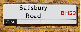
Map of Salisbury Road
| Postcodes | ||
|---|---|---|
| Icon | Postcodes for Salisbury Road | |
| Walking Distances | ||
| Distance Info | Green Circle = 10 Minutes Walk (800 metres) | |
About Salisbury Road
Salisbury Road is a street located in the town of Christchurch and in the village of Winkton. The street has a length of approximately 3,960 metres.
Salisbury Road is located within the Bournemouth, Christchurch and Poole, Dorset and New Forest District Council's jurisdiction. They provide various services, like refuse collection, and manage council tax collection. It's situated in the South West region of the UK.
Salisbury Road has been assigned the Unique Street Reference Numbers of 7500015, 81100289, 26721271, 7502031, 81100317 and 81100504 in the National Street Gazetteer.
Salisbury Road is located within the county of Dorset, situated in the South West region of the UK. It's 88.57 miles South West from central London., 4.89 miles North East from Bournemouth, 18.86 miles South West from Southampton and 21.3 miles West from Newport (IOW).

Do you know why this road is called Salisbury Road?
What's it like to live here?
Ask the community a question about Salisbury Road.
Do you have any questions, memories to share or know any facts about Salisbury Road? We'd love to know more.
Also on streetlist.co.uk, can you help?
Swing Swang Lane
28th April 2024
I am trying to find out why the lane is named Swing Swang?
It has been known known this since at least 1905 when hedge making contents used to be held here.
Swing Swang is often used to describe a fairground ride. I remember Swing Boats. Were they a bit like this or is Swing Swang another name for swings?
Swing Swangs are also mentioned in connection to orchards. Or were orchards just good places to have swings?
Estate Agents near Salisbury Road
| Name | Address | Website |
|---|---|---|
| Michael Adam Estate Agents | 237 Fairmile Road, Christchurch, BH23 2LQ | Visit Website |
| Belvoir | 22a Bargates, Christchurch, BH23 1QL | Visit Website |
| Belvoir Sales | 22a Bargates Christchurch BH23 1QL | Visit Website |
We have found 14 postcodes for Salisbury Road
Location Details
| Salisbury Road | |
|---|---|

| |
| Latitude | 50.758325 |
| Longitude | -1.769102 |
| OS Easting (X): | 416284 |
| OS Northing (Y): | 95503 |
| OS Grid Reference: | SZ163955 |
Neighbourhood Policing |
| Police Force: Dorset |
 View Neighbourhood Crime and Policing View Neighbourhood Crime and Policing |
| Find a Local Neighbourhood Watch Scheme |
Frequently asked Questions for Salisbury Road
What Council (Local Authority) is Salisbury Road in?
Salisbury Road is located within the local authority area of Bournemouth &Christchurch and Poole Council which is a Unitary Authority.
What Parish Council is Salisbury Road in?
Salisbury Road is located within the area of Burton Parish Council.
What Electoral Ward is Salisbury Road in?
Salisbury Road is located within the ward of Burton & Grange.
What County is Salisbury Road in?
Salisbury Road is located within the ceremonial county of Dorset.
What Constituency is Salisbury Road in?
Salisbury Road is located within the constituency of Christchurch.
What Part of the UK is Salisbury Road in?
Salisbury Road is located within the Array region of the United Kingdom.
What County Council area is Salisbury Road in?
Salisbury Road is located within the Dorset Council area.
What Police Force area is Salisbury Road in?
Salisbury Road is located within the Dorset Police area.
Roads that have a Junction with Salisbury Road
| Street | Junction Type |
|---|---|
| Ringwood Road (B3347) | junction |
| Priest Lane | junction |
| Priest Lane | junction |
| Derritt Lane | junction |
| Ringwood Road (B3347) | junction |
| Burley Road | junction |
| Homefield Close | junction |
| Redwood Drive | junction |
| Stony Lane (B3347) | pseudo node |
| Stony Lane (B3347) | junction |
| Burtoncroft | junction |
| Campbell Road | junction |
| Burton Hall Place | junction |
| Preston Lane | junction |
| Woodstock Road | junction |
| Footners Lane | junction |
| Bodowen Road | junction |
| Martins Hill Lane | junction |
| Martins Hill Lane | junction |
| Summers Lane | junction |
| Staplecross Lane | junction |
| Hawthorn Road | junction |
| Christchurch By Pass (A35) | junction |
Sunset and Sunrise times for Salisbury Road
| Sunrise | 05:19 |
|---|---|
| Sunset | 20:47 |
Latest Weather Conditions for Salisbury Road
| Observed at Weather Station: | Bournemouth Airport 12 May 2024 at 05:00 (3.21 miles away) |
|---|---|
| Current Weather: | Mist |
| Temperature and Humidity: | 10.7°C (95.4%) |
| Wind Direction and Speed: | N (5 mph) |
Population Statistics
| ONS Area Code | E00103073, E00103083, E00103080, E00103082, E00103069 & E00103075 |
|---|---|
| ONS Area Name | Self-Sufficient Retirement, Established Farming Communities, Ageing Industrious Workers & Renting Rural Retirement |
| Average Age | 48.68 & 48.05 |
| Area Population | 1212.00 & 1505.00 |
| Male Population | 560.00 & 735.00 (48%) |
| Female Population | 652.00 & 770.00 (52%) |
| Benefit Claimants | 4 & 5 (0%) |
| LSOA Code: | E01020345 &E01020343 |
|---|---|
| LSOA Name: | Christchurch 001C &Christchurch 001A |
| SOA Code: | 2a &5c |
| SOA Name: | |
| MSOA Code: | E02004236 |
| MSOA Name: | Christchurch 001 |
Nearest Supermarkets
| Sainsburys Christchurch |
|---|
| 1 Lyndhurst Road, Christchurch, England, BH23 4RY |
| 01425 277885 |
| Distance: 1.54 Miles |
| Directions from Salisbury Road to Sainsburys Christchurch |
| Waitrose Christchurch |
|---|
| 33 Bargates, Christchurch, Dorset, BH23 1QD |
| 01202 496682 |
| Distance: 1.57 Miles |
| Directions from Salisbury Road to Waitrose Christchurch |
| Tesco Christchurch Esso Express |
|---|
| 271 Barrack Rd, Christchurch, BH23 2AY |
| 0345 677 9162 |
| Distance: 1.75 Miles |
| Directions from Salisbury Road to Tesco Christchurch Esso Express |
| Tesco Bournemouth Extra |
|---|
| Riverside Ave, Bournemouth, BH7 7DY |
| 0345 677 9094 |
| Distance: 2.26 Miles |
| Directions from Salisbury Road to Tesco Bournemouth Extra |
Telephone Information
| Area Code |
|---|
| Area Code: 01202 - Bournemouth |
| Area Code: 01425 - Ringwood |
Broadband Information
| Speed | Average Speed | Median Speed | Maximum Speed | Next-generation access (NGA) | Number of Connections |
|---|---|---|---|---|---|
| Less than 2 Mbps | 2.1 | 1 | 4.6 | Y | 3 |
Local Government
| Local Council Details |
|---|
| Within the area of Bournemouth &Christchurch and Poole |
| Local Member of Parliament |
|---|
| Within the Westminster Parliamentary Constituency of Christchurch |
| The Member of Parliament is Christopher Chope |
| Details for the MP Christopher Chope on parliament.uk |
| Details for the MP Christopher Chope on theyworkforyou.com |
| In the 2019 General Election Christopher Chope won with a majority of 24,617 the result was Con hold. The total electorate was 71,520 |
| Wards, Parish Councils and County Councils |
|---|
| Ward: Burton & Grange Ward |
| Ceremonial County: Dorset |
Nearest Schools
England Primary Schools
Burton Church of England Primary School
Address: Burton Church of England Primary School, Campbell Road, Burton, Christchurch, Dorset, BH23 7JY
Distance: 0.07 miles
Contact: 01202482588
Mudeford Community Infants' School
Address: Mudeford Community Infants' School, Queen's Road, Mudeford, Christchurch, Dorset, BH23 3HH
Distance: 1.78 miles
Contact: 01202488142
The Priory Church of England Primary School
Address: The Priory Church of England Primary School, Wick Lane, Christchurch, Dorset, BH23 1HX
Distance: 1.83 miles
Contact: 01202484105
Christchurch Junior School
Address: Christchurch Junior School, Clarendon Road, Christchurch, Dorset, BH23 2AA
Distance: 1.46 miles
Contact:
England Secondary Schools
The Grange School
Address: The Grange School, Redvers Road, Christchurch, Dorset, BH23 3AU
Distance: 1.34 miles
Contact: 01202486536
Twynham School
Address: Twynham School, Sopers Lane, Christchurch, Dorset, BH23 1JF
Distance: 1.83 miles
Contact: 01202486237
Nearest Hospitals
| Name | Address | Postcode | Distance | Map |
|---|
Nearest Dentists
Dentists near Salisbury Road
| Name | Address | Postcode | Distance | Map |
|---|
Nearest GP Surgeries
Doctors near Salisbury Road
BURTON MEDICAL CENTRE
Address: 123 SALISBURY ROAD, BURTON, CHRISTCHURCH, DORSET, BH23 7JN
Distance: 0.42 miles
Contact: :
GROVE SURGERY
Address: FAIRMILE ROAD, FAIRMILE, CHRISTCHURCH, DORSET, BH23 2FQ
Distance: 1.35 miles
Contact: tel: 01202 481192
CHRISTCHURCH MEDICAL PRACTICE - COVID LOCAL VACCINATION SERVICE
Address: CHRISTCHURCH MEDICAL PRACTICE, 1 PUREWELL CROSS ROAD, CHRISTCHURCH, BH23 3AF
Distance: 1.56 miles
Contact: :
BARN SURGERY
Address: 1 PUREWELL CROSS ROAD, CHRISTCHURCH, DORSET, BH23 3AF
Distance: 1.56 miles
Contact: :
CHRISTCHURCH MEDICAL PRACTICE - COVID LOCAL VACCINATION SERVICE 2
Address: 1 PUREWELL CROSS ROAD, CHRISTCHURCH, BH23 3AF
Distance: 1.56 miles
Contact: :
CHRISTCHURCH MEDICAL PRACTICE
Address: CHRISTCHURCH MEDICAL PRAC, 1 PUREWELL CROSS ROAD, CHRISTCHURCH, DORSET, BH23 3AF
Distance: 1.56 miles
Contact: tel: 01202 481901
Nearest Dispensing Chemists
Pharmacies near Salisbury Road
| Name | Address | Postcode | Telephone | Map | Distance in Km |
|---|
Nearest Opticians
Opticians near Salisbury Road
CHEC CHRISTCHURCH
Address: 17 BARGATES, CHRISTCHURCH, BH23 1QD
Distance: 1.57 miles
Contact: :
BOOTS OPTICIANS (CHRISTCHURCH)
Address: UNIT 8, SAXON SQUARE SHOPPING CENTRE, CHRISTCHURCH, DORSET, BH23 1QA
Distance: 1.62 miles
Contact: :
LEIGHTONS LIMITED - CHRISTCHURCH
Address: 22 HIGH STREET, CHRISTCHURCH, BH23 1AY
Distance: 1.65 miles
Contact: :
SPECSAVERS (CHRISTCHURCH)
Address: 34 HIGH STREET, CHRISTCHURCH, DORSET, BH23 1AY
Distance: 1.65 miles
Contact: :
RON JOHNSEN OPTOMETRIST
Address: 21 CHURCH STREET, CHRISTCHURCH, DORSET, BH23 1BW
Distance: 1.75 miles
Contact: :
CLARE DORKINS - NICHOLSON EYECARE
Address: 1 RUNNYMEADE, RINGWOOD ROAD, BRANSGORE, CHRISTCHURCH, BH23 8NJ
Distance: 2.13 miles
Contact: :
Transport
Nearest Rail Stations
Christchurch Station is 1.55 miles away.
Address: Christchurch station, Stour Road, Christchurch, Dorset, BH23 1PL
Christchurch is situated on the Portsmouth Direct line|South Western Main Line and is managed by South Western Railway.
Christchurch Station is staffed on a part time basis.
Hinton Admiral Station is 2.44 miles away.
Address: Hinton Admiral station, Hinton Wood Lane, Hinton Admiral, Dorset, BH23 7DW
Hinton Admiral is situated on the Portsmouth Direct line|South Western Main Line and is managed by South Western Railway.
Hinton Admiral Station is staffed on a part time basis.
Directions from Salisbury Road to Hinton Admiral Rail Station