This section of the site is all about the BH Postcode area, also known as the Bournemouth Postal Area. Explore links to the next level to learn more about specific postcode districts such as BH1.
The BH postcode area represents a group of postal districts in the Bournemouth area of the United Kingdom. The area code BH stands for the letters b and h in BournemoutH. BH has a population of 551,987 and covers an area of 975,764 hectares. Fun fact: 0.85% of the population of Great Britain lives in this area.
The postcode area falls within the following counties: Dorset (90.38%), Hampshire (9.62%).
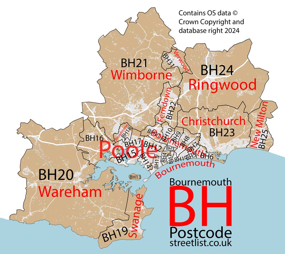
Post Towns and Postcode Districts for the BH Postcode
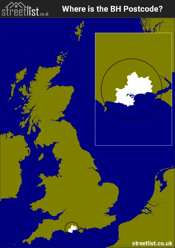
Where is the BH Postcode Area?
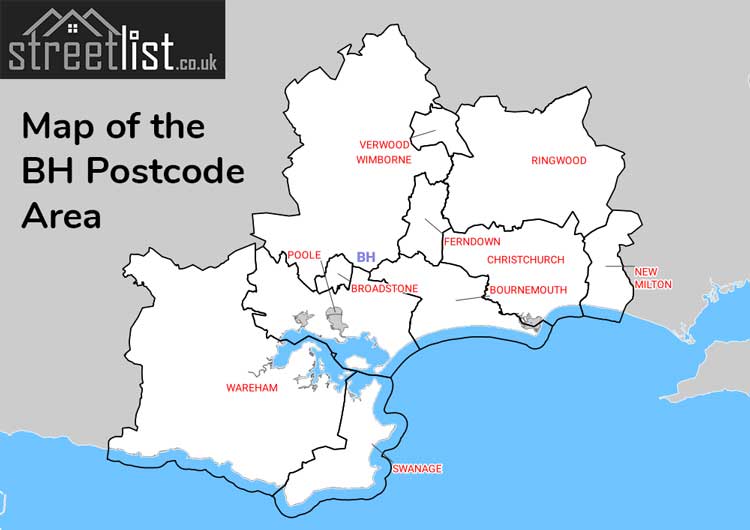
The BH Bournemouth Postcode is in the South West England. The postal area borders the following neighbouring postal areas: SO - Southampton, SP - Salisbury and DT - Dorchester, It also borders Poole Harbour and The English Channel.
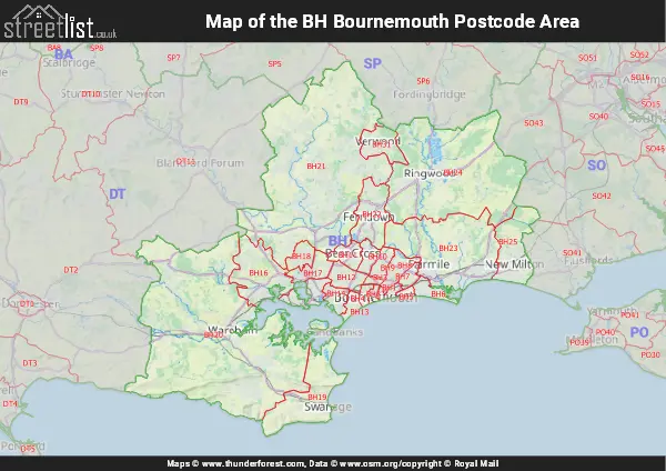
Map of the BH Bournemouth Postcode Area
Explore the BH Bournemouth postcode area by using our interactive map.
Postcode Districts within the BH Bournemouth Postcode Area
There are 26 postcode districts within the Bournemouth postcode area
A map showing the boundary of in relation to other areas
There are 10 towns within the Bournemouth postcode area.
| Unit | Area² |
|---|---|
| Hectares | 975,764² |
| Miles | 3,767² |
| Feet | 105,030,261,196² |
| Kilometres | 9,758² |
Postal Delivery Offices serving the BH Bournemouth Postcode Area
- Alder Hills Delivery Office
- Bournemouth Delivery Office
- Broadstone Delivery Office
- Christchurch Delivery Office
- Corfe Castle Scale Payment Delivery Office
- Ferndown Delivery Office
- New Milton Delivery Office
- Parkstone Delivery Office
- Poole Delivery Office
- Ringwood Delivery Office
- Swanage Delivery Office
- Verwood Delivery Office
- Wareham Delivery Office
- Westbourne Delivery Office
- Wimborne Delivery Office
- Winton Delivery Office
- Wool Scale Payment Delivery Office
Councils with Postcodes in BH
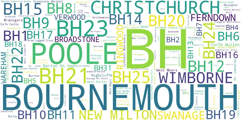
Towns and Villages within the BH Bournemouth Postcode Area
- Acton - village
- Ashley - village
- Ashley - village
- Ashley Heath - village
- Avon - village
- Avon Castle - otherSettlement
- Barton on Sea - village
- Bashley - village
- Beacon Hill - village
- Bearwood - village
- Bere Regis - village
- Binnegar - village
- Blashford - village
- Bloxworth - village
- Bournemouth - town
- Bransgore - village
- Burley - otherSettlement
- Burley Street - village
- Canford Magna - village
- Chalbury Common - village
- Christchurch - town
- Church Knowle - village
- Corfe Castle - village
- Corfe Mullen - village
- Cranborne - village
- Creech - otherSettlement
- Cripplestyle - village
- Crow - village
- East Lulworth - village
- East Morden - village
- East Stoke - otherSettlement
- Edmondsham - village
- Ferndown - town
- Furzehill - village
- Gaunt's Common - village
- Gussage All Saints - village
- Gussage St Michael - village
- Hampreston - village
- Hangersley - village
- Harman's Cross - village
- Haythorne - otherSettlement
- Henbury - village
- Hightown - village
- Hinton - village
- Hinton Martell - village
- Holt - village
- Holt Wood - village
- Holton Heath - village
- Horton - village
- Hurn - village
- Kingston - village
- Kingston - otherSettlement
- Langton Matravers - village
- Linwood - otherSettlement
- Lodge Copse Estate - village
- Long Crichel - village
- Longham - village
- Lulworth Cove - village
- Lytchett Matravers - village
- Lytchett Minster - village
- Mannington - village
- Manswood - village
- Matchams - otherSettlement
- Merley - village
- Mockbeggar - village
- Neacroft - village
- New Milton - town
- New Town - village
- Poole - town
- Ridge - village
- Ringwood - town
- Ripley - village
- Rockford - otherSettlement
- Sandford - village
- Sopley - village
- St Ives - village
- St Leonards - otherSettlement
- Stoborough - village
- Stoborough Green - village
- Stone - village
- Studland - village
- Sturminster Marshall - village
- Swanage - town
- Thorney Hill - village
- Three Legged Cross - otherSettlement
- Trickett's Cross - village
- Upton - village
- Verwood - town
- Wareham - town
- West Lulworth - village
- West Moors - village
- West Parley - village
- Whitmore - village
- Wimborne Minster - town
- Wimborne St Giles - village
- Winkton - village
- Witchampton - village
- Woodlands - village
- Wool - village
- Wootton - village
- Worgret - village
- Worth Matravers - village