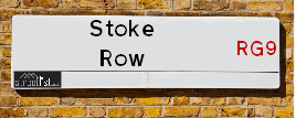
Map of Stoke Row Road
| Postcodes | ||
|---|---|---|
| Icon | Postcodes for Stoke Row Road | |
| Walking Distances | ||
| Distance Info | Green Circle = 10 Minutes Walk (800 metres) | |
About Stoke Row Road
Stoke Row Road is a street located in the village of Kingwood Common and near the village of Kingwood Common and in the village of Peppard Hill and in the village of Sonning Common and near the village of Stoke Row. The street has a length of approximately 4,319 metres.
Stoke Row Road is located within the South Oxfordshire District Council's jurisdiction. They provide various services, like refuse collection, and manage council tax collection. It's situated in the South East region of the UK.
Stoke Row Road has been assigned the Unique Street Reference Numbers of 36216309, 36201508 and 36210404 in the National Street Gazetteer.
Stoke Row Road is located within the county of Oxfordshire, situated in the South East region of the UK. It's 38.59 miles West from central London., 5.77 miles North from Reading, 18.65 miles South East from Oxford and 18.9 miles North from Basingstoke.

Do you know why this road is called Stoke Row Road?
What's it like to live here?
Ask the community a question about Stoke Row Road.
Do you have any questions, memories to share or know any facts about Stoke Row Road? We'd love to know more.
Also on streetlist.co.uk, can you help?
Eldroth Road
15th April 2024
I wondered if anyone has any old pictures of Wenning Bank House in the 1940’s and also Lane Side before of the same era .. we visited today with my Mum in law as she used to live at both these properties. Also any photos of the schools around that time .. thank you.
Can You Help?Napps Way
15th April 2024
Why is the road called Napps Way (belonging to Napp, but minus an
apostrophe as is usual with such nomenclature)? Moreover, who or
what is, or was, “Napp” in the respective, possessive case?
Several years ago, I met an elderly man (probably in his late-eighties)
who lives on Bentham Drive, Liverpool 16, and during a conversation
with him whilst in a Northwest Passenger Transport Ambulance on the
way to the former RLUH (Royal Liverpool University Hospital), he told
me that he could remember (when he was a boy, living in Childwall,
Liverpool 16) that, “Where Napps Way is now, during WW2, there was
a two-man gun emplacement on the, then, open land to protect the
railway line passing over Childwall Valley Road - next to the railway
bridge - when suddenly, as they were loading a live “shell” into the gun’s
breach, the aforementioned “shell” accidentally exploded in the gun’s
breach killing both of the two soldiers, that had been manning the gun,
instantly! (Very sad, of course, but could - perhaps - two ghosts relating
to those two, very unfortunately and prematurely-killed soldiers have
haunted that place of their deaths ever since - and have any residents
of Napps Way - formerly and in its latest incarnation - seen two, WW2
(uniformed) soldiers unexpectedly appear in or near their homes?)
Mauritius Road
15th April 2024
Why is Mauritius Road so called, since when and by whom? Does Greenwich have any particular links with Mauritius? Very interested to know. 🤞🏼
Can You Help?Estate Agents near Stoke Row Road
| Name | Address | Website |
|---|---|---|
| Beville Estate Agency | 28 Peppard Road, Sonning Common, RG4 9SU | Visit Website |
| Davis Tate | 64 Wood Lane Sonning Common RG4 9SJ | Visit Website |
| Brookstones Property Solutions | 81 Bell Street, Henley-On-Thames, RG9 2BD | Visit Website |
We have found 10 postcodes for Stoke Row Road
Location Details
| Stoke Row Road | |
|---|---|

| |
| Latitude | 51.536598 |
| Longitude | -1.000733 |
| OS Easting (X): | 469298 |
| OS Northing (Y): | 182492 |
| OS Grid Reference: | SU693825 |
Ordnance Survey Maps for Stoke Row Road
If you purchase a map through the links below, we may earn an affiliate commission.
| Map Series | link | Ordnance Survey |
| Explorer 1:25,000 171 Chiltern Hills West, Henley-on-Thames and Wallingford | Check Price on Amazon | Buy Direct from the Ordnance Survey |
| Landranger 1:50,000 175 Reading & Windsor | Check Price on Amazon | Buy Direct from the Ordnance Survey |
Neighbourhood Policing |
| Police Force: Thames Valley |
 View Neighbourhood Crime and Policing View Neighbourhood Crime and Policing |
| Find a Local Neighbourhood Watch Scheme |
Frequently asked Questions for Stoke Row Road
What Council (Local Authority) is Stoke Row Road in?
Stoke Row Road is located within the local authority area of South Oxfordshire Council which is a District Council.
What Parish Council is Stoke Row Road in?
Stoke Row Road is located within the area of Rotherfield Peppard Parish Council.
What Electoral Ward is Stoke Row Road in?
Stoke Row Road is located within the ward of Woodcote & Rotherfield.
What County is Stoke Row Road in?
Stoke Row Road is located within the ceremonial county of Oxfordshire.
What Constituency is Stoke Row Road in?
Stoke Row Road is located within the constituency of Henley.
What Part of the UK is Stoke Row Road in?
Stoke Row Road is located within the South East (England) region of the United Kingdom.
What County Council area is Stoke Row Road in?
Stoke Row Road is located within the Oxfordshire Council area.
What Police Force area is Stoke Row Road in?
Stoke Row Road is located within the Thames Valley Police area.
Roads that have a Junction with Stoke Row Road
| Street | Junction Type |
|---|---|
| Neals Lane | junction |
| Lime Avenue | junction |
| Stevens Lane | junction |
| Wyfold Lane | junction |
| Colliers Lane | junction |
| Colliers Lane | junction |
| Peppard Hill (B481) | junction |
Sunset and Sunrise times for Stoke Row Road
| Sunrise | 05:40 |
|---|---|
| Sunset | 20:22 |
Latest Weather Conditions for Stoke Row Road
| Observed at Weather Station: | Benson 27 April 2024 at 00:00 (7.09 miles away) |
|---|---|
| Current Weather: | Light rain |
| Temperature and Humidity: | 7.3°C (70.5%) |
| Wind Direction and Speed: | ENE (6 mph) |
Population Statistics
| ONS Area Code | E00145995, E00145993, E00145997 & E00145996 |
|---|---|
| ONS Area Name | Ageing in Suburbia, White Suburban Communities & Detached Retirement Living |
| Average Age | 43.88 |
| Area Population | 1316.00 |
| Male Population | 618.00 (47%) |
| Female Population | 698.00 (53%) |
| Benefit Claimants | 4 (0%) |
| LSOA Code: | E01028662 |
|---|---|
| LSOA Name: | South Oxfordshire 019D |
| SOA Code: | 8a |
| SOA Name: | |
| MSOA Code: | E02005976 |
| MSOA Name: | South Oxfordshire 019 |
Nearest Supermarkets
| Sainsburys Henley Local |
|---|
| 9-11 Bell Street, Henley-On-Thames, England, RG9 2BA |
| 1491410053 |
| Distance: 4.11 Miles |
| Directions from Stoke Row Road to Sainsburys Henley Local |
| Waitrose Henley-on-thames |
|---|
| 33 Bell Street, Henley-on-Thames, Oxfordshire, RG9 2BA |
| 01491 410440 |
| Distance: 4.12 Miles |
| Directions from Stoke Row Road to Waitrose Henley-on-thames |
| Tesco Emmer Green Esso Express |
|---|
| Buckingham Dr, Emmer Green, Reading, RG4 8RZ |
| 0345 674 6504 |
| Distance: 4.29 Miles |
| Directions from Stoke Row Road to Tesco Emmer Green Esso Express |
| Tesco Henley-on-thames Superstore |
|---|
| 359 Reading Rd, Henley-On-Thames, RG9 4HA |
| 0345 677 9343 |
| Distance: 4.65 Miles |
| Directions from Stoke Row Road to Tesco Henley-on-thames Superstore |
Telephone Information
| Area Code |
|---|
| Area Code: 01491 - Henley-on-Thames |
| Area Code: 0118 - Reading |
Local Government
| Local Council Details |
|---|
| Within the area of South Oxfordshire |
| Visit the Council's Website |
| Benson Lane, Crowmarsh Gifford, Wallingford, Oxfordshire &OX10 8ED |
| Send email |
| Telephone Number: 01491 823 000 |
| Local Member of Parliament |
|---|
| Within the Westminster Parliamentary Constituency of Henley |
| The Member of Parliament is John Howell |
| Details for the MP John Howell on parliament.uk |
| Details for the MP John Howell on theyworkforyou.com |
| In the 2019 General Election John Howell won with a majority of 14,053 the result was Con hold. The total electorate was 76,646 |
| Wards, Parish Councils and County Councils |
|---|
| Ward: Woodcote & Rotherfield Ward |
| Ceremonial County: Oxfordshire |
Nearest Schools
England Primary Schools
Peppard Church of England Primary School
Address: Peppard Church of England Primary School, Church Lane, Peppard, Henley-on-Thames, Oxfordshire, RG9 5JU
Distance: 1.06 miles
Contact: 01491628354
Stoke Row CofE Primary School
Address: Stoke Row CofE Primary School, School Lane, Nr. Henley-on-Thames, Oxfordshire, RG9 5QS
Distance: 1.34 miles
Contact: 01491680720
Sonning Common Primary School
Address: Sonning Common Primary School, Grove Road, Sonning Common, Reading, Berkshire, RG4 9RJ
Distance: 1.73 miles
Contact: 01189722105
Nearest Hospitals
| Name | Address | Postcode | Distance | Map |
|---|
Nearest Dentists
Dentists near Stoke Row Road
| Name | Address | Postcode | Distance | Map |
|---|
Nearest GP Surgeries
Doctors near Stoke Row Road
SONNING COMMON HEALTH CTR
Address: WOOD LANE, SONNING COMMON,READING, READING, BERKSHIRE, RG4 9SW
Distance: 1.66 miles
Contact: tel: 0118 9722188
NETTLEBED SURGERY
Address: WANBOURNE LANE, NETTLEBED, HENLEY-ON-THAMES, OXFORDSHIRE, RG9 5AJ
Distance: 2.77 miles
Contact: tel: 01491 641204
NETTLEBED SURGERY - COVID LOCAL VACCINATION SERVICE 2
Address: WANBOURNE LANE, NETTLEBED, HENLEY-ON-THAMES, RG9 5AJ
Distance: 2.77 miles
Contact: :
DR HAMILTON
Address: WAYSIDE GREEN, WOODCOTE, READING, RG8 0QL
Distance: 3.21 miles
Contact: :
GORING & WOODCOTE MEDICAL PRACTICE
Address: THE HEALTH CENTRE, WAYSIDE GREEN, WOODCOTE, READING, BERKSHIRE, RG8 0PR
Distance: 3.28 miles
Contact: tel: 01491 680686
EMMER GREEN SURGERY
Address: 4 ST. BARNABAS ROAD, EMMER GREEN, READING, BERKSHIRE, RG4 8RA
Distance: 3.85 miles
Contact: tel: 0118 9486900
Nearest Dispensing Chemists
Pharmacies near Stoke Row Road
| Name | Address | Postcode | Telephone | Map | Distance in Km |
|---|
Nearest Opticians
Opticians near Stoke Row Road
BUNKER OPTICIANS
Address: 45-47 DUKE STREET, HENLEY ON THAMES, OXFORDSHIRE, RG9 1UR
Distance: 4.16 miles
Contact: :
BOOTS OPTICIANS (HENLEY-ON-THAMES)
Address: 23 DUKE STREET, HENLEY-ON-THAMES, OXFORDSHIRE, RG9 1UR
Distance: 4.16 miles
Contact: :
ROBIN JAMES OPTICIANS
Address: 44 CHURCH STREET, CAVERSHAM, READING, BERKSHIRE, RG4 8AU
Distance: 4.89 miles
Contact: :
VISION EXPRESS (PANGBOURNE)
Address: 12 WHITCHURCH ROAD, PANGBOURNE, READING, BERKSHIRE, RG8 7BP
Distance: 5.14 miles
Contact: :
READING WEST EXTRA
Address: PORTMAN ROAD, READING, BERKSHIRE, RG30 1AW
Distance: 5.39 miles
Contact: :
SCRIVENS OPTICIANS (TILEHURST)
Address: 11 SCHOOL ROAD, TILEHURST, READING, BERKSHIRE, RG31 5AR
Distance: 5.48 miles
Contact: :
Transport
Nearest Rail Stations
Henley-on-Thames Station is 4.32 miles away.
Address: Henley-on-Thames station, Station Approach, off Station Road, Henley-on-Thames, Oxfordshire, RG9 1AY
Henley-on-Thames is situated on the Henley Branch Line and is managed by Great Western Railway.
Henley-on-Thames Station is staffed on a part time basis.
Directions from Stoke Row Road to Henley-on-Thames Rail Station
Tilehurst Station is 4.67 miles away.
Address: Tilehurst station, Oxford Road, Tilehurst, Berkshire, RG31 6TH
Tilehurst is situated on the Great Western Main Line and is managed by Great Western Railway.
Tilehurst Station is staffed on a part time basis.