Map of Stone Lane
| Postcodes | ||
|---|---|---|
| Icon | Postcodes for Stone Lane | |
| Walking Distances | ||
| Distance Info | Green Circle = 10 Minutes Walk (800 metres) | |
About Stone Lane
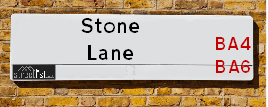
Stone Lane is a street located near Easton Town. It uses the postcode BA4 6RZ. The street has a length of approximately 3,228 metres.
Stone Lane is located within the Mendip District Council's jurisdiction. They provide various services, like refuse collection, and manage council tax collection. It's situated in the South West region of the UK.
Stone Lane has been assigned the Unique Street Reference Number of 25001236 and 25008145 in the National Street Gazetteer.
Stone Lane is located within the county of Somerset, situated in the South West region of the UK. It's 111.18 miles West from central London., 12.37 miles North from Yeovil, 22.02 miles South West from Trowbridge and 22.92 miles East from Taunton.

Do you know why this road is called Stone Lane?
What's it like to live here?
Ask the community a question about Stone Lane.
Do you have any questions, memories to share or know any facts about Stone Lane? We'd love to know more.
Also on streetlist.co.uk, can you help?
Swing Swang Lane
28th April 2024
I am trying to find out why the lane is named Swing Swang?
It has been known known this since at least 1905 when hedge making contents used to be held here.
Swing Swang is often used to describe a fairground ride. I remember Swing Boats. Were they a bit like this or is Swing Swang another name for swings?
Swing Swangs are also mentioned in connection to orchards. Or were orchards just good places to have swings?
Estate Agents near Stone Lane
| Name | Address | Website |
|---|---|---|
| Galion Limited | Mansfield Way, Baltonsborough, BA6 8FN | Visit Website |
| Galion Limited | Lakeview Road, Mandeville, Somerset, TA11 6FF | |
| Simon Heal Estate Agents | The Estate Office, Brook Hall, Evercreech, BA4 6DP | Visit Website |
We have found 1 postcode for Stone Lane
Location Details
| Stone Lane | |
|---|---|

| |
| Latitude | 51.119064 |
| Longitude | -2.601958 |
| OS Easting (X): | 357873 |
| OS Northing (Y): | 135761 |
| OS Grid Reference: | ST579358 |
Neighbourhood Policing |
| Police Force: Avon And Somerset |
 View Neighbourhood Crime and Policing View Neighbourhood Crime and Policing |
| Find a Local Neighbourhood Watch Scheme |
Frequently asked Questions for Stone Lane
What Council (Local Authority) is Stone Lane in?
Stone Lane is located within the local authority area of Mendip Council which is a District Council.
What Parish Council is Stone Lane in?
Stone Lane is located within the area of East Pennard Parish Council.
What Electoral Ward is Stone Lane in?
Stone Lane is located within the ward of The Pennards and Ditcheat.
What County is Stone Lane in?
Stone Lane is located within the ceremonial county of Somerset.
What Constituency is Stone Lane in?
Stone Lane is located within the constituency of Somerton and Frome.
What Part of the UK is Stone Lane in?
Stone Lane is located within the South West (England) region of the United Kingdom.
What County Council area is Stone Lane in?
Stone Lane is located within the Somerset Council area.
What Police Force area is Stone Lane in?
Stone Lane is located within the Avon and Somerset Police area.
Roads that have a Junction with Stone Lane
| Street | Junction Type |
|---|---|
| School Road | junction |
Sunset and Sunrise times for Stone Lane , BA4 6RZ
| Sunrise | 05:21 |
|---|---|
| Sunset | 20:51 |
Latest Weather Conditions for Stone Lane, BA4 6RZ
| Observed at Weather Station: | Yeovilton 12 May 2024 at 15:00 (7.99 miles away) |
|---|---|
| Current Weather: | Cloudy |
| Temperature and Humidity: | 22.5°C (60.1%) |
| Wind Direction and Speed: | S (15 mph) |
Population Statistics
| ONS Area Code | E00148091 |
|---|---|
| ONS Area Name | Agricultural Communities |
| Average Age | 45.25 |
| Area Population | 2044.00 |
| Male Population | 1017.00 (50%) |
| Female Population | 1027.00 (50%) |
| Benefit Claimants | 5 (0%) |
| LSOA Code: | E01029077 |
|---|---|
| LSOA Name: | Mendip 013C |
| SOA Code: | 2c |
| SOA Name: | |
| MSOA Code: | E02006059 |
| MSOA Name: | Mendip 013 |
Nearest Supermarkets
| Tesco Shepton Mallet Superstore |
|---|
| Townsend Shopping Park, Townsend, Shepton Mallet, BA4 5EG |
| 0345 671 9389 |
| Distance: 5.23 Miles |
| Directions from Stone Lane to Tesco Shepton Mallet Superstore |
| Morrisons Glastonbury |
|---|
| Street Road, Glastonbury BA6 9ED |
| 01458 831087 |
| Distance: 5.43 Miles |
| Directions from Stone Lane to Morrisons Glastonbury |
| Tesco Glastonbury Superstore |
|---|
| Wirral Park Rd, Glastonbury, BA6 9XE |
| 0345 671 9553 |
| Distance: 5.83 Miles |
| Directions from Stone Lane to Tesco Glastonbury Superstore |
| Morrisons Wells |
|---|
| Parkwood Estate (off East Somerset Way), Wells BA5 1SQ |
| 01749 679174 |
| Distance: 6.24 Miles |
| Directions from Stone Lane to Morrisons Wells |
Telephone Information
| Area Code |
|---|
| Area Code: 01458 - Glastonbury |
| Area Code: 01749 - Shepton Mallet |
Broadband Information
| Speed | Average Speed | Median Speed | Maximum Speed | Next-generation access (NGA) | Number of Connections |
|---|---|---|---|---|---|
| Less than 2 Mbps | 1.3 | 1 | 2.6 | N | 13 |
Local Government
| Local Council Details |
|---|
| Within the area of Mendip |
| Visit the Council's Website |
| Council Offices, Cannards Grave Road, Shepton Mallet, Somerset &BA4 5BT |
| Send email |
| Telephone Number: 03333 043333 |
| Local Member of Parliament |
|---|
| Within the Westminster Parliamentary Constituency of Somerton and Frome |
| The Member of Parliament is David Warburton |
| Details for the MP David Warburton on parliament.uk |
| Details for the MP David Warburton on theyworkforyou.com |
| In the 2019 General Election David Warburton won with a majority of 19,213 the result was Con hold. The total electorate was 85,866 |
| Wards, Parish Councils and County Councils |
|---|
| Ward: The Pennards and Ditcheat Ward |
| Ceremonial County: Somerset |
Nearest Schools
Nearest Hospitals
| Name | Address | Postcode | Distance | Map |
|---|
Nearest Dentists
Dentists near Stone Lane
| Name | Address | Postcode | Distance | Map |
|---|
Nearest GP Surgeries
Doctors near Stone Lane
MILLFIELD PREP SCHOOL
Address: EDGARLEY HALL, GLASTONBURY, SOMERSET, BA6 8LD
Distance: 4.03 miles
Contact: :
MILLBROOK SURGERY, CASTLE CARY
Address: MILLBROOK GARDENS, CASTLE CARY, SOMERSET, BA7 7EE
Distance: 4.27 miles
Contact: tel: 01963 350210
EVERCREECH SURGERY
Address: PRESTLEIGH ROAD, EVERCREECH, SHEPTON MALLET, SOMERSET, BA4 6JY
Distance: 4.62 miles
Contact: :
GROVE HOUSE SURGERY
Address: WEST SHEPTON, SHEPTON MALLET, SOMERSET, BA4 5UH
Distance: 5.09 miles
Contact: tel: 01749 342314
PARK MEDICAL PRACTICE
Address: CANNARDS GRAVE ROAD, SHEPTON MALLET, SOMERSET, BA4 5RT
Distance: 5.21 miles
Contact: tel: 01749 334383
GLASTONBURY HEALTH CENTRE - COVID LOCAL VACCINATION SERVICE
Address: GLASTONBURY HEALTH CENTRE, 1 WELLS ROAD, GLASTONBURY, BA6 9DD
Distance: 5.23 miles
Contact: :
Nearest Dispensing Chemists
Pharmacies near Stone Lane
| Name | Address | Postcode | Telephone | Map | Distance in Km |
|---|
Nearest Opticians
Opticians near Stone Lane
ROBERT FRITH OPTOMETRISTS LTD (CASTLE CARY)
Address: FORE STREET, CASTLE CARY, SOMERSET, BA7 7BG
Distance: 4.34 miles
Contact: :
SPECSAVERS (STREET)
Address: 93 HIGH STREET, STREET, SOMERSET, BA16 0EZ
Distance: 6.02 miles
Contact: :
EYETECH (STREET) LTD
Address: 100 HIGH STREET, STREET, BA16 0EW
Distance: 6.07 miles
Contact: :
EYE-TECH OPTICIANS
Address: 100 HIGH STREET, STREET, SOMERSET, BA16 0EW
Distance: 6.07 miles
Contact: :
BOOTS OPTICIANS (STREET)
Address: 141A HIGH STREET, STREET, SOMERSET, BA16 0EX
Distance: 6.10 miles
Contact: :
MILLICANS EYE CENTRE
Address: 75 HIGH STREET, WELLS, SOMERSET, BA5 2AQ
Distance: 6.47 miles
Contact: :
Transport
Nearest Rail Stations
Castle Cary Station is 3.68 miles away.
Address: Castle Cary station, Station Wharf, Castle Cary, Somerset, BA7 7PE
Castle Cary is situated on the Reading to Taunton Line|Heart of Wessex Line and is managed by Great Western Railway.
Castle Cary Station is staffed on a part time basis.
Bruton Station is 6.74 miles away.
Address: Bruton station, Station Approach Road, Bruton, Somerset, BA10 0EH
Bruton is situated on the Reading to Taunton Line|Heart of Wessex Line and is managed by Great Western Railway.
Bruton Station is an unstaffed station.