Map of Wood Lane
| Street Crime (updated 04/05/2024) | ||
|---|---|---|
| Location Note | Central Point of Street - Not Actual Location | |
| MSOA Info | For MSOA E02004416 (Statistical Neighbourhood) | |
| Click Hint | Click on a Circle for a detailed breakdown below map. | |
| Crime Levels |
Green = Very Low Yellow = Low Orange = High Red = Very High |
|
| Postcodes | ||
| Icon | Postcodes for Wood Lane | |
| Walking Distances | ||
| Distance Info | Green Circle = 10 Minutes Walk (800 metres) | |
About Wood Lane
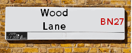
Wood Lane is a street located near the village of Boreham Street. It uses the postcode BN27 1GA. The street has a length of approximately 1,264 metres.
The street is publicly maintained which means that the road is adopted and East Sussex is responsible for the repair and upkeep of the highway.
Wood Lane is located within the Wealden District Council's jurisdiction. They provide various services, like refuse collection, and manage council tax collection. It's situated in the South East region of the UK.
Wood Lane has been assigned the Unique Street Reference Number of 42703141 and 42701352 in the National Street Gazetteer.
Wood Lane is located within the county of East Sussex, situated in the South East region of the UK. It's 47.67 miles South East from central London., 14.97 miles East from Lewes, 22.26 miles East from Brighton and 28.39 miles South from Maidstone.
Wood Lane is within the Post Town of HAILSHAM

Do you know why this road is called Wood Lane?
What's it like to live here?
Ask the community a question about Wood Lane.
Do you have any questions, memories to share or know any facts about Wood Lane? We'd love to know more.
Also on streetlist.co.uk, can you help?
Swing Swang Lane
28th April 2024
I am trying to find out why the lane is named Swing Swang?
It has been known known this since at least 1905 when hedge making contents used to be held here.
Swing Swang is often used to describe a fairground ride. I remember Swing Boats. Were they a bit like this or is Swing Swang another name for swings?
Swing Swangs are also mentioned in connection to orchards. Or were orchards just good places to have swings?
Estate Agents near Wood Lane
| Name | Address | Website |
|---|---|---|
| Foley & Neville Estate Agents | Forge Meadow Hammer Lane, Cowbeech, BN27 4JL | Visit Website |
| Bexhill Estates | 46b Cooden Sea Road, Cooden, Bexhill On Sea, TN39 4SL | Visit Website |
| Mison West Property Agents | 66 High Street Westham BN24 5LP | Visit Website |
We have found 1 postcode for Wood Lane
Location Details
| Wood Lane | |
|---|---|

| |
| Latitude | 50.875725 |
| Longitude | 0.359108 |
| OS Easting (X): | 565954 |
| OS Northing (Y): | 111182 |
| OS Grid Reference: | TQ660112 |
Neighbourhood Policing |
| Police Force: Sussex |
 View Neighbourhood Crime and Policing View Neighbourhood Crime and Policing |
| Find a Local Neighbourhood Watch Scheme |
Frequently asked Questions for Wood Lane
What Council (Local Authority) is Wood Lane in?
Wood Lane is located within the local authority area of Wealden Council which is a District Council.
What Parish Council is Wood Lane in?
Wood Lane is located within the area of Wartling Parish Council.
What Electoral Ward is Wood Lane in?
Wood Lane is located within the ward of Herstmonceux & Pevensey Levels.
What County is Wood Lane in?
Wood Lane is located within the ceremonial county of East Sussex.
What Constituency is Wood Lane in?
Wood Lane is located within the constituency of Bexhill and Battle.
What Part of the UK is Wood Lane in?
Wood Lane is located within the South East (England) region of the United Kingdom.
What County Council area is Wood Lane in?
Wood Lane is located within the East Sussex Council area.
What Police Force area is Wood Lane in?
Wood Lane is located within the Sussex Police area.
Roads that have a Junction with Wood Lane
| Street | Junction Type |
|---|---|
| Wartling Road | junction |
Sunset and Sunrise times for Wood Lane , BN27 1GA
| Sunrise | 05:12 |
|---|---|
| Sunset | 20:37 |
Latest Weather Conditions for Wood Lane, BN27 1GA
| Observed at Weather Station: | Herstmonceux West End 11 May 2024 at 14:00 (2.01 miles away) |
|---|---|
| Current Weather: | Sunny day |
| Temperature and Humidity: | 24.9°C (46.3%) |
| Wind Direction and Speed: | ENE (7 mph) |
Population Statistics
| ONS Area Code | E00107716 |
|---|---|
| ONS Area Name | Rural Employment and Retirees |
| Average Age | 46.83 |
| Area Population | 1250.00 |
| Male Population | 624.00 (50%) |
| Female Population | 626.00 (50%) |
| Benefit Claimants | 4 (0%) |
| LSOA Code: | E01021205 |
|---|---|
| LSOA Name: | Wealden 014E |
| SOA Code: | 2a |
| SOA Name: | |
| MSOA Code: | E02004416 |
| MSOA Name: | Wealden 014 |
Nearest Supermarkets
| Tesco Bexhill Express |
|---|
| 47-51 Cooden Sea Rd, Bexhill-On-Sea, TN39 4SL |
| 0345 674 6401 |
| Distance: 3.93 Miles |
| Directions from Wood Lane to Tesco Bexhill Express |
| Waitrose Hailsham |
|---|
| Vicarage Field, Hailsham, East Sussex, BN27 1BE |
| 01323 846708 |
| Distance: 4.41 Miles |
| Directions from Wood Lane to Waitrose Hailsham |
| Iceland Hailsham |
|---|
| 17 High Street, Hailsham, Sussex, BN27 1AL |
| 01323846630 |
| Distance: 4.43 Miles |
| Directions from Wood Lane to Iceland Hailsham |
| Asda Hailsham |
|---|
| 3 The Quintins, North Street, Hailsham, BN27 1DP |
| 01323 534500 |
| Distance: 4.48 Miles |
| Directions from Wood Lane to Asda Hailsham |
Telephone Information
| Area Code |
|---|
| Area Code: 01435 - Heathfield |
| Area Code: 01323 - Eastbourne |
| Area Code: 01424 - Hastings |
Local Government
| Local Council Details |
|---|
| Within the area of Wealden |
| Visit the Council's Website |
| Vicarage Lane, Hailsham, East Sussex &BN27 2AX |
| Send email |
| Telephone Number: 01323 443 322 or 01892 653 311 |
| Local Member of Parliament |
|---|
| Within the Westminster Parliamentary Constituency of Bexhill and Battle |
| The Member of Parliament is Huw Merriman |
| Details for the MP Huw Merriman on parliament.uk |
| Details for the MP Huw Merriman on theyworkforyou.com |
| In the 2019 General Election Huw Merriman won with a majority of 26,059 the result was Con hold. The total electorate was 81,963 |
| Wards, Parish Councils and County Councils |
|---|
| Ward: Herstmonceux & Pevensey Levels Ward |
| Parish: Wartling Parish Council |
| Ceremonial County: East Sussex |
Nearest Schools
England Primary Schools
Herstmonceux Church of England Primary School
Address: Herstmonceux Church of England Primary School, Hailsham Road, Herstmonceux, Hailsham, East Sussex, BN27 4LG
Distance: 1.81 miles
Contact: 01323833148
Nearest Hospitals
| Amberstone Hospital |
|---|
| Address: Carters Corner, Amberstone Hospital, Hailsham, BN27 4HU, |
| NHS Sector |
| Sussex Partnership NHS Foundation Trust |
| Telephone: 01323 440022 |
| Visit Hospital Website |
| Distance: 5.9 (miles) |
| Directions from to Amberstone Hospital |
| The Hellingly Centre |
|---|
| Address: The Drive, Hailsham, |
| NHS Sector |
| Sussex Partnership NHS Foundation Trust |
| Telephone: 01323 440022 |
| Visit Hospital Website |
| Distance: 6.91 (miles) |
| Directions from to The Hellingly Centre |
| Bexhill Hospital |
|---|
| Address: Holliers Hill, Bexhill-on-Sea, TN40 2DZ, |
| NHS Sector |
| East Sussex Healthcare NHS Trust |
| Telephone: 0300 131 4500 |
| Visit Hospital Website |
| Distance: 8.62 (miles) |
| Directions from to Bexhill Hospital |
Nearest Dentists
Dentists near Wood Lane
LITTLE COMMON DENTAL PRACTICE
Address: 65 BARNHORN ROAD, BEXHILL-ON-SEA, EAST SUSSEX, TN39 4QB
Distance: 3.70 miles
Contact: :
DENTAL SURGERY (2 TOWN HOUSE GARDEN)
Address: 2 MARKET STREET, HAILSHAM, EAST SUSSEX, BN27 2AE
Distance: 4.39 miles
Contact: :
PORTMAN SMILE CLINIC - HAILSHAM
Address: 21 HIGH STREET, HAILSHAM, BN27 1AN
Distance: 4.46 miles
Contact: :
DENTAL SURGERY
Address: 62 HIGH STREET, HAILSHAM, EAST SUSSEX, BN27 1AX
Distance: 4.46 miles
Contact: :
NORTH STREET DENTAL CARE
Address: 36 NORTH STREET, HAILSHAM, EAST SUSSEX, BN27 1DN
Distance: 4.49 miles
Contact: :
KINGSWOOD DENTAL PRACTICE
Address: 13 NORTH STREET, HAILSHAM, EAST SUSSEX, BN27 1DQ
Distance: 4.52 miles
Contact: :
Nearest GP Surgeries
Doctors near Wood Lane
HERSTMONCEUX INTEGRATIVE HEALTH CENTRE
Address: HAILSHAM ROAD, HERSTMONCEUX, HAILSHAM, EAST SUSSEX, BN27 4JX
Distance: 2.01 miles
Contact: tel: 01323 833535
THE SURGERY - NINFIELD
Address: HIGH STREET, NINFIELD, BATTLE, EAST SUSSEX, TN33 9JP
Distance: 2.80 miles
Contact: tel: 01424 892569
LITTLE COMMON SURGERY
Address: 82 COODEN SEA ROAD, LITTLE COMMON, BEXHILL ON SEA, EAST SUSSEX, TN39 4SP
Distance: 3.99 miles
Contact: tel: 01424 847575
QUINTINS MEDICAL CENTRE
Address: HAWKSWOOD ROAD, HAILSHAM, BN27 1UG
Distance: 4.21 miles
Contact: tel: 01323 845669
BATTLE ROAD MEDICAL CENTRE
Address: 85 BATTLE ROAD, HAILSHAM, BN27 1UA
Distance: 4.25 miles
Contact: :
HAILSHAM MEDICAL GROUP
Address: VICARAGE LANE, HAILSHAM, EAST SUSSEX, BN27 1BH
Distance: 4.31 miles
Contact: tel: 01323 848494
Nearest Dispensing Chemists
Pharmacies near Wood Lane
WARWICK AND RADCLIFFE PHARMACY
Address: HAILSHAM ROAD, HERSTMONCEUX, HAILSHAM, BN27 4JX
Distance: 2.01 miles
Contact: tel: 01323 833162
LITTLE COMMON PHARMACY
Address: 77 COODEN SEA ROAD, LITTLE COMMON, BEXHILL-ON-SEA, EAST SUSSEX, TN39 4SL
Distance: 3.94 miles
Contact: tel: 01424 843080
KAMSONS PHARMACY
Address: 12 CAREW COURT, HAWKSWOOD ROAD, HAILSHAM, EAST SUSSEX, BN27 1UL
Distance: 4.30 miles
Contact: tel: 01323 449484
SEAFORTH PHARMACY
Address: VICARAGE LANE, HAILSHAM, EAST SUSSEX, BN27 1BH
Distance: 4.31 miles
Contact: tel: 01323 841500
BOOTS
Address: 26 EASTBOURNE ROAD, PEVENSEY BAY, PEVENSEY, EAST SUSSEX, BN24 6ET
Distance: 4.40 miles
Contact: tel: 01323 761321
BOOTS
Address: 23-25 VICARAGE FIELD, HAILSHAM, EAST SUSSEX, BN27 1BG
Distance: 4.41 miles
Contact: tel: 01323 842495
Nearest Opticians
Opticians near Wood Lane
SIMPLY VISION OPTICIANS (BEXHILL)
Address: 26 COODEN SEA ROAD, BEXHILL-ON-SEA, TN39 4SJ
Distance: 3.91 miles
Contact: :
BOOTS OPTICIANS (VICARAGE FIELD)
Address: 1 VICARAGE FIELD, HAILSHAM, EAST SUSSEX, BN27 1BE
Distance: 4.39 miles
Contact: :
BOOTS OPTICIANS (HAILSHAM)
Address: UNIT 1, VICARAGE FIELD, HAILSHAM, EAST SUSSEX, BN27 1BG
Distance: 4.41 miles
Contact: :
FOCUS MEDICAL EYE CENTRE
Address: 18 HIGH STREET, HAILSHAM, EAST SUSSEX, BN27 1BJ
Distance: 4.42 miles
Contact: :
SPECSAVERS (HAILSHAM)
Address: 16 THE QUINTINS, NORTH STREET, HAILSHAM, EAST SUSSEX, BN27 1DP
Distance: 4.46 miles
Contact: :
MARK SOPER OPTICIANS LIMITED
Address: 72 HIGH STREET, HAILSHAM, EAST SUSSEX, BN27 1AU
Distance: 4.50 miles
Contact: :
Transport
Nearest Rail Stations
Normans Bay Station is 3.68 miles away.
Address: Normans Bay station, Normans Bay, Pevensey, East Sussex, BN24 6PR
Normans Bay is situated on the East Coastway Line and is managed by Southern.
Normans Bay Station is an unstaffed station.
Pevensey Bay Station is 4.09 miles away.
Address: Pevensey Bay station, Wallsend Road, Pevensey, East Sussex, BN24 6AA
Pevensey Bay is situated on the East Coastway Line and is managed by Southern.
Pevensey Bay Station is an unstaffed station.